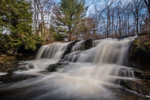


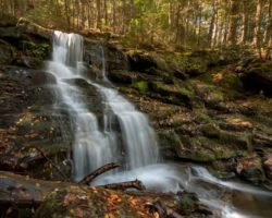
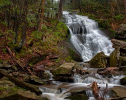
The southern corner of Lackawanna County, Pennsylvania, is dominated by Pinchot State Forest. And, hidden away in this forest is one of my favorite waterfalls in northeastern Pennsylvania: Choke Creek Falls.
Choke Creek Falls is located along Choke Creek, which serves as the dividing line between Lackawanna and Luzerne Counties. The waterfall is about 20 feet in total height spread out over two drops. It’s at least as wide as it is tall.

Like other nearby waterfalls such as Seven Tubs and Rattlesnake Falls, Choke Creek Falls is located within Pinchot State Forest. (Note: This forest was formerly known as Lackawanna State Forest.) This large forest is comprised of several different sections, and Choke Creek Falls is located within the Thornhurst Tract of the forest.
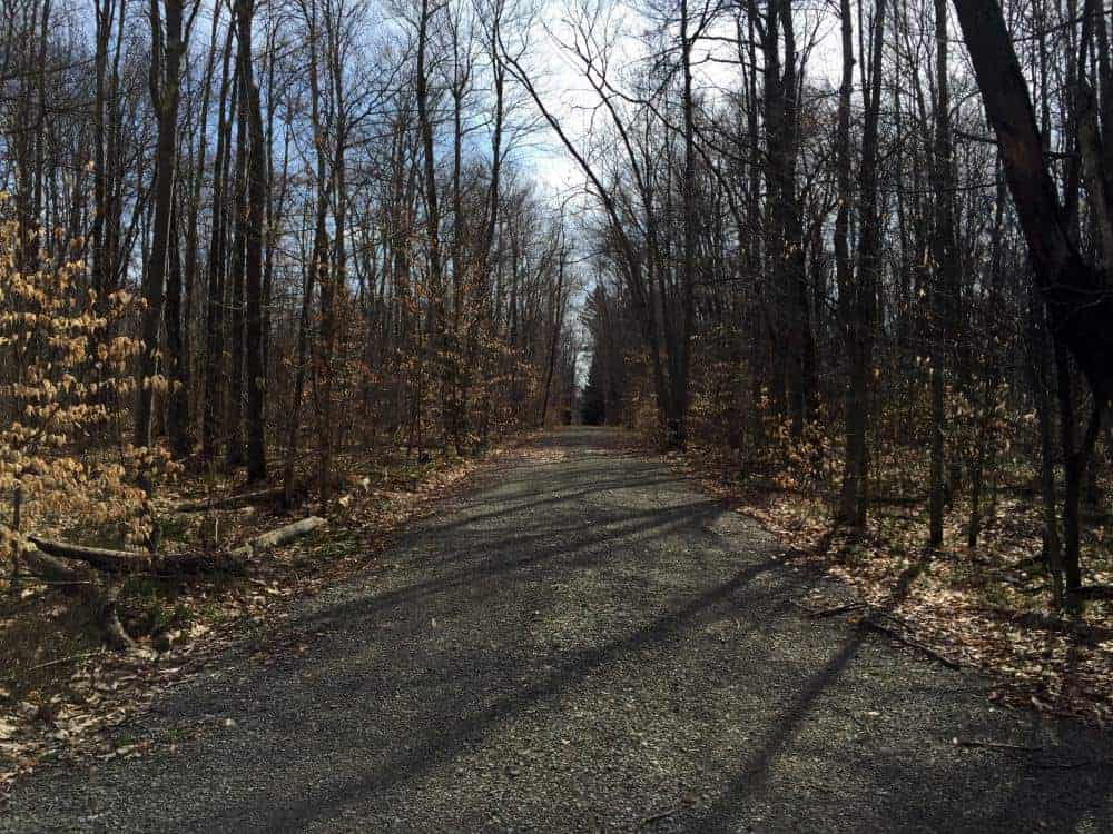
The hike to Choke Creek Falls is a pleasant 3/4 of a mile walk through this beautiful forest. It is mostly on old access roads, but that doesn’t take away from the beauty of the forest.
Despite not being marked, the short walk means that this is a popular spot. This is especially true on hot summer days. It is obvious from the rope swings that this is a popular swimming spot. However, use extreme caution here as water depths can vary and help would be fairly far away.
Sadly, this popularity with locals has also led to a decent amount of trash around Choke Creek Falls. While some pieces can’t be moved, like the sofa that was near the falls on my visit, consider taking a trash bag with you when you visit to help maintain the beauty of this area.
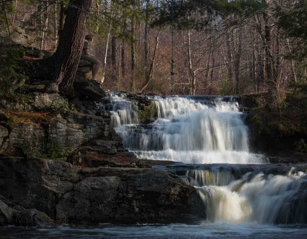
While this is far from the tallest and most impressive waterfall in Pennsylvania, Choke Creek Falls’ isolation and the surrounding natural beauty make this one of my favorite waterfalls in the region.
This is definitely a waterfall that is worth the drive and hike to see.
How to Get to Choke Creek Falls
Choke Creek Falls is located 3.5 miles down well-maintained dirt roads in Pinchot State Forest in southern Lackawanna County, Pennsylvania.
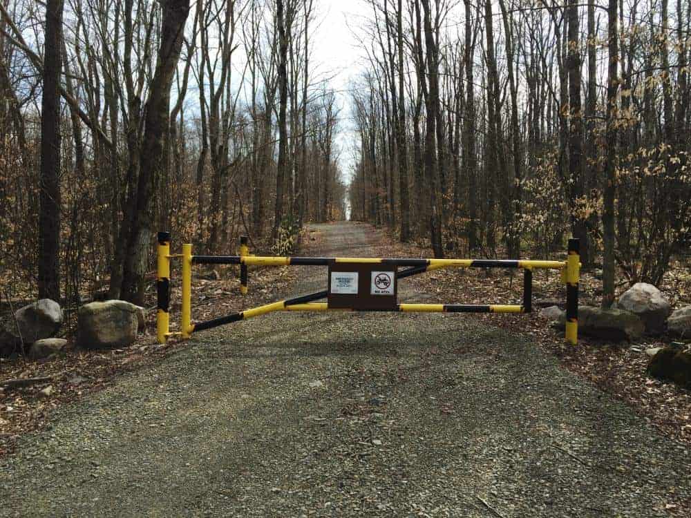
Parking is found at an unmarked, 90-degree turn along Phelps Road. Parking can be found at the following coordinates: 41.174697, -75.609054.
There is enough room at this spot for several cars to park. Make sure that you do not block the gate.
Start your hike by walking past the gate and hiking down the access road. You’ll pass another road on your left, but keep walking for about a quarter mile until you reach a clearing.
You’ll see a gated road straight ahead of you across the clearing and another gate to your right. Follow the trail past the gate to the right, which soon heads downhill.

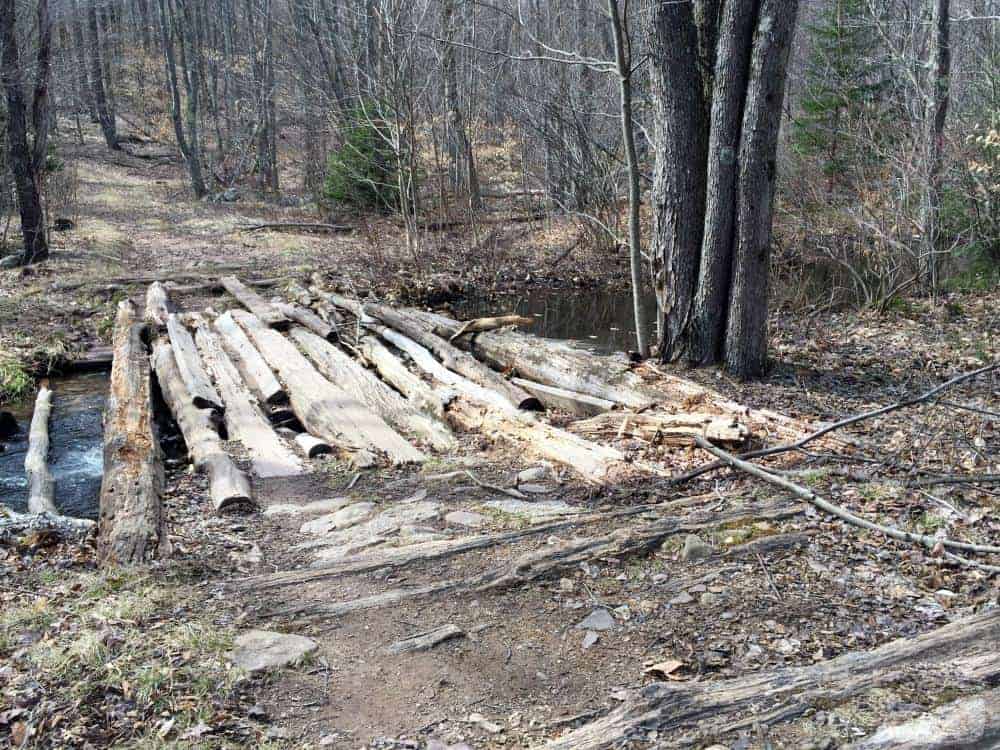
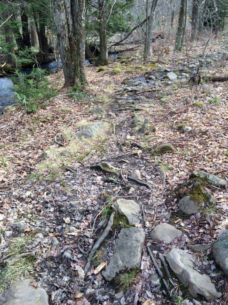
After another quarter mile, you’ll come to a wooden bridge over Butler Run. This bridge is just above the confluence of Butler Run and Choke Creek. Cross the bridge, and head along the obvious trail that follows Butler Run downstream. After just a few yards, the trail will veer to the right and follow Choke Creek upstream.
This trail is part of the Pinchot Trail which was rerouted in the fall of 2017 to go past Choke Creek Falls. Because of this, this final trail to the falls may be marked with orange blazes, but I haven’t been able to personally confirm this yet.
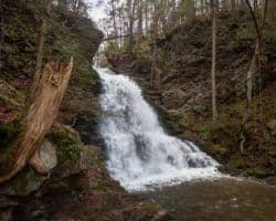
If Choke Creek Falls is flowing well, you should soon be able to hear it. Either way, you will soon arrive at the top of the falls after another quarter mile of hiking from the bridge over Butler Run.
For those that are interested, Choke Creek Falls can be found at the following coordinates: 41.171440, -75.618089.
[Click here for information on how to use coordinates to find your destination.]
Want to see more of Pennsylvania’s best waterfalls? Check out our Pennsylvania Waterfalls page!
 "
"


I can’t tell you how happy I am to have discovered your blog. The information is presented well and in a simple easy to understand form. I am anxious to read each one . I also hope to attend one or more of your photo workshops but not till next year as I’m definitely not a cold weather person.. Keep up the good work.
Thanks so much, Jim. I’m not a cold weather person, either, so I totally understand.
I bought your book and also have been using your blog. I was just at Choke Creek Falls today and they do in fact have the last part of the trail (after the bridge) marked with orange markers.
Good to know. Thanks for the update.
I was thinking of going this weekend (Memorial Day weekend) but that could be a mistake with the crowds, right?
I don’t think that area gets a ton of visitors, but it would likely be more crowded than normal.
So how far is Choke Creek from the Phelps Road access, 3/4 miles or 3.5 miles?
It’s a 3/4 mile hike from the parking area.