

Berks County, Pennsylvania, is home to five of the most scenic covered bridges remaining in Pennsylvania Dutch Country. Several of the bridges also have a look to them that’s rare among other PA covered bridges, making these great ones to visit even if you’ve seen many of the state’s other bridges.
The Berks County’s covered bridges are located throughout the county with bridges that are easy to access from both downtown Reading and I-78.
The bridges below are listed in a clockwise direction as if you were visiting them all from downtown Reading. However, the bridges can be easily visited in the opposite direction, or even just enjoyed one or two at a time when you are visiting a portion of the county.
Here are the five remaining historic covered bridges in Berks County, PA.
Wertz’s Covered Bridge
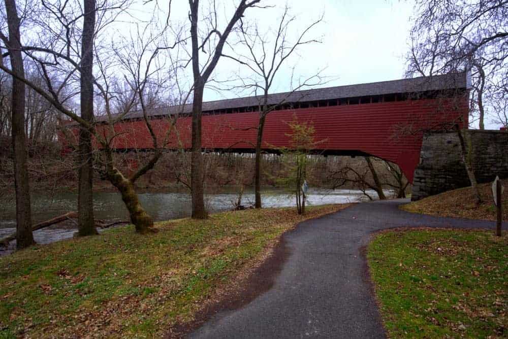
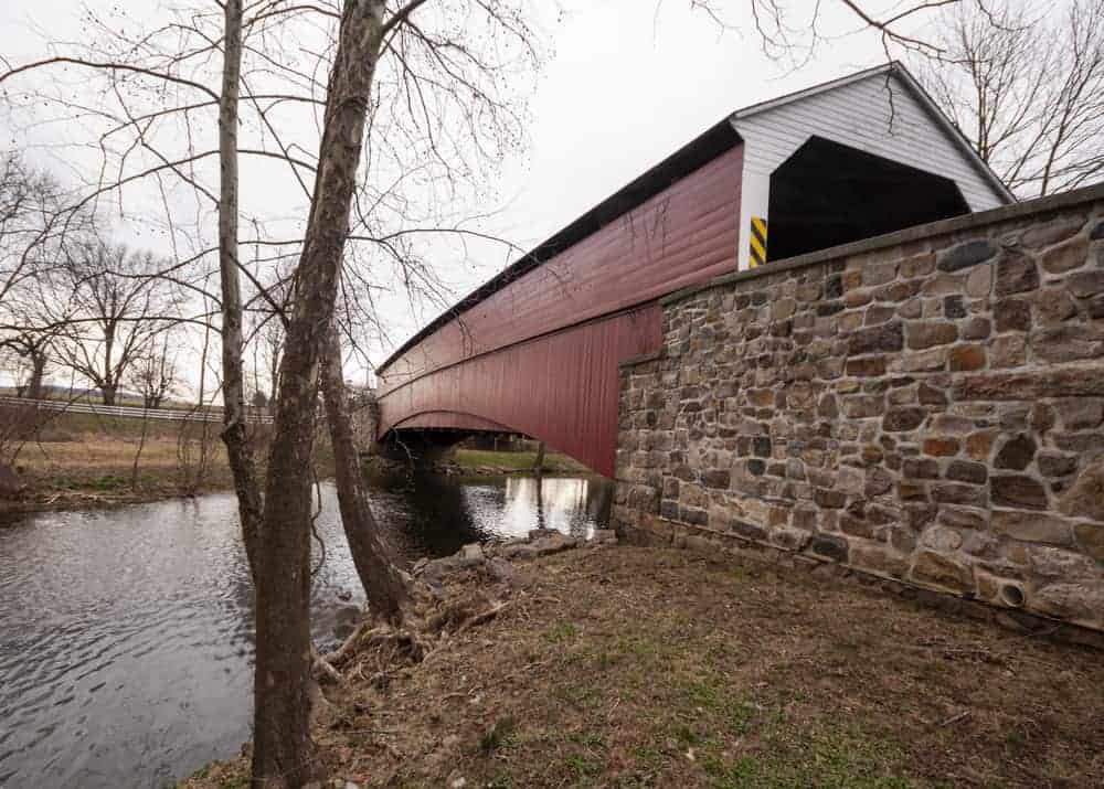
Wertz’s Covered Bridge is the closest covered bridge to Reading, PA, and is located on the grounds of the Berks County Heritage Center. Also known as Red Covered Bridge, this is the longest single-span covered bridge in the state with a length of 204 feet. It’s also the longest covered bridge in Berks County.
Wertz’s Covered Bridge was built in 1867 and spans Tulpehocken Creek. Today, it is only open to foot traffic.
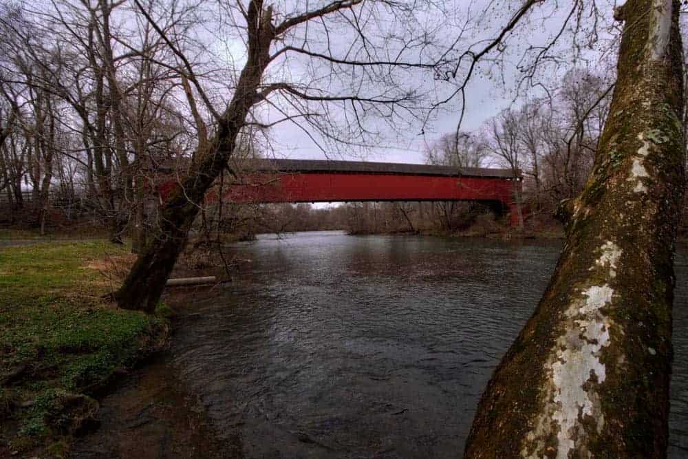
Getting There: Wertz’s Covered Bridge is located on the park grounds of the Berks County Heritage Center. Visitors are welcome to visit the bridge from dawn to dusk. The bridge is located west of downtown reading and can be found at the following address: 1102 Red Bridge Rd, Reading, PA 19605.
Park in the heritage center’s parking lot and walk the trails the short distance back to the bridge. The bridge itself is located at the following coordinates: 40.369052, -75.979097.
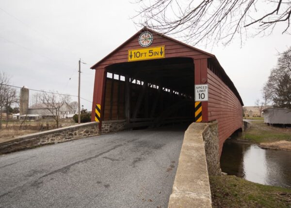
Dreibelbis Covered Bridge
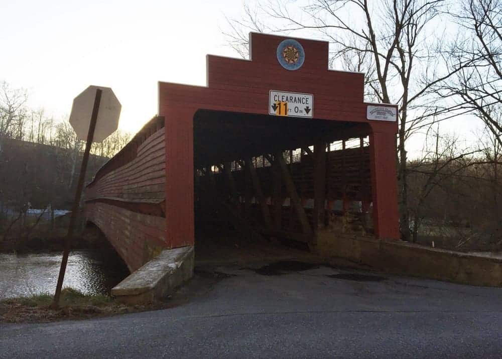
Dreibelbis Covered Bridge, also known as Dreibelbis Station Covered Bridge is located roughly two miles off of Interstate 78 in northern Berks County. The bridge was built in 1872 by an unknown builder. It spans 172 feet over Maiden Creek.
The website for the Berks History Center has a shocking amount of information about the history of this bridge which can be read here.
Getting There: Dreibelbis Covered Bridge is located near I-78 in the northern portion of the county. It’s close proximity to the highway makes it a great stop when traveling the highway. The bridge can be found at the following coordinates: 40.554738, -75.879738.
The bridge’s location at a T-shaped intersection and in a residential area makes parking a challenge, but there is a bit of room to pull off of the highway along Dreibelbis Road.
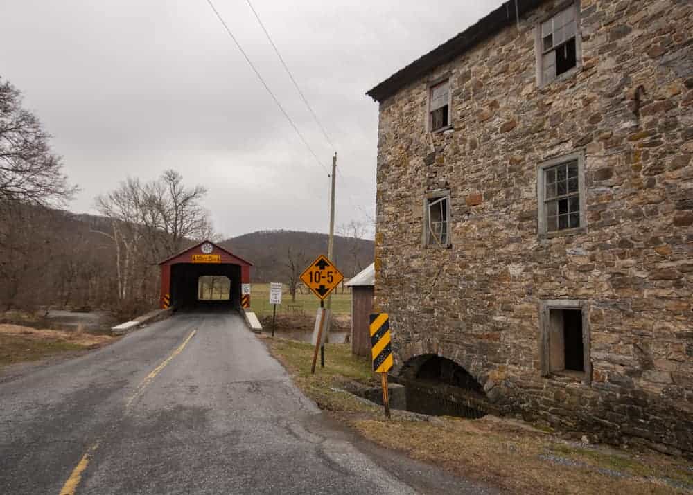
Kutz’s Mill Covered Bridge
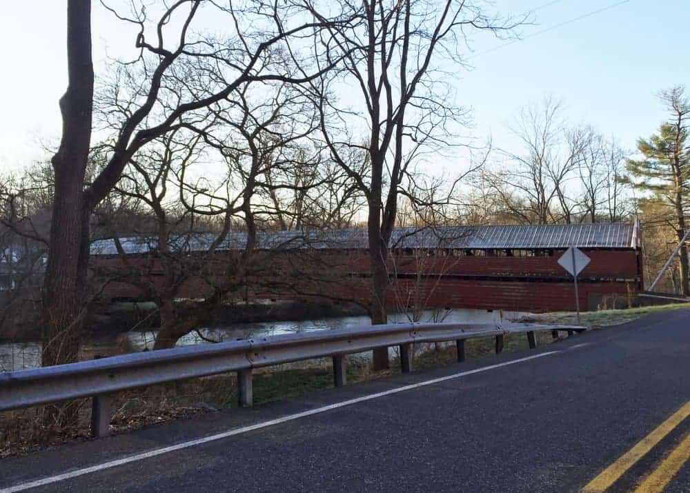
Kutz’s Mill Covered Bridge is located in northern Berks County near Kutztown and Crystal Cave. The bridge crosses Sacony Creek and was built in 1854. It is 93 feet long, which makes it the shortest covered bridge in Berks County.
The namesake Kutz’s Mill dates back to the same era and is still located on the northwestern side of the bridge. Keep in mind that the mill is on private property, so please enjoy it only from the road.
Getting There: Kutz’s Mill Covered Bridge is located in a rural area northwest of Kutztown, PA. It can be found at the following coordinates: 40.533708, -75.805443.
Parking at the bridge is very tricky since it’s surrounded by private property and homes. There may be a bit of room to pull off to the side of the road on the southeastern side of the bridge, but make sure to respect the private property around the bridge.
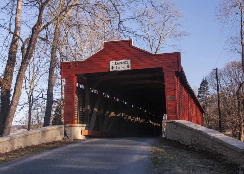
Pleasantville Covered Bridge
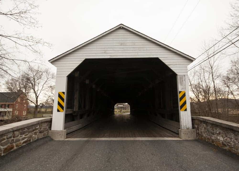
Pleasantville Covered Bridge is located east of Reading near Oley, PA. The bridge was built in 1852 and in 1856. The bridge was built over two periods due to lumber shortages in 1852. This creates a bridge that utilizes a unique truss system, though it doesn’t look overly different to those without a trained eye.
Pleasantville Covered Bridge spans Little Manatawny and is 126 feet in length.
Getting There: Pleasantville Covered Bridge is located a short distance off of Route 73 between Oley and Boyertown. It can be found at the following coordinates: 40.379202, -75.738740.
Like most of the other bridges in the county, parking is a bit tricky at the bridge. However, there is a small area to pull off on the southwestern side of Pleasantville Covered Bridge.
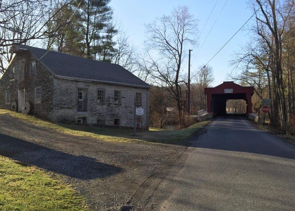
Greisemer’s Covered Bridge

Greisemer’s Covered Bridge is located less than two miles south of Pleasantville Covered Bridge in eastern Berks County. The bridge is 124 feet long and crosses Manatawny Creek. Greisemer’s Mill still sits near the bridge.
The exact date of building is hard to derive as different sites list different dates. Some places say it was built in 1832 (which would make it one of the oldest covered bridges in Pennsylvania), while others say 1868 or even 1932 (which seems wrong but was taken from an official source).
Getting There: Greisemer’s Covered bridge is located 1.5 miles from Pleasantville Covered Bridge in a beautiful area in eastern Berks County. It can be found at the following coordinates: 40.363020, -75.737933.
There is a nice pull off on the southeastern side of the bridge for those looking to get out and enjoy this bridge.
Looking for other things to do in the area? Check out the covered bridges of Lancaster County, visit the Boyertown Museum of Historic Vehicles, or head over to the birthplace of Daniel Boone.
[If you need help using the coordinates listed in this article, read my explanation here.]
 "
"