Ever since I first saw a photo of Hector Falls in Warren County, Pennsylvania, I knew I had to visit. (Go here if you are looking for the Hector Falls near Watkins Glen, New York).
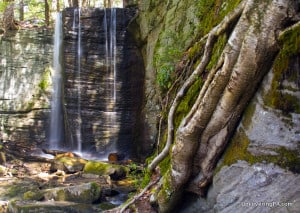
My interest wasn’t because of amazing water flow or neck-wrenching height; in fact, Hector Falls at some points in the year is little more than a trickle and, at a height of only around 22 feet, is nothing to write home about. Instead, what made this a must-see in my book was the strange geologic formation that surrounds the waterfall.
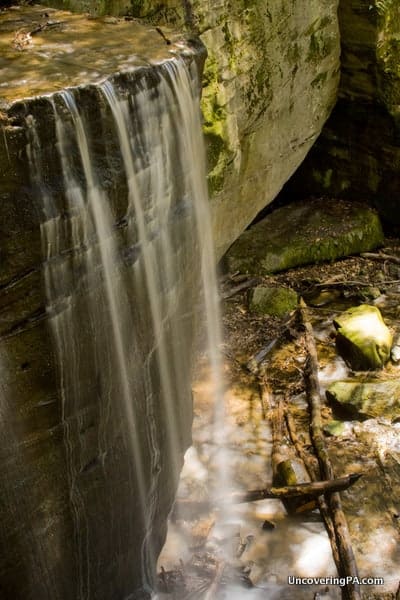
Set amidst a collection of large boulders that have been worn down over the years, Hector Falls plummets over 20 feet off of a rectangular-shaped rock face. When the water levels are above average, the water flows off two different faces, creating several streams of water cascading to the shallow pool below.
The waterfall itself is hidden among a collection of large boulders that obscure the bottom of the falls. While this does make the waterfall slightly tricky to find, it gives it a lost world type of feel.
If you enjoy taking photos of waterfalls as much as I do, Hector Falls in the Allegheny National Forest can be one of Pennsylvania’s more challenging waterfalls to photograph. While the rock walls that surround the falls certainly make it more visually interesting, they also create large shadows that make it difficult to find consistent light.
On the other hand, I was lucky enough to visit after several large rainstorms, meaning that I had great water flow cascading over the falls.
Obviously, if you aren’t as interested in photography as I am, the timing of your visit isn’t as critical, but I still would recommend waiting until after a good storm to visit.
How to Get to Hector Falls
Hector Falls is fairly simple to reach if you know where you are going. However, if you only have a vague idea, it can be a bit challenging to find, as I discovered when I visited.
Parking for the falls is located about 2 miles down a dirt road, which starts in the town of Ludlow on Route 6 along the McKean County and Warren County border. The road can be very rocky in places and those in cars should use extreme caution as rocks and clearance can be an issue in places.

"Waterfalls of Pennsylvania" by Jim Cheney
If you love PA waterfalls, you won't want to miss this waterfall book from Jim Cheney, author of Uncovering PA, featuring more than 180 great waterfalls. Order it now on Bookshop.org or Amazon.
While you could theoretically drive nearly all the way to the waterfall, a locked gate blocks the entrance, so you’ll likely have to park next to the gate (make sure not to block it) and walk to the falls. The parking area next to the gate is located at 41.695848, -78.980740.
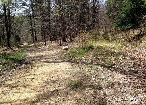
The hike itself is roughly a mile long, most of which is along an old forestry road. Walk downhill for about 10 minutes until you come to a fork in the road just after a large clearing on the right.
While this trail isn’t super well-defined, the nearby stream makes it fairly easy to follow. All told, it’ll take you about five minutes walking along this trail to reach the waterfall, which is tucked behind the large boulders at the end.
It is also possible to reach the top of the falls from the trail, though, as always, use extreme caution when near the top of any waterfall.
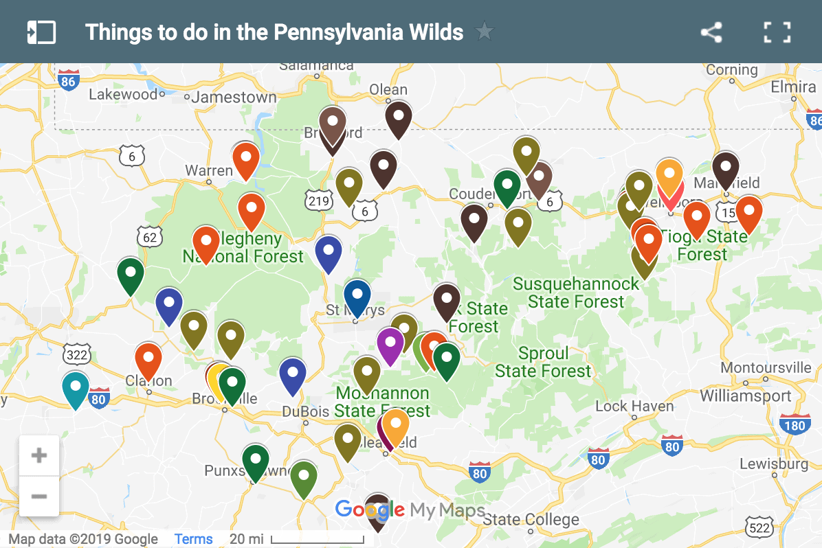
The coordinates for Hector Falls are 41.6853 -78.975067, which you can put into your GPS, or use the map below to see where the waterfall and parking area are located.
Looking for other waterfalls in the area? Check out nearby Logan Falls, Pigeon Falls, and Bent Run Falls.
[Click here for information on how to use the coordinates in this article to find your destination.]

 "
"




We picked up the forestry road via Scenic Drive in Ludlow. Once you cross the tracks, you will travel one mile to a fork in the forest road, keep right. Travel another 2.1 miles to a gated oil well road on the left. This is where we parked. There were no markers for the trail, we lucked out when we pulled in, there was a ranger parked there, and he verified we were in the right place. The gate was marked 258H. Well worth the hunt, we will go back!
You directions are spot on, Jim, have been there many times, but a picture of the parking area might be a good touch, I keep forgettin to get one myself when I am there!
Ludlow is just over the county line in McKean county
Fixed that part, Dan. Thanks for pointing it out. Just messed up where the county line is with Hector Falls being just over the line in Warren County.
Was wondering if there was horse camping and riding
Based on the Allegheny National Forest Recreation maps, it doesn’t look like it’s listed for horses. Here’s some good information: https://www.fs.usda.gov/recmain/allegheny/recreation
I have been to some of the falls on Route 6. It seemed that we would go just a few miles and we would find another one. Its been a few years and I would love to go back again!
Years ago, 1960’s vintage, friends and us, when we lived in Erie, traveled to Sheffield and drove to the Hector Falls. We drove through the Sheffield Cemetery , over the trail to the Sheffield fire tower and set up camp. Then we hiked to Hector falls. The girls took their showers under the Falls. That damn near killed them because the pressure of the water coming down pounded their tender bodies. Afterwards, we hiked back to our primitive campsite near the fire tower. My wife and I bathed in a small stream with Irish Spring soap. We were both allergic to the soap and have never used it since,
we all enjoyed our experience and will never forget it. What a memory!! I hope others can experience it also. Nature is wonderful.
Why is the geologic situation different? is it the wall or the boulders ? looks cool.
Thank you for the GPS coordinates to the trailhead!! I went a few months ago and couldn’t find it.
I hope they helped you find it this time.
Thank you for posting this!! It helped a great deal today when we went and visited! Followed these directions and we got right where we needed