Laurel Hill State Park is one of my favorite places to explore in southwestern PA, and one of my favorite spots to visit in the park is Jones Mill Run Dam.
Laurel Hill State Park is probably best known for its amazing collection of Civilian Conservation Corps (CCC) buildings constructed in the 1930s and 1940s, and Jones Mill Run Dam is no exception. The dam was constructed by these workers in 1935 as one of the first projects in the area to help supply water to support the camps.
While the pumphouse is no longer there, the dam still stands as both a testament to the craftsmanship of the work done here and as one of the most beautiful spots in the park.
Jones Mill Run Dam is located in the northwestern portion of this Somerset County park, and a 1.3-mile roundtrip hike along relatively easy trails can take you to this beautiful spot. Here’s everything you need to know to reach this fantastic destination.
Parking for Jones Mill Run Dam
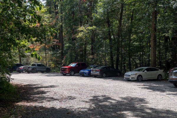
While there are several places that you could park for the hike to Jones Mill Run Dam thanks to interconnecting trails, the most popular spot is at the trailhead for the Pumphouse Trail, which can be found at the following coordinates: 40.005203, -79.244635.
This spot is 1.5 miles from County Line Road, the spot where most will enter the park.
This is a very large parking area, though, this is also one of the most popular hikes in the park, so it might be full on busy days.
If this lot is full, there are other parking areas that have access to the same trails, so take a look at the park map and find an alternative place to park if necessary.
[Click here for information on how to use the coordinates in this article to find your destination.]
Hiking to Jones Mill Run Dam

From the main parking area listed above, it’s an easy 0.7-mile one-way hike to the dam.
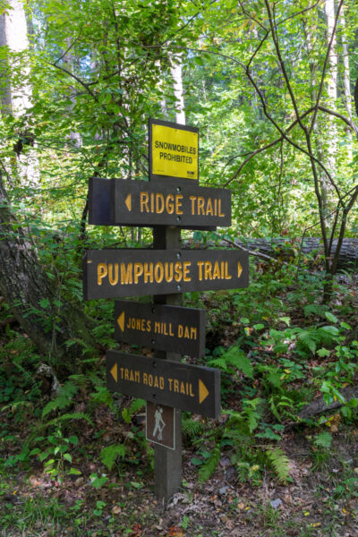
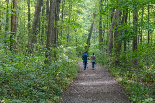
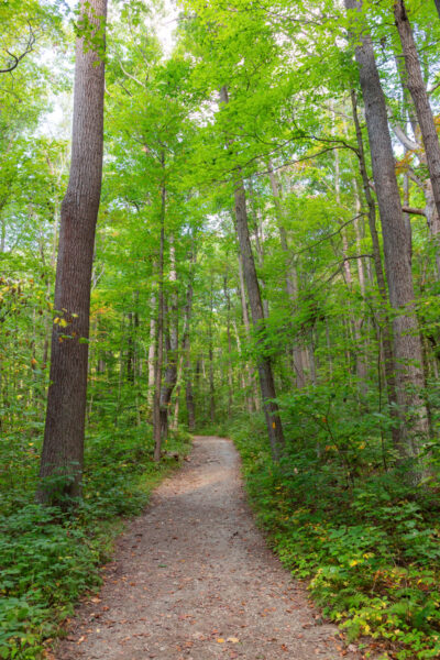
Start by going past the wooden gate at the far end of the parking area. This is the start of the Pumphouse Trail, which you will take all the way to the dam. This is a great hike any time of the year, but is an especially great spot to see fall foliage in the Laural Highlands.
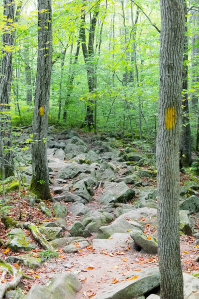
This trail is wide and relatively flat as it passes through the gorgeous forest in Laurel Hill State Park. Along the way, you’ll pass several other trails including the Waterline Trail and the Shay Trail but continue straight on the path you are hiking.
After about six-tenths of a mile, you’ll see a wooden sign that points to your left and says “Jones Mill Run Dam”. While the Pumphouse Trail continues for another mile or so beyond this sign, you’ll want to turn here.
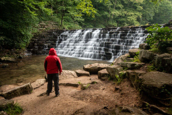
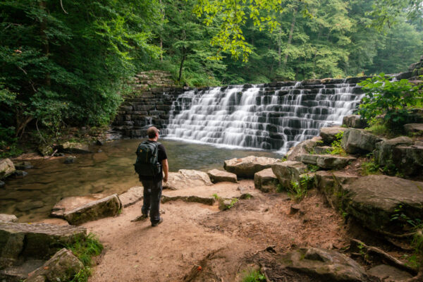
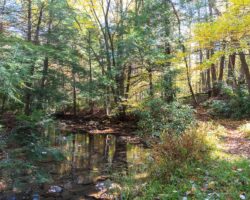
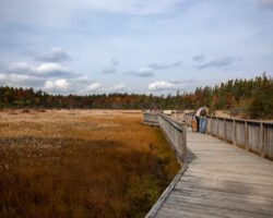
Just before the dam, you’ll reach the edge of the small pond above the dam. While this pond is man-made, it’s nearly 90 years old at this point, and it’s quite a beautiful spot. Make sure to take a second to enjoy it.
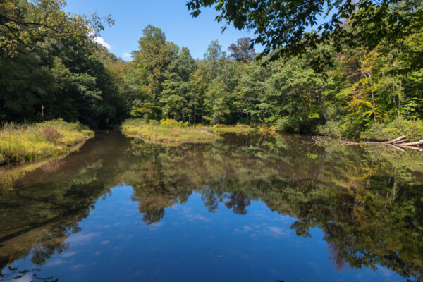
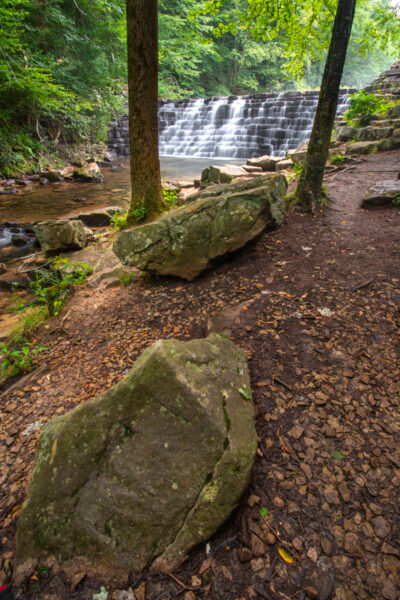
Jones Mill Run Dam is located at the outflow of this pond and is approximately 15 feet in height.
It was constructed in 1935 using locally quarried Pottsville sandstone. Amazingly, no machinery was used in the construction here. Instead, each stone was hand-hewn and then put in place using a leverage system.
The craftsmanship here is truly astonishing.
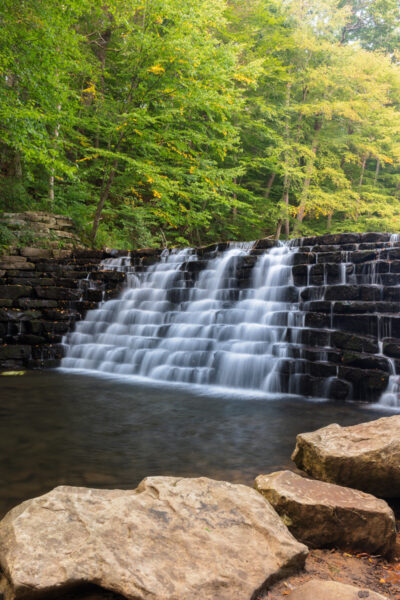
Today, water still flows over the dam much as it has for the last nine decades. The small steps in the dam create both a pleasing look and sound at this beautiful spot.
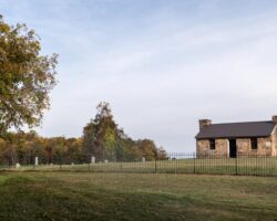
At the base of the dam, there are several information signs that offer a bit of history of the area, as well as ample room to sit and relax on the rocks.
Once you’ve enjoyed this spot, you could certainly retrace your steps back to the car. However, I prefer to hike back a slightly different way that is about a tenth of a mile shorter than returning the way you came.
It’s worth noting, however, that while this is a level hike, it does have some fairly uneven terrain, is muddy in spots, and requires you to cross several small streams on wooden boards. If this doesn’t sound doable to you, it’s better to go back the way you came.
That being said, if you prefer a bit more fun hike on the way back to your car and want to see more of Jones Mill Run, start your hike back by following the creek downstream on the same side that you are on.
Hiking downstream, you are now following the Tram Road Trail. This was an old logging road, which is quite obvious in some spots where it is very straight and flat.
However, the straight and flat spots are interspersed with spots where you are climbing over jagged rocks. Don’t fret though, as the hardest part of this trail is just downstream from the dam and only lasts for only a couple hundred feet.
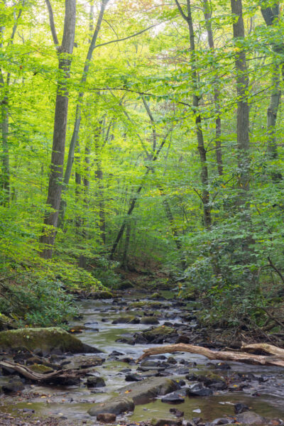
Once past the rocks, and as you hike further down the trail, there are constant views of Jones Mill Run, which is quite a beautiful stream.
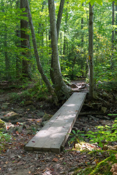
There are also a handful of small stream crossings which range from 10-20 feet in length. These bridges are all solid but a bit crude in their appearance, sometimes being 4-5 feet above the water with no railings. Make sure to use care here, especially if you are hiking with younger children.
In my opinion, the natural beauty mixed with the rocky areas and the unique bridges make this portion of the Tram Road Trail one of the most fun hikes I’ve done in the Laurel Highlands.
About four-tenths of a mile downstream of Jones Mill Run Dam, you’ll come to the Shay Trail. Note that the sign says Pumphouse Trail, but the park map says Shay Trail, so don’t be confused at this spot.
Take the Shay Trail to the left, where you’ll soon meet back up with the Pumphouse Trail. Take that trail to the right and follow it back to the parking area to complete your 1.3-mile hike.
Overall, I highly recommend the hike to Jones Mill Run Dam in Laurel Hill State Park. Not only is the dam itself both beautiful and historic, but the hike, especially on the way back, is a lot of fun.
Even better, there are other great hikes in the park, notably the Overlook Tower and the Hemlock Natural Area, which mean you can make an entire day of great outdoor adventure in this corner of the Laurel Highlands.
Looking for even more things to do nearby? Check out Cole Run Falls, the best things to do in Ohiopyle State Park, and the covered bridges of Somerset County.
 "
"


So glad I found this article. Very straightforward and informative. I had looked at park map, but you article helped me to figure out which trail I had to take.