South-central Pennsylvania isn’t an area known for its towering waterfalls. However, ever since I’d stumbled across the two waterfalls on Mill Creek, I’d heard rumors of other waterfalls in York County, PA. While several of the creeks are likely on private property, one creek that was rumored to have waterfalls was located on State Game Lands 181 near Airville.
State Game Lands 181 is a remote piece of public land a little over two miles upstream of the better known Mill Creek.
The Mason-Dixon Trail, which is the trail off of which the Mill Creek waterfalls are located, runs through the southern edge of State Game Lands 181 along Oakland Run, which is also home to its own small waterfall. The game lands are broken into two parcels of land, though hikers will find the most interesting elements on the eastern parcel located along the Susquehanna River.
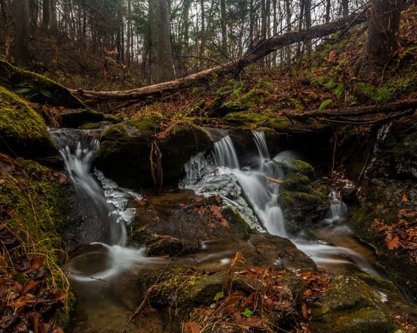
The northern edge of this parcel of the game lands is along Duncan Run.
This rarely visited stream drops close to 300 feet in the last half mile of its course before it reaches the Susquehanna River. Despite not finding any photos of waterfalls on Duncan Run online, the rumors I had heard and a quick glance at a topographic map told me that this stream was worth checking out.
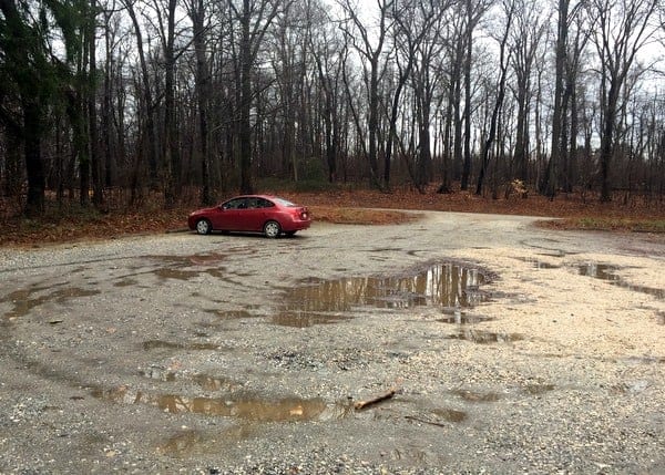
I drove to the parking area for this portion of State Game Lands 181, which is located at the end of East Posey Road, a well-maintained dirt road.
From this parking area, there are three trails that lead off into the woods. One is an old forest road that is a continuation of East Posey Road. According to the online State Game Lands mapping system, this road appears to head south towards Oakland Run.
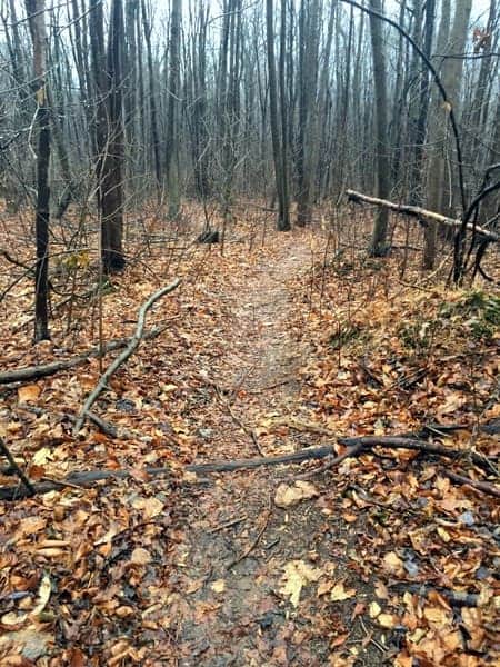
At the back of the parking area, next to the game lands information sign, there are trails heading off to both the left and right.
To see the waterfalls of Duncan Run, you will want to take the trail to the left (if you are facing the front of the sign). This trail quickly descends into the woods.
After about five minutes of hiking, the trail comes to Duncan Run. The trail appears to continue beyond the creek, but boundary markers both on in the woods and online indicate that Duncan Run is the edge of the game lands, and I can only assume the land beyond this stream is private property.

"Waterfalls of Pennsylvania" by Jim Cheney
If you love PA waterfalls, you won't want to miss this waterfall book from Jim Cheney, author of Uncovering PA, featuring more than 180 great waterfalls. Order it now on Bookshop.org or Amazon.
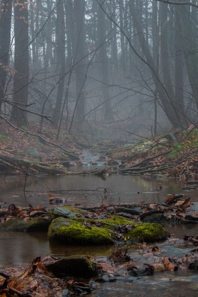
Turn right to head downstream along the creek. While there is a bit of a trail for a few yards, this trail quickly disappears and the forest takes over.
From this point on, the hike down Duncan Run is a full-on bushwhack.
While there are places where the land is more open than others, there is nothing along the creek that could be described as a trail. In fact, as you move further downstream, the creek gets harder and harder to follow.
Climbing over wet rocks, along slippery hillsides, and through underbrush will be required to see the waterfalls on this creek. It’s also unlikely that you’ll be unable to avoid getting your feet wet during this hike. If you aren’t prepared for this kind of challenge, it’s probably best to turn back at this point.
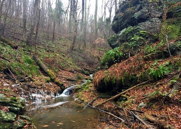
It’s also worth noting that this land seems like perfect habitat for both ticks and snakes. Because of this, tackling the creek when the weather is cold, but not cold enough for ice, is probably best.
While there may be more challenging bushwhacks out there, this certainly ranks as a very challenging hike. However, those that are comfortable enough with the challenges to proceed will be treated to waterfalls that, while not tall, make up for it with beauty and the chance to see something rarely seen by others.
Take your time climbing down Duncan Run. When I completed this hike, it took me about 45 minutes to make it the 3/10ths of a mile or so from the end of the trail to the bottom of the second waterfall on the creek.
Along the way, I crossed the creek at least three times, once had to walk through the middle of the creek, and twice had to climb up the hillside and back down to avoid obstructions along Duncan Run. Had water levels been even higher, as they likely would be in the spring, this trip would be even harder.
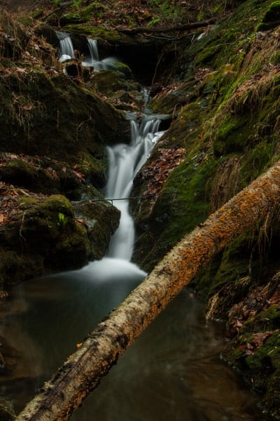
The first waterfall on York County’s Duncan Run is located about halfway through the bushwhack down the creek.
Here, Duncan Run drops about 10 feet over two drops. The first is about 2-3 feet in height, while the second drop is about 8 feet tall.
Getting in the middle of the two drops is fairly straightforward, though getting to the bottom of this waterfall requires a bit of a sketchy descent downstream of the waterfall and a short walk back upstream.
As you proceed down the creek, there are a handful of other drops of several feet as Duncan Run tumbles downhill towards the Susquehanna River. As you near the largest waterfall, the right side of the creek is the most open to walk on, though it’s possible this could be different depending on water levels and any obstructions that may pop up.
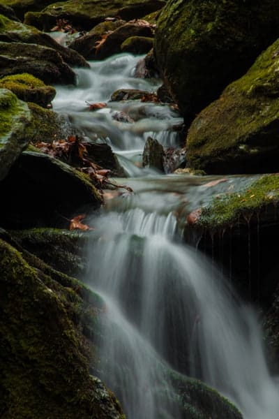
One of the hardest parts of the hike is at the top of the largest waterfall. Large rock walls abruptly shoot up, giving you only two choices: go up the hillside and go up and over these obstructions or get your feet wet climbing over possibly slippery rocks near the top of the falls.
Despite the cold water, I opted to get my feet wet and inch along the edge of the rock walls, but use your best judgment, especially if the creek is running high. Next to the top of the waterfall is a neat rock shelter. While only a few feet deep, it was tall enough that I was able to stand up inside of it.
After a bit of rock scrambling, I made it to the bottom of this waterfall. Here, the creek drops about 15 feet in three major drops. Since these drops are between boulders, it makes getting a view of the entire waterfall difficult, at least at the level of the water during my visit. However, the towering rock walls above the falls make this waterfall look even more impressive.
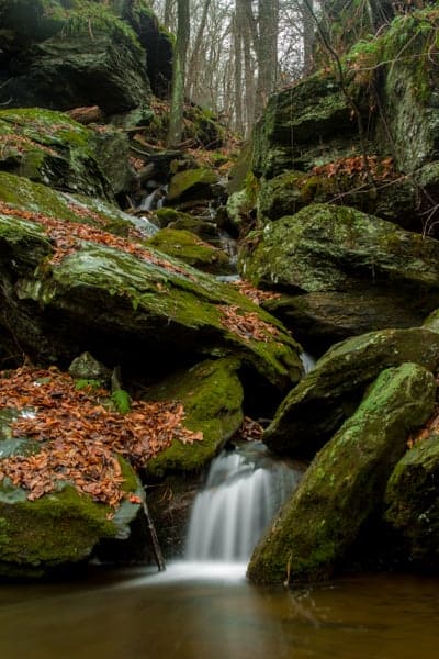
Just downstream of this waterfall is the boundary line for State Game Lands 181 and a private property sign.
Looking through the trees downhill, it’s obvious that Duncan Run continues to drop about 40 feet through a series of drops before tumbling into the Susquehanna River below. A cabin sits precariously along the lakeshore, and I can only imagine their great view of the falls when water levels are higher.
As always, make sure to respect the private property markers.
To return to your car, you have two options. The first is to hike back up Duncan Run until you reach the trail about half-a-mile upstream, and then take that back to your car. However, if you are feeling adventurous, and have a GPS with you to make sure you don’t get lost, there is another option.
For this option, follow Duncan Run back upstream until you reach the upper, 10-foot waterfall.
From here, bushwhack your way straight up the hillside. This will involve walking through a lot of underbrush and even a few small trees. It’s definitely not an easy walk, and there are no trails.
The reason for having a good GPS is that you will quickly lose sight of the creek and have little visual reference for the direction in which you are headed.
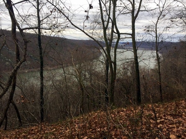
Once you get to the top of the hill, you will reach a wide trail, probably 100 feet or so above the creek below. If there are no leaves on the trees, you’ll have a great view of the Susquehanna River from this point.
If the trees were cleared out a bit, this would be a very popular spot as the view is quite commanding. If you look at the hillside directly across the river, you’ll notice the popular viewing area known as The Pinnacle. This point is also directly across the river from Tucquan Glen Nature Preserve.
This trail is probably wide enough for a car to drive along it, and you’ll have no problem following it back to your vehicle. To get back to the parking area, turn right (when facing the Susquehanna River far below).
After about 5-10 minutes of walking, this trail will put you out at the same place where you started your hike.
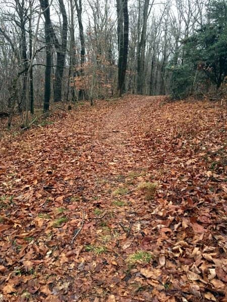
Hiking State Game Lands 181 to see the Duncan Run waterfalls in York County isn’t for the faint of heart. It’s a challenging hike through some very rugged terrain. However, those that have the skill and tenacity to make the trip will be rewarded with some of the best scenery along the Susquehanna River in York County, PA.
How to Get to the Waterfalls of State Game Lands 181
Duncan Run and the waterfalls of State Game Lands 181 are located a few miles east of Airville, Pennsylvania. The parking area lies at the end of East Posey Road, a hilly, but well-maintained dirt road.
The parking lot can be found at the following coordinates: 39.843597, -76.357582.
The waterfalls of Duncan Run are located at approximately the following coordinates: Upper Falls (39.846957, -76.355324) and Lower Falls (39.848019, -76.354002).
As a reminder, this is a very difficult hike. If you are looking for another nearby waterfall that is much easier to visit, don’t miss the fantastic Mill Creek Falls, or Letort Falls and Caledonia Falls which are a bit further away. Tucquan Glen is another great nearby hike.
Safety Note: State Game Lands are designed primarily for hunting and, while hiking is permitted throughout the year, trails and trail markings are not common on these lands. Before setting out onto any of PA’s game lands, it’s important to have an idea of where you are going, a good GPS, and an appropriate amount of blaze orange clothing.
Depending on the day of the week and time of the year, there may be hunters on the land, so it’s important to take the necessary safety precautions while hiking on this land. Check here to see what animals are in season throughout the year.
[Click here for information on how to use the coordinates in this article to find your destination.]
Want to see more of Pennsylvania’s best waterfalls? Check out our Pennsylvania Waterfalls page!

 "
"


LOVE THE BEAUTIFUL PICTURES THANK YOU SIR.
You’re welcome, Brenda. Glad you enjoyed them.
Thanks for this. I did this hike yesterday after checking out Mill Creek. I frequent Kelly’s Run/Tucquan Glen and It was nice to switch it up.
There are 2 even better waterfall hikes near by, one is on otter creek, and the other is a secret but you can find it if you do some research, lol.
Are these falls bigger than Mill Creek Falls? Trying to decide if the hike is worth it, and bringing a 12 year old possibly. I’d like to know more about the rock shelter! How deep was it?
The last waterfall is probably taller overall, but since a lot of the water passes through the rocks, it’s definitely not as impressive as Mill Creek Falls.