One problem with being a waterfall lover in the Harrisburg region is that there aren’t many waterfalls close to the area. Sure, I can get to a lot of great Pennsylvania waterfalls in a few hours, but if I want to stay closer to home, there really aren’t any options outside of Letort Falls or Acriggs Falls.
So, when I discovered that there was a great waterfall in southern York County, I knew I had to check it out. (Check out another set of waterfalls I found in York County at the nearby Duncan Run.)
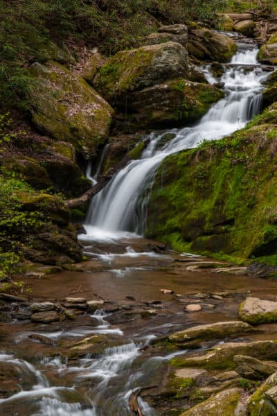
Mill Creek Falls is located in a very rural section of York County, PA, just off Route 372 near Holtwood Dam.
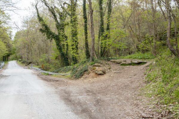
Coming from downtown York, I turned off of the main road onto River Road immediately before crossing the Norman Wood Bridge over the Susquehanna River to Lancaster County, where there are also great hikes such as Tucquan Glen and Shenks Ferry. (If coming from Lancaster County, take the first right immediately after crossing the bridge.)
About a mile down the road, just after the first bridge, is an unmarked, but quite obvious trailhead that heads off to left at approximately these coordinates: 39.819163, -76.336048.
This is the Mason-Dixon Trail, a nearly 200-mile trail that is popular with day hikers. However, very little hiking is required to reach Mill Creek Falls. In fact, the whole trip to the top of the falls takes less than five minutes from the trailhead.
The Mason-Dixon Trail follows along the hillside a good distance above the creek below. After a very short distance, you’ll see Mill Creek Falls and have a wonderful look at it from above.
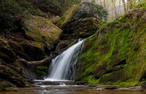
Roughly 20 feet from top to bottom, this waterfall makes two turns in 3 different drops that are separated by a few feet.
The trail offers nice views of the falls, but it’s also possible to head down to creek level to see it more closely. From my experience, the best spot to descend is in a rocky area near the crest of the falls. However, if you opt to do this yourself, be very careful as it was quite difficult.
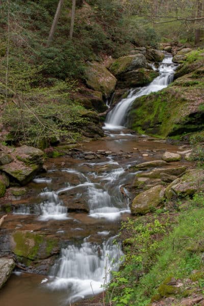
From the bottom of Mill Creek Falls, the angle and slope of the falls look quite different than it does from the top.

"Waterfalls of Pennsylvania" by Jim Cheney
If you love PA waterfalls, you won't want to miss this waterfall book from Jim Cheney, author of Uncovering PA, featuring more than 180 great waterfalls. Order it now on Bookshop.org or Amazon.
In fact, because of the twists in the falls, it is actually a bit harder to see the entire falls from the bottom than it is from the top. However, being so close to the beauty of the falls is certainly worth the trip to the bottom in my opinion.
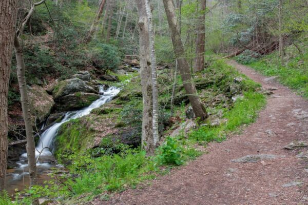
Back on the trail, I definitely recommend continuing on the trail upstream for another 5 minutes of relatively easy walking. Along the stream, there were several sections of small cascades, that make the creek quite beautiful and add the wonderful sound of falling water to the soundtrack of the forest.
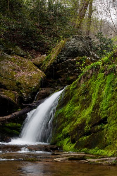
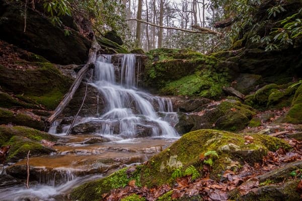
Eventually, you’ll reach a fork in the creek. At this point, the trail turns to the right and starts uphill. However, before heading uphill, take a moment to look to your left. Here, on the stream that flows into Mill Creek, you’ll see a small second waterfall.
Unfortunately, getting to this waterfall not only requires some tricky wading and rock balancing but also requires navigating a small logjam in the creek. However, while it’s only about 6-8 feet tall, this upper waterfall is worth seeing if you can do so safely.
While you could turn around after seeing this second waterfall, I definitely recommend continuing along the Mason-Dixon Trail.
Where the stream splits, the trail breaks with Mill Creek and heads sharply uphill. There are a series of steep, but not overly difficult switchbacks that take you to the crest of the ridgeline.
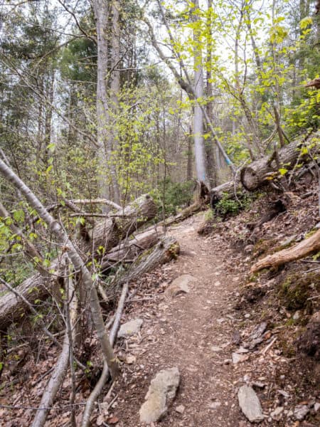
Once at the top of the ridge, continue walking along it for about 5 minutes. Eventually, you’ll come to a small rock outcropping that has nice views of Holtwood Dam when there are no leaves on the trees.
This is a great spot to rest for a bit, and, in season, catch some nice views of the Susquehanna River.
From here, you could continue to follow the Mason-Dixon Trail, which will eventually meet back up with the road near the dam, or you can return the way you came.

While I’ve continued on in the past and there’s nice scenery, it requires a long road walk to get back to your vehicle, so I’d recommend simply returning the way you came so you can check out the waterfalls a second time.
Overall, Mill Creek Falls and this section of the Mason-Dixon Trail are surprisingly unknown given how impressive they are and how beautiful this area is. However, just because you’ve enjoyed the beauty of the area, there’s still more to see at nearby Lock 12.
At this point of the Susquehanna River, the Susquehanna and Tidewater Canal once ran alongside the river. Going the 45 miles from Wrightsville, Pennsylvania, to Havre De Grace, Maryland, the canal was open from 1840-1895 and carried lumber, coal, grain, and other supplies along the river.
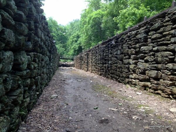
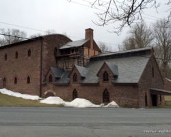
While several areas of the canal can still be seen today, the best preserved is Lock 12, which is along the same road as Mill Creek Falls (look for signs for the lock when driving back to the main road).
The walls of the lock are quite well preserved and still show signs of where the old doors would have been. View of the lock can be had from the top or from inside the lock, giving you a unique vantage point.
In the vicinity are several signs that explain the history of the canal and how it worked. You’ll also likely notice the ruins of several buildings that would have been in use during the mid-1800s.
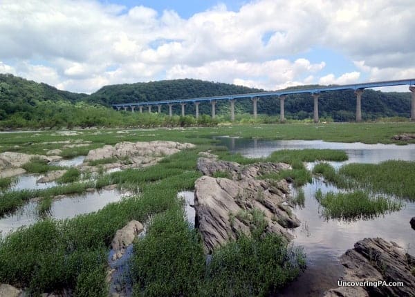
From the Lock 12 area, it’s also worthwhile to follow some of the trails behind the lock down towards the Susquehanna River just a few minutes walk away. Being below Holtwood Dam, the river here is very shallow with many small pools full of minnows and crayfish. This scenic area is definitely worth checking out for its semi-natural beauty.
How to Get to Mill Creek Falls and Lock 12
Both Mill Creek Falls and Lock 12 are located off of River Road on the York County side of the Susquehanna River near Holtwood Dam.
To see Mill Creek Falls, drive about a quarter-mile down River Road from Holtwood Road. Park in the second lot that you pass on the right.
From here, continue walking further up the road until you reach the bridge over Mill Creek. The waterfall is located about 100 yards up the trail that starts just after the bridge on your left.

The trailhead can be found at the following coordinates: 39.819141, -76.336116.
To see Lock 12, park in the first parking lot that’s located directly adjacent to Holtwood Road and take the short trail to the lock.
Looking for more great things to do in the area? Check out the White Cliffs of Conoy, Chickies Rock, The Pinnacle, and the Indian Steps Museum.
[Click here for information on how to use the coordinates in this article to find your destination.]



 "
"


Thanks for the directions to these falls, Jim. The coordinates were right on the nose and I parked just before the bridge. Like a fool, I decided to climb down to the base of the falls to try and get some better photo vantage points. I’m not a climber by nature, so I treaded very carefully. To make a long story short, the ascent/ descent was successful (with great care) and I was able to snap a bunch of images. Sadly, however, none turned out very well I think because by the time I arrived the lighting was wrong (I arrived by 1:30 PM EST which meant the sun was nearly at the top of the falls). Next time, I’ll arrive in the morning. I also think that somehow I missed some of the falls. I was tired by the time ascended back up to the base of the bridge and followed the trail for a while, but I think there may have been more as I went higher. Anyway, definitely returning soon before it gets colder and thanks again for your precise directions!
Glad the directions were helpful. My pictures didn’t come out great either because I was also there in the middle of the day. Hoping to visit again soon to photograph this waterfall again, as well as a couple more that I think are hiding in that area.
I currently came across some information on “Misty Falls”, apparently not far from these and looking quite impressive. I think I’ll swing by there on my home from Kilgore Falls of MD when I visit in the coming days.
Where’s Misty Falls located?
Thanks for another great article. I appreciate your discussion about Lock 12 on the Susquehanna and Tidewater Canal. The story of the canal systems in Pennsylvania is not well known but I’ve find it fascinating.
Thanks so much for this post that lead my daughters and I on a beautiful fall adventure today. They are ages 2 and 4, and the hike to the falls was easy and short for us all, considering I had to hold and steady the girls for safety the whole time. We loved seeing the falls and had lots of fun at the dam and lock 12 as well. Great opportunity to teach about water, power and PA heritage. For others with littles, the dam area has porta potties. Lock 12 has bathrooms that lock in the fall. The area also has picnic tables and swings. Thanks again!
I would like to take my famiky here. Is there any entrance fees?
Nope. Very, very few of the outdoor areas in PA have admission fees.
Great information.
Can we take a stroller upto mill creek fall View?
I can’t imagine a stroller would make it. However, it’s only a few hundred yards, at most, from the road. You could take a stroller from the parking area to the trail and just leave the stroller there while checking out the falls.
Definitely not stroller friendly. Your little one should be able to walk while holding your hand or be in a wearable baby carrier. I walked with my 2 and 4 year old but would not slow them to let go of my hand because they could have a serious tumble in some spots. It’s too narrow and steep and bumpy for a stroller. It’s best to think of it as a hike that is short enough for kids to do.
Wonderful spot for family with kids, real joyful natural heaven.
Thanks for the details, with out this post and coordinates, with out which we could have restricted ourself to the Dam and historical locksite
If you turn right instead of left before the bridge there is more of the Mason Dixon trail exploring down the trails and off a little bit we found several areas that were obviously used in the same time period you can see some old remains of other canals its abit of a rough hike but absolutely worth it..
Thanks for the great story about a beautiful waterfall and also historic canal lock. A small critique: there are at least 3 River Roads in the immediate area, including two on the East side of the Susquehanna (one of which leads to Tacquan Glen). The road to Mill Creek Falls and to the Lock 12 area is actually McCalls Ferry Road, not River Road. Crossing Route 372 from the Lock 12 side (now heading South) is River Road and it leads to the remnants of Lock 15. These are also in excellent shape, but you cannot get down into Lock 15 as you can Lock 12. At Lock 12, don’t miss the reconstructed dual lime kilns. The dual structure is unique and these are in great shape.
How did Mill Creek Falls get it’s name? I assume it was because there was a mill (or mills) there. If so, what can you tell me about the mill(s)?
Thank you very much, !!!!
That would be my assumption, but I really don’t know for sure. The York County Historical Society might have more information if you want to dig into it.
Just before you cross the bridge over Mill Creek Falls to the right was John Stokes sawmill, the stone foundation is still standing , some of the stone lined mill race is there and small parts of the dam enbutment remain directly above the bridge .
Nice read & great photos,
Okay. I will contact them.