Located deep in Snyder County, you’ll find one of my favorite hidden gems in the Susquehanna Region of PA, the Snyder-Middleswarth Natural Area.
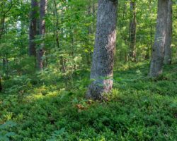
The Snyder-Middleswarth Natural Area is a 500-acre National Natural Landmark that can be found within Bald Eagle State Forest. It is home to one of the largest swaths of old-growth forest in Pennsylvania, having been saved from logging when the land was purchased in 1902.
Interestingly, from 1921 until the mid-1990s, this area was an actual state park, but for some reason, this status was changed, and it’s now simply a natural area within the state forest.
Visiting the Snyder-Middleswarth Natural Area had been on my list for many years, but its isolated location, even by state forest standards, made it a hard spot to visit, but I was excited to finally check it out in the summer of 2025.
Getting to the Snyder-Middleswarth Natural Area
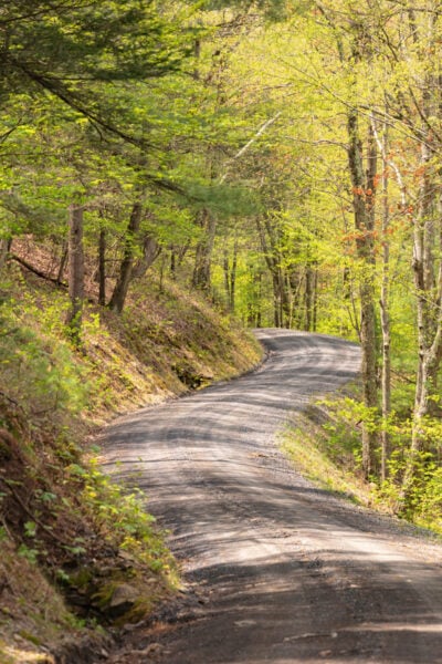
No matter how you get to the Snyder-Middleswarth Natural Area, you will have to traverse several miles of dirt roads within Bald Eagle State Forest. Note that these roads are not maintained in the winter months, so this is a spot you’ll want to save for when it’s warmer out.
I approached the natural area from the west. This meant I had about four miles of driving on gravel roads from Ulsh Valley Road. However, at the time of my visit (mid-2025), these roads were easy to navigate in a standard car. I have no specific information about the roads approaching from the east via the community of Troxelville.
No matter how you go, make sure to use caution as these roads are narrow, curvy, and conditions on gravel roads can change from year to year.
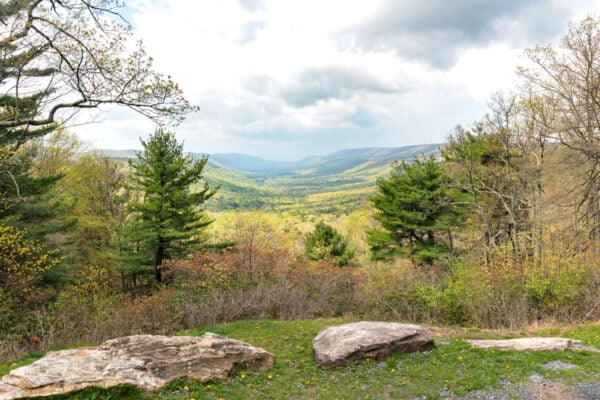
It’s worth noting, if you do approach the Snyder-Middleswarth Natural Area from the west, there is a fantastic roadside vista along Locust Ridge Road that is worth a stop as it’s one of the best roadside vistas in Bald Eagle State Forest. It can be found at the following coordinates: 40.793671, -77.310118.
There is a fair bit of room for parking at Snyder-Middleswarth, probably more than will ever be needed due to its remote location. The main parking area can be found at the following coordinates along Swift Run Road: 40.809551, -77.282722.
If this parking area is full, you can also park a bit to the east at Rock Springs Picnic Area.
[Click here for information on how to use the coordinates in this article to find your destination.]
Hiking in the Snyder-Middleswarth Natural Area
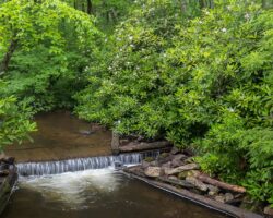
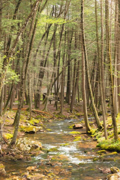
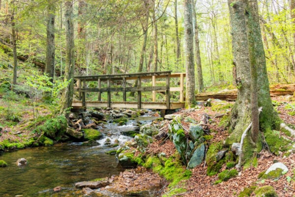
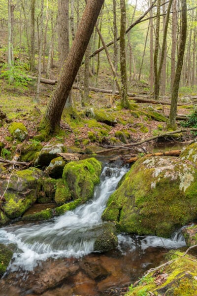
Even before you start hiking, make sure to take some time to check out the beautiful area around the parking lot. Swift Run flows through the Snyder-Middleswarth Natural Area, and there’s a small waterfall directly next to the bridge over the creek.
When it’s flowing well, this is a really scenic spot, and I spent a good while just enjoying the stream as it ran through the parking area and taking photographs.
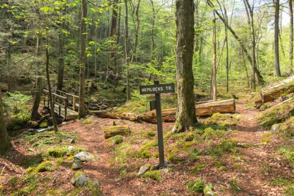
There are two trails that leave from the parking area: the Swift Run Trail and the Hemlocks Trail. These trails combine together to make a fantastic loops that runs approximately 3.4 miles through this beautiful virgin forest.
For those looking for a longer hike, you can also extend this hike further using additional trails within the state forest. These can be found on either the state forest map or on the more-detailed map from Purple Lizard (which is what I used).
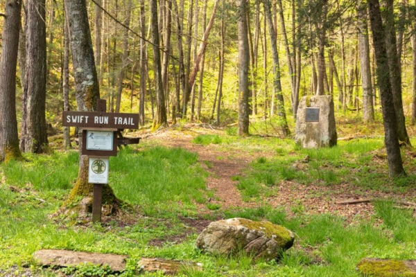
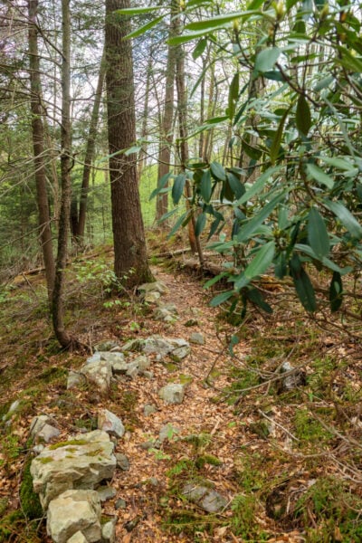
While both trailheads loop back to the same parking area, I opted to do the hike in a counterclockwise direction following up the right side of Swift Run. This trailhead is well marked with both a trail sign and a stone with a historic marker denoting the area’s National Natural Landmark status.
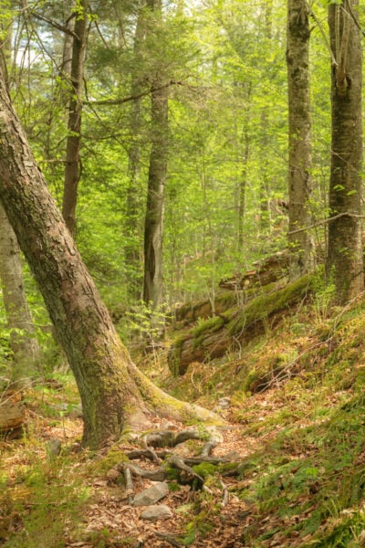
The Swift Run Trail runs up Swift Run, sometimes close enough that the trail might be wet in times of high water. This trail is narrow and overgrown in spots, but is overall a relatively easy hike despite some rough footing in some places.
As the trail slowly ascends the hillside alongside the creek, you’ll pass massive hemlocks that are numerous in the area.
Sadly, they used to be even more numerous, but many were lost to the wooly adelgid that is decimating hemlock trees all throughout the region.
You’ll see part of their destruction as you hike the Swift Run Trail as you’ll pass next to and even through several massive hemlocks. It is truly amazing how large some of these trees are.
I actually came across a two-decade old report from the Department of Conservation and Natural Resources noting that one fallen tree had 347 rings! That is a seriously old tree.
Honestly, when I was hiking the Swift Run Trail, it felt almost primeval and reminded me of some of the hiking I’ve done in the Pacific Northwest thanks to the towering trees and copious amount of moss on the rocks that dot the beautiful stream.
This is truly a special place.
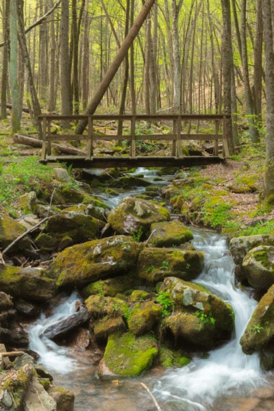
About halfway through the hike, you’ll come to a wooden bridge over Swift Run. From here, you can continue further up the creek and do a longer loop, but I opted to complete the standard 3.4-mile hike and followed the trail uphill.
While both portions of the hike are blazed in yellow, the second half of the hike is technically, on the Hemlocks Trail. It’s worth noting that, like the Swift Run Trail, while the Hemlocks Trail isn’t overly difficult, there are a lot of roots and rocks, so care should be taken when hiking here.
After a short uphill that takes you away from the creek, the trail flattens out as it continues through the forest. Fortunately, while the trail takes you away from Swift Run, there’s still an almost constant sound coming from the creek below that makes this a great hike.
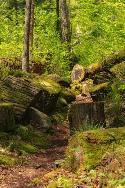
Even though the Hemlocks Trail isn’t far or high above Swift Run, it was interesting to me how different this part of the hike was. There were even more massive hemlocks that had been toppled in recent years. In fact, in spots, it almost looked like a tornado had come through the damage was so extensive.
However, there was still a lot of beauty to be found here, including some mountain laurel, which I’m sure are quite stunning when they are in bloom.
The Hemlocks Trail ends back at the parking lot where you started, and you hike on a bridge over the small waterfall just as you arrive back at your car.
Overall, I was blown away by the Snyder-Middleswarth Natural Area. It really is amazing to me how many incredible spots there still are for me to explore after a dozen years of travel around the state.
Whether you just make a quick stop to view the small waterfall in the parking lot, go on the 3-mile hike, or do an extended excursion, I highly recommend a visit to the Snyder-Middleswarth Natural Area in Snyder County, PA.
Looking for more places to visit nearby? Check out T&D’s Cats of the World, the covered bridges of Snyder County, and the Poe Paddy Tunnel.