When I just started exploring Pennsylvania, Angel Falls was one of the first waterfalls I visited. However, since my visit was in the summer, the falls weren’t much more than a trickle. Wanting to see this waterfall at its most impressive, I recently revisited the falls after a good deal of rain had fallen in northeastern Pennsylvania.

Angel Falls is located in the southern reaches of Loyalsock State Forest. The 59.2-mile Loyalsock Trail used to pass directly next to Angel Falls but was rerouted to help protect the area. Nevertheless, hikers are still allowed to venture to Angel Falls, as well as to Gibson Falls, and an unnamed falls further down the stream.
There are three ways to hike to Angel Falls and Gibson Falls from two different parking areas.
The traditional way is to hike the Loyalsock Trail from a parking area on Brunnerdale Road and take a side trail to the top of the waterfall. While this is how most people reach the falls, I think this makes a better option for the return portion of a loop hike.
Instead, from this same parking area (which can be found at these coordinates: 41.385239, -76.668308), cross Brunnerdale Run on the Loyalsock Trail and follow it for about half a mile. At this point, the Loyalsock Trail will make a hard turn to the right and you’ll see an unblazed old forest road in front of you. Follow this old road.
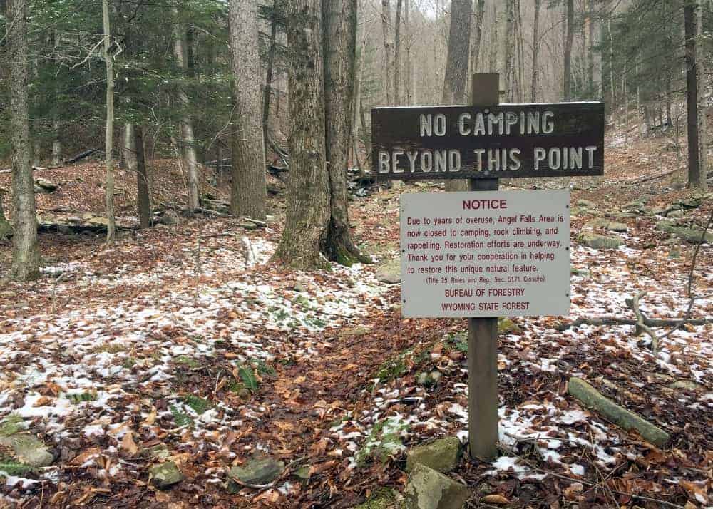
The old road is easy to follow, though a bit overgrown in places and follows relatively close to Ogdonia Run. After a few minutes of hiking, you’ll come to a sign that says “No Camping Beyond This Point” with another sign below it that contains a few rules, none of which apply to hikers at the time of my visit.
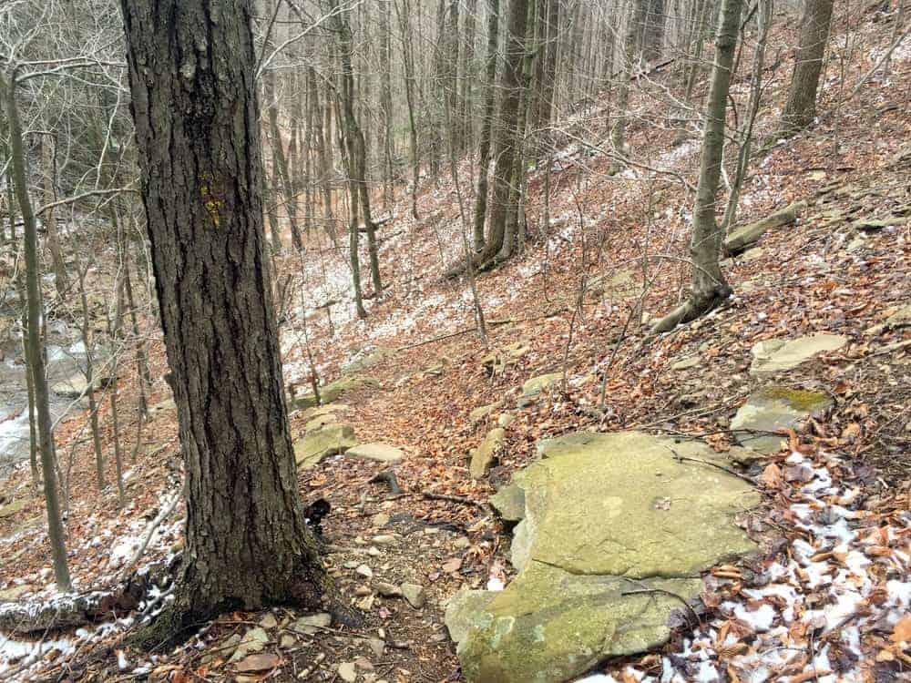
From this point, there really isn’t much of a trail, but the forest is relatively open. Take care and work your way upstream on Falls Run, which you’ll come to just a short distance beyond the sign.
At some point below the lowest waterfall, you’ll need to cross the waterway. Depending on water levels, this may or may not be possible without getting your feet wet. Several blowdowns also complicate this approach.

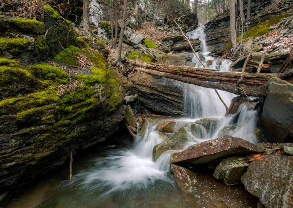
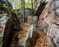
A short way up the stream, you’ll come to the lowest waterfall on Falls Run. This waterfall is only about 12 feet in height, which pales in comparison to the two waterfalls further upstream. Nevertheless, it’s a beautiful spot, and it’s well worth taking a few minutes to enjoy.
When you are ready to continue upstream, head up the left bank (if looking upstream). There’s not really a trail at this point, so pick the way that seems best to you making sure to stay away from the cliffs.
As you make your way up the bank, you’ll eventually see the remnants of a trail and possibly a few markers for the Loyalsock Trail that once ran here.
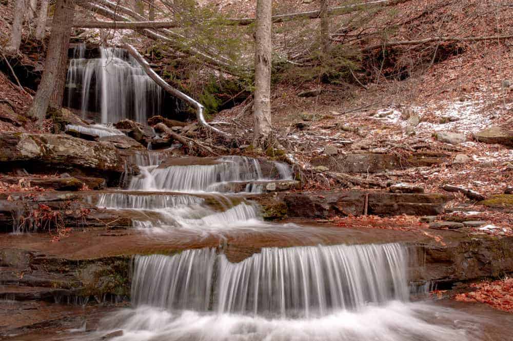
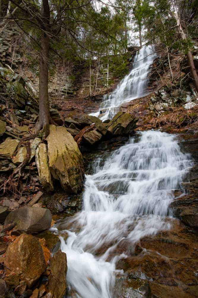
Once you get to the top of the rise, take a small trail to your right that goes through a gap in the cliffs. This is the hidden Gibson Falls. This 30-foot waterfall is often missed by those that visit the top, or even the bottom, of Angel Falls and don’t know that this waterfall is just steps downstream.
Gibson Falls features two main drops, with the upper one being the largest and most impressive. Be careful if you opt to get a closer look as the rocks here are very slippery.
Once you are ready to continue, stay on the left bank and head back to the trail remnants you were previously following and head to the left of the cliffs, again making sure to not get too close to the edge.
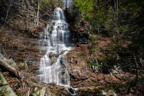
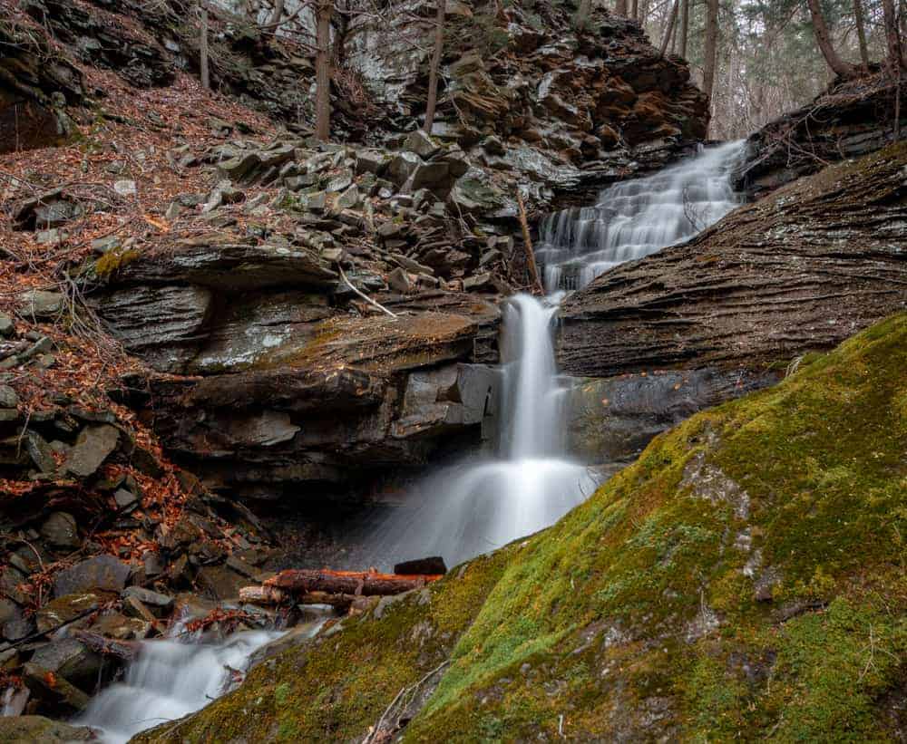
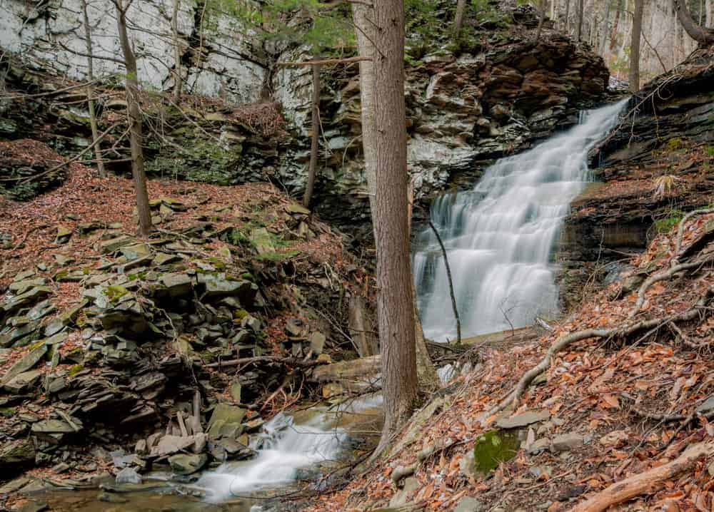
Once you reach the top of the cliffs, the impressive Angel Falls comes into view. It is said that this waterfall was named Angel Falls because it reminded people of Angel Falls in Venezuela, the world’s tallest waterfall.
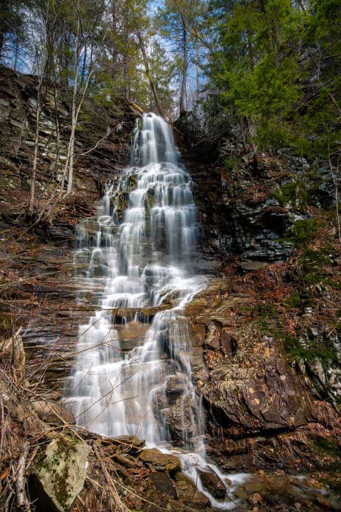
Angel Falls features a 60-70 foot straight drop, along with a small drop just below it. When this waterfall is flowing well, it’s one of the most impressive waterfalls in Pennsylvania. For those that use them, Angel Falls is located at the following coordinates: 41.394033, -76.677017.
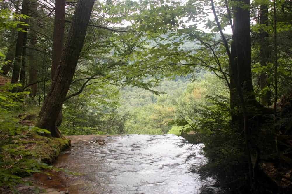
From the base of Angel Falls, follow an obvious blue-blazed side trail on the left bank as it meanders its way to the top of Angel Falls. The top of the falls offers an impressive view over the valley below, but make sure to be cautious around the edges of the cliffs.
From this point, you have two choices. The first option is to follow your steps back down the gorge and toward your car. This is the shorter, but harder of the two options. However, if you opt to park at the shortcut spot (which will be explained below) this is your best bet.
To do a loop hike, follow the blue blazes to the Loyalsock Trail. When you get to the trail, turn right and hike for about a little over a mile back to the main parking area on Brunnerdale Road.
A Shortcut to Angel Falls
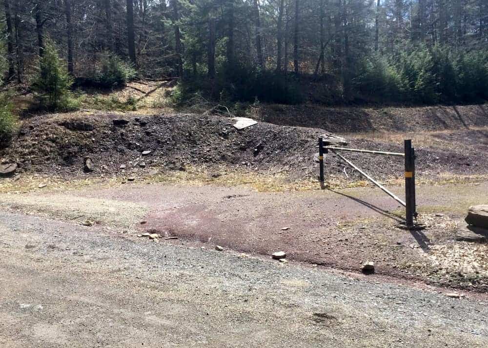
If you are comfortable with a bit of off-trail hiking and don’t mind a wet stream crossing, there is a short cut you can take to Angel Falls. Instead of parking where the Loyalsock Trail crosses Brunnerdale Road, park at a clearing along a bend in Ogdonia Road. The clearing can be found at these coordinates: 41.389829, -76.678420.
When parking, make sure that you don’t block the gate.
From this spot, cross the road and make your way down the steep embankment towards Ogdonia Creek.
At the creek, carefully make your way to the opposite bank. Unless water levels are extremely low, you will have to get your feet wet to make this crossing. At times of particularly high water, this may be an unsafe or impossible crossing.
Once across the creek, walk away from it. In less than 100 yards, you’ll come to either the trail, the sign for the gorge, or Fall Creek itself (depending on where you crossed the creek). From that point, simply head up the gorge to the top, and then retrace your steps back to your car.
While this option is definitely more challenging, it does cut over a mile off your hike to Angel Falls in Loyalsock State Forest.
Note that the hike mentioned here was adapted from one found in “Hiking the Endless Mountains” by Jeff Mitchell (Affiliate link). I can’t recommend this book enough for those looking to explore northeastern PA.
Looking for more places to explore in the area? Check out Jacoby Falls, Dry Run Falls, the covered bridges in Sullivan County, Cottonwood Falls, and our top things to do in Worlds End State Park.
[Click here for information on how to use the coordinates in this article to find your destination.]
 "
"


Thank you. Can’t wait to check it out