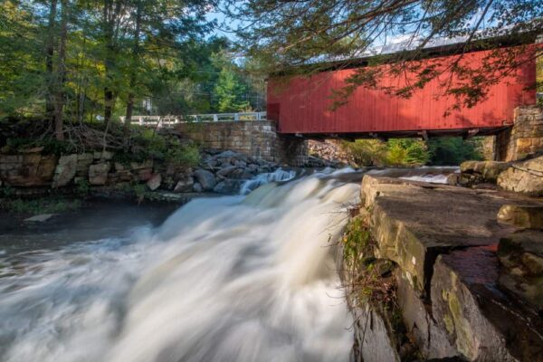
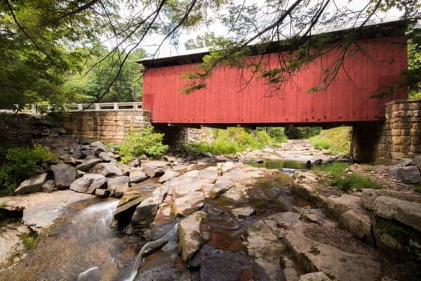
There are just over 200 covered bridges in Pennsylvania, but only one of them features a natural waterfall directly below it: Packsaddle Covered Bridge.
Packsaddle Covered Bridge is located in a rural part of southeastern Somerset County, Pennsylvania. While getting to this bridge takes a bit of time as it’s not near any major roads or communities, it’s definitely a worthwhile spot to check out if you love covered bridges and waterfalls.
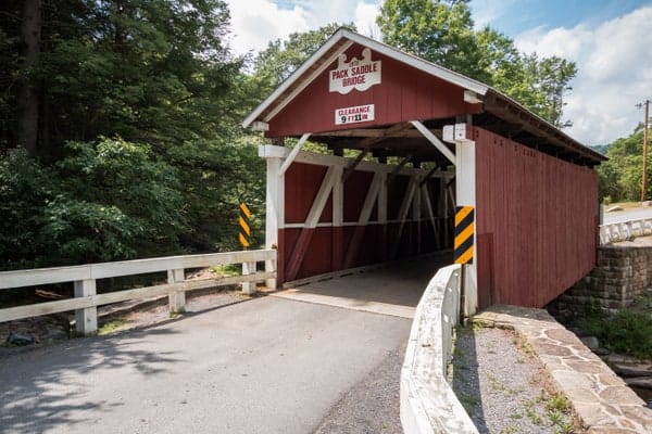
Packsaddle Covered Bridge (which is known as Doc Miller Covered Bridge in some sources) was built in 1870 by a builder that has been sadly lost to time. At 48 feet long, it is the shortest of the 10 covered bridges in Somerset County, PA. However, this isn’t a bridge you visit because of its immense length.
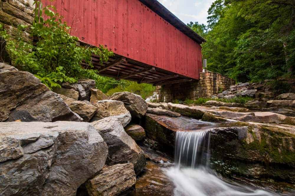
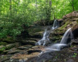
Pulling up to Packsaddle Covered Bridge, you’ll instantly notice its idyllic setting as it crosses Brush Creek in a narrow valley that’s surrounded by woodland. In fact, even without the waterfall, this is an incredible spot to visit and certainly one of the most beautiful covered bridges in the region.
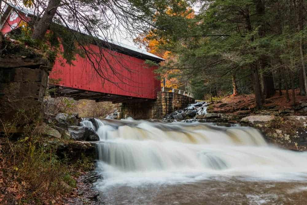
The waterfall itself is located directly under the bridge and can’t be seen without getting out of your car and peering over the edge of the railings. For those that aren’t able to climb down to the base of the bridge, you’ll still be able to see the waterfall from above.
That being said, I highly recommend scampering down to the base of the waterfall if you are able as the views from the bottom are fantastic.
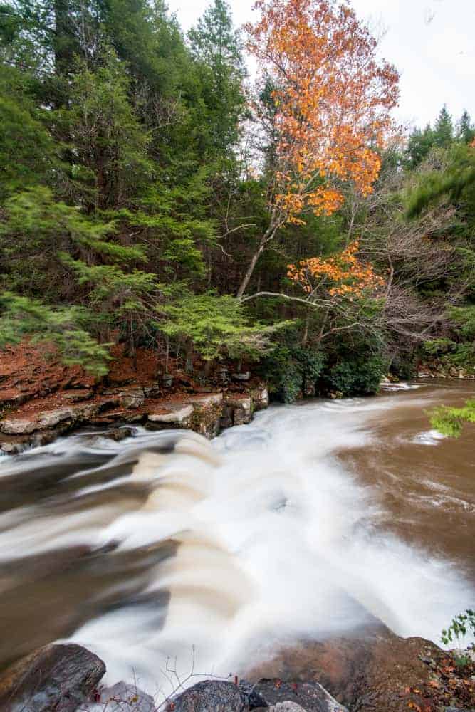
This waterfall on Brush Creek is approximately 10-12 feet in total height between the two drops and about twice as wide as it is tall. Water levels here can be fairly low in the summer, so it’s best to visit after it has rained or during the spring melt.
It’s possible to get nice views of Packsaddle Covered Bridge and its waterfall from both sides of the bridge, though the views you can get do vary based on the side you climb down.
The harder side to climb down is the western side of the bridge and the same side on which there is a cabin near the bridge. This side also offers the best views as you can climb to the base of the falls and a bit downstream.
There is no real trail to the base here, and you’ll have to either carefully climb down one of the steep user-created trails or make your way down the rocks near the covered bridge. These rocks can become slippery when they are wet, so use caution.
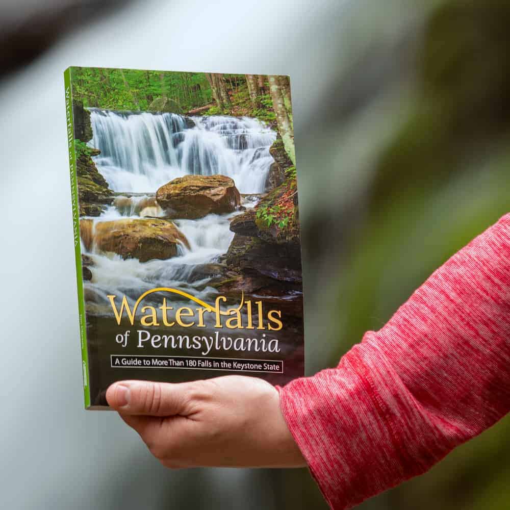
"Waterfalls of Pennsylvania" by Jim Cheney
If you love PA waterfalls, you won't want to miss this waterfall book from Jim Cheney, author of Uncovering PA, featuring more than 180 great waterfalls. Order it now on Bookshop.org or Amazon.
If you opt to climb down this side, be aware of the private property line near the bridge and stay between the creek and the signs.
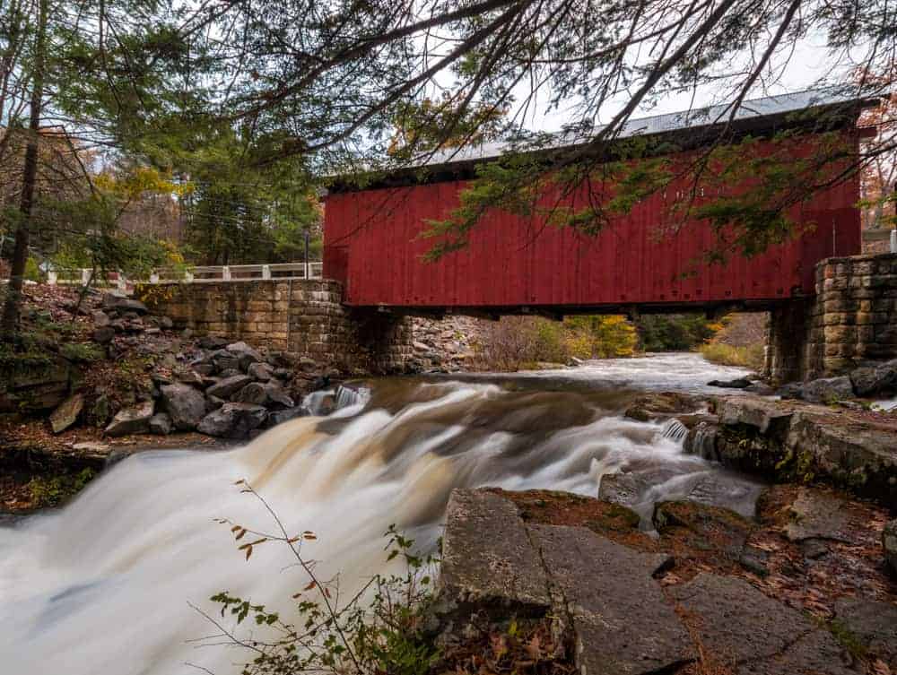
From this side of the bridge, you can get a great view of the Packsaddle Covered Bridge, the waterfall, and the pool below them. I’ve been told by visitors that this is a great fishing hole if you are looking to spend a bit of time enjoying this spot.
The eastern side of the bridge (the opposite side from the cabin) is a bit easier to navigate, but it does require crossing a narrow and shallow stream when water levels are high. If water levels are high, this side stream actually creates a second small waterfall that flows into Brush Creek adjacent to the bridge.
On this side of the creek, there are large rocks from which you can view the waterfall and covered bridge. Use caution, however, as a slip on these rocks would drop you into the waterfall or the pool below it.
That being said, this is definitely the easier of the two sides to get a bit of a downstream view of the waterfall. However, you cannot easily get to stream level from here.
Regardless of whether you climb down one side, both sides, or simply peer over the edge of the bridge, Packsaddle Covered Bridge is undoubtedly one of the most beautiful covered bridges in all of Pennsylvania. If you love covered bridges and/or waterfalls, this is a spot you definitely won’t want to miss.
How to Get to Packsaddle Covered Bridge

Packsaddle Covered Bridge is located in the Laurel Highlands of Southwestern Pennsylvania. The nearest community is Berlin, PA, though that is more than 11 miles away.
Packsaddle Covered Bridge can be accessed from either the east or the west and the roads in are well maintained, so driving there shouldn’t pose any issues for most of the year.
The bridge can be found along Packsaddle Road at the following coordinates: 39.867544, -78.817226.
There is a nice size pull-off on the eastern side of the bridge that can accommodate several cars. Parking typically only becomes an issue here when the local high school has its dances as this is a popular spot for portraits.
Even then, however, there is usually room to pull off somewhere along Packsaddle Road.
Looking for more spots to visit nearby? Check out the covered bridges of Bedford County, Coral Caverns, and the Great Allegheny Passage.
 "
"

Thank You and Please keep up this great artistic work! May God Please Bless and use you!😇😇
McConnells Mill State Park in Butler County, PA has a nice covered bridge with a waterfall.
That’s a great spot too! Definitely one of my other favorites.
Please give some roads in directions because not all of us older folks have a way to find the number locations.
If you have a smartphone with a mapping function, pop that coordinates into that and it’ll take you right there. If you don’t, copy/paste those coordinates into Google Maps on your computer and it’ll give you directions. Since people are coming from a variety of directions, it makes sense to provide information that can be used by anyone to find their way to the spot.