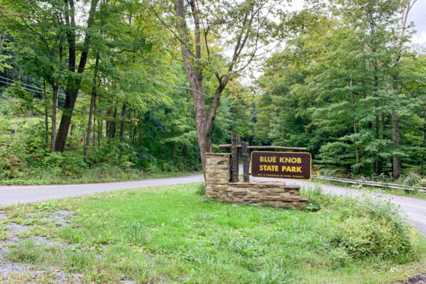
Located high atop the second-tallest peak in Pennsylvania, Blue Knob State Park is probably best known for its ski slope and for being one of the snowiest places in PA. However, during the warmer months of the year, there are also some really nice hiking trails here.
Wanting to explore a small portion of this 6,100-acre park, I decided to hike a slightly modified version of the Pavia Lookout Loop.
The Pavia Lookout Loop is located near the top of the mountain, just down the road from the ski slope, and high above the park’s campgrounds, swimming pool, and picnic areas. While the trail is officially only listed as a mile, I did a modified version of this hike that was also on the Mountain View Trail and the Three Springs Trail that created the two-mile hike described in this article.
This hike is relatively easy, with only one steep downhill section. All told, there is only about 150 feet of elevation gain and loss on this entire loop, making it suitable for just about everyone.
While you could reach this trail and vista from other spots in the park, the best parking area is located at an unmarked spot at a nearly 180-degree bend along Pavia Road (called Ski Access Road on the park map). This spot can be found at the following coordinates: 40.287410, -78.565774. Or, if you’d rather, you can look at your odometer and travel one mile from the intersection of Pavia Road and Forest Road.
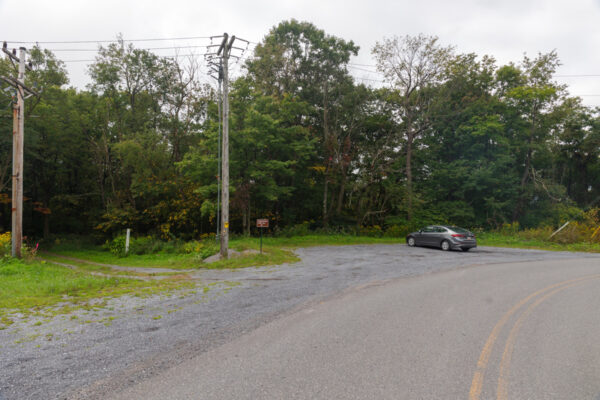
This is a large gravel pull-off that is marked only with a small sign that reads “Mountain View Trail” that has room enough for a fair number of vehicles.
From this parking area, you want to walk past the gate and start heading down the trail. At this point, it’s an old gravel road, so it’s quite easy to follow.
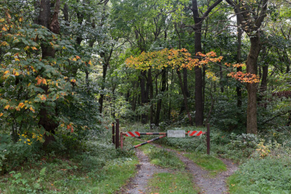
Just after entering the forest, you’ll come to a trail split with the Three Springs Trail branching off to your left. Take this turn instead of continuing on the Mountain View Trail. This is actually the continuation of the old forest road, so you might not even realize that you are on a different trail.
According to the park map, the Pavia Lookout Loop starts on the righthand side of the trail shortly after you turn onto the Three Springs Trail. However, this turn-off isn’t well marked and is easy to miss. Because of this, I recommend continuing on the loop as described here instead of trying to do it in a counterclockwise direction or going straight to the overlook.
That being said, if you are able to find the turn-off, it would be about half a mile hike directly to Pavia Lookout.

"Waterfalls of Pennsylvania" by Jim Cheney
If you love PA waterfalls, you won't want to miss this waterfall book from Jim Cheney, author of Uncovering PA, featuring more than 180 great waterfalls. Order it now on Bookshop.org or Amazon.
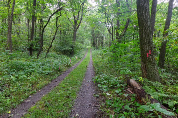
Regardless, to continue on the two-mile loop listed here, continue following the old road that is now the Three Springs Trail. Despite being close to the ski slope, this area feels very removed from civilization and is quite a beautiful hike through the woods.
After hiking for a little less than half a mile, the Three Springs Trail descends rather steeply down a hill. Keep your eyes peeled on your right for a black post with the number 4 on it, as well as a very worn wooden sign that says “Lookouts”. This numbered post corresponds to the numbers you can find on the map of Blue Knob State Park.
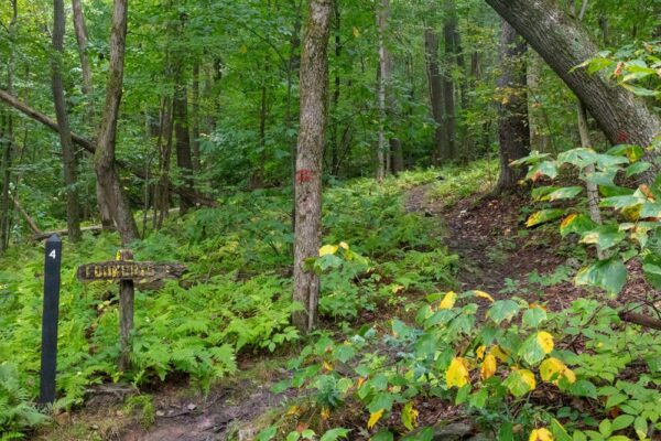
At this point, you’ll want to turn to the right and follow this trail into the woods. It’s uphill at first, but it’s not overly difficult, and the trail is easy to follow despite not being very well blazed. That being said, the entire hike uses red blazes where they are visible.
The forest here is truly breathtaking, and the old stone steps that can be found here are really neat to hike across. This part of the trail is simply a trail, instead of an old road, so you definitely get more of the sense of hiking through a pristine woodland here.
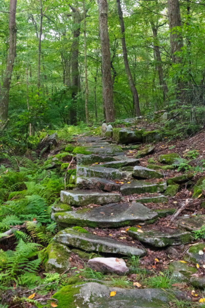
It was on this section of the trail that I ran into the only two other hikers I saw during my entire hike. They saw my camera and asked if I was out looking for Bigfoot. So, I suppose that’s something to keep your eyes peeled for.
As you hike, you’ll pass an obvious trail to your right with a signpost with the number 5 on it. Continue walking straight and don’t take this side trail as it will skip the overlook (though it is a shortcut back to your vehicle should you need that for some reason).
Approximately 0.6 miles after the turn at the number four marker, you’ll reach Pavia Overlook (Note that the sign here says “Pavia Overlook” despite the trail being the Pavia Lookout Loop). This vista faces to the west and provides a largely unobstructed view overlooking Blue Knob State Park and Gallitzin State Forest.
For those that use a GPS while hiking, the overlook can be found at the following coordinates: 40.279328, -78.562777.
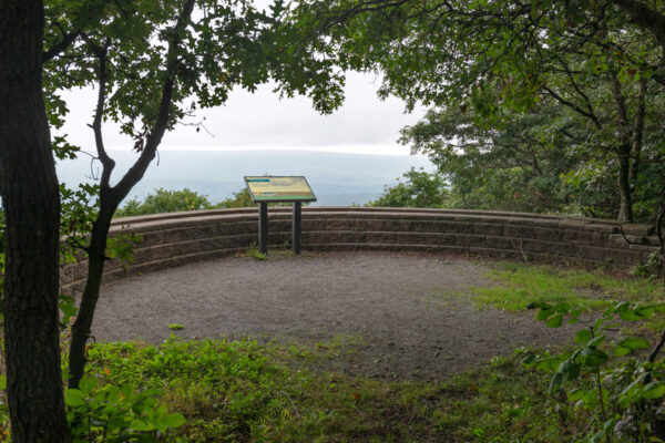
At Pavia Overlook, you’ll see a beautiful stone wall and an information sign here that provides you with a bit of history and information on the area. It also gives you a bit of an idea of what can be seen from here.
Unfortunately, the valley was quite foggy when I visited, which created a lot of visual interest, but did cut down on how far I could see across the rolling hills of Bedford County.
Definitely take a minute to enjoy this beautiful spot as you are standing at one of the best overlooks in PA.
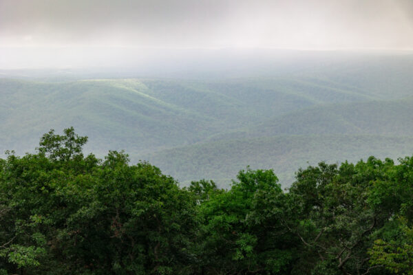
Once you’ve had a chance to enjoy the view, continue to follow the trail through the woods (Don’t go back the way that you came). After a few minutes of hiking, you’ll come to spot 6 on the map which is where the shortcut trail you’d seen earlier meets back up with the main portion of the Pavia Lookout Loop.
Continue straight on the trail that you are on and it will eventually meet back up with the dirt road that is now the Three Springs Trail after about a half-mile relatively flat hike from the overlook.
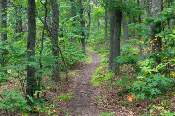
Once back to the main trail, turn left for the short walk back to your car.
Overlook, this modified version of the Pavia Lookout Loop is a great hike in the Allegheny Mountains. While it’s not difficult, it passes through some beautiful scenery and features a really nice vista in the middle of the hike.
So, if you find yourself looking for a nice little hike in northern Bedford County (or if you don’t mind a short drive from Altoona and Blair County), this is a spot to definitely add to your list.
Looking for even more things to do nearby? Check out the Lost Children of the Alleghenies Monument, Cabbage Creek Falls, the covered bridges of Bedford County, and the Johnstown Flood National Memorial.
[Click here for information on how to use the coordinates in this article to find your destination.]

 "
"



My 13 yr old Son and I recently ran across the Overlook…and I was just as amazed as him.. definitely pretty to cool to see all the mountains and how far away you can see. The picture map does a great job at showing you the different places. Definitely something for kids and adults to experience.