Pennsylvania is home to many reservoirs, and since many of these were all created by flooding valleys, it’s not uncommon for the ruins of towns to be deep below the waters surface. What is rare, however, is for those ruins to be exposed.
However, during times to significant drought, some of the ruins below the Youghiogheny River Lake in the Laurel Highlands are exposed, particularly the remains of the Great Crossings Bridge near Addison, PA.
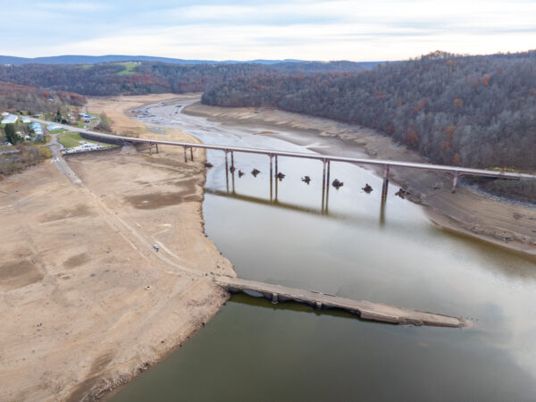
At normal water levels, the over 200-year-old Great Crossings Bridge sits below approximately 50 feet of water. However, during times of significantly low water, like we saw in the fall of 2024, levels can drop far enough for the bridge and several other small ruins to be exposed on the lake floor.
This is something you definitely don’t want to miss, and I have everything you need to know to check it out here.
The History of the Great Crossings Bridge
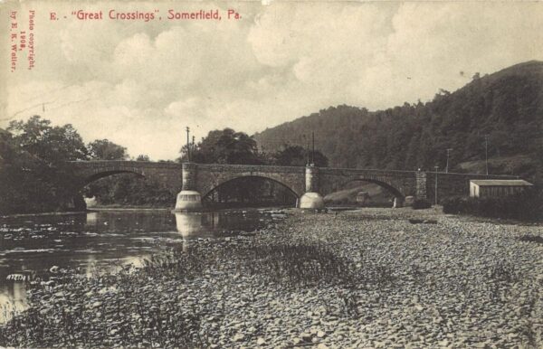
The Great Crossings Bridge was built between 1813 and 1818 by James Kinkead, James Beck, and Evan Evans. The bridge was dedicated on July 4, 1818 with President James Monroe in attendance.
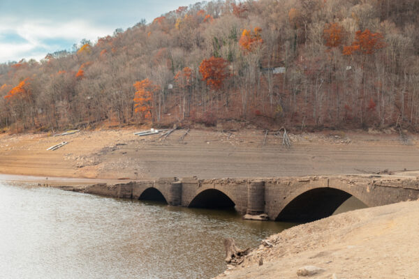
This sandstone bridge measures 375 feet in length and is 40 feet tall and 30 feet wide. It was built with three arches, which were each visible during my visit.
The bridge once carried Route 40 over the Youghiogheny River and led to the community of Somerfield (originally known as Smythfield).
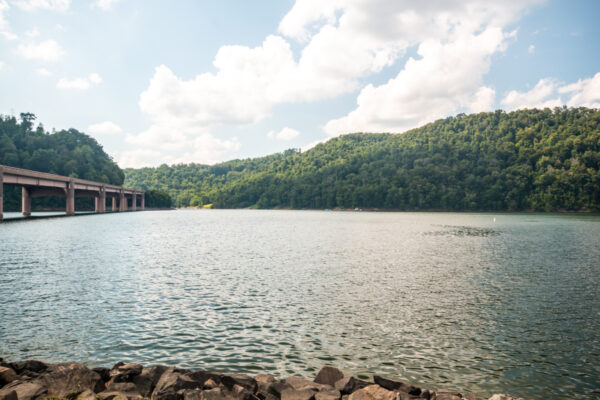
In 1940, the Youghiogheny River Lake was created to provide flood control for land downstream, such as in Ohiopyle State Park, as well as to provide electricity for the region.
Since then, the Great Crossings Bridge typically sits well below the surface of the water, but it is always awaiting low water levels to make its return above the surface.
When to See the Great Crossings Bridge
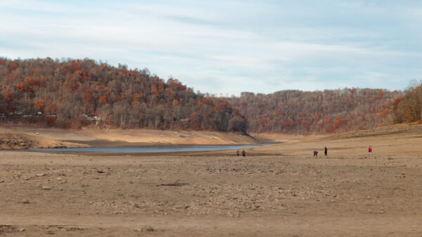
The Great Crossings Bridge is rarely visible and often sits at least 30-50 feet below the waters surface, even when the lake is drawn down in the winter.
Typically, the lake is kept at an elevation of 1,439 feet during the summer months and drops to around 1,419 feet in the winter. The bridge starts to come above the water at 1,392 feet and the decking is exposed at 1,384 feet.
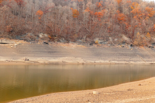
On the early November 2024 day that I visited, the lake’s level was below 1,370 feet, meaning that the bridge was very well exposed. According to my research, while the bridge has been exposed several times over the years, most recently in 2019, it’s been since at least 1998 that the lake levels exposed this much of the bridge.
Visiting the Great Crossings Bridge
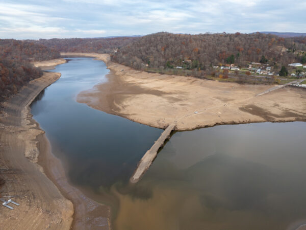
Visitors wanting to see the Great Crossings Bridge for themselves can visit it at the Somerfield North Recreation Area in Addison, Pennsylvania. This area can be found here: 110 Cornish Cir, Addison, PA 15411 (Coordinates: 39.753677, -79.394504).
There is ample parking at the recreation area, though it does get quite crowded on weekends when the bridge is exposed, so don’t expect to have this spot to yourself.
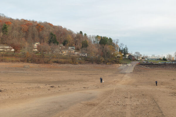
The bridge sits about a quarter mile from the parking area, and getting to it requires walking down the boat ramp and then across the dirt-covered lake bottom to the remains of the stone bridge. This is not an overly difficult walk, but you do have to go downhill to get there and places on exposed bottom can be a bit rocky.
As you’re walking to the Great Crossings Bridge, take note of the foundations of buildings and sidewalks that you can see on the lake bottom. These are even more evidence of the community that once occupied this valley.
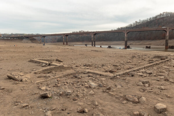
It’s also impressive to see how far above the water the current Route 40 bridge is, especially if you’ve seen the area at a normal water level. Other ruins dot the land below the modern bridge.
As you approach the ruins of the Great Crossings Bridge, it’s worth noting that the bottom of the lake drops off sharply, so use great caution when exploring this area.
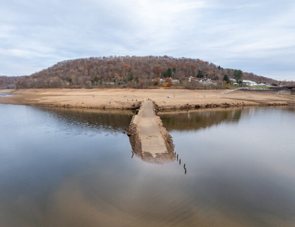
Depending on when you visit, walking out onto the bridge itself may or may not be allowed. For example, on the day that I visited concrete barricades blocked off the bridge, so I was unable to walk out onto it and check it out.
In the future, these may or may not be present, but please respect any rules set up that the U.S. Army Corps of Engineers puts in place during your visit.
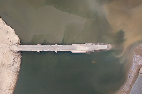
Truthfully, while walking out on the bridge would be neat, the real interest here, in my opinion is seeing this incredible bridge that has been sitting underwater for over 80 years. It’s quite an impressive bridge, and the fact that it’s still in such good shape is a testament to the men that built in over 200 years ago.
Overall, it was pretty incredible to see the ruins of the Great Crossings Bridge in Somerset County, PA. To see such an impressive bridge that is normally 50 feet underwater is truly an amazing experience. It almost feels as if you are walking into a time capsule.
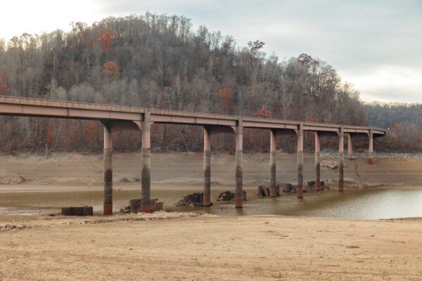
If you have the chance to see this incredible site, whether in late 2024 or during a future period of low water, I highly recommend taking the time to do so.
Let me end with a quick note about drones. I confirmed with a U.S. Army Corps of Engineers ranger on site that flying a drone over the lake is fine, but you can NOT fly from their property. He directed me to the land outside of the gate at the top of the hill, and all drone operations were conducted off of their land.
If you want to fly a drone here, please make sure you are following all applicable rules.
Looking for more places to visit nearby? Check out Nemacolin Woodlands Resort, Fort Necessity National Battlefield, or go white water rafting on the Youghiogheny River.

 "
"
