
Traveling around Bucks County, Pennsylvania, to visit the covered bridges is unlike any other bridge hunting experience that I’ve had in the state.
As one of Pennsylvania’s original counties, the County of Bucks, as it’s officially known, was formed in 1682 and is located in the state’s southeastern corner.
Because of its early formation and settlement, Bucks County has a much older feel than many of the other counties in the state. And, while much of the southern half of the county is crowded Philadelphia suburbs, the Upper Bucks is surprisingly rural, filled with the types of charms you would expect from the English countryside.
It’s in Upper Bucks that you’ll find the majority of the county’s 12 covered bridges.
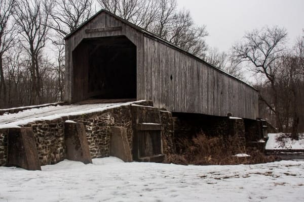
The covered bridges of Bucks County, Pennsylvania, are a bit different from most of the other bridges in the state in that all 12 are built using Town’s Lattice Truss. Even to the most casual observer, you’ll likely notice the lattice boards inside these bridges and how they differ from the typical Burr Arch Truss’ curved beam.
This article is split into three parts. The first part will cover the five historic covered bridges in northwestern Bucks County. The second part will showcase the six covered bridges in the northeastern part of the county. The third part will highlight the one southern Bucks County covered bridge.
The Northwestern Covered Bridges in Bucks County
The historic covered bridges in northwestern Bucks County stretch from near Doylestown all the way up towards Allentown and I-78. The bridges are listed south to north, starting from the one closest to Doylestown, but could also be visited in reverse order if coming in from the north.
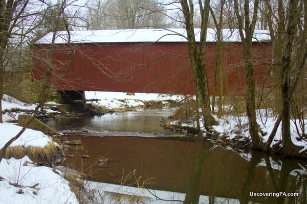
Pine Valley Covered Bridge
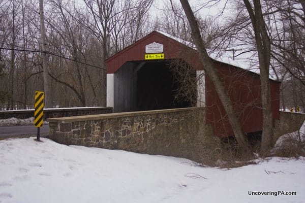
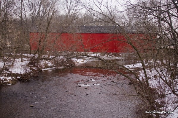
Located less than a 10-minute drive outside of downtown Doylestown, Pine Valley Covered Bridge sits in a scenic area along a busy road. The bridge spans 81 feet over Pine Run Creek along the border of Doylestown and New Britain. Pine Valley Covered Bridge was built in 1842 and was repaired in 2007 after it was damaged by an over-height truck.
The bridge sits next to Covered Bridge Park, a small community park in New Britain. The park contains ample parking and amenities such as a playground, basketball court, and walking trails. It’s along these walking trails that you can get the best views of Pine Valley Covered Bridge.
There is also a wide area next to the covered bridge to view the covered bridge or just for photographs.
Getting There: Getting to Pine Valley Covered Bridge is quite easy if you’re coming from downtown Doylestown as the bridge sits just half a mile off the main road heading west out of downtown.
When you get to the bridge, park in the parking area for Covered Bridge Park and walk the 100 yards to the bridge. The parking area can be found at the following coordinates: 40.304823, -75.186929.
South Perkasie Covered Bridge
Note: This bridge was severely damaged in September 2021 by the remnants of Hurricane Ida. Hopefully, it will be rebuilt in the future.
Of the 12 covered bridges in Bucks County, Pennsylvania, there are only two that are no longer open to cars, and South Perkasie Covered Bridge is one of them.
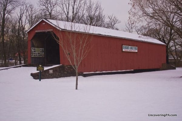
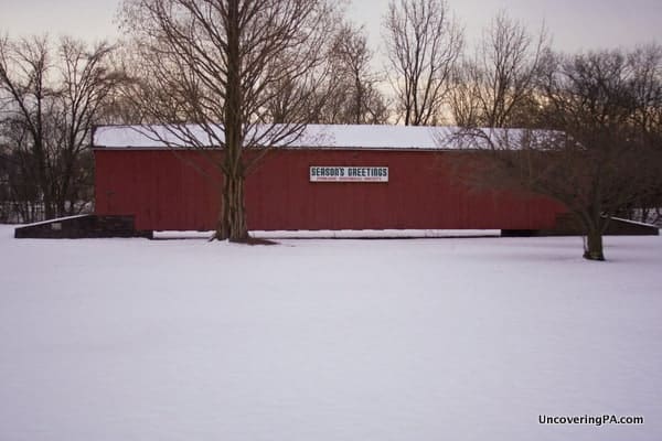
South Perkasie Covered Bridge was built in 1832, making it the oldest covered bridge in Bucks County, and one of the oldest in the state. The 93-foot long bridge used to span Pleasant Spring Creek, about a mile from its current location but was moved in 1958 to keep it from being destroyed.
Today, the bridge is a feature of Lenape Park just a few blocks from the heart of Perkasie. It sits in the middle of a flat, open field near Pleasant Spring Creek. Given that the bridge sits directly next to a creek, it would have been great to have the bridge spanning the water, but it’s still relatively scenic over land.
While visiting, don’t miss the signage inside the bridge, which has photos and information about the moving of the bridge to its current location in August 1958.
Getting There: South Perkasie Covered Bridge is located at the edge of Lenape Park, a small park with nothing more than a couple of baseball fields. It’s not hard to miss the bridge, which is a couple hundred yards beyond the outfield fences of the baseball fields.
Park anywhere in the park and walk to the bridge. South Perkasie Covered Bridge is located at the following coordinates: 40.367480, -75.294955.
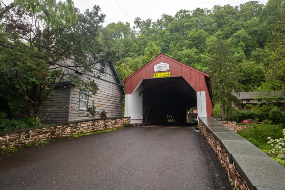
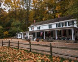
Mood’s Covered Bridge
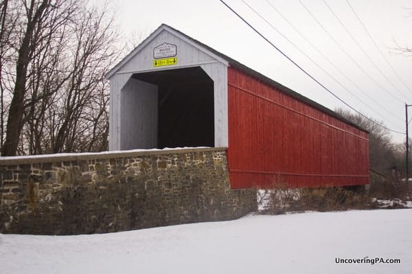
Located next to the Upper Bucks Campus of the Bucks County Community College, Mood’s Covered Bridge sits in a fairly residential area. Because of this, it sees a good amount of traffic. Fortunately, though, it is located next to a small park with ample parking space, which means you don’t have to get on the main road when visiting.
Mood’s Covered Bridge spans 121-feet over the East Branch of the Perkiomen Creek. It was originally built in 1874 but unfortunately was burned to the ground in an arson fire in June 2004. The bridge was rebuilt and reopened in February 2008.
Unfortunately, because the bridge was completely destroyed, it has been removed from the National Register of Historic Places.
The bridge is located next to the Morris C. Bryan Walking Path, which follows the creek in both directions.
Getting There: Like South Perkasie Covered Bridge, Mood’s Covered Bridge is located in Perkasie. Parking is available in a lot on the western side of the bridge, just downhill from the community college.
The parking area can be found at the following coordinates: 40.381226, -75.271710.
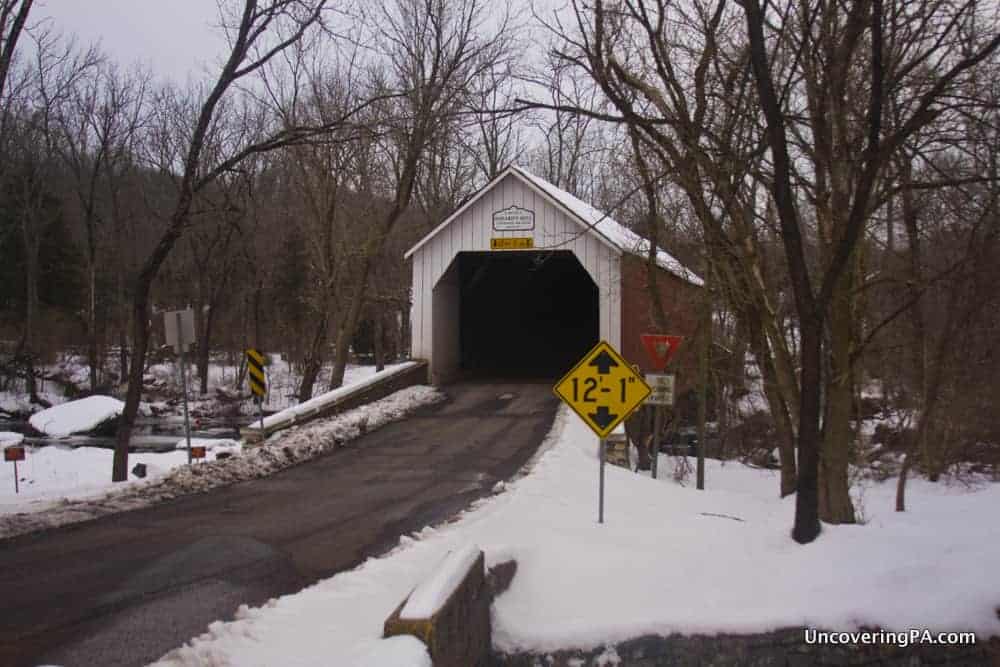
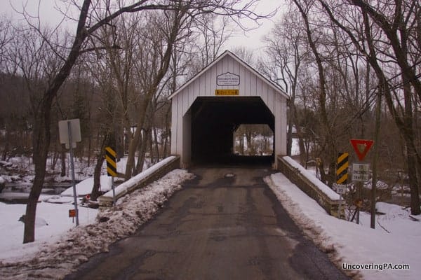
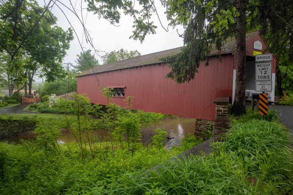
Sheard’s Mill Covered Bridge
Unlike the first three bridges I’ve covered, the last two are located in rural areas of Bucks County.
Sheard’s Mill Covered Bridge, also known simply as Sheard’s Covered Bridge was built in 1873 and spans 130-feet over Tohickon Creek.
Many covered bridges are named after local mills, but rarely are those mills still standing. However, Sheard’s Mill Covered Bridge is located next to the still-standing Sheard’s Mill, giving this bridge a great historic character.
The Mill sits on the edge of the Tohickon Family Campground. The land is posted, so I didn’t get close enough to read the historical marker next to the mill, but you can still enjoy it from the road.
Sheard’s Mill Covered Bridge is surrounded by private property and forest, making it one of the more difficult bridges to photograph that I’ve visited in Pennsylvania. However, the historic charm of the mill more than made up for it.
Getting There: Sheard’s Mill Covered Bridge is located in a forested area of the borough of Quakertown, just a couple of miles from Lake Nockamixon.
Parking at this bridge is a challenge because of private property, but there are a few areas surrounding the bridge that are large enough to pull a car off the road.
Sheard’s Mill Covered Bridge is located at the following coordinates: 40.454819, -75.278159.
Knecht’s Mill Covered Bridge
Knecht’s Mill Covered Bridge is located in an area of beautiful farmland just a few miles south of I-78 and Bethlehem, Pennsylvania. Its proximity makes this an easy covered bridge to visit if you are already in southern Lehigh or Northampton Counties.
The bridge crosses 110 feet over Cooks Creek and was built in 1873.
While there are no historic buildings next to the bridge like at Sheard’s Mill Covered Bridge, the drive to and from Knecht’s Covered Bridge is one of the most historically interesting drives I’ve been on in Pennsylvania.
It seems like everywhere you look in this part of Upper Bucks County there is a historic barn or old mill.
Getting There: Knecht’s Covered Bridge is located in about the most out of the way place you can find in Bucks County, spanning the border between the townships of Riegelsville and Springfield, PA.
Parking here is a bit tricky as the bridge is surrounded by private property and scenic white picket fences. Fortunately, the road that the bridge is on is very out of the way and likely sees little traffic. The bridge can be found at the following coordinates: 40.538083, -75.277833.
The Northeastern Covered Bridges in Bucks County
There are six historic covered bridges in northeastern Bucks County, PA. The bridges here are listed north to south, but you could just as easily visit them in the reverse order.
Northeastern Bucks County is one of the most beautiful areas in eastern Pennsylvania and features great spots like Ringing Rocks County Park and Ralph Stover State Park, both of which are easy to visit while exploring these covered bridges.
Uhlerstown Covered Bridge
Uhlerstown Covered Bridge is the northernmost bridge in eastern Bucks County. This bridge is located near the Delaware River and spans the D&L Canal and its towpath, both of which are part of Delaware Canal State Park.
Unfortunately, there’s no direct access from the bridge to the towpath, making getting views from both spots difficult.
According to some sources, this bridge was constructed in 1832. However, it seems more likely according to records that it was built in 1856. In 1985, this bridge received a significant restoration, though as much of the original wood was reused as possible.
Uhlerstown Covered Bridge is 101 feet long and has two windows half-way through the bridge, which is rare for Bucks County covered bridges.
Getting There: Uhlerstown Covered Bridge is located along Uhlerstown Hill Road a third of a mile from River Road and near the Uhlerstown-Frenchtown Bridge over the Delaware River.
The bridge can be found at the following coordinates: 40.525426, -75.073156.
Parking around the bridge is very tricky as the roads here are narrow and there are private homes surrounding the area. Find the spot that seems best to pull over during your visit.
If you want to see the bridge from below, the closest parking area for the D&L Canal’s towpath can be found at Tinicum Park 1.3 miles to the south at the following coordinates: 40.505966, -75.073674.
Erwinna Covered Bridge
Erwinna Covered Bridge is located just a few miles south of Uhlerstown Covered Bridge along Geigel Hill Road, less than half a mile from River Road.
This is the shortest covered bridge in Bucks County, PA at only 56 feet in length. The bridge crosses Swamp Creek.
Erwinna Covered Bridge is another bridge where the date it was built is up for debate. Some sources indicate it was constructed in 1871 while others say 1832.
Getting There: Erwinna Covered Bridge is located in Tinicum Township near the Delaware River. It can be found at the following coordinates: 40.502540, -75.074456.
There is a bit of room to pull off to the side of the road on the bridge’s eastern end.
Frankenfield Covered Bridge
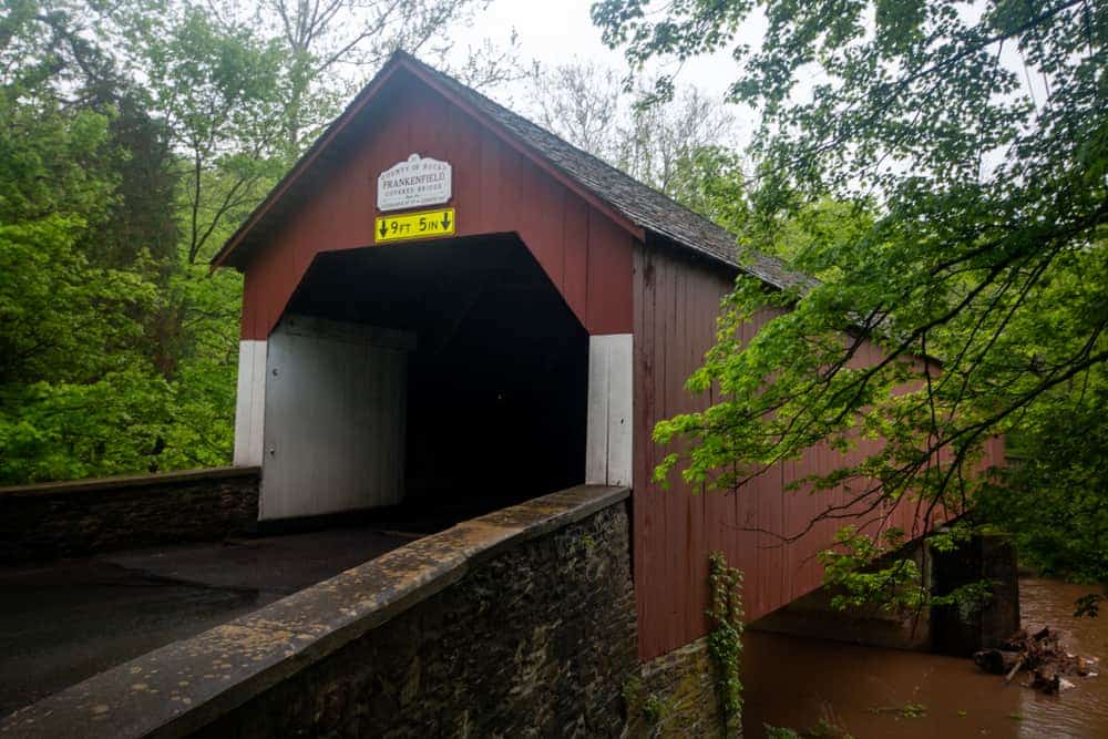
Frankenfield Covered Bridge is located in an incredibly beautiful spot in the forests of Bucks County. However, it’s also not far from the Delaware River, which makes it relatively easy to visit.
At 130 feet in length, Frankfield Covered Bridge is one of the longest covered bridges in the county and is the longest of all the bridges that are still open to traffic.
The bridge was built in 1872 and crosses Tinicum Creek.
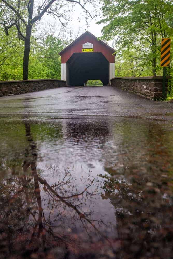
Getting There: Frankenfield Covered Bridge is on Hollow Horn Road in a rural area near Van Sant Airport. It can be found at the following coordinates: 40.475815, -75.099405.
There are several places near the bridge where you can pull off to the side of the road to check out the bridge.
Cabin Run Covered Bridge
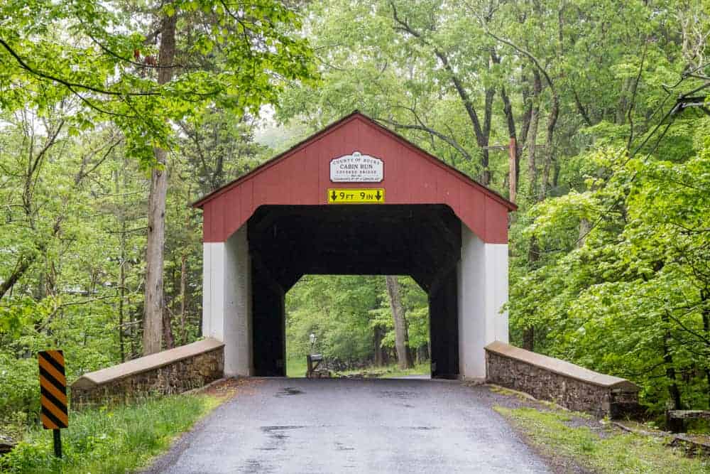
Cabin Run Covered Bridge is located along Cabin Run, a stream that is said to have been named for the many cabins and small buildings that once lined its banks. The bridge is just upstream of where Cabin Run flows into Tohickon Creek near Ralph Stover State Park.
This bridge is 82 feet long and was built in 1871. Like many covered bridges in Bucks County, it is located in a forested area and is incredibly well preserved.
Getting There: Cabin Run Covered Bridge is located on the aptly named Covered Bridge Road. It can be found at the following coordinates: 40.432012, -75.112553.
There is room on the southern end of the bridge for several cars to pull off to the side of the road.
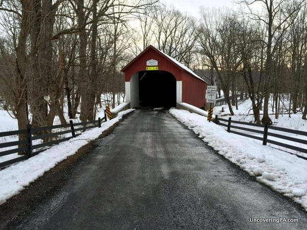
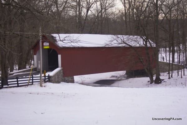
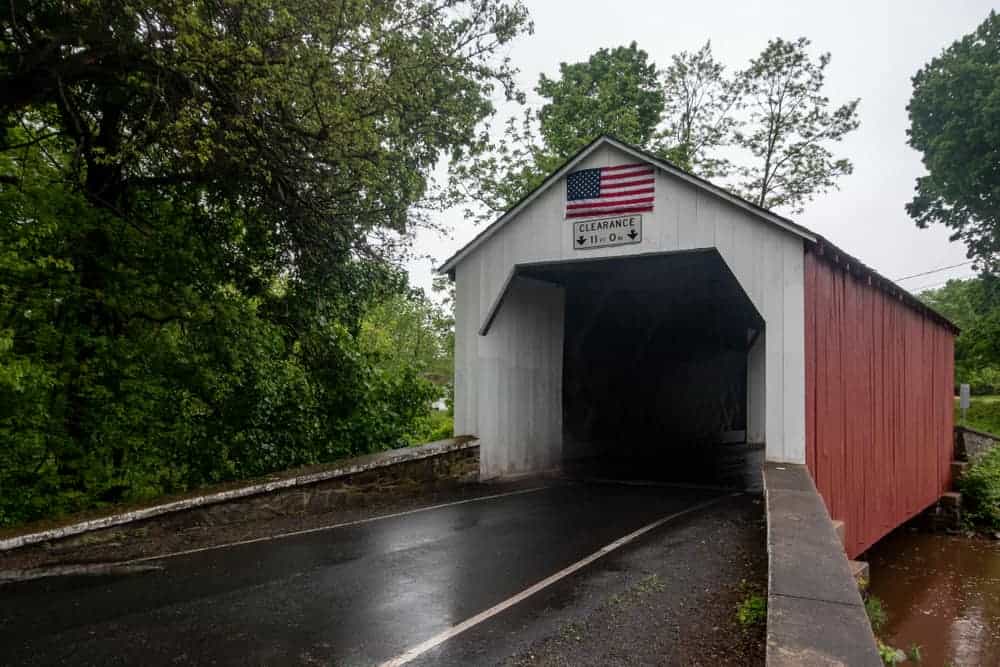
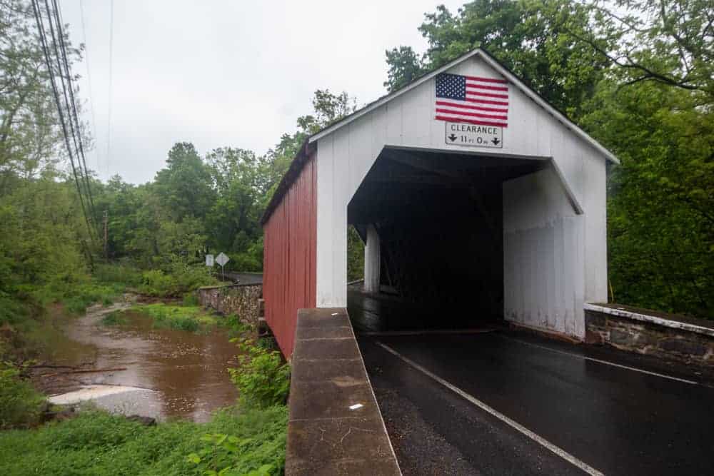
Loux Covered Bridge
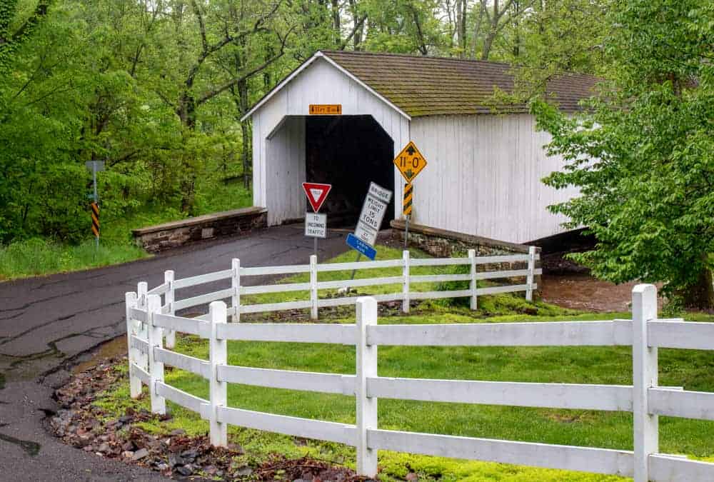
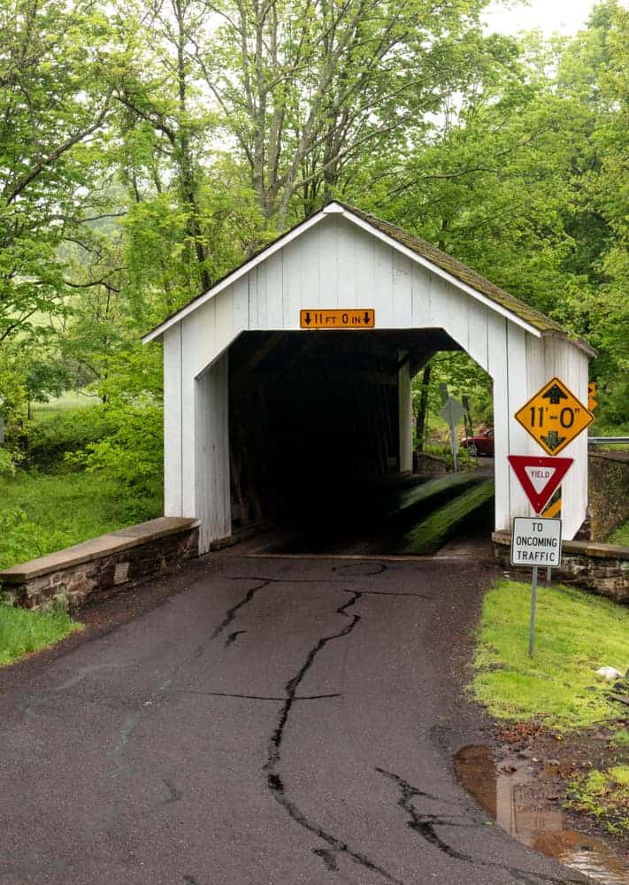
Loux Covered Bridge stands out among the covered bridges in Bucks County because it is the only one that is painted white. Unfortunately, I couldn’t find why this one features a different coloration from the county’s 11 other bridges.
Loux Covered Bridge is located at the bottom of a small hill, which creates some great spots for photography near the bridge. There is even a small waterfall nearby when water levels are high.
The bridge is located on Cabin Run, upstream of Cabin Run Covered Bridge. It is only 60 feet long making it one of the shortest covered bridges in the county. It was built in 1874.
Getting There: Loux Covered Bridge is located along Wismer Road a short distance from Route 413 and 611, two popular roadways in the area. It can be found at the following coordinates: 40.423017, -75.127711.
This is a tricky covered bridge to park at as the road makes a 180-degree turn near the bridge. However, there is space for a couple of cars a short distance south of the bridge.
Van Sandt Covered Bridge

Van Sandt Covered Bridge (also known as Van Sant Covered Bridge) is located a short distance from Bowman’s Hill Tower and Washington Crossing Historic Park.
It is 86 feet long and spans Pidcock Creek. Depending on the source, it was built in either 1870 or 1875.
This covered bridge is connected to an urban legend about a woman and baby that are said to have died here. It is claimed that if you park your car in the middle of the bridge at night, you can hear the baby’s cries. Keep in mind this is a public road and people live nearby, so if you visit at night, be careful and respectful.
Getting There: Van Sandt Covered Bridge is located south of New Hope, PA, near some of the auxiliary sites for Washington Crossing Historic Park. It can be found at the following coordinates: 40.327010, -74.957816.
There is room along both sides of the bridge for cars to park. However, be aware that due to the popularity of the urban legend, parking along the road is not allowed from 10pm to 6am.
The Southern Covered Bridge in Bucks County
There is only one historic covered bridge in Lower Bucks County.
Schofield Ford Covered Bridge
Schofield Ford Covered Bridge is located within the 1,700-acre Tyler State Park in Lower Bucks County.
Schofield Ford Covered Bridge crosses Neshaminy Creek and is the longest covered bridge in Bucks County at 164 feet. It is located along one of the park’s trails and is open to hikers and horseback riders.
The bridge was originally constructed in 1873. In 1991, it was destroyed in an arsonist’s fire and was completely rebuilt in 1997.
Getting There: Schofield Ford Covered Bridge is the only covered bridge in the county that requires hiking to reach as it sits a quarter-mile from the parking area.
The closest parking area for the bridge is located off of Swamp Road at the following coordinates: 40.245869, -74.978042.
From here, follow the trail from the parking lot to the bridge. There are many other trails in the park that reach the bridge for those looking for a longer hike.
The bridge can be found at the following coordinates: 40.244404, -74.980800.
Looking for more places to visit nearby? Check out the one covered bridge in Philadelphia, the covered bridges in Chester County, the covered bridges in Lehigh County, and the Byers’ Choice Christmas Museum.
[If you need help using the coordinates listed in this article, read my explanation here.]
 "
"


I am from Philadelphia and when my kids were small we visited all the Bucks County covered
bridges and made a photograph albumn.
I am retired and live in Huntsville, Al
I really enjoyed your article about the bridges. I was just there 10/17/15 and enjoyed seeing them. I just wish I had seen this first at least I would have known a little about them. I hope I can find your other articles about them too.