When I travel through PA, I’m always on the lookout for lesser-known spots to go hiking, so when I found out about the Wolf Creek Narrows Natural Area in Butler County, I knew I needed to check it out.
The Wolf Creek Narrows Natural Area is located just west of downtown Slippery Rock and less than two miles east of I-79, making it a convenient spot to reach north of Pittsburgh.
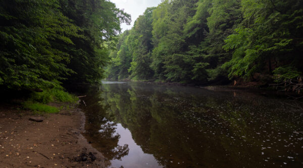
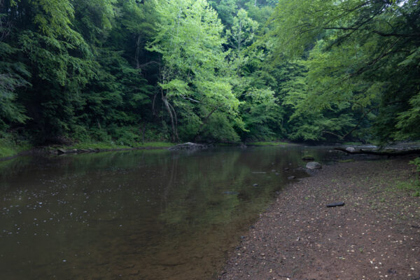
This piece of public land is 243 acres in size and is located primarily on the eastern bank of Wolf Creek, a tributary of Slippery Rock Creek. In this area, Wolf Creek passes through a narrow gorge with 50-foot rock walls. It is thought that this was once a cave that collapsed during the last ice age.
Wanting to see this interesting area, I decided to hike the natural area’s 1.5-mile trail.
Where to Park for the Wolf Creek Narrows Natural Area
The parking area for the Wolf Creek Narrows Natural Area is located along Miller Road, less than two miles west of downtown Slippery Rock.
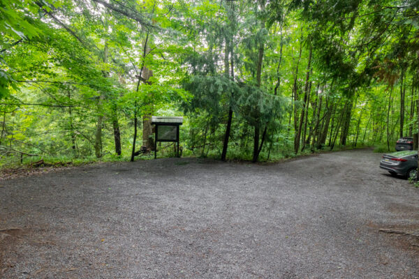
There is no parking area for the Wolf Creek Narrows. However, the Miller Woods Nature Preserve, which is located directly across the road, has a nice size dirt lot where you can park while exploring Wolf Creek Narrows.
This lot can be found at the following coordinates: 41.063668, -80.088181.
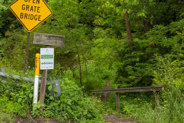
To reach the start of the Wolf Creek Narrows Trail, head back to the road and turn right. Follow the road over the bridge and, just after the bridge, look for the sign on your left marking the slightly overgrown trailhead.
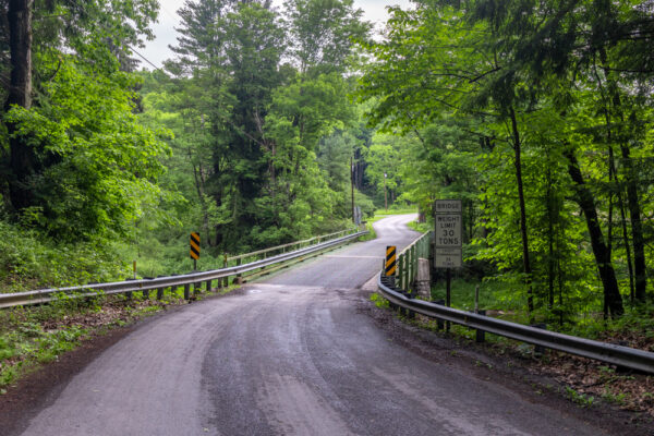
While the walk on the road is only about 100 yards, make sure to use caution as there is no sidewalk here and the road bends at this point limiting sight lines.
There is also a trail at Miller Woods Nature Preserve where you parked. However, the information I found online indicates that this trail is overgrown, so I opted not to check it out. There is a kiosk in the parking lot with a map of Miller Woods should you decide to explore further.
[Click here for information on how to use the coordinates in this article to find your destination.]
Hiking the Wolf Creek Narrows Trail
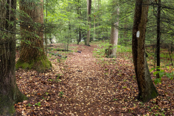
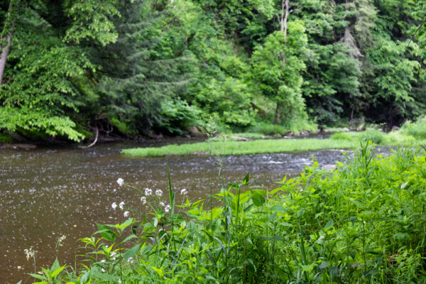
From Miller Road, the Wolf Creek Narrows Trail starts off a bit overgrown, but after a few feet, it opens up along the banks of Wolf Creek.
During the springtime, this trail is said to be one of the best places to see wildflowers in Pennsylvania. Sadly during my June visit, only a few flowers were to be found along the trail. Nevertheless, this was an incredibly beautiful hike, so don’t fret if you can’t make it out for the spring wildflowers.
The Wolf Creek Narrows Trail is a balloon-shaped trail. This means that you walk about a quarter-mile and reach a trail split, with the trail making a loop back to this point.
At the trail split, I opted to stay to the left and hike upstream along the creek.
This walk along the creek is quite beautiful, and the dense forest makes this almost seem like you’re far from civilization. This is in part because the land wasn’t heavily logged, leaving many large trees throughout the property.
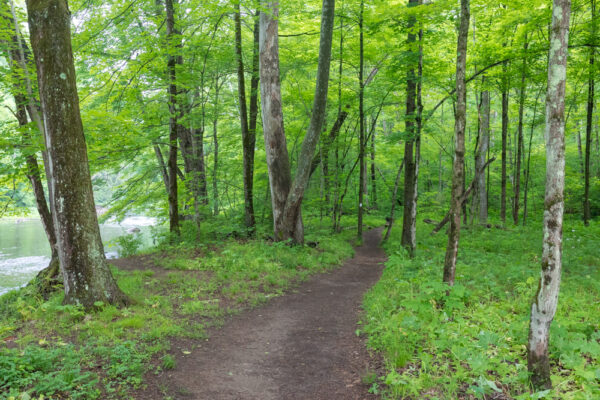
The area along the creek is flat and open, making for an easy hike along this part of the trail. There are many opportunities to get closer to the creek, which is wide and quite clear.
About four-tenths of a mile from the trailhead, the trail begins to curve away from the creek and head steeply uphill. If you wanted an easy hike, you could simply turn around at this point and retrace your steps back to your vehicle.
However, wanting to see the entire trail, I opted to continue the loop. While the second half of the hike isn’t quite as beautiful as the first half, it’s still quite a scenic area.
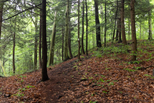
The trail climbs somewhat steeply uphill to about 100 feet above the creek below. Along the way, there are peek-a-boo views of Wolf Creek and the cliffs that surround it.
There is also a single bench near the top of the hill – the only one you’ll find along the trail.
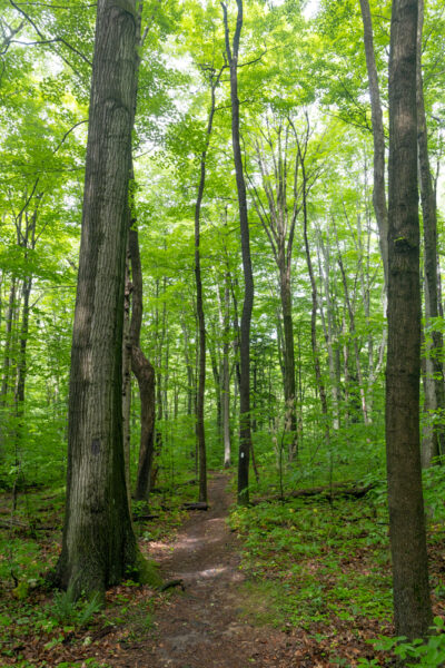
Once along the ridgeline, the trail passes through quite a beautiful forest filled with towering black cherry trees and sugar maples. This contrasts to the primarily hemlock forest near the creek.
Eventually, the trail starts to head downhill back towards the creek. There are a few steps built into the hillside here, but there are also a few places where you might have to watch your footing, especially if it’s muddy.
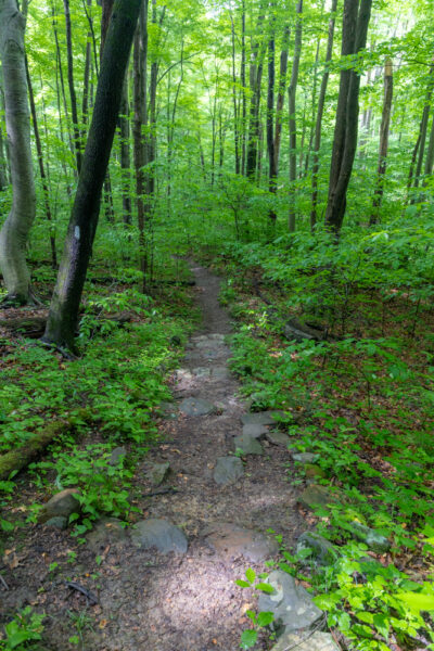
Overall, this trail isn’t very difficult, but there are a few places where you have to watch your footing on the uphill and downhill portions. That being said, unless you have a problem with small hills, most visitors should have no trouble completing this loop.
Once at the bottom of the hill, the Wolf Creek Narrows Trail soon meets back up with the lower portion of the trail. From this point, turn left and follow the creek downstream back to your car.
Without a doubt, the Wolf Creek Narrows Natural Area is a beautiful spot for a hike, and parts of this forest feel almost magical. That being said, I probably wouldn’t make the 50-minute drive up from Pittsburgh just to do this hike as it’s a bit on the short side.
However, if you combine this trail with a visit to other nearby attractions, such as the Jennings Environmental Education Center, McConnells Mill State Park, or even simply the nearby North Country Brewing Company in Slippery Rock, this is definitely a fun and beautiful spot to explore.
For more information and a trail map, visit the Western Pennsylvania Conservancy’s website.
Looking for even more places to visit nearby? Check out the Sunken Garden Trail in Moraine State Park, the Harlansburg Station Museum, and Springfield Falls.
 "
"


Also a stone marker that marks the spot of an early peace treaty between the local pa tribes and the settlers army. Up the hill to the left from parking area. Corner of property
Interesting. I’ll have to go back and check that out.
Hi Jim, just wanted to let you know that per the website for this natural area, dogs must be onleash OR otherwise kept under control. Therefore leashes are not mandatory.