Most visitors to Adams County, Pennsylvania, come to visit the Gettysburg National Battlefield, though some also explore the town and its countryside. If you’re looking for a way to experience the history of the area and see this beautiful part of the state, don’t miss the four historic covered bridges near Gettysburg.
These bridges include Sachs Covered Bridge, possibly the most historic covered bridge in Pennsylvania, as well as two that are located on private property, but can be seen from the road. Sadly, only one of these four bridges is still open to traffic, but they are all worth taking the time to see.
The bridges below are listed with the two public bridges listed first and the two private bridges listed after that.
So, the next time you are in Gettysburg and looking for something to do, don’t miss these historic covered bridges in Adams County.
Sachs Covered Bridge
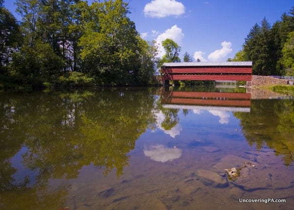
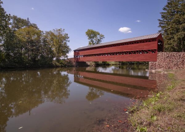
Sachs Covered Bridge in Gettysburg might be the most historic covered bridge in the state or even the entire country.
Also known as Sauck’s Covered Bridge or Sauches Covered Bridge, this bridge was built in 1854 using a Town truss. It spans 100 feet over Marsh Creek.
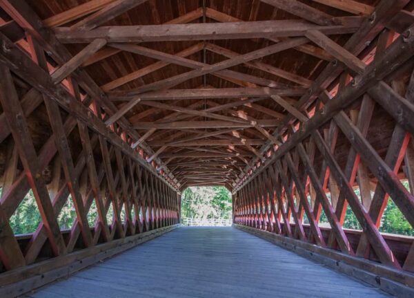
The bridge is most notable for being crossed on multiple occasions by both Union and Confederate troops during the Battle of Gettysburg. In fact, many of the Confederate troops crossed the bridge on their retreat south on July 4, 1863.
Today, the bridge is on the outskirts of the Gettysburg National Military Park and near the Eisenhower National Historic Site.
This bridge is also said to be one of the most haunted places in all of Gettysburg.
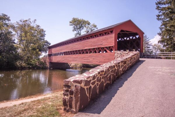
Getting There: Sachs Covered Bridge sits in the southwestern corner of Gettysburg National Military Park. The bridge is located at the end of a short dirt road off of Pumping Station Road. It can be found at the following coordinates: 39.797431, -77.276194.
There is a dirt parking area adjacent to the bridge for a handful of cars to park.
Jacks Mountain Covered Bridge
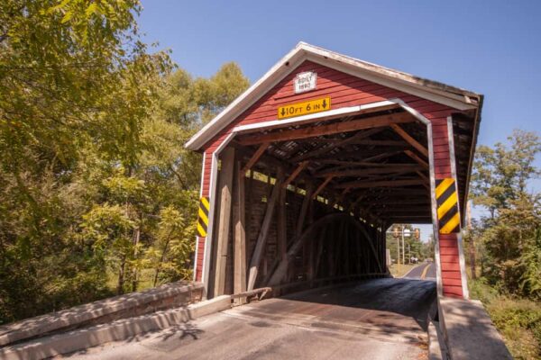
Jacks Mountain Covered Bridge is the only covered bridge in Adams County that you can still drive through. The bridge is located southwest of Gettysburg near Fairfield, Pennsylvania.
Jacks Mountain Covered Bridge, officially known as the G. Donald McLaughlin Memorial Covered Bridge, was built in 1890 using the traditional Burr truss. It crosses 75 feet over Tom’s Creek.
The bridge may be the only one in the state with a traffic light on either end to control traffic through the bridge.
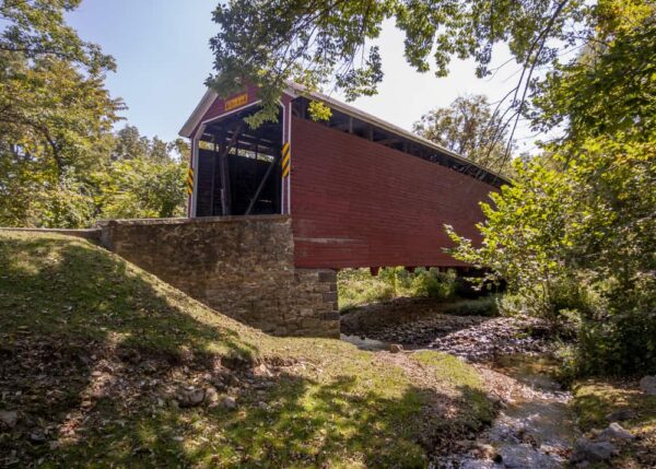
Getting There: Jacks Mountain Covered Bridge is located southwest of Gettysburg and just off of Route 116 on Jacks Mountain Road near Fairfield. It can be found at the following coordinates: 39.767284, -77.386504.
There is a bit of room to pull off to the side of the road on the southern side of the bridge.
Heikes Covered Bridge
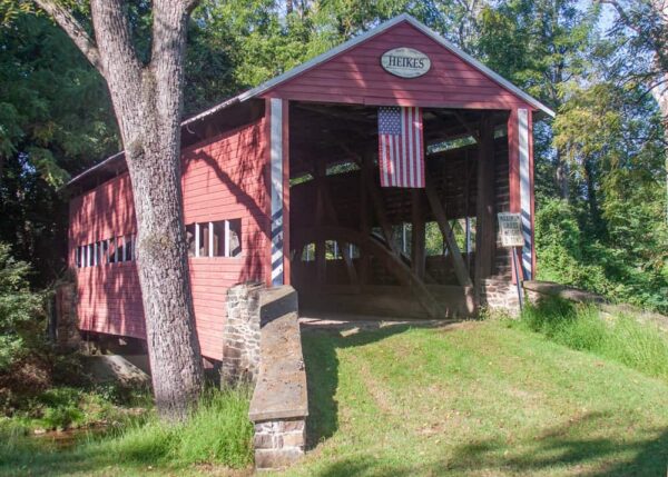
Heikes Covered Bridge is located north of Gettysburg on the western side of Route 15. The bridge was built in 1892. It’s 67 feet long and crosses Bermudian Creek.
While I believe that Heikes Covered Bridge is located at its original location, it is currently on private property. That makes checking out this bridge a bit challenging. However, since the bridge is located close to the roadway which makes it fairly easy to see from the road.
Make sure to respect private property and obey any signs you may see.
Getting There: Heikes Covered Bridge is located halfway between York Springs and Heidlersburg along Willow Road. The bridge can be found at the following coordinates: 39.980307, -77.151710.
While this bridge is on private property, there’s a bit of room to pull off to the side of the road for those wanting to stop for a minute to see this beautiful bridge.
Anderson Farm Covered Bridge
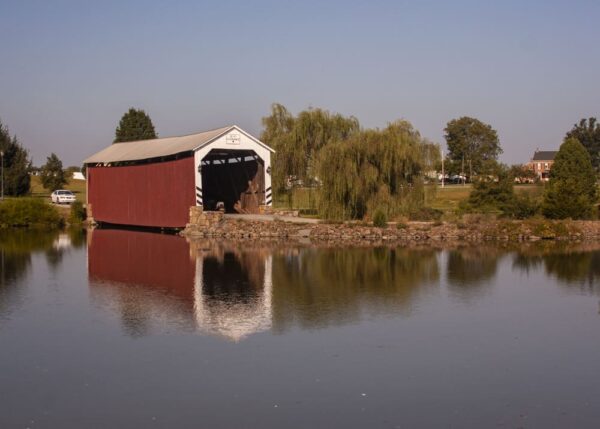
Of the four covered bridges in Adams County, Anderson Farm Covered Bridge is the hardest to see. This bridge is also located on private property.
Anderson Farm Covered Bridge, also known as Reeser Covered Bridge and Mud Run Covered Bridge, once spanned nearby Mud Run, but was moved to this spot at some point in the past. Today, it crosses a small pond on the property and is said to be used for storage. Even so, from a distance, it seems to be well cared for.
The bridge can be seen from the road, though its close to 100 yards from the road at its closest point.
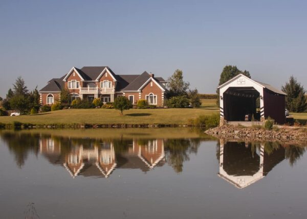
Again, always respect private property and enjoy this bridge from Stoney Point Road.
Getting There: Anderson Farm Covered Bridge is located north of Gettysburg and east of Route 15 near Lake Meade. It is located along Stoney Point Road. The bridge can be found at the following coordinates: 39.976917, -77.025161.
Stony Point Road is a fairly busy road, but there is a bit of room to pull off to the side near the bridge. If you do so, use extreme caution as cars move along this road quickly.
Explore More Near Gettysburg
If you want to explore more after visiting the four historic covered bridges near Gettysburg, PA, here a few options:
- Visit the covered bridges in Cumberland County, PA
- Visit the covered bridges in Franklin County, PA
- Spend a weekend exploring Gettysburg and Adams County
- Visit quirky attractions in Gettysburg like Civil War Tails and the Gettysburg Dime Museum
- See the small waterfall in Caledonia State Park
[Click here for information on how to use the coordinates in this article to find your destination.]


 "
"
