Despite its close proximity to Harrisburg, Perry County, Pennsylvania, isn’t known as a tourism hotspot. In fact, it’s one of the least visited counties in the state. However, in addition to its natural beauty, there are more covered bridges in Perry County than all but four other counties in Pennsylvania.
These 14 covered bridges are (almost) all in fantastic shape, and a tour is a great way to explore rural Pennsylvania.
Half of the covered bridges in Perry County are located along Route 274 in the middle of the county, making them quite easy to visit at one time. The others are located in the north-central and northeastern areas of the county.
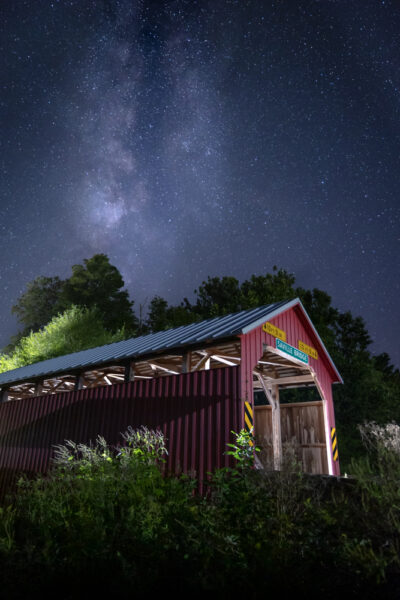
Because of this, I’ve split Perry County’s covered bridges into three groups: Northeastern Bridges, Northern Bridges, and Central Bridges. They are all listed in a logical order for visiting within those regions.
Northeastern Perry County Covered Bridges
The four most northeastern covered bridges in the county stretch from Liverpool in the north to Duncannon in the south, and are all located in close proximity to either Routes 15 or 322.
The covered bridges in this article are listed north to south as that direction allows them to most easily connect into a driving tour of the central covered bridges.
However, they can be done just as easily from the opposite direction. If you do visit them in the opposite direction, they connect very well to the covered bridges of Snyder County.
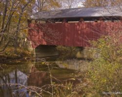
Red Covered Bridge
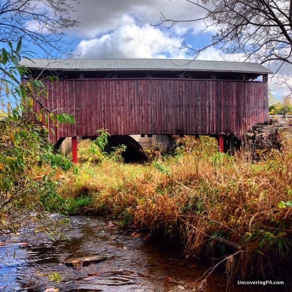
Located on the outskirts of Liverpool, a few miles from Route 15 and the Susquehanna River, Red Covered Bridge is one of the most scenic bridges in the area.
At 55 feet, it’s the shortest covered bridge in Perry County. According to most sources, it’s listed as crossing Wild Cat Creek (or Wildcat Creek), but Google Maps labels the creek as Bargers Run.
The bridge was built in 1886 but has since been bypassed by PA Route 1005.
While it appears that the bridge may now be located on private property, the bridge was not posted when I visited, so walking up to the bridge seems to be allowed. However, should you rather (or if signs pop up in the future), it’s possible to get a good view of the bridge from the road.
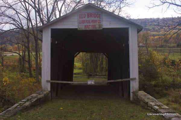
Getting There: Red Covered Bridge is located in northern Perry County, The bridge is less than two miles off Route 15, about halfway between Harrisburg and Sunbury. The bridge is located at the following coordinates: 40.567946, -77.015197.
There is a pull-off that can accommodate a car or two on the side of the road that the bridge is on.
Fleisher’s Covered Bridge
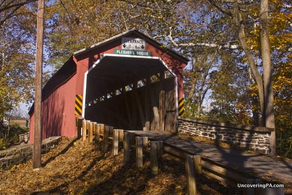
Fleisher’s Covered Bridge is located just outside of Newport, less than a mile from the Perry County Fairgrounds.
Fleisher’s Covered Bridge was built in 1887 and spans 125 feet over Big Buffalo Creek.
While there is plenty of posted private property around the bridge, there is ample room for those that want to photograph or look at the bridge to get a variety of angles.
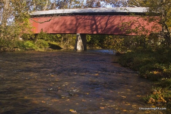
Getting There: Fleisher’s Covered Bridge is located roughly two miles from the center of Newport, Pennsylvania, along the same road at the Perry County Fairgrounds, at the following coordinates: 40.489474, -77.158112.
There is room for a car or two to pull off the road before crossing the bridge.
Clay’s Covered Bridge
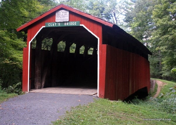
Clay’s Covered Bridge (also known as Wahneta Covered Bridge) is located along the hiking trails of Little Buffalo State Park. Its current location, over a typically dry creek bed in the Little Buffalo Historic District is quite scenic. The wooded area is home to Shoaf’s Mill, with its still operational water wheel, and an old train car.
Clay’s Covered Bridge is 82-feet long and was built in 1890. It was moved to its current location when Holman Lake was created. The bridge originally crossed Little Buffalo Creek and was located one mile to the west.
Getting There: Clay’s Covered Bridge is located in the middle of Little Buffalo State Park, just below the earthen dam.
The closest parking area is near the entertainment pavilion and about 500-600 feet from the bridge. The parking area is located at the following coordinates:40.455572, -77.171113. (The bridge is located at 40.455607, -77.170056, for those that are interested.)
To get to the bridge, park in the lot and head away from the dam towards Shoaff’s Mill. The bridge can be found on the park’s map if you’re having trouble finding it.
Dellville Covered Bridge
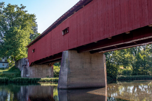
Dellville Covered Bridge is one of the most beautiful covered bridges in Perry County. While the historic bridge was lost to an arsonist’s fire in November 2014, it was rebuilt and reopened in July 2019.
Dellville Covered Bridge is located a few miles outside of Duncannon. The bridge spans 174 feet over Sherman Creek, making it the longest (and the widest) covered bridge in Perry County. It was originally built in 1889.
While many of the original pieces of wood were too charred to be reused, the bridge was rebuilt using the original plans which were found during the reconstruction.
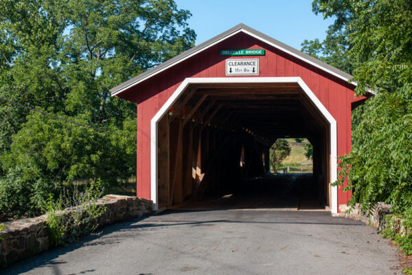
Getting There: Dellville Covered Bridge is located about 10 miles outside of Duncannon at the following coordinates: 40.363870, -77.116808.
To view the covered bridge, drive through it and park in the small parking area on the opposite side of Sherman Creek.
Central Perry County Covered Bridges
With one exception, all of the Central Perry County Covered Bridges are located just off of Route 274. This makes them quite easy to visit.
They are listed here from east to west because that connects best to the bridges above. However, feel free to do them in the opposite direction if you are approaching Perry County from the south or the west.
Rice Covered Bridge
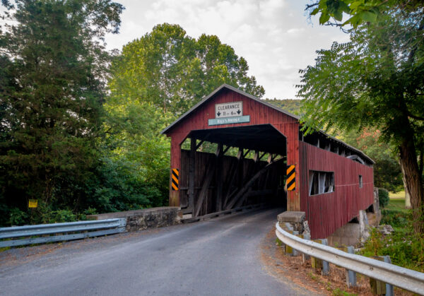
Not only is Rice Covered Bridge in the easternmost of the covered bridges in central Perry County, but it’s also the only one in this section not located along Route 274.
That being said, this covered bridge, which is located in Landisburg, is only a short distance off of that roadway and, like most of the others in this section, crosses Sherman Creek.
Rice Covered Bridge (which is also known as Landisburg Covered Bridge) was constructed in 1869. At 132 feet in length, this is the third-longest covered bridge in the county.
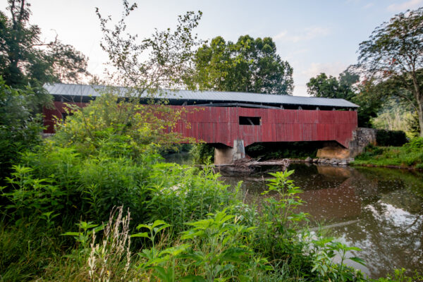
Interestingly, it uses a combination of Burr arch trusses and Queen post trusses, so make sure to take a minute to look at the unique interior structure of the bridge.
Getting There: Rice Covered Bridge is located just south of Landisburg, PA on Kennedy Valley Road. It can be found at the following coordinates: 40.335998, -77.309441.
There is a bit of room to pull off to the side of the road on the northern end of the bridge.
Waggoner’s Covered Bridge
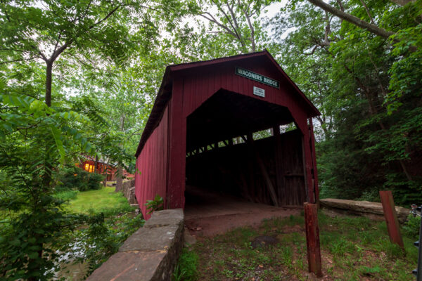
Sadly, Waggoner’s Covered Bridge was destroyed by fire in October 2021.
Pennsylvania is home to more than 200 historic covered bridges, and Waggoner’s Covered Bridge was the last of these that I visited.
Waggoner’s Covered Bridge is the easternmost of the Perry County bridges along Route 274 and crosses Bixler Run, just upstream of its confluence with Sherman Creek.
It was constructed in 1889 and uses a Burr Arch Truss.
Waggoner’s Covered Bridge no longer allows traffic and can only be viewed from the southern end of the bridge due to private property on the northern side. It could use some repairs but is still a beautiful bridge.
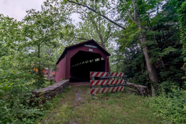
Getting There: Of all the covered bridges in Perry County, PA, Waggoner’s Covered Bridge might be the hardest to visit. That’s because one side of the road is the driveway for a private home and the other side is a rutted dirt road.
To see this bridge, park your car along Route 274 at the following coordinates: 40.358829, -77.372283.
Make sure not to block the entire road if possible in case someone drove further towards the bridge. While those in a high-clearance vehicle might be able to drive closer to the bridge, it’s only 250 feet from Route 274 to the bridge, so it’s best to just walk due to the rutted and narrow road.
Adair’s Covered Bridge
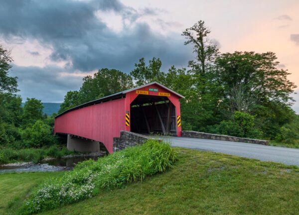
Adair’s Covered Bridge is located in a beautiful valley surrounded by forest and farmland (like most of the bridges on this list).
This covered bridge crosses Sherman Creek and is located near where Cisna Run enters the larger waterway. Because of this, the bridge is also known as Cisna Covered Bridge.
Adair’s Covered Bridge is 150 feet long, which makes it the second-longest covered bridge in Perry County. It was originally constructed in 1864 and is the oldest of the still-standing bridges in the county.
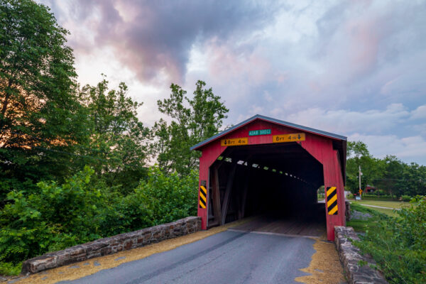
Getting There: As stated above, Adair’s Covered Bridge is located at a beautiful and peaceful spot just off of Route 274. It can be found at the following coordinates: 40.350539, -77.424179.
There is a bit of room on the northern side of the bridge to pull off of the road, though this isn’t the easiest covered bridge to park at. Make sure when parking that you don’t block the entrance to the adjacent campground.
Bistline Covered Bridge
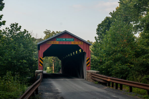
Bistline Covered Bridge is the next bridge heading west and also crosses Sherman Creek.
This bridge is located in a wooded area about halfway between Andersonburg and Couchville and is a little over a mile south of Route 274.
Bistline Covered Bridge (which is also known as Flickinger’s Mill Covered Bridge) is 96 feet long and was constructed in 1871.
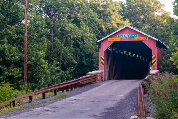
Getting There: Bistline Covered Bridge is located along Bistline Bridge Road south of Route 274 and can be found at the following coordinates: 40.334042, -77.470476.
There is a bit of room to pull off of the road on the northern side of the bridge.
Enslow Covered Bridge
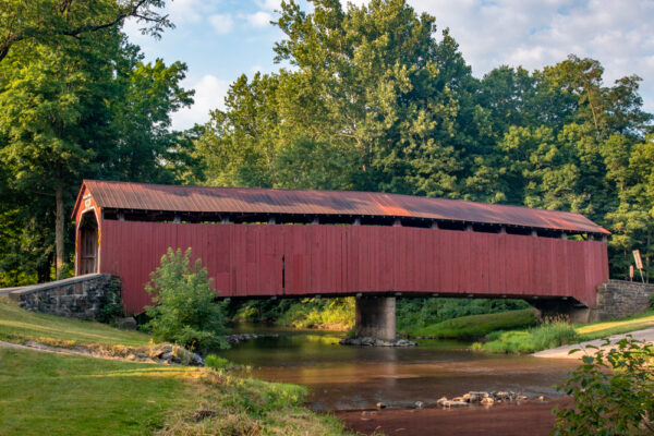
Enslow Covered Bridge is located a short distance west of Bistline Covered Bridge and also crosses Sherman Creek.
This bridge, which is also known as Turkey Tail Covered Bridge, was built in 1904 and is 110 feet long.
While this bridge allows traffic, it also has a spot adjacent to it for larger vehicles to ford the river when water levels are low. I can’t recall seeing any other Pennsylvania covered bridges with this feature, so that’s definitely something to check out while you are visiting.
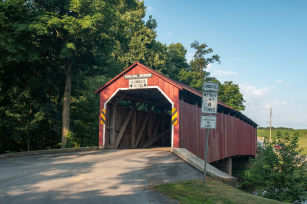
Getting There: Enslow Covered Bridge is located near the community of Blain in central Perry County at the following coordinates: 40.329316, -77.491422.
There is room to pull off to the side of the road on both sides of the bridge.
Book’s Covered Bridge
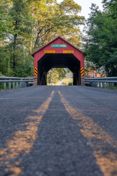
Book’s Covered Bridge, also known as Kauffman Covered Bridge, is located just west of Enslow Covered Bridge. And, like most of the others in this area, crosses Sherman Creek.
Book’s Covered Bridge was constructed in 1884 and is 70 feet in length.
This bridge has undergone a major restoration in the last 20 years and is one of the gems of Perry County. It was also the 200th covered bridge I visited in the state.
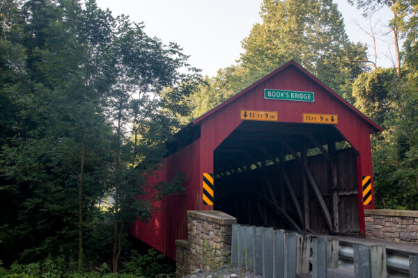
Getting There: Book’s Covered Bridge is located in a forested area on the edge of farmland at the following coordinates: 40.324574, -77.524485.
There is room to pull off the road on either side of the bridge.
Mount Pleasant Covered Bridge
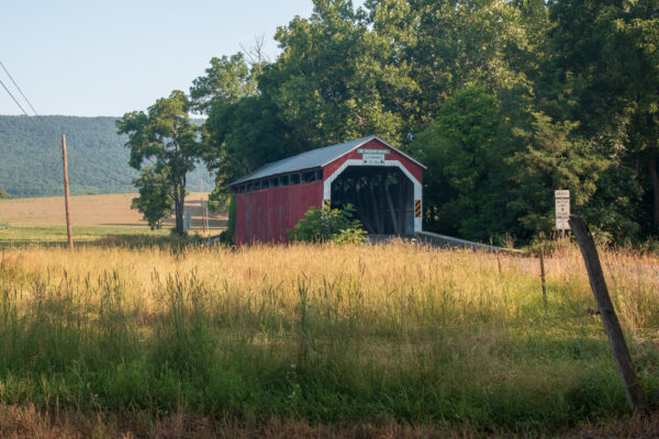
Mount Pleasant Covered Bridge is the next bridge heading west and is, not surprisingly, located in a scenic area of farmland and forest. However, this spot is especially pleasant and offers a lot of beauty for photographers.
Mount Pleasant Covered Bridge was constructed in 1918. While this is later than most wooden bridges were made, it may have been designed to save other building materials for the war effort.
This covered bridge is one of the few in the county that uses King-post trusses in its design. It is 60 feet long and crosses Sherman Creek.
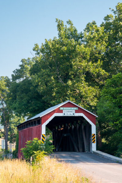
Getting There: Mount Pleasant Covered Bridge can be found at the following coordinates: 40.315239, -77.545447.
There is plenty of room to pull off of the road on the southern end of the bridge.
New Germantown Covered Bridge
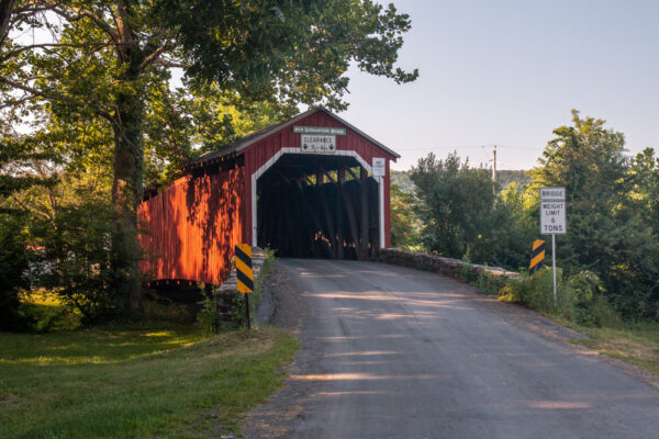
New Germantown Covered Bridge is the furthest west covered bridge in Perry County, Pennsylvania, and is the furthest upstream of the nine covered bridges across Sherman Creek.
New Germantown Covered Bridge is 74 feet long and was constructed in 1891. Interestingly, it uses a combination of King-post and Queen-post trusses, something that is quite unusual among covered bridge designs in the state.
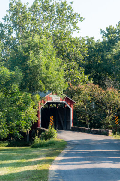
Getting There: New Germantown Covered Bridge is located just south of the community of New Germantown in western Perry County. It can be found at the following coordinates: 40.306780, -77.568161.
There is room to pull off of the road on the southern side of the bridge.
North-Central Perry County Covered Bridges
The two covered bridges in north-central Perry County are both located near Ickesburg, PA.
While they are listed separately from the central bridges, if you wanted to see them in a tour of covered bridges, it would make the most sense to visit them in between Waggoner’s Covered Bridge and Adair’s Covered Bridge.
These covered bridges are also located near several of the covered bridges in Juniata County, including Academia Pomeroy Covered Bridge, the longest covered bridge in Pennsylvania.
These two bridges are only about a mile apart and are listed from south to north.
Kochenderfer Covered Bridge
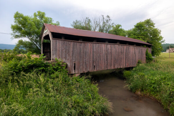
Kochenderfer Covered Bridge is located just south of Route 17 near the communities of Ickesburg and Saville.
Built in 1919, it is the most recently constructed of the covered bridges in the county but is, rather interestingly, one of the bridges in the worst shape. Nevertheless, this bridge is definitely worth checking out even if it could use a bit of rehabilitation.
Kochenderfer Covered Bridge is located adjacent to the roadway and no longer allows vehicles to cross it. It is 71 feet long and crosses Big Buffalo Creek.
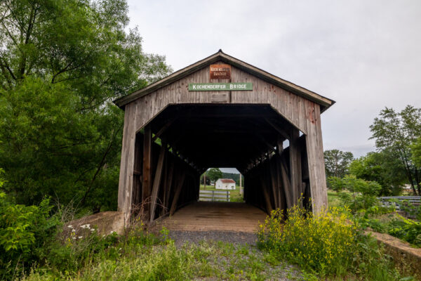
Getting There: Kochenderfer Covered Bridge can be found at the following coordinates: 40.424329, -77.387077.
There is plenty of room to pull off to the side of the road on the northwestern end of the bridge.
This bridge is privately owned and can be easily seen from the road. When I visited, there were no “No Trespassing” signs, so I was able to get a bit closer on the dirt road leading up to it, but make sure to respect any signs that might pop up in the future.
Saville Covered Bridge
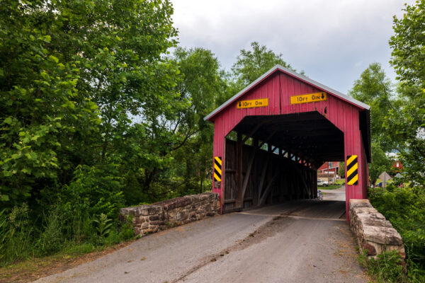
Saville Covered Bridge is one of my favorite covered bridges in the county and is worth taking the opportunity to see if you love covered bridges.
This covered bridge is located in a narrow woodland between several farms and crosses Big Buffalo Creek upstream of Kochenderfer Covered Bridge.
It was built in 1903 and is 60 feet in length.

If you have a chance to visit after dark, this area is just dark enough to view the Milky Way under ideal conditions.
Getting There: Saville Covered Bridge is located along Covered Bridge Road at the following coordinates: 40.438002, -77.396119.
There is a bit of room to pull off the road on the northern end of the bridge but be careful to not block the road or any of the driveways for the nearby homes.
Looking for more places to visit nearby? Check out the covered bridges of Cumberland County, Hawk Rock along the Appalachian Trail, the Tuscarora Academy Museum, and the abandoned train tunnel in Tuscarora State Forest.

