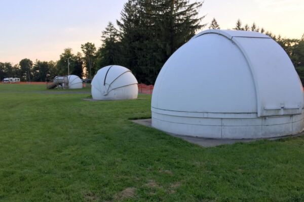
Cherry Springs State Park is one of the most popular state parks in Pennsylvania thanks to its amazing night sky. However, if you are looking for things to do near Cherry Springs Stat Park during the day, there aren’t many options in the park.
In fact, there is only one short trail at Cherry Springs State Park, and no other popular amenities like a stream, beach, or pool. This means that you’ll have to leave the park if you really want to explore the Pennsylvania Wilds during the daytime.
So, if you are looking for great hiking trails near Cherry Springs State Park, here are a few of my favorites within a short drive of the park.
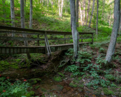
Cherry Springs Interpretive Trail
While Cherry Springs State Park doesn’t have any major trails, it does have one small one for those looking for something to do during the daytime.
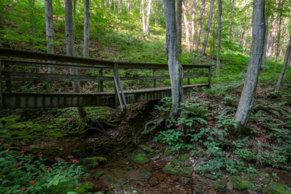
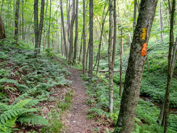
The Cherry Springs Working Forest Interpretive Trail is an easy one-mile hike that starts near the entrance to the Overnight Astronomy Field and passes through both the park and the adjacent Susquehannock State Forest.
Along the path, there are signs that offer insight into the area, the night sky, and the importance of the forest.
Daugherty Loop Trail
Ole Bull State Park is located only 20 minutes southeast of Cherry Springs State Park and is home to the fantastic Daugherty Loop Trail.
This great hike in Ole Bull State Park is approximately two miles in length and passes through the beautiful woodland of the park. While it’s not an overly difficult hike, definitely ignore the park map which lists it as “Easiest hiking” as it’s more of a medium difficulty.
If you have a bit of extra time and energy, consider adding on the short but steep climb up to the ruins at Castle Vista.
Barbour Rock Trail
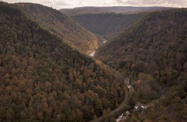
The Barbour Rock Trail is located on the northwestern end of the Pennsylvania Grand Canyon, 40 minutes from Cherry Springs State Park.
Barbour Rock is one of the best vistas in the area and can be easily reached via a one-mile trail that is listed as being handicapped-accessible. However, what this trail lacks in difficulty and length, it makes up for by offering an incredible view of the PA Grand Canyon.
Twin Sisters Trail
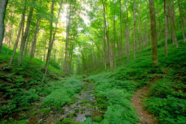
The Twin Sisters Trail is located within the Hammersley Wild Area, 35 minutes south of Cherry Springs State Park.
This is the second-largest wild area in PA and the largest area of the state with no roads. Several great trails pass through this landscape, but none are better than the Twin Sisters Trail.
This trail is nearly 7 miles long and features a great vista, an isolated forest, and the chance to really get away from it all. If you don’t want to hike the entire length, the vista and a beautiful meadow are located two miles into the hike.
Austin Dam
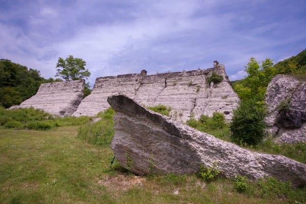
Austin Dam Memorial Park was the location of two dam failures in the early 20th century, including one that killed more than 70 people.
Today, the ruins of the dam are the focal point of the park that’s located about 30 minutes from Cherry Springs State Park. Visitors can see the ruins from near the parking area, or follow the Austin Dam Trail beyond the ruins for a 1.5-mile out-and-back hike that passes several other old dams.
If you’d rather, you can hike in the opposite direction from the dam for the 2.3-mile out-and-back trail to the ruins of the Bayless Paper Mill.
Lyman Run Trail
The Lyman Run Trail is located within Lyman Run State Park, only 15 minutes from Cherry Springs State Park.
The Lyman Run Trail is several miles in length and runs from the park’s popular campground to the far end of Lyman Run Lake. Along the way, it follows the course of the creek and the shores of the lake, offering some of the most beautiful scenery in the park.
This trail’s length means you can either do a short hike or a long hike by combining it with some of the park’s other trails.
The Turkey Path
The Turkey Path is located on the eastern rim of the Pennsylvania Grand Canyon in Leonard Harrison State Park. This spot is roughly 45 minutes from Cherry Springs and near the charming town of Wellsboro.
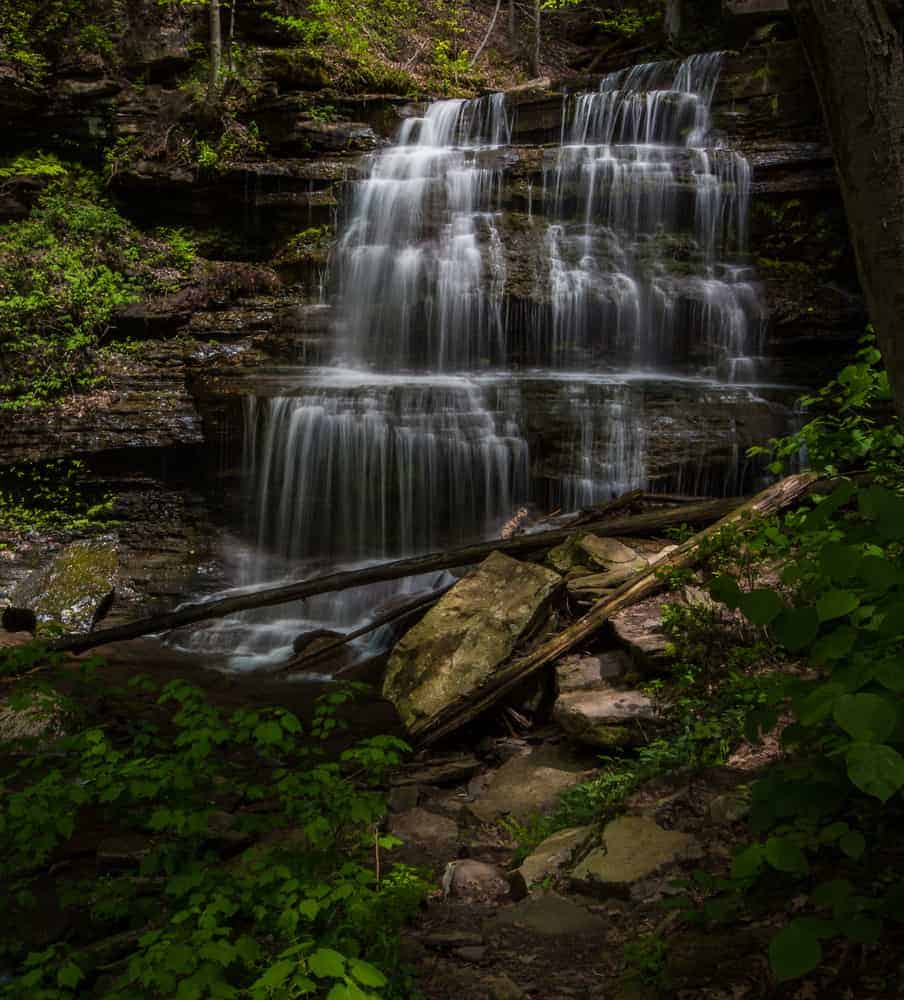
This trail starts from the incredible overlook at the canyon’s rim before descending 800 feet on the one-mile hike to the canyon’s floor at Pine Creek. Along the way, the trail passes several beautiful waterfalls and passes over a series of boardwalks and wooden steps.
Note that there is another Turkey Path on the opposite rim in Colton Point State Park which is a nice hike but not as nice as this one, in my opinion.
Susquehannock Trail System
If you are looking for a backpacking trail near Cherry Springs State Park, the Susquehannock Trail System is a great option. This trail encircles the area around Cherry Springs on its 85-mile loop through Potter and Clinton Counties.
The trail passes through some of the aforementioned parks and features many great options for both a long-distance backpacking trip and shorter day-hikes.
The closest access point to Cherry Springs State Park is at the Cherry Springs Fire Tower, only two miles from the park.
Dutlinger Natural Area Loop
The Dutlinger Natural Area is located adjacent to the Hammersley Wild Area (mentioned above) and this hike will take you into a different area than the aforementioned hike.
This loop, which starts at a parking area along Trout Run Road, offers the chance to explore one of the largest strands of old-growth forest in PA and to see some of the state’s tallest and most remote trees.
This hike uses several connected trails to create a 10-mile loop hike and passes by small waterfalls, gorges, and beautiful streams.
Pine Creek Rail Trail
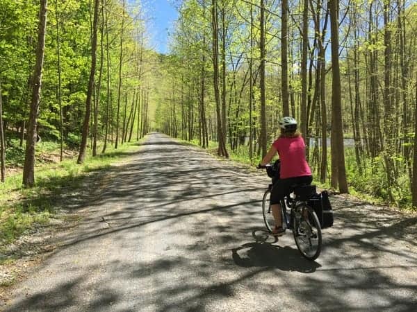
If you’re looking for more of a walk or a bike ride than a hike, the Pine Creek Rail Trail is a perfect option.
This rail trail is 60-miles long and passes through the PA Grand Canyon from Wellsboro to Jersey Shore along the Susquehanna River. The closest access point to Cherry Springs State Park is 30 minutes away along Route 6.
This trail offers visitors the chance to see the amazing beauty of the canyon from its base along Pine Creek. It’s possible to bike the entire distance, coordinate a shuttle (and rentals) with local companies for a day trip, or to simply enjoy a short portion of the trail by bike or foot.
Do you have a favorite hiking trail near Cherry Springs State Park? Let us know in the comments below.
Looking for even more things to do near Cherry Springs? Check out the PA Lumber Museum, the Coudersport Ice Mine, and Kinzua Bridge State Park.
 "
"