There are several impressive roadside waterfalls in Pennsylvania, but none as impressive as Hinckston Run Falls near Johnstown.
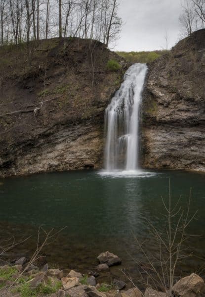
Hinckston Run Falls drops 60 feet off of stone cliffs into an impressive pool below. According to information online, Hinckston Run Falls is not naturally occurring but was created when Hinckston Run Reservoir was created in 1904. The route of Hinckston Run was altered and instead directed to flow over these cliffs before continuing on its regular path towards the Conemaugh River.
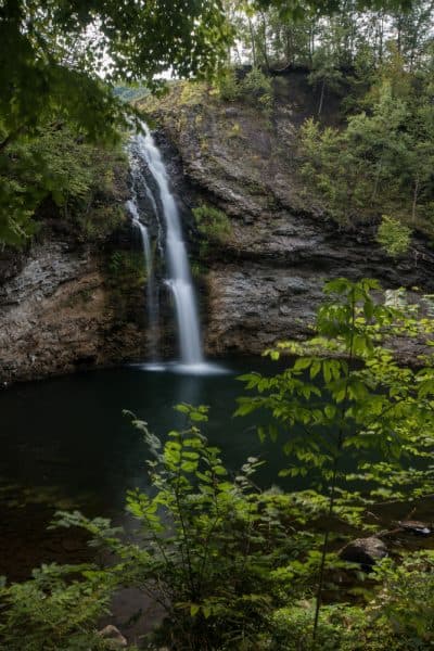
However, if you didn’t know that Hinckston Run Falls wasn’t natural, you would never know as there is nothing man-made in appearance around the falls.
In addition to its incredible natural beauty, what makes Hinckston Run Falls so great is how easy it is to reach.
The waterfall is located at a bend in the aptly named Waterfall Drive. In fact, the best view of this waterfall can be found sitting in your car as the waterfall sits only about a hundred feet from the edge of the roadway.
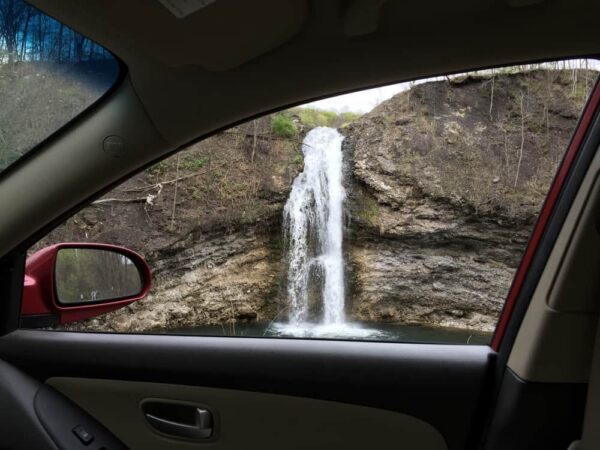
This is fortunate for two reasons. One, the land around the falls is private property and you aren’t allowed to actually leave the roadway to get a closer look. Secondly, much of the roadside has been marked with “No Parking” signs, which ensures that any visit to this waterfall will be short.
Nevertheless, this waterfall is impressive enough that it’s worth these restrictions to see it if you happen to be traveling through the Johnstown area.
The height of Hinckston Run Falls makes it one of the tallest waterfalls in the western half of the state. The beautiful green pool below the falls and the imposing cliffs surrounding it creates an almost otherworldly scene, even if you do have to view the waterfall from your car.
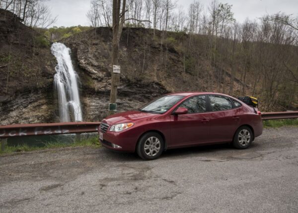
Even better, since it flows from a dammed lake, it tends to have water throughout the year, making this a great waterfall to check out if others in the area are running low.
So, the next time you are looking for a beautiful waterfall near Johnstown, Pennsylvania, take the short trip over to Hinckston Run Falls.

"Waterfalls of Pennsylvania" by Jim Cheney
If you love PA waterfalls, you won't want to miss this waterfall book from Jim Cheney, author of Uncovering PA, featuring more than 180 great waterfalls. Order it now on Bookshop.org or Amazon.
How to Get to Hinckston Run Falls
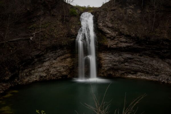
Hinckston Run Falls is located about 15 minutes by car north of downtown Johnstown. It can be found at the following coordinates: 40.371175, -78.890850.
Again, remember that the land adjacent to the road is private property and had been marked during my visit. In addition, there are “No Parking” signs here. Make any visit to the area short and ensure that you respect the landowner’s rights to the property.
Also, one quick note about driving directions. If you are using your GPS and approaching from the north, such as via Route 22, they often like to route you down a short stretch of private road between Benshoff Hill Road and Waterfall Road.
Instead of taking this shortcut, which would only save you a couple of minutes anyway, stay on Benshoff Hill Road until it intersects with Waterfall Road a mile further down the road.
Looking for more places to explore in the area? Check out nearby Buttermilk Falls and Yoder Falls. You can also learn about the area’s history at the Johnstown Flood National Memorial, the Johnstown Flood Museum, and Johnstown Inclined Plane.
[Click here for information on how to use coordinates to find your destination.]

 "
"




Jim This is Ron Shawley executive director of laurel highlands historical village. You can add more information to this story. We have parking for waterfall just above the falls at the laurel highlands veterans memorial. We also have additional trail just above the falls around the Hinckston dam. For information feel free to call me 814 241 6123
Laurel Highlands Historical Village Inc Hiking Trails
Honan Ave. Community Hiking & Biking Trail
The trail starts off the River Walk trail in Cambria City, Johnstown, heading North on Honan Ave. Along the 3 mile trail you will be able to view a huge active Beaver dam, small waterfalls and at the end of trail a huge waterfall. The trail has educational interpretive signs along the trail to teach students about the wildlife in this region. We also have provided benches along the trail for those seeking a break, and a quick rest stop. Then the trail splits in two parts, one part staying on the western side of the dam, named eagle trail where Bald Eagles can be seen. To reach the Joseph P Whipey trail, you cross the bridge turn left on road and enter at midpoint or by pavilion.
Joseph P. Whipey Trail
1.5 mile trail that runs along the length of the dam but through the wood line. The trail starts by the pavilion on the eastern flank of the dam. The 1st part of trail is easy walking but the 2nd half is rather steep as the trail heads up to the overlook where hikers can view the whole reservoir below. The trail runs thru the LHHV Forest
Eagle Trail
The Eagle trail so named because of the eagles that often can be seen perched along the trail in the higher trees. The trail starts behind the dam along Hunt road, it then runs behind the dam coming out on waterfall road from their trail follows the road along the dam. The trail is 1.75 miles long, and is an easy walk with some slight hills. Along the trail you can see waterfalls, old historical foundations, many low land and wetland birds, and also mammals native to region.
The LHHV Forest
The LHHV Experimental Forest, located 3 miles north of Johnstown, in Middle & East Taylor townships, offers quiet refuge to all who seek the natural enchantment of a forest experience. Tucked away in the heart of the Hinckston Run Dam, the Forest is bordered on its Western ridge boundaries by the Hinckston Dam Wildlife Management Area. The LHHV Forest is located on property that surrounds Hinckston Reservoir. Our hiking trails encompass the wooded area itself. The trail as listed above has stops for resting and watching the area wildlife. We have local students who utilize the Forest Trail as an outside classroom.
LHHV Mountain
Just off of Honan Ave and River Walk trail is the new LHHV Mountain Trail. Here hiking trails will weave in and out of fields, extending up a slight slope reaching the summit. On the summit we have an over look, with views of Stone Bridge, Johnstown, Cambria City and West End. Keeping it as simple as possible, the trail allows everyone to not only view native wildlife but learn about plants, wildlife, and the whole eco system. UPJ Geology Club, will be providing outdoor classes on Geology of region, Space, Weather, and conservation. Also on location will be various ethnic communities show casing their heritage. Parking for Honan Ave Community Hiking and Biking trail is next to the river, signs point the way. Please do not park near gate as this is a turnaround for those living there.
Would like to have actual directions to drive by the falls. Not everyone is a techie and uses GPS coordinates.
Coordinates are much easier for everyone. Simply copy/paste them into Google Maps on something similar and they will show you exactly where it is, and you can get custom directions from there. If you aren’t sure how to do it, there’s a link at the bottom of the article with instructions on how to use coordinates.
Love this! I grew up in Vinco so it’s nice to see Hinckston Run get some attention. Another great addition in this area for your site is the Staple Bend Tunnel. I live out of state now but every time we go home to visit my kids insist on going to the tunnel for a bike ride…and to see the waterfall. Love your site!
Staple Bend Tunnel has been on my list for a long time. I need to get there sometime soon.
Is there any place to park overnight near any of the above mentioned sights?
Not that I’m aware of, but others may be able to chime in with suggestions.