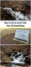
One such waterfall is Jarrett Falls, which is hidden away deep in state game lands near McConnellsburg in Fulton County.
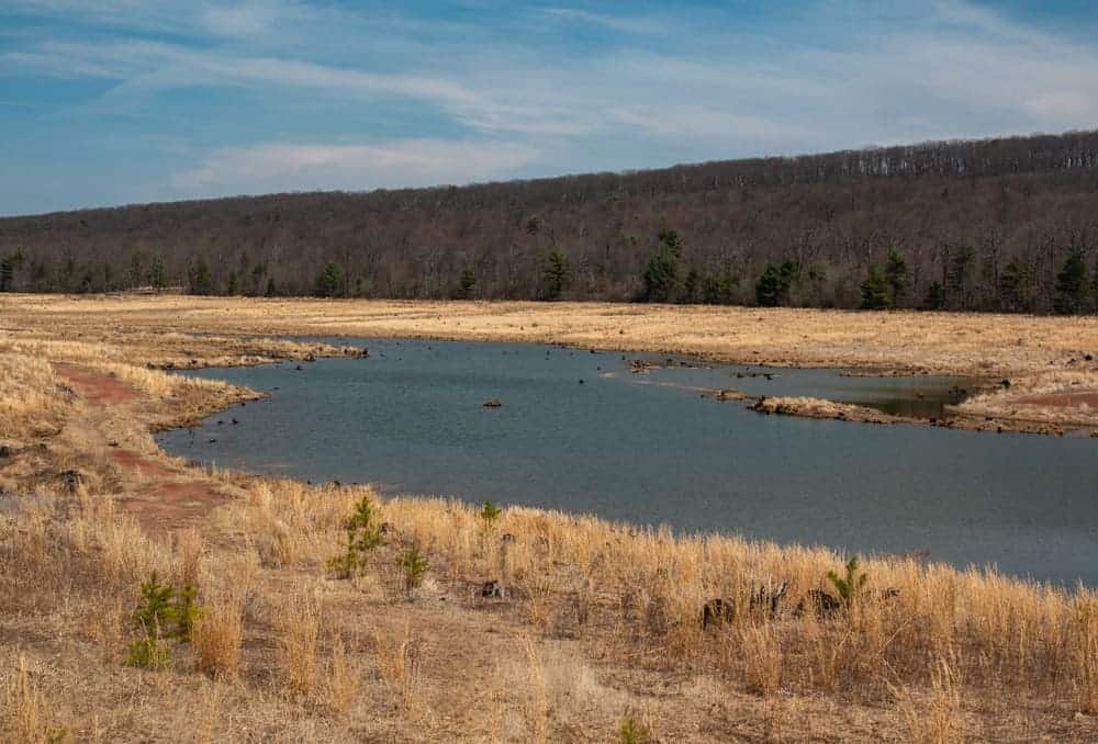
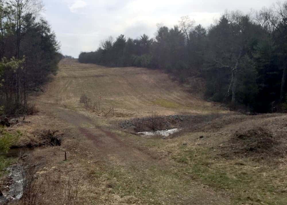
Jarrett Falls is located southwest of McConnellsburg in State Game Lands 53. This parcel of public land was once best known for Meadow Grounds Lake. However, the lake was drained in early 2013 because the dam was becoming dangerous.
At the time of publication, the lake sat empty, which was sad, but also rather interesting, to see. However, I”ve been told that the dam has been fixed and the lake is full again.
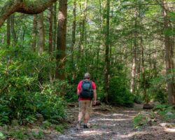
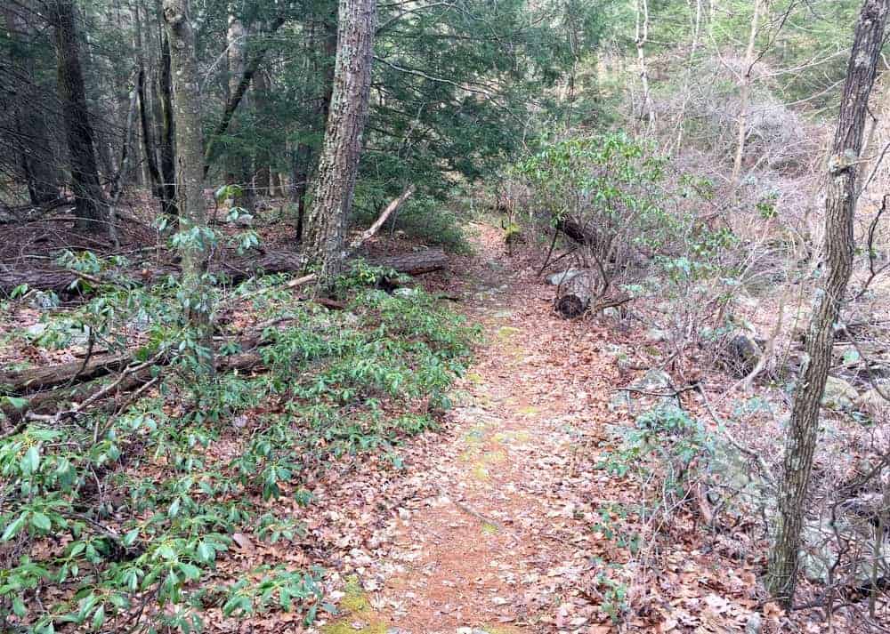
The hike to Jarrett Falls is roughly 1.8 miles in length. Overall, this trail is a pleasant and easy-to-follow hike through the woods. There trail only loses about 300 feet in elevation, and despite a few rises, it’s a relatively flat hike all the way to the waterfall.
If the trail was better maintained and had some more consistent infrastructure, it would be an amazing trail and perfect for the whole family. However, it’s worth noting that this trail features a minimum of two stream crossings with no bridges and there may be a significant number of trees down along the trail. Still for those looking for great waterfall hikes, this is a fantastic choice.
While not an overly challenging hike otherwise, these factors make this trail a difficult one and one not well suited for smaller children, but perfect for those looking for an adventure.
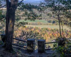
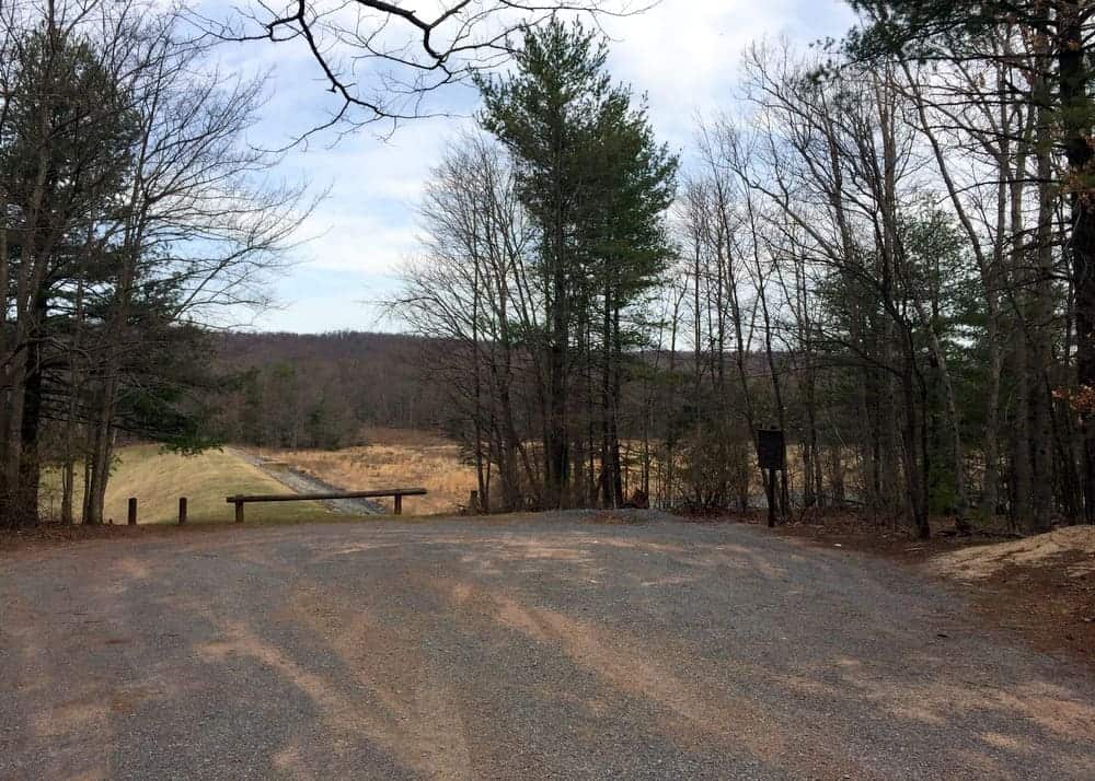
The trail to Jarrett Falls starts from a parking area adjacent the dam for Meadow Grounds Lake. After parking your car, cross to the dam’s western side. Even though the lake is nearly completely empty, there’s still some water at the base of the dam.
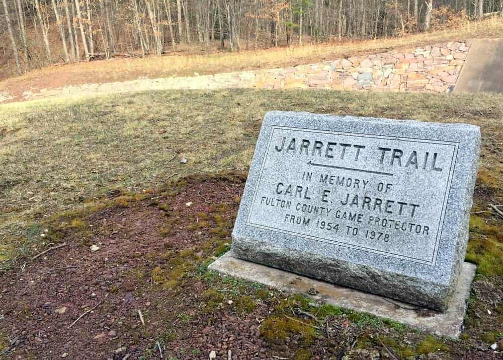
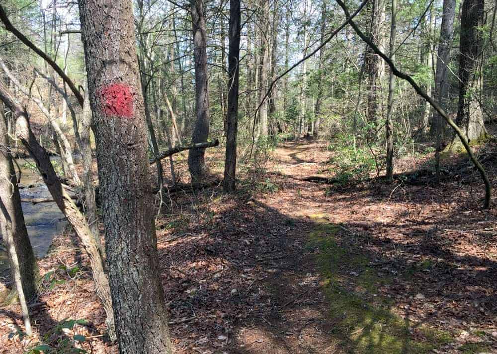
Just as you are coming to the flood spillway, you’ll see a marker for the Jarrett Trail, which is named after Carl Jarrett, a local game protector. Turn left and soon cross over the spillway and continue hiking down the trail.
While the Jarrett Trail never strays far from the banks of Roaring Run, this first part of the stream can be a trickle even in the spring as most of the water flows down the main area of the stream.
This portion of the Jarrett Trail undulates through the woods and includes one small stream crossing which can usually be handled without issue. In places, you may see red blazes on trees, but these are irregular enough to not provide a significant amount of help while navigating the trail.
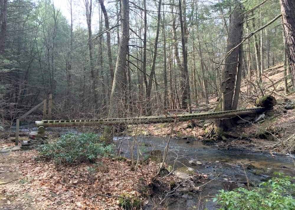
After approximately a half mile of hiking, you’ll come to a large clearing in the woods and a narrow footbridge over a feeder stream. At the clearing, turn left and cross the bridge over Roaring Run.
While it can be hard to spot, the trail continues down the left bank of the creek (as you are facing downstream). Simply pass through the field on the left bank and head into the woods. While the trail isn’t well marked, it’s very easy to find and follow once you get to the tree line.
After 10 minutes or so, you’ll come to another bridge over Roaring Run. Cross this bridge and continue the hike downstream on the opposite bank.
It’s worth noting that after hiking this bridge, the trail gets much harder. Not only are there two more creek crossing with no bridge, but there were also numerous large blowdowns along the trail when I visited. While I can’t say for sure, the blown down trees looked relatively new and likely happened at some point over the winter.
Since it was very early in the season, it’s possible that someone may come through with a chainsaw and remove these trees at some point, but if not, hiking over, around, and even through these trees is difficult and expect to get a few scratches doing so.
After hiking the trail for a few more minutes, you’ll come to the first wet crossing of the hike. Here, two trees have fallen across the creek, which provide an option for those wanting to try and keep their feet dry for now. Otherwise, you can carefully wade across the stream.
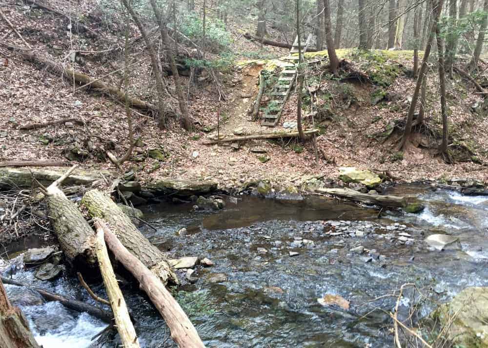
Once to the opposite bank, use the sturdy wooden ladder that has been chained to the hillside to climb to the top of the bank or scurry up the eroded hillside.
After hiking above the creek for a short distance, the trail will appear to end at a large rock. This is the hardest part of the hike to Jarrett Falls.
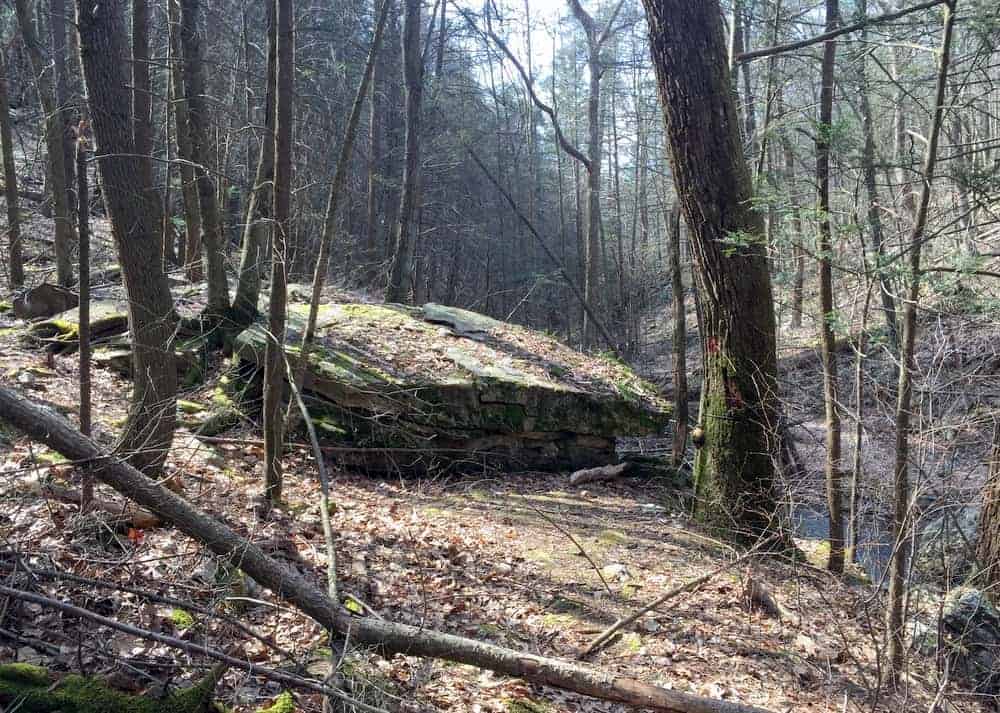
At the rock, turn toward the creek and make your way down the bank. At the time of my visit, a steel cable was there to help with this descent and made it much easier.
At the creek, you’ll need to make your way to the opposite bank. If water levels are somewhat high (which they likely are if you are hiking to see a waterfall), this is a bit of a challenging place to cross. If possible, use the metal cable to assist you in your crossing of the creek. It is very unlikely you’ll be able to cross here without getting your feet wet unless water levels are very low.
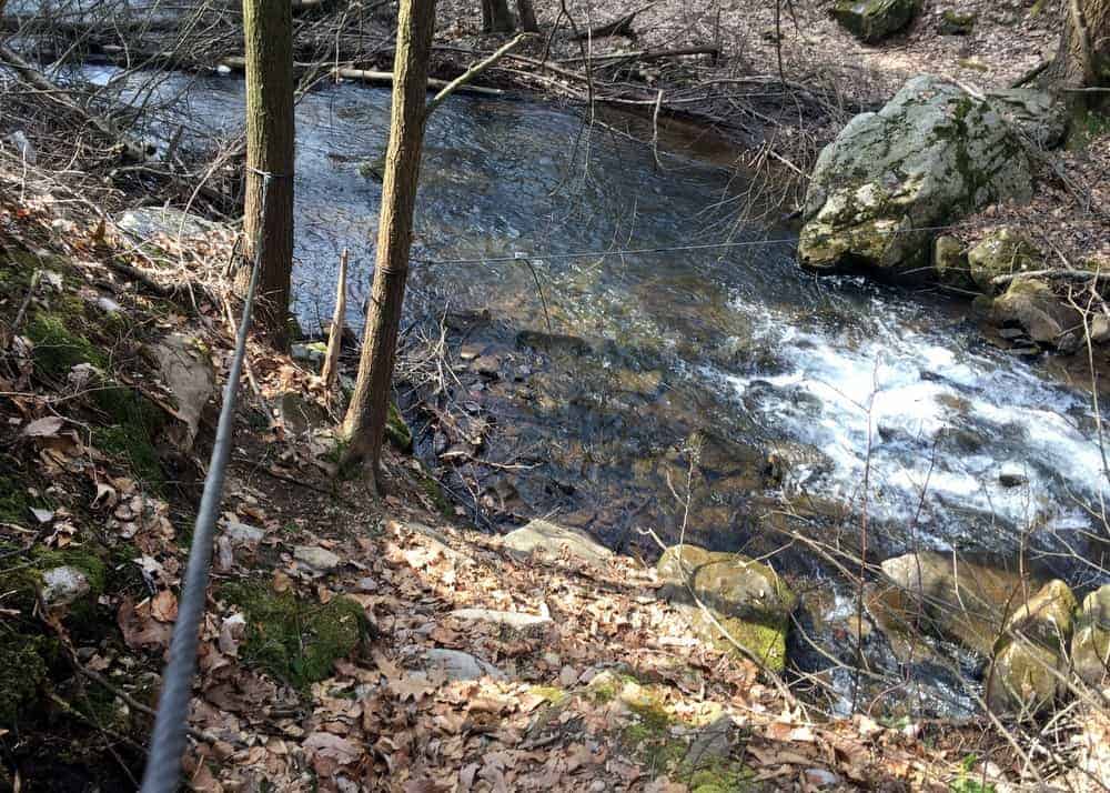
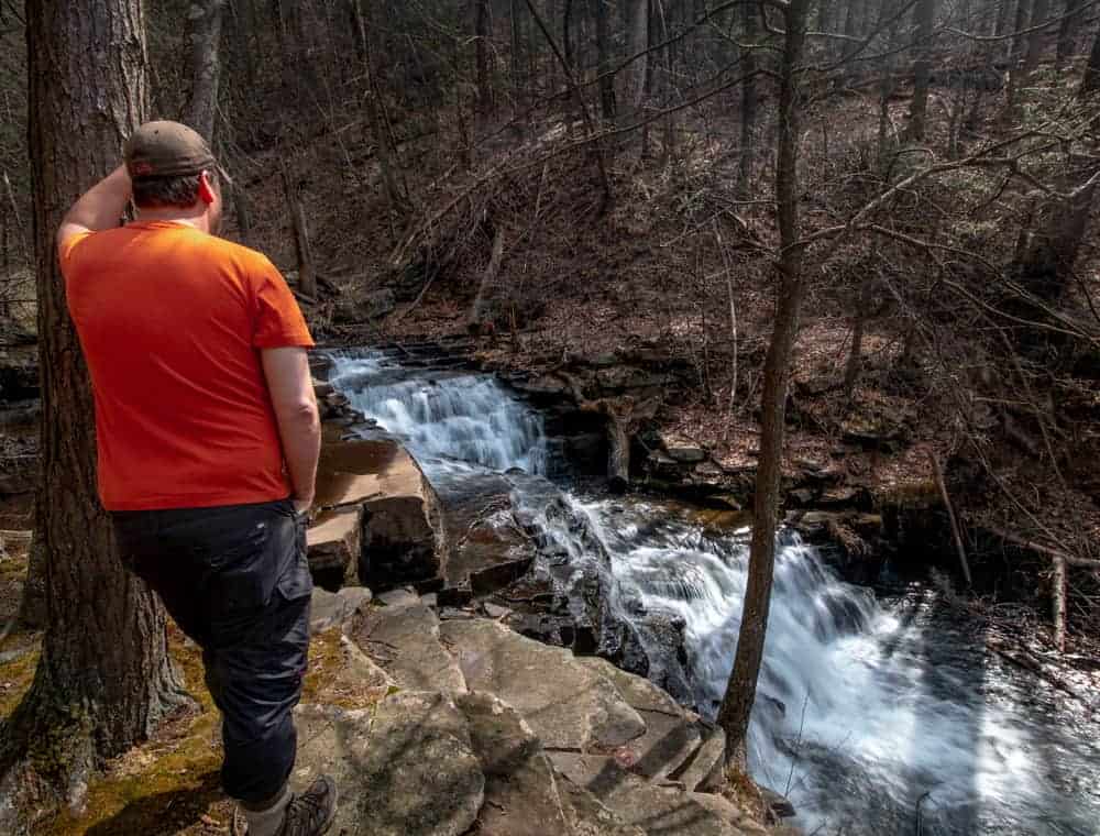
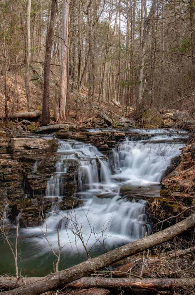
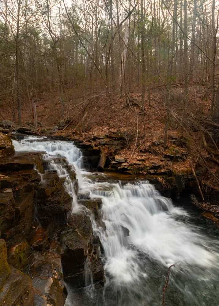
Once across the creek, continue downstream until you reach the top of Jarrett Falls.
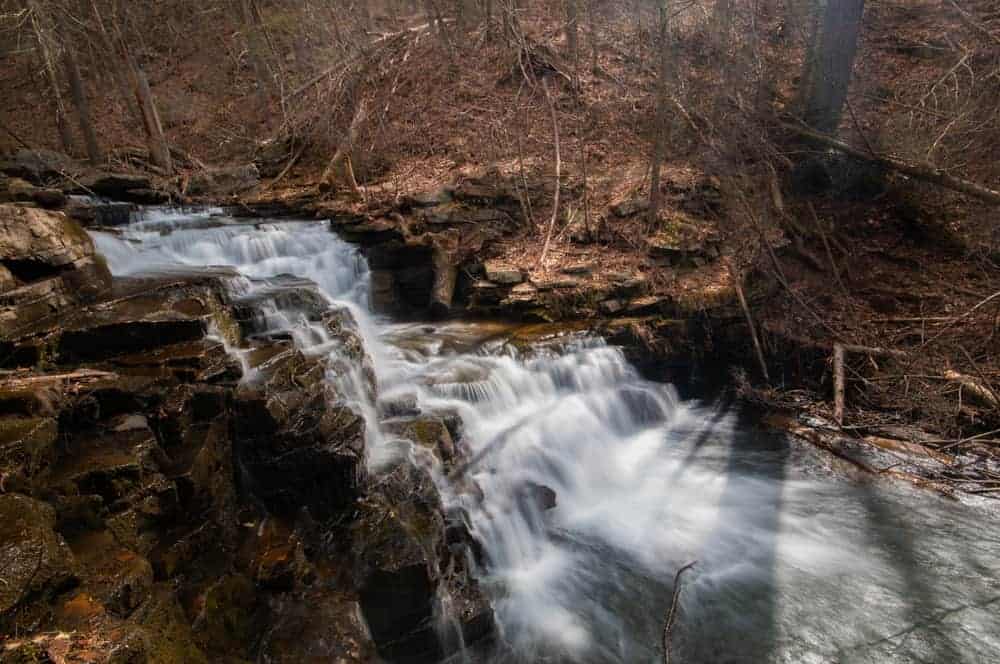
Jarrett Falls is approximately 15 feet in height, and there is a beautiful shape to the falls as the water cascades down the tiers of the waterfall. The rocks at the top of Jarrett Falls make for great places to sit and just enjoy the area. A break here is definitely well-earned after completing the hike to this hidden spot.
If you want to get to the bottom of Jarrett Falls, another stream crossing is required as the cliffs on this bank won’t allow you to easily descend to the bottom.
To cross the creek, head a few yards above the falls and look for a tree spanning the creek. Above the tree, someone has strung up another metal cable. While it’s neither easy nor safe, it seems to me that the easiest and safest way to cross the creek is to walk along the tree using the cable for balance.
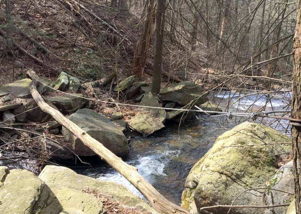
If you opt to do this, use EXTREME caution. A fall here would not only drop you 5-6 feet into the creek, but also might lead to a trip over the edge of the waterfall.
Once on the opposite bank, make your way down to the bottom of the falls. Again, there is no good or easy way to do this, so pick the method that looks best to you.
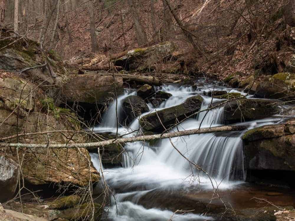
Large blowdowns dominate the area below Jarrett Falls making it difficult to get a good vantage point or photographs from the bottom. Nevertheless, this is probably the best spot from which to view Jarrett Falls.
If you are feeling extra adventurous, my research and a quick look at topographic maps seems to indicate that there is another waterfall just downstream of Jarrett Falls. However, due to the lack of a trail and the conditions on the day I visited, I was unable to confirm this.
Once you are ready, it’s a 1.8-mile hike back to your car. Simply follow the trail that you took to get back to your car.
The only confusing point comes after the first bridge crossing. The trail makes a 90-degree up a small bluff at the edge of the creek. However, this turn is easy to miss, and might leave you wondering if you forgot about a creek crossing.
Jarrett Falls near McConnellsburg is an amazing hidden gem, and it’s rather surprising that it’s not better known. If the trail were to get cleaned up a bit and a few more bridges were installed, this would be a star attraction for the McConnellsburg area.
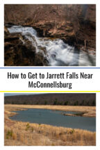
How to Get to Jarrett Falls near McConnellsburg
Jarrett Falls is located on State Game Lands 53 near McConnellsburg in Fulton County, Pennsylvania. A few miles of dirt roads need to be traversed to reach this waterfall, but nothing I wasn’t able to handle in a regular car.
The parking area for the trail to the waterfall is adjacent to the old dam. Follow the road passed the dry lake bed and park at the end of the road at the following coordinates: 39.904911, -78.057623.
From here, cross the old dam and follow the directions above for the 1.8-mile hike to Jarrett Falls. For those that are interested, Jarrett Falls can be found at the following coordinates: 39.886529, -78.062699
Before going, note that this waterfall and the entire hike are on state game lands. While not required, it is highly recommended that you wear at least a bit of blaze orange clothing while hiking on land that allows hunting.
Looking for more adventure in the area? Check out the Abandoned PA Turnpike, the birthplace of President James Buchanan, Big Mountain Overlook, and the covered bridges of Bedford County.
[Click here for information on how to use the coordinates in this article to find your destination.]
Want to see more of Pennsylvania’s best waterfalls? Visit our Pennsylvania Waterfalls page!
 "
"