
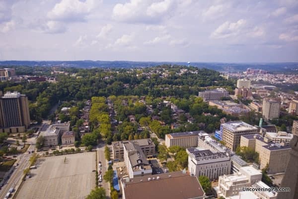
During my visits to the city over the last few years, I’ve made a point of seeking out some of the city’s best spots for epic photographs of the Pittsburgh skyline (and even had the chance to photograph Pittsburgh from above on the PPG Place roof).
Some of these spots are well-known, while others are little-known even to Pittsburgh natives. Whether you love to take photos or just want to admire the city, these spots are sure to delight!
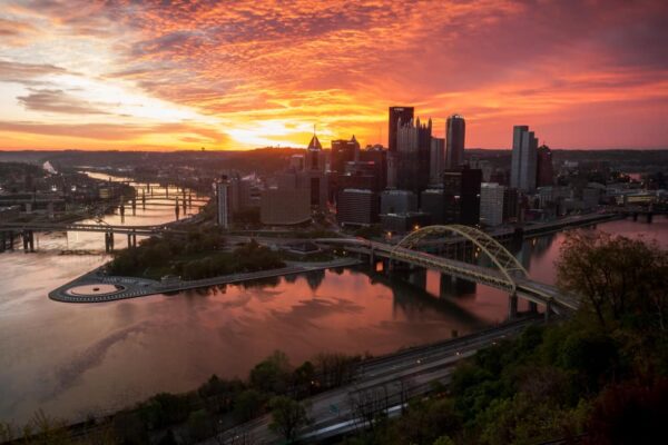
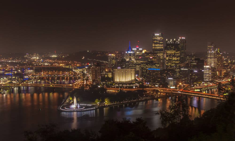
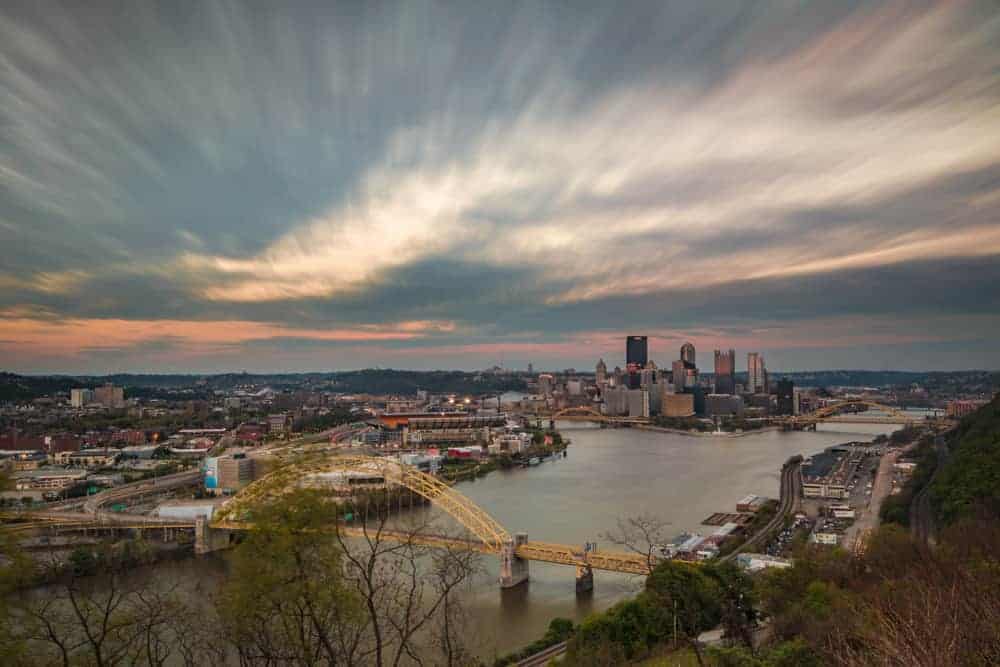
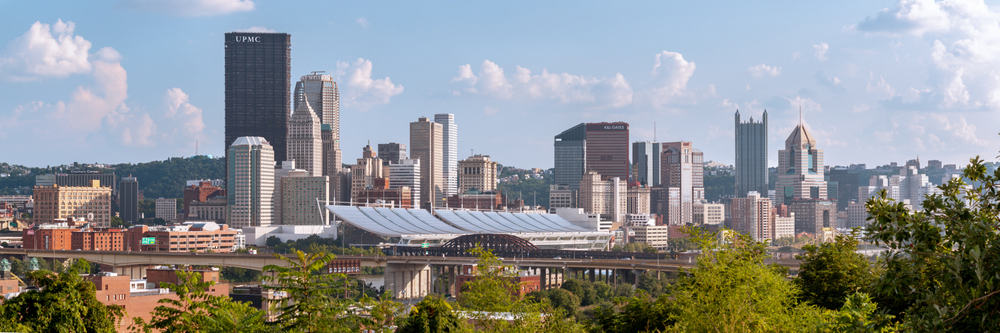
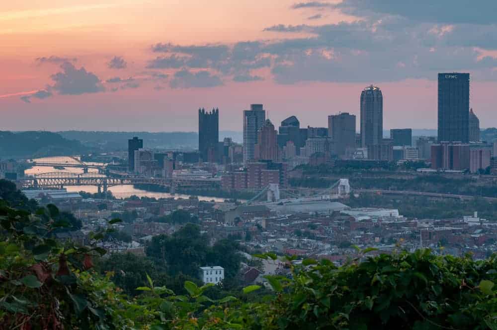
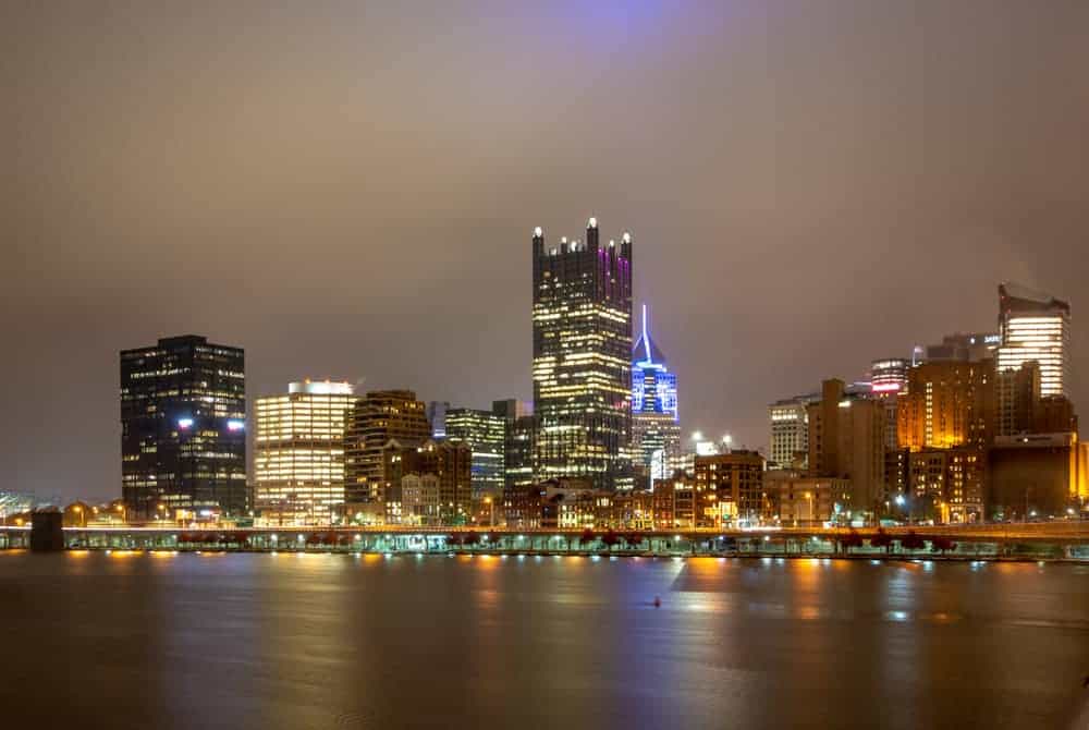
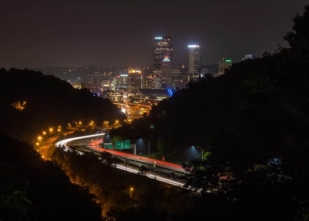
Mount Washington
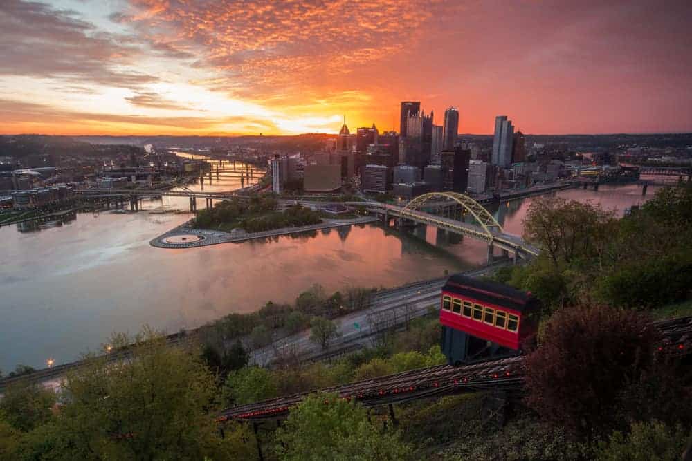
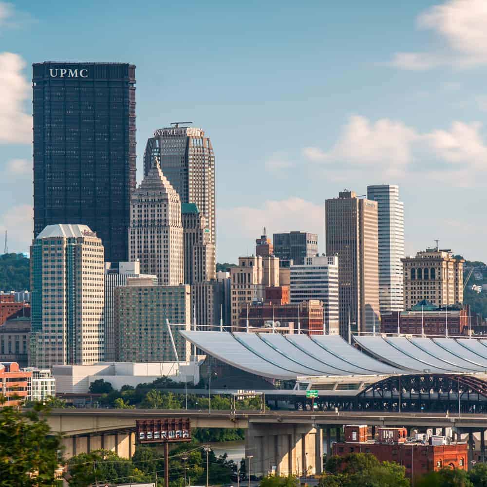
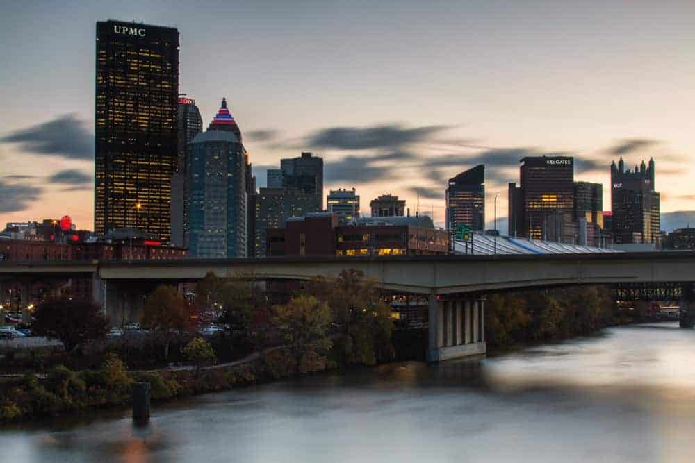
The most well-known spot for shots of downtown Pittsburgh is Mount Washington. Located just across the Monongahela River from downtown, the photos from this overlook are truly some of the best you’ll come across anywhere.
If you want the classic shot of downtown Pittsburgh that you’ve probably seen many times before, this is where you want to head. In the past, I’ve declared this to be the best natural overlook in the world, and I still hold that this is definitely true.
While the shot above is the classic shot from Mount Washington, there are many other great vantage points here. Turning your camera to the east gives a unique view along the Monongahela River, and the view of the west overlooks the Ohio River.
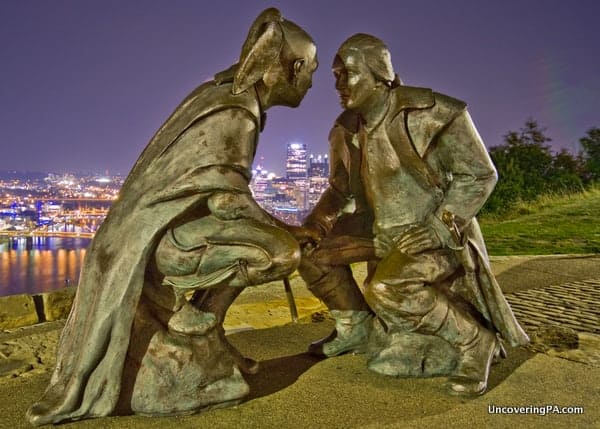
There are also great shots to be had near the western edges of Mount Washington. From here, shots of George Washington and Guyasuta can be quite interesting.
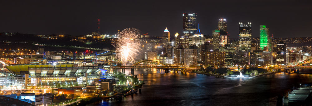
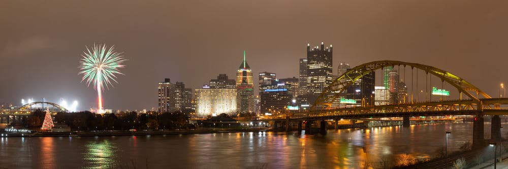
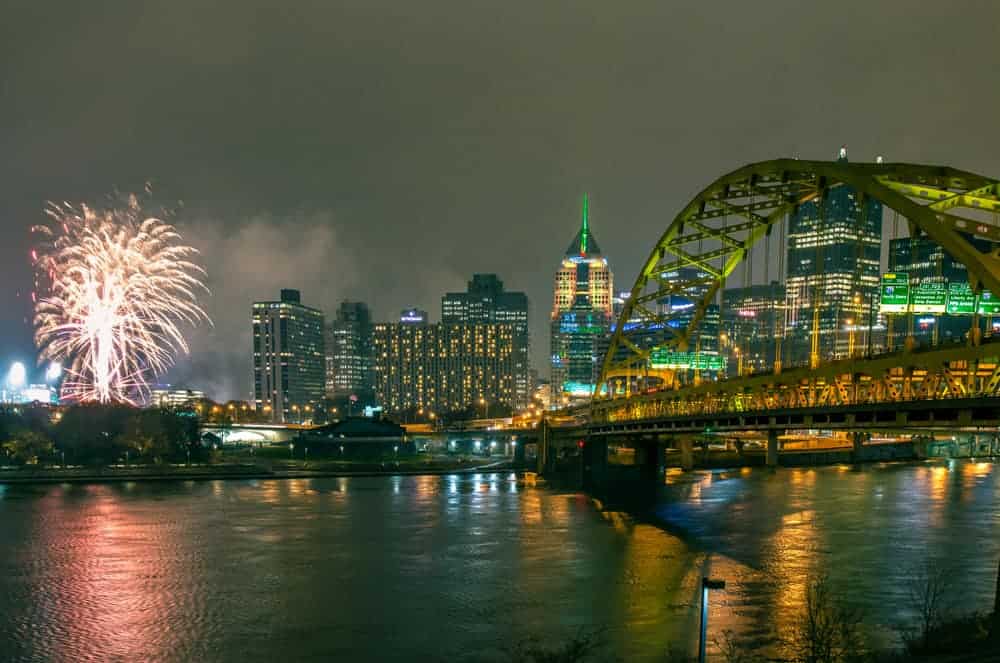
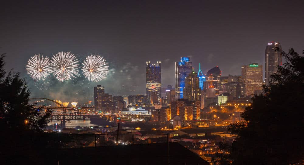
To get photos from the top of Mount Washington, head to the following coordinates and walk along the ridgeline: 40.438147, -80.018890. This is also one of the best spots for photos of fireworks in Pittsburgh.
Schenley Park
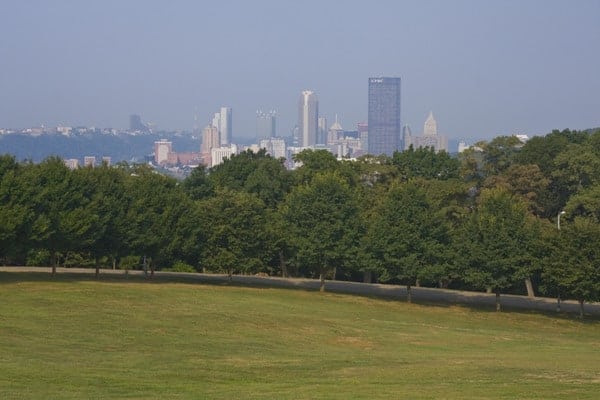
Located in west Pittsburgh near Oakland and Squirrel Hill, Schenley Park is one of the city’s coolest parks and its second largest. Once home to horse racing, the park is popular today with hikers, bikers, and golfers. However, what I enjoyed most was the great view overlooking downtown Pittsburgh.
What makes the view from the southern corner of Schenley Park so great is that you can see the entire skyline of Pittsburgh from one spot. This gives a great opportunity to see the skyscrapers of both downtown and Oakland. It also really allows you to grasp how much taller the Cathedral of Learning is than the other buildings around it.
To get to this view, head to the following coordinates within Schenley Park: 40.430600, -79.945468.
North Shore Bike Path
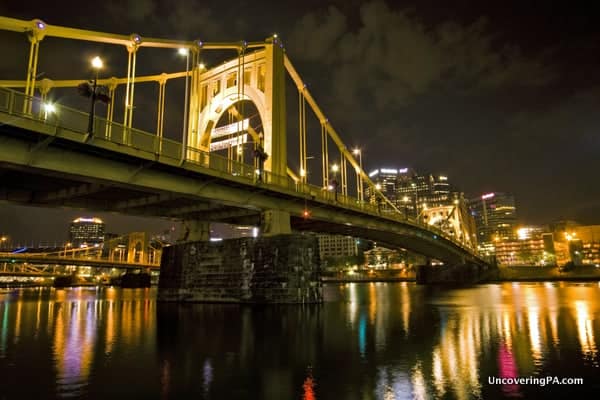
The views along the entire North Shore Bike Path are quite exceptional. However, my favorite section is the area from just west of the Roberto Clemente Bridge to the Rachel Carson Bridge. From here, the views of downtown Pittsburgh are simply phenomenal. Despite being separated from downtown by the Allegheny River, it really feels like you are completely enveloped by the majesty of downtown Pittsburgh.
What I love most about the view from here is how close you are to the iconic yellow bridges of Pittsburgh. There is something amazing about standing next to these bridges and looking over the downtown area.
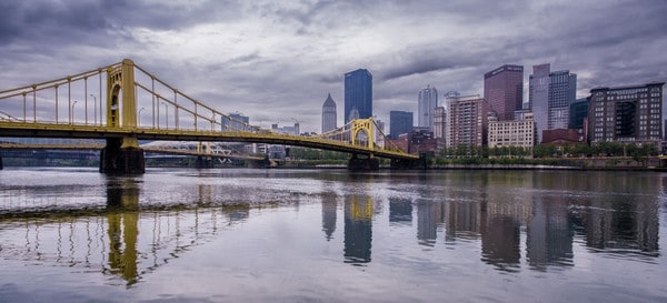
To visit the North Shore, start at the following coordinates along the Three Rivers Heritage Trail near PNC Park and walk upstream until you reach the third bridge: 40.446398, -80.004102.
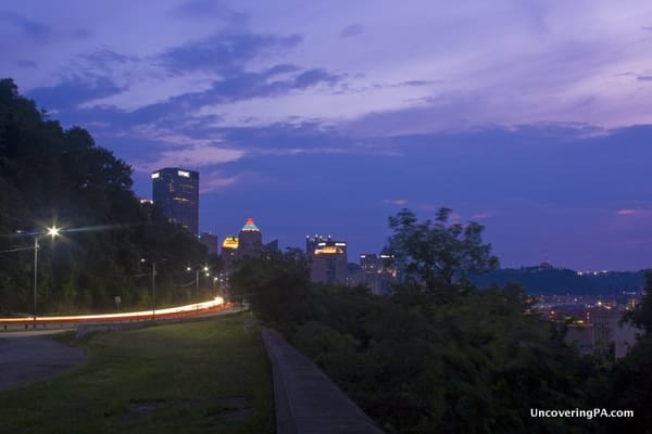
West End Overlook
Mount Washington gets all the love, but the West End-Elliot Overlook Park, which sits a bit further downstream, provides an equally amazing view. What’s especially great about the overlook here is that you are looking directly at Point State Park, providing a very symmetrical view of downtown Pittsburgh and the three rivers. This is also one of the best places to see fireworks in Pittsburgh.
What puts it a step below Mount Washington, in my opinion, is that it’s a bit harder to reach from downtown Pittsburgh, and there is really only one angle here for photographs. However, with such an amazing view, it’s well worth visiting and one of the best views in the city.
West End-Elliot Overlook Park can be found at the following coordinates: 40.445217, -80.033227.
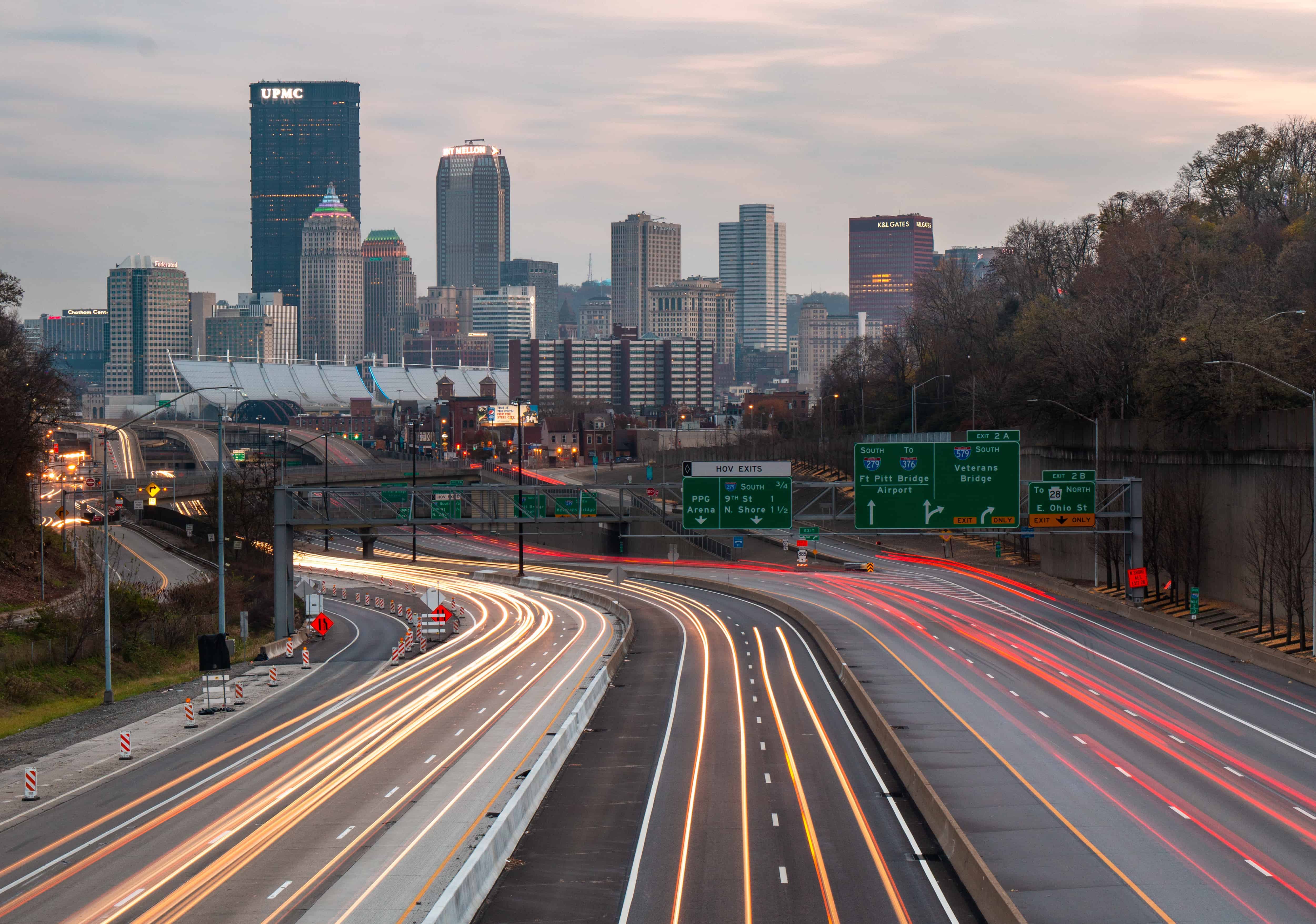
Fort Pitt Bridge
The Fort Pitt Bridge is well known for its amazing views of the city. In fact, emerging from the tunnel and onto the bridge is often called Pittsburgh’s front door. However, few realize that there are great views that can be had from the walkway near the bridge.
Unfortunately, the sidewalk on the bridge is on the opposite side of the road from the city, making photography from here impossible. However, if you continue walking along the bridge and onto the ramp that leads to Carson Street, there are some amazing views of the city with the bridge in the foreground.
While the best views aren’t technically on the bridge, they are on the ramps from the bridge before it merges with the main road, so I figure we can still call that the bridge (Right?).
For these views, head to approximately these coordinates, which are on a sidewalk along the ramp: 40.438464, -80.014300.
Station Square
Located on the southern shores of the Monongahela River, this view is somewhat similar to the one from the North Shore. However, having to shoot over railroad tracks makes the downtown area seem a bit further away. Nevertheless, there are great views to be had from this shopping and entertainment area of Pittsburgh.
The view here is also fairly similar to some of the vantage points that you can get from the top of Mount Washington, which is directly behind this viewpoint, but being much closer to water levels provides a nice vantage point and some cool photo opportunities.
Your GPS should be able to direct you to Station Square, but just in case, these views can be had from the backside of the complex at the following coordinates: 40.434280, -80.004602.
Troy Hill Staircase
One of my favorite little-known views of Pittsburgh is from the top of a staircase in the Troy Hill neighborhood. This staircase runs from Vinial Street (just west of Penn Brewery) to Brabec Street at the top of the hill.
While the views from the stairs themselves are fantastic (and probably even more so when there are no leaves on the trees), the best views can be found on the public path from Brabec Street to the top of the staircase.
The one unfortunate part about this view is that to get it, you’ll have to look over either the front or backyard of a home along this road. However, the sidewalk to the stairs is public property, so you shouldn’t have any issues checking out the view from here.
If you’d rather avoid looking over the home’s yard, a similar, but not as nice view, can be had from near the intersection of Province Street and Troy Hill Road.
This great place to take photos in Pittsburgh can be found at these coordinates: 40.458018, -79.992354.
The Color Park
Located along the Three Rivers Heritage Trail on Pittsburgh’s South Side, The Color Park is a fabulous place to enjoy legal graffiti art. However, it’s also a great spot to view Pittsburgh’s skyline from.
That’s because the view from here is a bit different from a lot of spots because you are not only upriver of the city, but you can also see the city from the level of the Monongahela River. While there is a bridge between you and the city, I really like how it helps frame the skyline and adds a nice touch to photos from this spot.
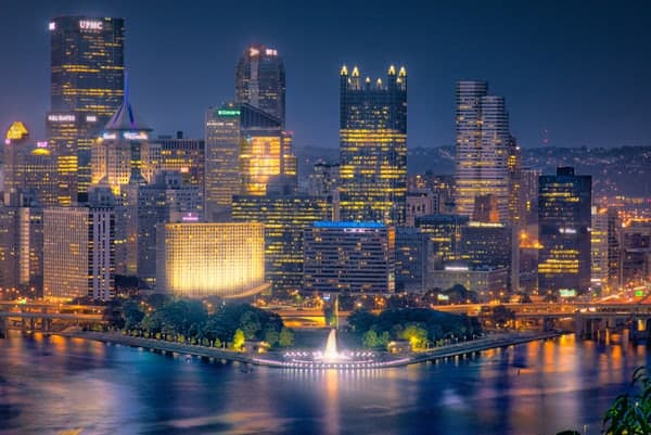
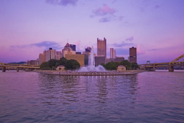
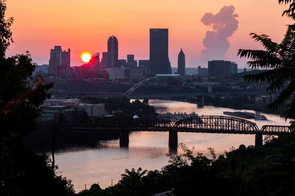
Point State Park
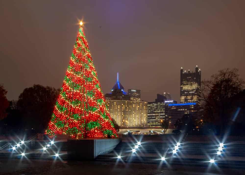
Point State Park, better known simply as The Point, is where the Allegheny and Monongahela Rivers come together to form the Ohio. This was an important piece of land prior to the Revolutionary War and is best known for its great museum and fountain.
However, there are also stellar views of the Pittsburgh skyline from this spot.
I especially like visiting here at sunrise as you can sometimes get great color in the sky from the sun rising behind the building. It’s also a nice spot in the evening, especially during the Christmas season when the tree is lit.
The Point can be found at the following coordinates: 40.441913, -80.013157
36th Floor of the Cathedral of Learning
The Cathedral of Learning on the University of Pittsburgh campus is one of Pittsburgh’s tallest buildings and is the second tallest university building in the world. There are many great places to explore on the lower floors, but if you’re looking for a great view, head to the 36th floor.
While the building itself is 42 stories, the 36th floor is the highest one that is publicly accessible. Home to the university’s Honors College, the 36th floor offers an impressive view over Oakland the surrounding city. Unfortunately, the windows here are quite small and don’t provide a great view of the downtown skyscrapers. However, as best I can tell, this is the highest, publicly-accessible building floor in the city.
The Cathedral of Learning is located at 4200 Fifth Avenue, Pittsburgh, PA 15260.
Frank Curto Park
Located along Bigelow Boulevard between downtown Pittsburgh and Polish Hill, Frank Curto Park is a speck of land that is very easy to miss. In fact, I initially drove right by the park and had to make a long detour through downtown Pittsburgh to circle back around again. However, the unique view here is well worth checking out.
At the western edges of the park, there’s a great view of downtown Pittsburgh with the traffic along the busy roadway in the foreground. The park itself is home to several very interesting sculptures and you can frequently see wild turkeys here as well.
The park is located at the following coordinates: 40.452754, -79.974149. The listed coordinates are the entrance to the park’s one-way road, which can only be accessed by traveling towards downtown on Bigelow Boulevard. The best view of downtown is from the far edge of the park.
Eleanor Street Park
Located high above the city in the South Side Slopes, there is a fantastic view of the city from Eleanor Street Park. This local playground doesn’t have much to draw visitors to it, but those looking for a unique view of the city won’t want to miss the view from just above the park at the intersection of Eleanor and Primrose Streets.
This park is also a great place to see fireworks in Pittsburgh if you are looking for a unique vantage point. While not as impressive as viewing them closely from near the city, the photography possibilities are, in my opinion, much better here.
Note that the drive up to Eleanor Street Park is not for the weak of heart. I’ve encountered few trips around Pittsburgh that feature more insanely steep and narrow roads that getting up to this park.
Eleanor Street Park can be found at the following coordinates (40.421237, -79.972583) or adjacent to this address: 933 Eleanor St, Pittsburgh, PA 15203.
The Deck of the Gateway Clipper
While it might be touristy, a trip on the Gateway Clipper provides many great vantage points of downtown Pittsburgh that you simply can’t get from land. And, while you could take your own watercraft out, it’s much easier to photograph or simply enjoy the view from the deck of the boat.
Cruises are offered throughout the day, including several during and after sunset. When I rode on the Gateway Clipper, I opted for a sunset cruise, which created many great photo opportunities, many of which were hard to capture because shooting long-exposures doesn’t work very well from a moving boat. Nevertheless, I was able to get a few good shots, and I really had a great time watching the city’s lights turn on from the comfort of the boat.
The Gateway Clipper leaves from Station Square at regular intervals throughout the year. You can also get similar views on the Just Ducky Tours as well.
Fineview Overlook
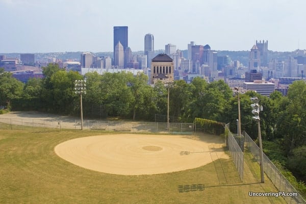
Fineview Overlook takes its name from the Fineview neighborhood of Pittsburgh, which is, rather obviously, known for its fine view of the city. The overlook itself is nothing more than a few benches and the sidewalk along Catoma Street between Meadville and Lanark Streets.
Despite simply being called Fineview Overlook, I would say that the view from here is really pretty awesome. I especially loved how the baseball diamond at Fineview Fields is in the foreground, giving a really unique look at the meshing of residential and urban life.
Fineview Overlook can be found at the following coordinates: 40.460525, -80.004395.
West End Bridge
Spanning the Ohio River just west of downtown Pittsburgh, the West End Bridge features an amazing view of the city’s three rivers and the skyline. This is an especially great spot at sunrise, but can still be enjoyed at any time of the day.
While most enjoy this view from their cars, there is also a walkway on the eastern side of the bridge that offers fantastic views both for photographers and those that just want to take a few moments to enjoy the city.
The West End Bridge’s walkway can be accessed from near the Rivers Casino at the following coordinates: 40.448413, -80.025482.
The Boy Scouts of America Building

Located near PPG Paints Arena, the Boy Scouts of America Building’s courtyard has an under-appreciated view of downtown Pittsburgh. From this spot, the buildings in downtown Pittsburgh rise up in impressive scale while the cars on the highway zoom past below.
In addition to the impressive view, you can also enjoy the Boy Scouts monument here, which includes both a replica of the Liberty Bell and an audio program.
From a photography standpoint, a chain-link fence between the courtyard and the road makes images a bit of a challenge, but it’s still a unique vantage point that’s worth checking out.
The Boy Scouts of America Building can be found at 1275 Bedford Ave, Pittsburgh, PA 15219.
Hot Metal Bridge
Spanning the Monongahela River between Pittsburgh’s Southside Flats and South Oakland neighborhoods, the Hot Metal Bridge is one of the most historic bridges in Pittsburgh. In fact, during World War II, 15% of the steel made in the United States passed over this bridge while it was being created in the factory.
Today, the bridge features capacity for cars, as well as a wide walkway for pedestrians and bicyclists. It’s also part of the Great Allegheny Passage trail between Pittsburgh and Cumberland, Maryland.
Photographers will enjoy the fantastic view of Pittsburgh from the Hot Metal Bridge, which includes the river, downtown buildings, a marina, and one of Pittsburgh’s famous gold bridges.
The Hot Metal Bridge can be accessed from either end of the bridge with the easiest access point being at the intersection of South Water Street and Hot Metal Street in the Southside Flats.
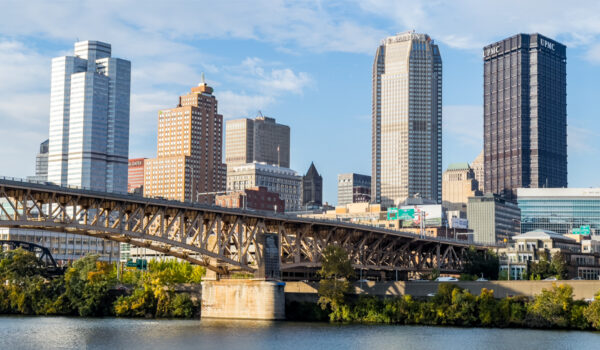
Smithfield Street Bridge
The Smithfield Street Bridge is one of the most iconic bridges in Pittsburgh, and it also has some great views of Pittsburgh.
The best view from the bridge can be found on the western side of the bridge along the southern bank of the Monongahela River (the area closest to Station Square). From here, the city can be seen at a unique angle that isn’t often photographed.
This is also a great spot to see fireworks in Pittsburgh when they are shot off from the Point.
The Smithfield Street Bridge can be found at the following coordinates: 40.434151, -80.002729.
The Strip District
The Strip District is located east of downtown Pittsburgh and is known as one of the city’s best shopping and eating areas. However, it’s also home to some great views of the Pittsburgh skyline.
While there are views throughout the entire area, my favorite spot is located near the corner of Penn Ave and 17th Street. Minus the McDonald’s, which sits just out of frame, this offers a great view of the city and traffic heading into it.
Other great views of the city’s skyline can be found along Smallman Street, Liberty Avenue, and from the top of the Cork Factory Parking Garage.
Mr. Roger’s Statue
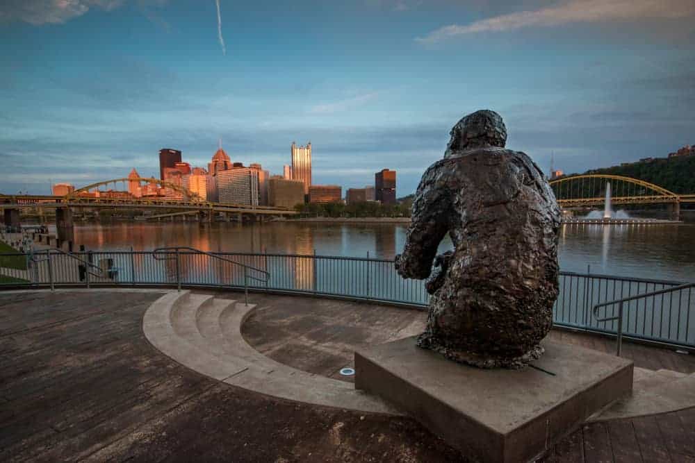
Officially known as “Tribute to Children,” the statue of Fred Rogers has one of the best views of Pittsburgh’s skyline. Located on the North Shore near Heinz Field, visitors come both for the view and to pay their respects to this famous children’s television host.
The statue sits above the North Shore Trail, offering fantastic views of people along the trail, the city’s skyline, and the Ohio River.
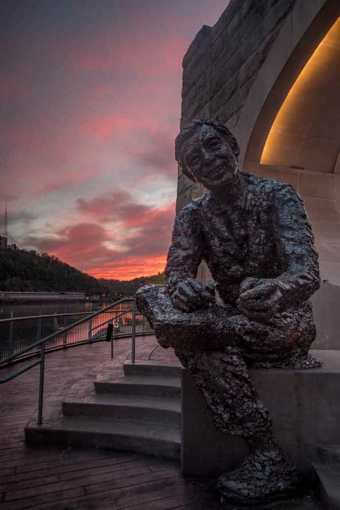
In addition to the great view of the city, photographs of the statue are also popular. Installed in 2009, this 11-foot tall statue is a bit controversial in its look, but still offers a great opportunity for photographs.
The Mr. Roger’s Statue can be found along North Shore Drive near the intersection with Art Rooney Avenue.
Swindell Bridge
The Swindell Bridge connects the Northview Heights and the Perry South neighborhoods of the city. This bridge is located very high above I-279 below and is definitely not one for those with a fear of heights.
City views can be had from the walkway on the southern side of the bridge near the fire station. Since this bridge has only a low railing, a tall chainlink fence has been installed along the walkway. While this makes walking across such a high bridge feel more secure, it does make taking photos much more difficult as you have to do so through the small holes in the fence.
Nevertheless, this is a fantastic spot to get a unique view of the city’s skyline.
The best views of the Pittsburgh skyline from the Swindell Bridge can be found at these coordinates: 40.472600, -80.004185.
Forrester Street in Greenfield
Forrester Street is located along a bluff over the Monongahela River in Greenfield. This dead-end road is the type of street that you’d never discover unless you searching deep for a great view of Pittsburgh.
From the end of the road, you can get a fantastic view of the river, the Hotel Metal Bridge, and the skyline of Pittsburgh. This is an especially great view at sunset.
If you opt to shoot from here, be careful as you will be standing on a public roadway, albeit at the end of a dead-end road, so you shouldn’t encounter too much traffic.
This view can be found at the following coordinates: 40.423923, -79.949831
Herr’s Island
Herr’s Island, also known as Washington’s Landing, is a large island in the middle of the Allegheny River. This island was once a major industrial site, but now has been reclaimed and features homes, an athletic club, a marina, and a lot of green space.
The island is located between the Troy Hill and Strip District neighborhoods and is bisected by the 31st Street Bridge.
The island’s western edge features a fantastic view of the city’s skyline in the distance in a nice green space along the Three Rivers Heritage Trail.
The western end of Herr’s Island can be found at the following coordinates: 40.460232, -79.981057.
Gerst Way Pedestrian Bridge
The Gerst Way Pedestrian Bridge is a walkway over I-279 that connects the neighborhoods of Fineview and Spring Hill-City View. While this bridge is completely enclosed in chainlink, someone was kind enough to cut a small hole in the fence in the center of the bridge.
From here, there’s a fantastic view of the city, and this is definitely one of my favorite places to photograph Pittsburgh’s skyline from.
If you visit here at dusk or dawn, you can get light trails from cars passing along the highway in both directions, as well as great light on the city.
The entrance to the Gerst Way Pedestrian Bridge can be found here: 40.462281, -80.000019.
16th Street Bridge
The 16th Street Bridge, also known as the David McCullough Bridge, crosses the Allegheny River between the Strip District and the North Shore neighborhood. The bridge itself is one of the most impressive bridges in the city and offers dramatic views in both directions.
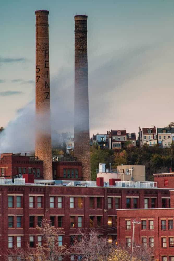
Looking downriver to the west offers fantastic views of the city. Upriver there are great views of both the Strip District as well as the former Heinz Factory.
Access to the 16th Street Bridge is from either bank but is easiest from the Strip District at the intersection of Penn Avenue and 16th Street. Walkways are available for either side of the bridge.
Learn more about one of these great photo spots through UncoveringPA’s article about Mount Washington. Or check out the most epic photos location in Harrisburg and the best photo locations in Philly.
[Click here for information on how to use coordinates to find your destination.]
 "
"

I went to Pennsylvania this summer (Philadelphia), and I actually considered going to Pittsburgh. I’m pretty sure there was a cheap Megabus that could take me there. But for some reason I never did it and after seeing these pictures I really regret it, because it looks AWESOME!
Pittsburgh really is an amazing city. Definitely worth checking out sometime as it’s one of the most underrated cities in the world.
Thanks for the info on Frank Curto Park and Fineview… those are definitely places that I’ll have to check out.
Yes, Pittsburgh is quite a city. We lived there for eleven years (78-89). Sports, entertainment, education…lots of stuff for a growing family. I must admit the winters were not so nice, but the other three seasons were quite nice.
Pittsburgh is so beautiful! Loved seeing these views!
Coming out of the “tubes” at night when everything is lit up is my favorite view of the city. Even after over 40 yrs it never gets old.?
The best is coming out of either tunnel on a motorcycle. Such an incredible view and a great way to fully immerse yourself in the experience. I personally actually prefer riding out of the Liberty tubes at night on the bike, given the choice between the two – I love riding across the bridge and immediately being surrounded by the towering buildings downtown!
These are really great! I’ve been to a lot of them, and there are a couple I’m going to add for you to check out – but you definitely also have a few I’ve never been to before! This is a great reference for me. Thanks!
Emerald View Park – https://goo.gl/maps/TwWDxWJJ43s
The other one I’ll share with you privately! 🙂
I remeber coming home on the bus while attending Ohio University. The sun was in the west, light reflecting off all the buildings, and I remember thinking, “Most of these people have no idea what they’re about to see”, when we burst out of the Fort Pitt Tunnel. There were more than a few gasps and “wows” as passengers took in the sight of our beautiful city. I still love driving in from the South Hills and seeing that unforgettable site again.
Was born and lived my the first 42 years in the Burgh. Since then have lived in
Sharon, West Palm Beach, Middletown, Campbelltowm, Palmyra, Elizabethtown but Pittsburgh will always be my hometown. You can take the girl out of Pittsburgh but you can’t take Pittsburgh out of the girll. After an additional 47 years, I’m still a Pittsburgher.