
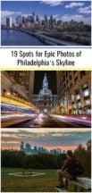
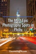
I’ve decided to share some of my favorite places to take photos in Philadelphia so that you can also get your postcard perfect images of this amazing city’s skyline. I’ve already shared the best places to take pictures in Pittsburgh and in Harrisburg, but now I thought I’d share some of the best places for skyline photos in Philadelphia.
Whether you’re visiting Philly for the first time or have lived in the city your whole life, you’re sure to find somewhere great to shoot in this guide. Here are some of my favorite places to take photos of Philly’s skyline.
[Click here for information on how to use the coordinates in this article to find your destination.]
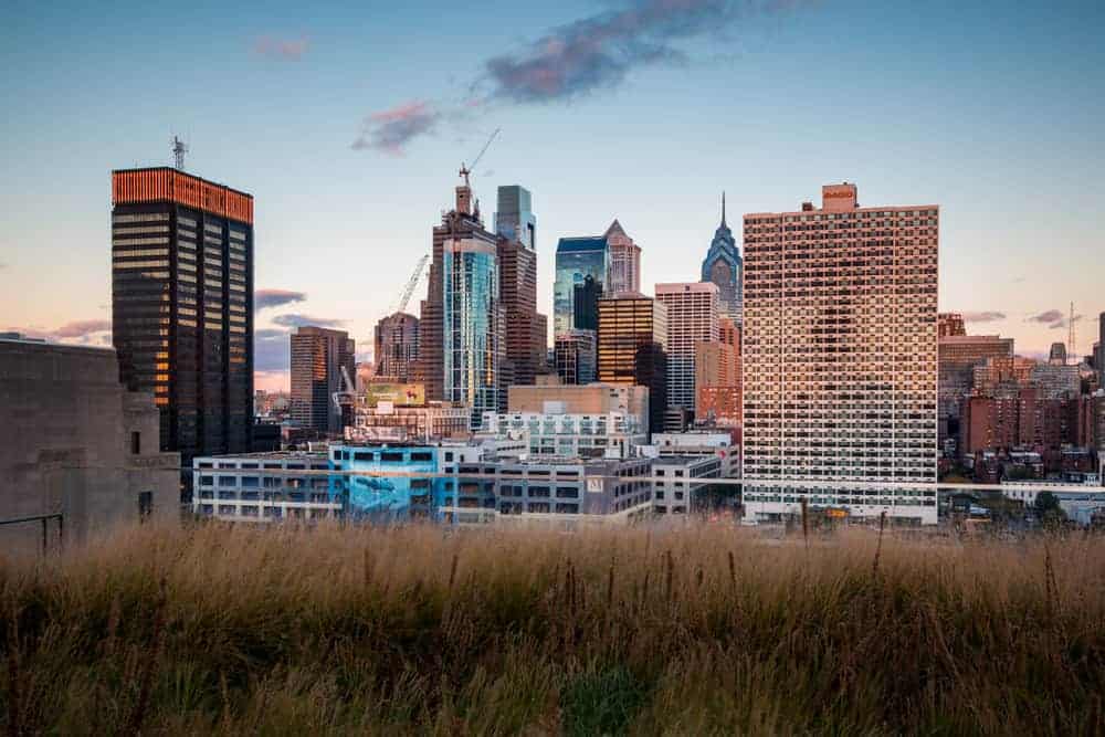
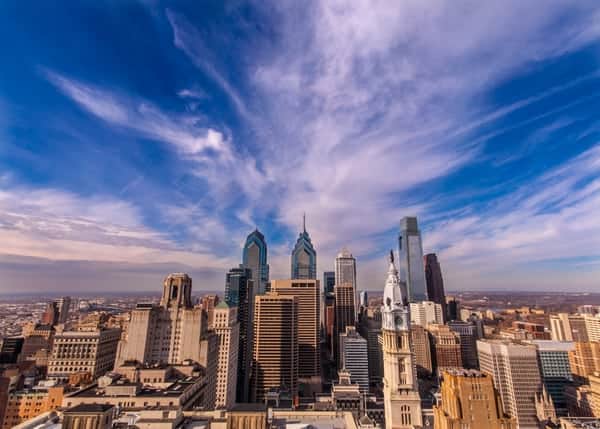
Rocky Steps
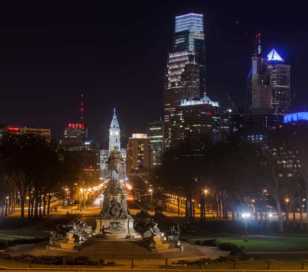
The steps to the Philadelphia Museum of Art, better known as the Rocky Steps, are one of the most popular destinations for visitors to Philadelphia. However, they are not just a famous filming location and the gateway to an amazing art museum, but they also provide fantastic views of Philadelphia’s skyline.
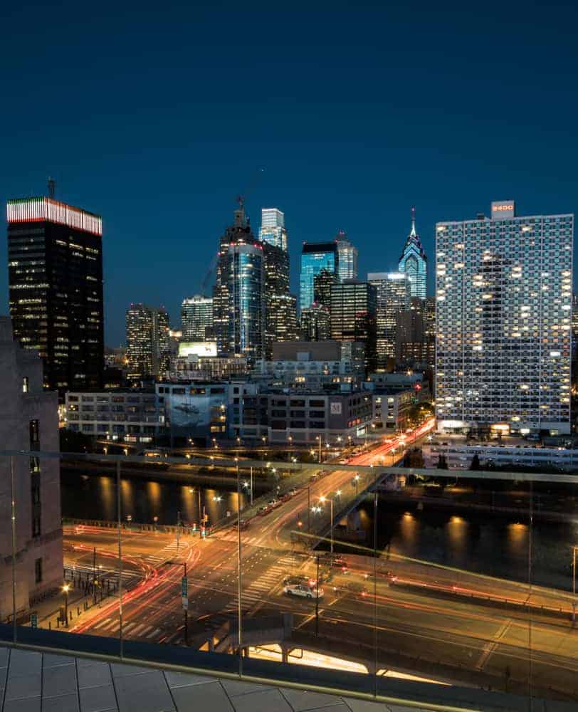
While this is a great view during the day, it’s also one of my favorite places to photograph Philly after dark.
From the top of the steps, it’s possible to see the entire skyline at the end of the Benjamin Franklin Parkway. Just at the bottom of the steps, a statue of George Washington sits in front of a grassy area known as the oval, adding a nice element to many photos.
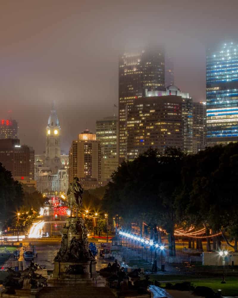
The Rocky Steps can be found at the end of the Benjamin Franklin Parkway at the following coordinates: 39.964685, -75.179732.
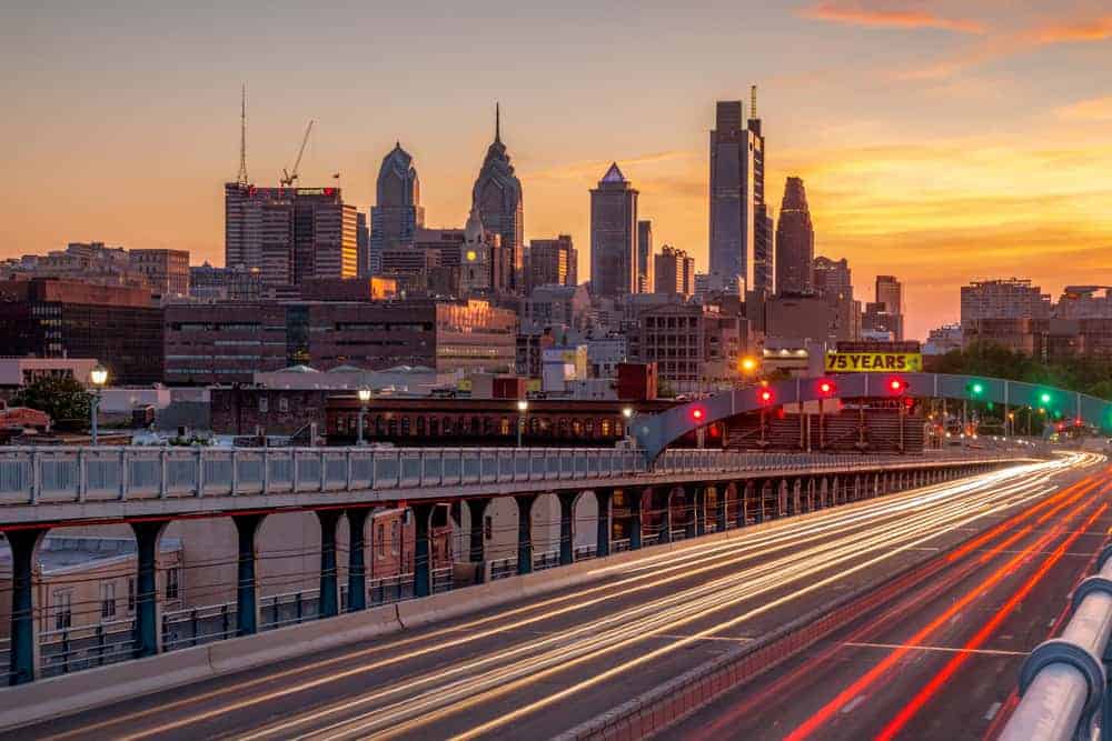
South Street Bridge
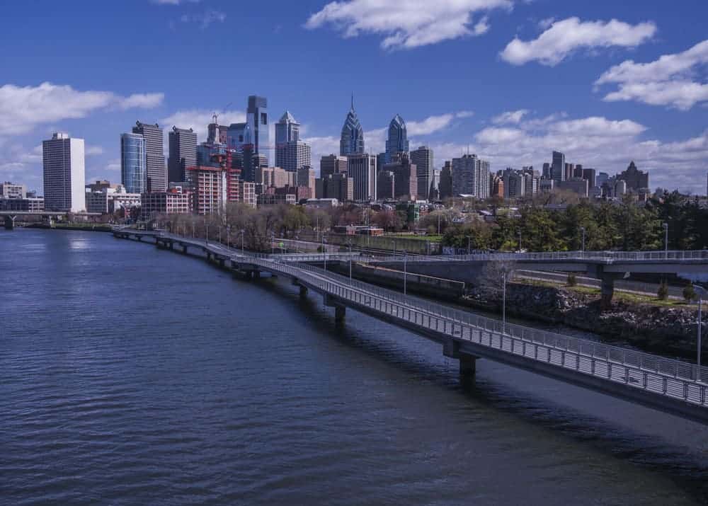
Spanning the Schuylkill River west of downtown Philadelphia, the South Street Bridge features some of the most amazing views of Philly’s skyline that you’ll find anywhere. In fact, this is probably the most commonly seen angle of the skyline in articles and marketing materials about the city.
The best place to shoot photos is from the wide sidewalk on the northern side of the bridge. From here, you can capture the city, the river below, and the Schuylkill River Trail’s boardwalk as it snakes its way towards the city. There are also two cutouts in the bridge that offer places to stand without being in the way of the flow of pedestrians on the bridge.
Given where the bridge is situated, this is an especially fantastic place to photograph sunrise in Philadelphia.
The South Street Bridge can be found at the following coordinates: 39.946916, -75.186704.
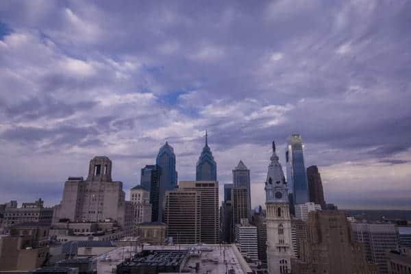
Broad Street

One of my absolute favorite places to photograph the city from is the median of Broad Street on the southern side of Philadelphia’s City Hall. From here, you can capture absolutely amazing views of City Hall, which was once the tallest building in the world.
I especially love getting fantastic light trails from the cars that pass by this point.
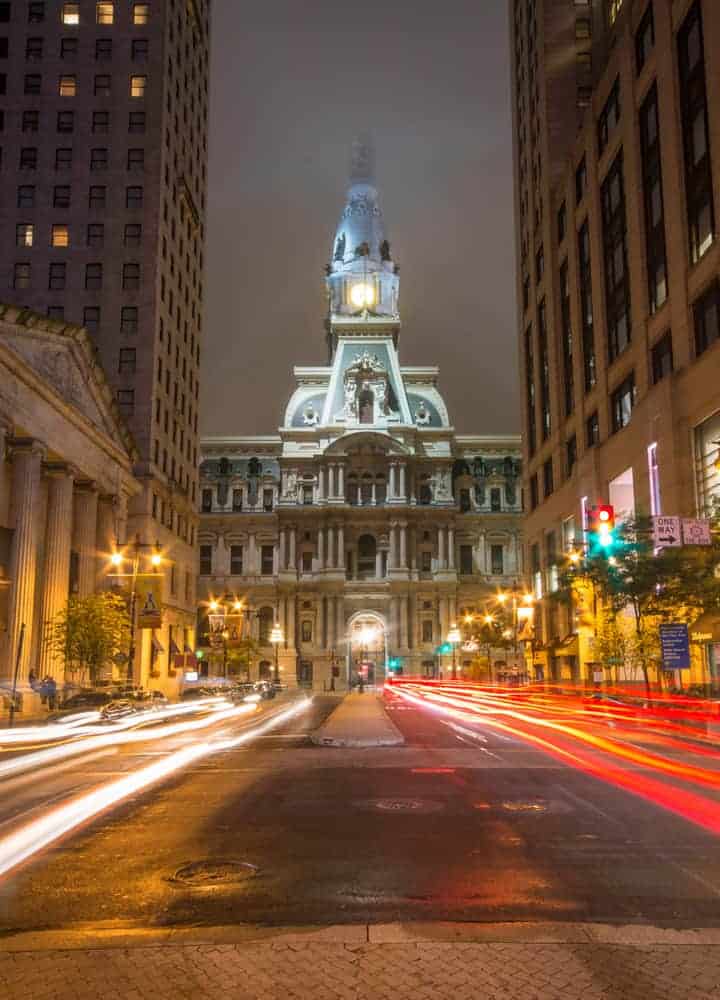
Just keep in mind that this median is located in the middle of two lanes of traffic. If you opt to shoot from here, use extreme caution and always know where you are in relation to the traffic lanes.
The best photo spot can be found on South Broad Street between Sansom Street and Walnut Street.
Belmont Plateau
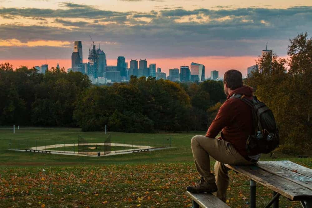
If you’re trying to figure out where to photograph Philadelphia at sunrise, you can’t go wrong with Belmont Plateau. Located a short drive outside of the downtown area in Fairmount Park, this plateau offers amazing views of the skyline in the distance.
Even better, there’s a beautiful tree which is perfect for framing the city’s skyline.
While this is a neat spot to see the city at any time of the day, haze can make photos from this spot a bit challenging at times. That’s why I definitely recommend it for sunrise if possible.
Belmont Plateau can be found at the following coordinates: 39.989784, -75.212473.
Spring Garden Street Bridge
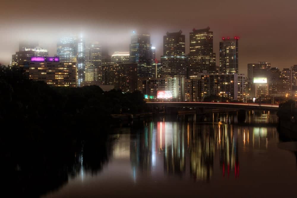
The Spring Garden Street Bridge crosses the Schuylkill River near the Philadelphia Museum of Art. While it does provide a somewhat similar skyline view to the Rocky Steps, the foreground of the shot here is completely different.
Reflections off of the Schuylkill River provide a great contrast to the hardscape of the city’s buildings. A little further along the bridge, you can also capture the traffic traveling along I-76 with the city in the background.

This can be a great spot to capture the skyline after dark, though bright lights from the rail yard below make it challenging to get highway traffic after dark.
If you stand on the sidewalk on the side away from the city, this bridge can also be a great spot to capture Boathouse Row which is just upriver.
The Spring Garden Street Bridge can be found at the following coordinates: 39.964289, -75.183452.
Cira Green
While parking garages can provide fantastic views of a city, they are often off limits to those that don’t park there. However, the rooftop of a parking garage near 30th Street Station is home to a park known as Cira Green.
Cira Green is located on the parking garage’s 12th floor, 95 feet above the street below. From here, visitors get an expansive view of the city which includes not only the city’s skyline, but also several of the sports stadiums in the distance.
In addition to great views, there are grassy areas to relax on and even a hill you can walk to the top of. During the summer months, there is occasionally live music or other events here.
Cira Green can be accessed from a marked door into the parking garage along South 30th Street at approximately the following coordinates: 39.952984, -75.183723.
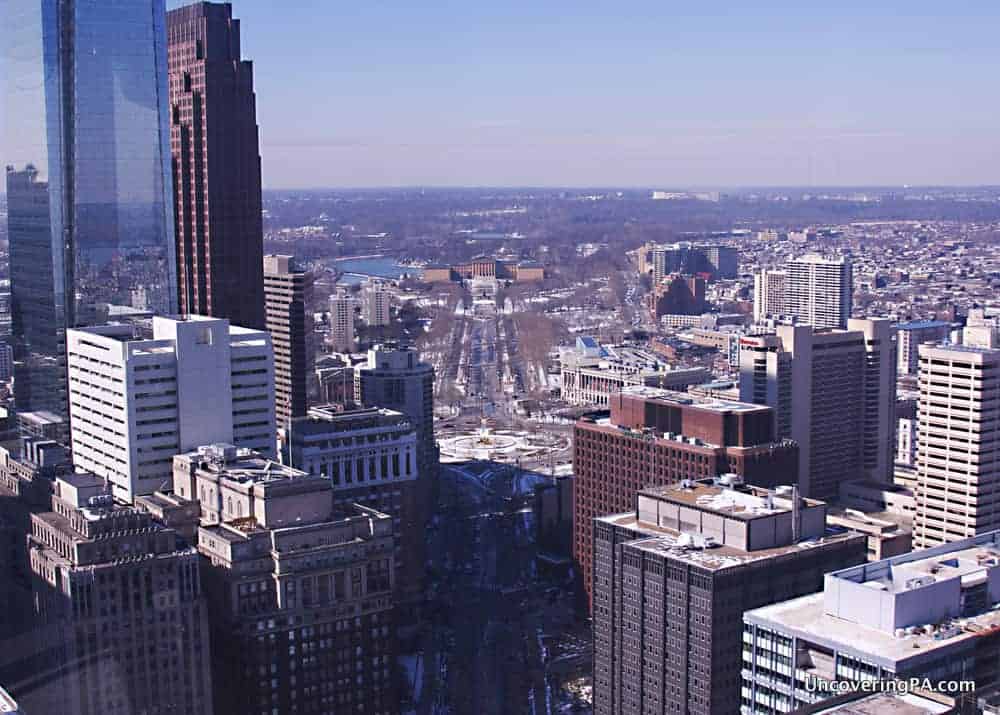
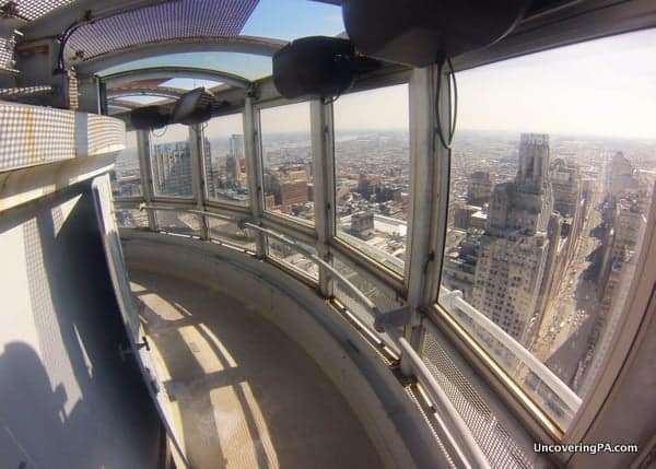
One Liberty Observation Deck
One Liberty Observation Deck is the tallest official observation area in the city. Located on the 57th floor of the One Liberty Building, nearly 900 feet above the city streets below, this observation deck has the most commanding view in the city. The entire observation area is surrounded by windows meaning you have a 360-degree view of the city.
Without a doubt, this is one of the best views of the city, and the signage around the observation area also gives you a chance to learn a bit about what you are looking at.
*Please note as of September 2020 One Liberty Observation Deck has “suspended operations indefinitely.” It has remained on this list in hopes that it will reopen in the future.
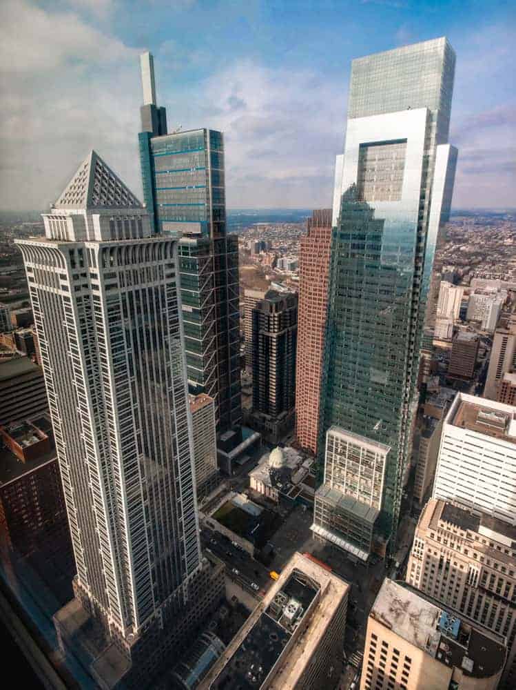
If you are looking for the best photo spots in Philly, however, this might not be it. Lights reflecting off of the windows make photos here a challenge, and that’s not helped after dark without the ability to use a tripod.
Still, you won’t find a better 360-degree view of the city anywhere.
One Liberty Observation Deck can be found at the following address: 1650 Market Street in Center City.
Benjamin Franklin Bridge

The Benjamin Franklin Bridge spans the Delaware River between Philadelphia and Camden, New Jersey. In addition to lanes for both regular traffic and trains, there is also a walkway that takes pedestrians and bicyclists over the river.
The bridge, which is quite a beautiful subject as well, offers amazing views of the city’s skyline to the west and the Philadelphia skyline’s silhouette, particularly the Philadelphia skyline at night.
Because of the direction, the Benjamin Franklin Bridge is among one of the best spots in Philadelphia to photography sunset. However, the bridge does close in the evenings, sometimes just after or even before sunset, so make sure to check the hours of the walkway before you make plans.
The entrance to the Benjamin Franklin Bridge walkway is located at the intersection of 5th Street and Race Street at the following coordinates: 39.955086, -75.147671. From here, it’s about a 10-minute walk to the first cut out, which offers the best views of the city.
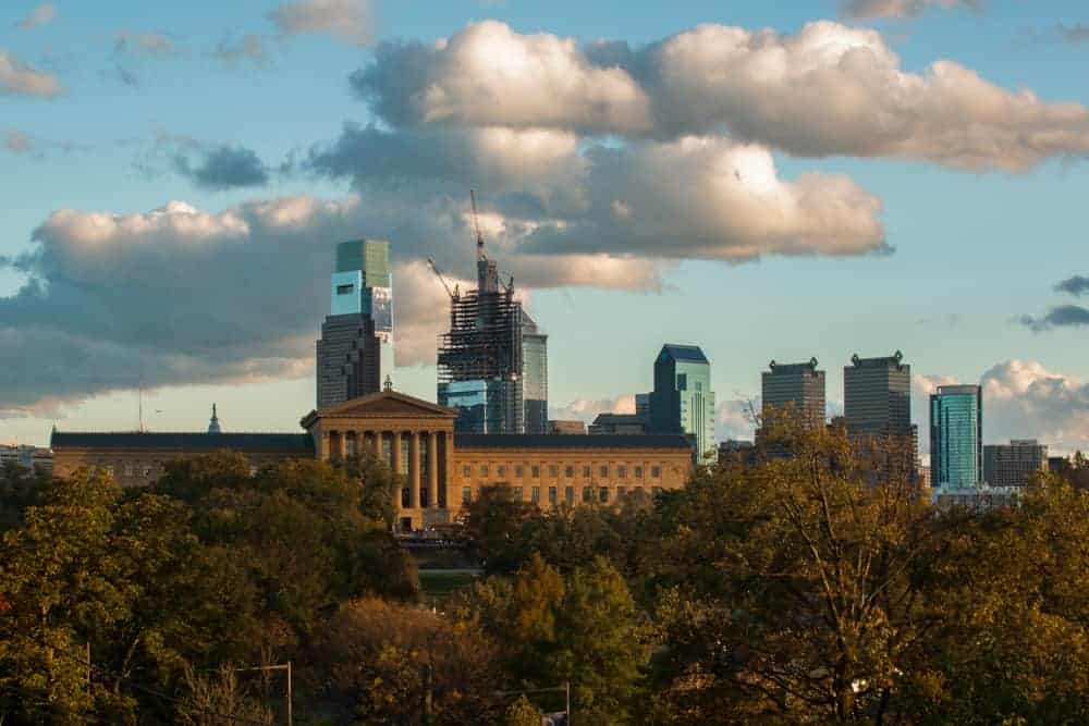
Fairmount Water Works
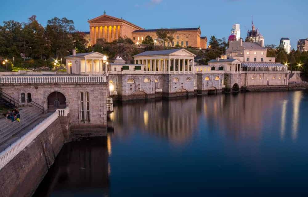
Located behind the Philadelphia Museum of Art, Fairmount Water Works offers a unique view of the city, dominated by the museum. Built in the early 1800s to provide safe drinking water for the city, this site is not only historic, but also features amazingly beautiful architecture.
This is a great place to watch the sun set over Philadelphia, as there are fantastic views both upstream and downstream along the Schuylkill River.
While it is near both the Rocky Steps and the Spring Garden Street Bridge, the wonderful architecture of the waterworks and the Philadelphia Museum of Art offer a unique view that you can’t get elsewhere.
My favorite spot to shoot here is from a pavilion next to the Fairmount Dam on the river. This spot can be found at the following coordinates: 39.966882, -75.184589.
LOVE Park
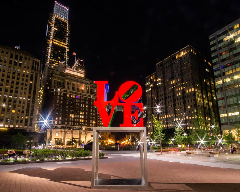
LOVE Park, officially known as John F. Kennedy Plaza, is best known for its famous LOVE statue by artist Robert Indiana. However, it’s also a fantastic place to skyline shots of Philly.
The park actually offers three different shots that are worth taking while in the park. The first is looking towards City Hall, and the second is of the skyscrapers in Center City Philly.
My favorite, however, is to shoot toward the statue and get some of the buildings in the background. This shot looks especially great after dark and has the added benefit of not having a crowd of selfie takers to deal with.
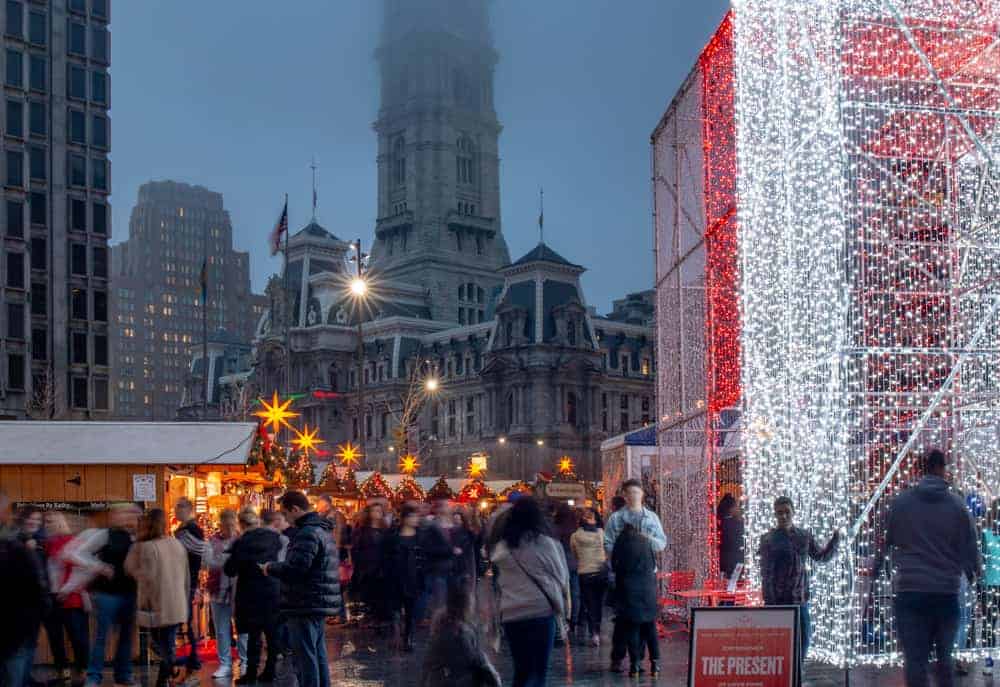
LOVE Park is also a great photo spot during the holiday season when it’s home the best Christmas Markets in Philadelphia.
Bartram’s Garden

Bartram’s Garden is the oldest, still existent botanical garden in North America and is located along the banks of the Schuylkill River southwest of downtown Philadelphia.
In addition to being a beautiful and historic garden, Bartram’s Garden also has amazing views of Philly’s skyline. While some industrial buildings mar the view a bit, this is a unique angle of the city that isn’t often seen.
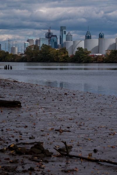
Views can be had from both the banks of the Schuylkill River as well as from the meadow next to the parking area.
Bartram’s Garden can be found at 5400 Lindbergh Boulevard. The grounds are open from dawn to dusk.
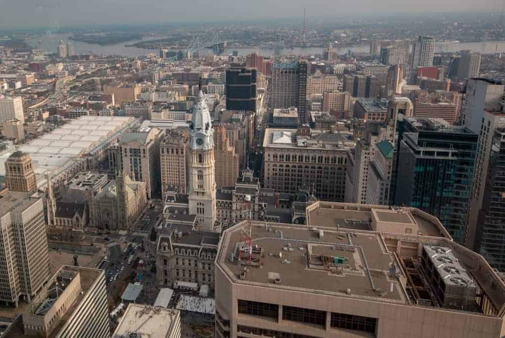
City Hall Observation Deck
Until 2016, the City Hall Observation Deck was the highest, publicly-accessible point in the city. And while it has been surpassed by both the One Liberty Observation Deck and Sky Garten, this spot is definitely worth checking out if you want to find unique views of Philadelphia.
This small observation deck, which can only accommodate four visitors at a time, sits just below the feet of the William Penn Statue at the top of the building. This 360-degree viewing platform offers amazing views of the city, especially when looking up the Benjamin Franklin Parkway towards the Philadelphia Museum of Art.
Unfortunately, operating hours, a time limit of 15 minutes, and windows make it a bit difficult to get great photos from here, but it still offers amazing views from one of the most iconic points in Philadelphia.
Tickets for the City Hall Observation Deck can be purchased at the small gift shop located on the eastern side of City Hall.
Lemon Hill
Located north of the Philadelphia Museum of Art, Lemon Hill is a little-known vantage point for skyline photos of Philly. This park area features a historic mansion, but also offers nice views of the city from the hillside’s southern slopes.
Views of the city feature trees, the museum of art, and the tops of the city’s tallest buildings. While this isn’t a view you’ll see often, it’s a nice spot to get some unique photos of Philly’s skyline or just to enjoy the beauty of this city.
Photo spots from Lemon Hill can be found along Lemon Hill Drive at approximately these coordinates: 39.970243, -75.186392.
Loews Hotel
The Loews Hotel is not only one of the best hotels in Philly, but it also offers some of the most amazing views of Philadelphia’s skyline.
To get the best views, ask for a room facing west. These rooms offer an absolutely stunning view of Center City Philadelphia, city hall, and many of the city’s other skyscrapers.
For even better views, though, head to the hotel’s top floor, where a small lounge is located. While this area is closed from time to time for events, the lounge’s windows offer a very impressive view of the city from the 33rd floor.
Note that the views from the Lowes Hotel are only accessible to guests (Affiliate link). The hotel can be found at 1200 Market Street.
Bok Bar
Bok Bar is located in South Philly on the rooftop of the former Edward W. Bok Technical High School. Today, this building has a variety of uses, but the highlight for photographers (or lovers of Philly’s great beer gardens) is Bok Bar.
Bok Bar is a seasonal bar offering drinks, food, and amazing views of the Philadelphia skyline. This is a great spot to visit any time of the day, but I definitely recommend this for sunset if you can manage to visit during those hours.
It’s worth noting that Bok Bar does not allow anyone under 21 years of age except on Sundays.
Camden Waterfront
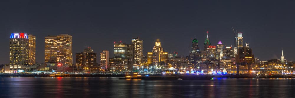
Located across the Delaware River from Philly, the Camden waterfront offers amazing views of Philly’s skyline. While not in Philly (or even Pennsylvania), the short trip here is worth it if you want to check out one of the best places to see the Philly skyline.
To get there from Philly, you can drive over the Benjamin Franklin Bridge, walk the bridge’s pedestrian pathway (watch the operating hours if you are planning to walk back), or take the subway to Camden.
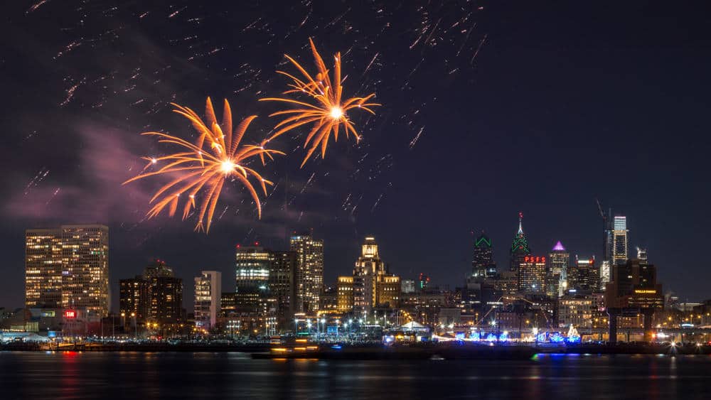
This area is especially great on New Year’s Eve and the Fourth of July when Philly has great fireworks shows that are shot from the middle of the Delaware River.
Logan Square

Logan Square is located along the Benjamin Franklin Parkway between City Hall and the Philadelphia Museum of Art. The square is surrounded by some of Philly’s best sites and a fountain is located in the heart of the square.
From the square, there are great views to be had of the skyscrapers in Center City Philly, as well as City Hall.
One of my favorite shots is to get the traffic moving through Logan Square with the tall city buildings in the background.
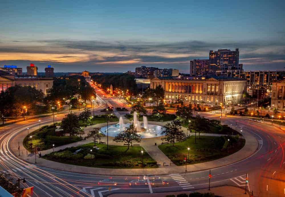
Another great spot at Logan Square is Assembly Lounge, a bar located on the rooftop of The Logan Hotel. Located adjacent to the square, this bar offers phenomenal views of the Benjamin Franklin Parkway, especially at sunset.
Neshaminy State Park
Neshaminy State Park is located just outside of the Philadelphia city limits in Bucks County, Pennsylvania. While it’s a bit of a drive from downtown, it has one of the best views of Philadelphia’s skyline, especially on clear days.
The park is positioned about 15 miles north of Philly’s downtown core along the banks of the Delaware River. Despite the distance, the Philadelphia skyline’s outline is still quite impressive from the park.
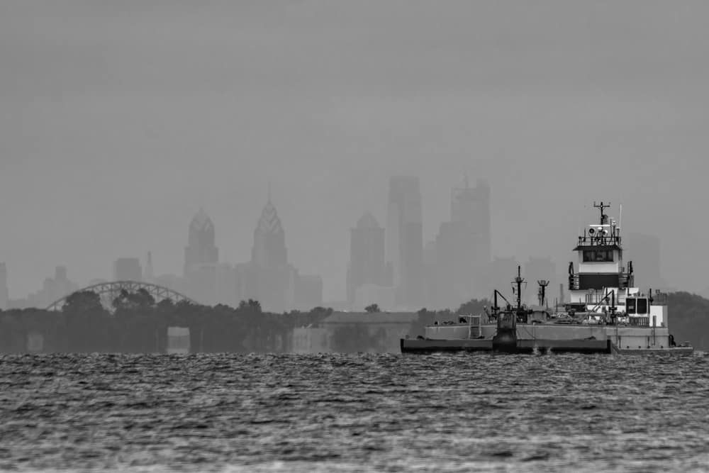
To see the skyline, head to the southeastern corner of the park where Delaware Drive meets the River Walk. From here, look downstream along the river for this great view. If you are lucky, you might even get a few barges or tugboats in your view, which adds an interesting dynamic to the view.
The view at Neshaminy State Park can be found at the following coordinates: 40.074285, -74.919163.
Do you have any other favorite spots to photograph the Philly skyline? Let me know in the comments section below.
[Click here for information on how to use the coordinates in this article to find your destination.]
 "
"

Thanks for these tips! I got some cool shots of the City Hall building tonight using your suggestions! Much appreciated since we are only here for a short time.
That’s great! Glad it was helpful.
Thanks for a great article and places to take photographs. Just wondering why Boathouse Row was not mentioned.
That’s a great spot, but I was focusing on places to take photos of the city’s skyline, not just great photo spots in the city.
You left out the view from the Mann Center, especially at the highest point, up on the viewing grounds near the theatre. It’s incredible!
I’ve been to the entrance to the Mann Center and wasn’t overly impressed with the view, but maybe I was standing in the wrong spot. Since there was an event going on that I wasn’t attending, my ability to explore the area was somewhat limited.
Awesome article. You are the go to person for any Pennsylvania photography ideas. I regularly look at your waterfall destinations. Very informative and valuable sharing of your experiences
Thanks so much! Hope you get some great photos of the Philly skyline.