Just half a mile from the Ohio border, Quaker Falls near New Castle, PA might be the westernmost waterfall in Pennsylvania.
Located along Falling Spring Creek, a tributary of the Mahoning River, this area used to be known for a small community called Quakertown, since several of the first residents were Quakers. I’ve heard that there are a few ruins and gravestones in the surrounding woods but didn’t come across anything myself other than the ruins of a gunpowder factory that sits just off of the parking lot.
While Quaker Falls, which is also known as Quakertown Falls, is located less than 100 yards from the road, its location in a deep, forested gorge makes it impossible to see from your car. In fact, until a park was recently created here, I’m sure most drivers went right by without any knowledge of the beauty that sat just feet from the road.
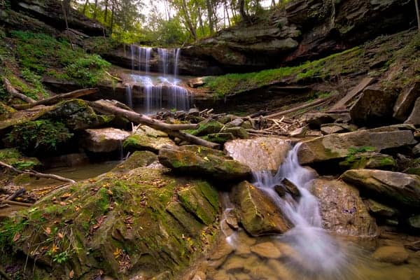
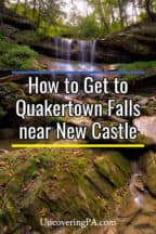
The waterfall itself is approximately 50 feet tall and falls in two drops, with a large shelf in the middle of the drop. This shelf gives it a look that reminds me of Buttermilk Falls in Indiana County and Round Island Run Falls in Clinton County but is otherwise a relatively unique look for the waterfalls in Pennsylvania.
The waterfall also has a beautiful plunge pool beneath it that is often a very interesting shade of green. I have no idea if this is a natural coloration to the water from plants or the result of industrial runoff, but it definitely adds another unique and beautiful touch to the falls.
When I first visited Quaker Falls in 2015, the land was owned by a local utility company, though visiting was unofficially allowed. However, shortly after my visit, the waterfall and the land surrounding it were closed to the public.
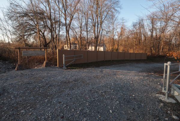
Fortunately, after several years of planning and construction, Lawrence County opened the Quaker Falls Recreation Area in October 2021, ensuring that the public would be able to visit this beautiful waterfall any time they wanted. I was hoping that this waterfall would open sooner so that I could have included it in my book, “Waterfalls of Pennsylvania”, but I’ll just have to save it for a future edition.
I finally had a chance to revisit this beautiful spot in late 2022, seven years after my first visit, and was incredibly impressed by the work done here.
While you previously had to park along the road to see this spot, there is now a parking lot with room for about 10 cars. If this is full, there does appear to still be room for a few cars along the road. Just note that both parking areas are gravel, so they are unlikely to be maintained in the winter.
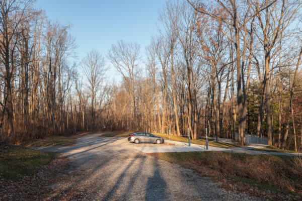
The turn-off into this parking area is a bit easy to miss while driving down Route 224 (West State Street), so make sure you are paying attention as you get close.

"Waterfalls of Pennsylvania" by Jim Cheney
If you love PA waterfalls, you won't want to miss this waterfall book from Jim Cheney, author of Uncovering PA, featuring more than 180 great waterfalls. Order it now on Bookshop.org or Amazon.
The turn-off for the parking area can be found at the following coordinates: 41.021615, -80.511235. If you prefer an address, you can use the one for the tavern near the entrance on the opposite side of the road: 5095 W State St, Edinburg, PA 16116. (But note that this address isn’t exact.)
Directly next to the parking area is a gravel path that leads to both sides of the rim above the waterfall, as well as a bridge across Falling Spring Creek.
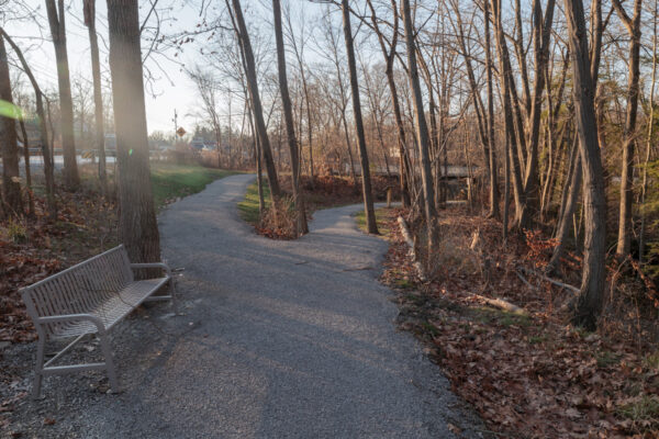
Along this path, there are signs that offer a bit of information related to the history and ecology of the site, which are very well done and worth taking a few minutes to read.
From the path, there are nice views of Quaker Falls, especially from the parking lot side of the creek, though they are definitely better in the winter when there are no leaves on the trees.
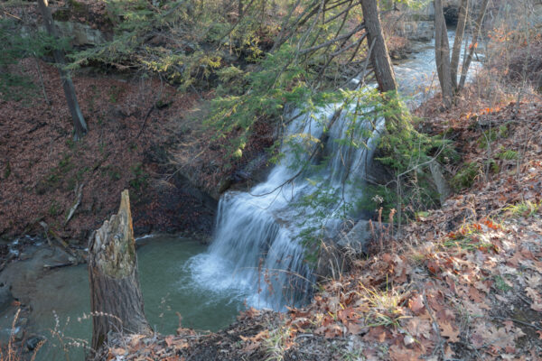
Since this site first opened, several new viewing platforms have opened, both at the rim of the waterfall and near its base. These provide excellent views.
The one near the base is especially great because getting to the bottom used to be quite sketchy, and now it’s very easy for anyone that can handle a few dozen stairs.
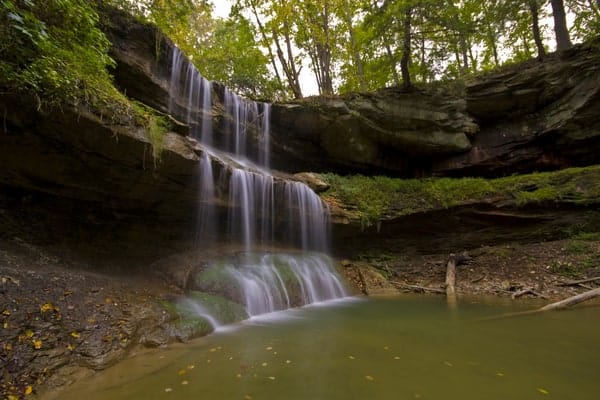
During my first visit, after checking out the waterfall from the base, I decided to venture downstream to see if there was anything else worth seeing.
There is no map of the park, but from looking at property records for the county, I believe that the land below the waterfall is public land. That being said, if you do head downstream from the main waterfall please respect any private property signs that you might see.
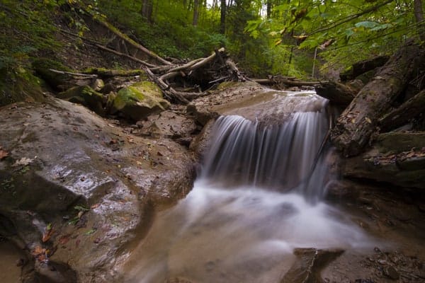
Working my way downstream was challenging at times, thanks to debris along the creek, but I followed the creek for several hundred yards. In the end, I didn’t see anything of note, though it was a very beautiful hike and well worth the effort simply to see the beauty of the area.
Overall, Quaker Falls is one of my favorite waterfalls to visit in the Pittsburgh area, and I’m so happy that it’s reopened to the public after being closed for several years. If you love PA waterfalls, definitely add this spot to your list of places to visit.
[Click here for information on how to use the coordinates in this article to find your destination.]
If you’re looking for other nearby waterfalls, consider Big Run Falls, Hells Hollow Falls, Springfield Falls, and Buttermilk Falls, which are all just a short drive away.


 "
"

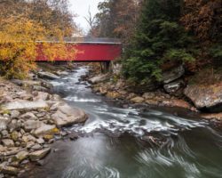
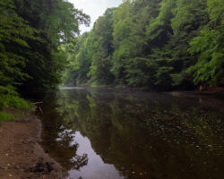

If you go down further theres another water fall. It takes about five minutes of walking down stream to get to it but is so worth it!
I visited this site this past weekend, and there are many “No Trespassing – Private Property” signs now posted all across the gravel parking area. They have been several accidents associated with the falls in the past few weeks. So Penn Power (the owner of the property) is stepping up its vigilance with many signs and police patrols. So it is now posted as Private Property, so enter at you own risk, good chance the police will find you. 8/20/2016
That’s a shame to hear. When I visited, there were some kids standing very close to the upper rim, so it’s not surprising to hear that people have had accidents there.
Can anyone else confirm this for me? Unless I hear directly from the property owner, I like to get a second source before updating an article.
I can confirm. The property is now heavily posted. The whole way around the falls and property. Lots of signs and plainly visible. A young man fell and suffered serious injuries this summer. The signs went up not long after.
There is one easier wider trail that leads to the old graveyard; it is a bit east of the parking lot on 224. And it can be found behind a giant sign that says, “Carbon Limestone Landfill”. Take the trail to the right behind the sign and follow it through a field to and old cobblestone road (which is a bit hard to identify as most of it is buried). It leads to and past the old graveyard. If you pay attention on the trail you will see an old brick building which is hard to see because of the overgrowth, but it’s there. Also.. the trail leads past the graveyard to the bottom where the creek passes under a railroad bridge. If you wish to continue on the trail, it will lead you back up to the parking lot but you will need boots to cross the creek. There is a more narrow steep trail you can take back to the Carbon Limestone sign without crossing the creek but it’s hard to follow if you don’t know where to go. It leads back up and you will pass a really neat area that is canyon like.
So sad:-( We drove 100 miles to see this waterfall. About a mile to the east on 224, we spotted the first no trespassing sign on the north shoulder. Every 100 feet or so, another one. When we got to the GPS coordinates, there was nowhere to park on the right. We pulled over to the left, deciding that we would at least try to get a glimpse of the falls. We could hear the falls, and soon saw why the signs are up. Thanks to the disgusting, littering pigs who left behind not just beer cans, pop cans, condoms, shirts, underwear, and towels, but even whole bags of garbage! Who does such a thing??? Because of a few slobs, the rest of us are denied this view.
People don’t respect things any more. Tge place was trashed when I filmed my youtube video this summer. It was closed off due to injury.
I feel off the trail as a child, but luckily was not hurt. The cemetery at that time (in late 1960’s early 1970) was in bad shape. I do not understand why it has not been named as a historical landmark or some other designation to have it preserved. I do remember from reading the worn headstones that many had died around the same time.
Visiting the Quakertown Falls in October 2024, from the parking area, there are now wooden steps descending down to a fenced, wood viewing platform near the base of the waterfall. In the parking lot, walk down to the pavilion at the far end, and continue walking to look for the top of the wooden steps. It is now safe for anyone to walk down the steps to enjoy the waterfall, instead of descending the former trail on the same side, or the difficult trail on the opposite side.
I went today. I found no parking area. I rode up and down, back and forth. There was a Quaker Heights Drive, nothing else. I saw vinyl fencing that blocked off an area. Possibly the former entrance. I found nothing after diligently searching.
There is a large parking area that’s located exactly at the coordinates listed in this article. Definitely there. I’ve been several times both before and after it was opened as a county park.