Pennsylvania features many amazing sites, but few are as geologically significant as the Triple Continental Divide in Potter County.
Located near Gold, PA, north of Route 6, this area is the start of three major waterways: the Allegheny River, the Genesee River, and Pine Creek. According to signage that appears near the divide, this is the only Triple Continental Divide in the country east of the Mississippi River.
I recently took the time to track down each waterway to its uppermost publicly-accessible spot. These were all road crossings, and while it would be great to go even further upstream, doing so would require crossing private land.
Triple Continental Divide Sign
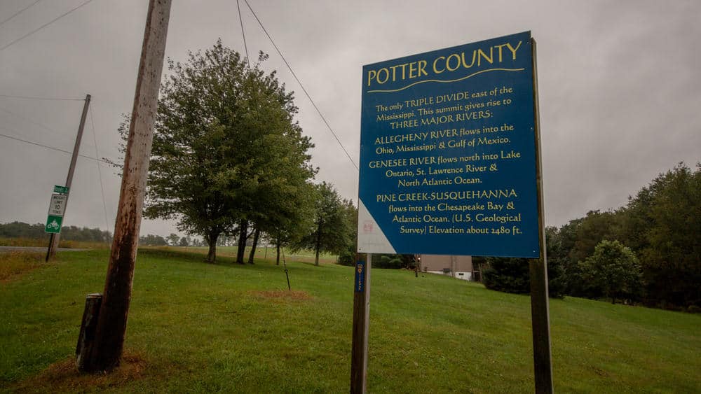
The sign denoting the Triple Continental Divide is located at the intersection of Route 449 and Rooks Road. This sign offers a bit of information on why this area is special and about the three major waterways that start near here.
While not located directly on the continental divide, it’s in close proximity to it. When rain falls in this area, as it was when I visited, the water will flow from this spot into the Gulf of Mexico, the Chesapeake Bay, and the Great Lakes.
The Triple Continental Divide sign can be found at the following coordinates: 41.858988, -77.825243. There is a bit of space to pull off on the southbound side of the road.
The Source of the Allegheny River
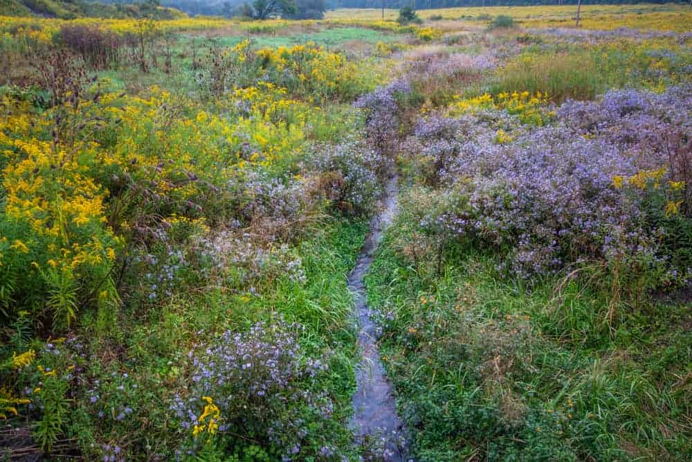
The Allegheny River is one of the most well-known waterways in Pennsylvania and flows from this spot in Potter County to Pittsburgh before joining the Ohio River. In fact, the Allegheny River is the largest source of the Ohio River, which is, in turn, the largest source of the Mississippi.
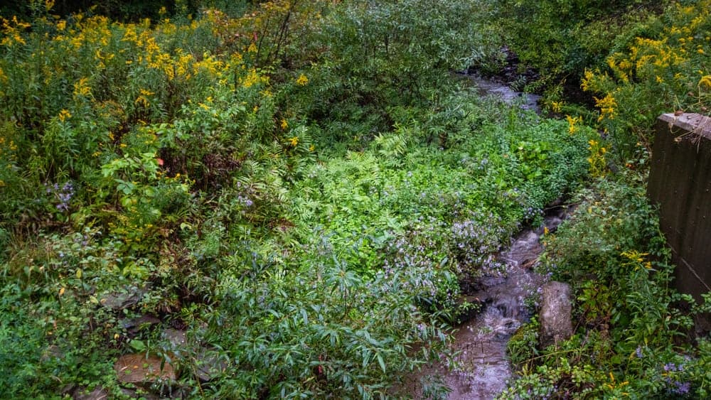
The source of the Allegheny River is located 3.5 miles from the triple divide sign along Route 49. The river is so small here that I was able to easily step across it, so, don’t be expecting a major river crossing. However, there is both a historical marker and a river marker denoting the spot.
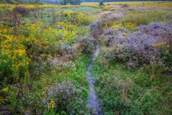
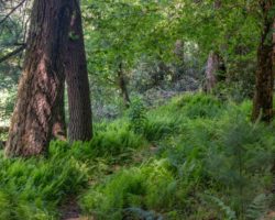
During my visit in early September, the field through which the Allegheny River was flowing was filled with fantastic wild flowers and was one of the most beautiful fields I have ever seen.
The source of the Allegheny River can be found at the following coordinates: 41.854648, -77.876235.
If you opt to pull over here for a closer look, use extreme caution as it is along a busy road and the shoulder is not very wide.
The Source of the Genesee River
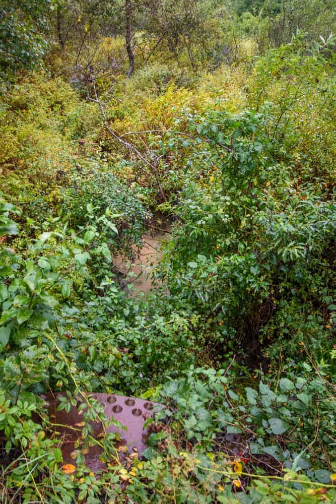
The Genesee River is the second waterway with its source at the Triple Continental Divide in Potter County. This river is only in Pennsylvania for a short distance before crossing the border into New York.
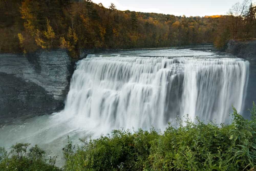
However, in New York, it’s a river of incredible beauty and importance. It is the Genesee River that flows through the majestic Letchworth State Park creating a massive canyon and featuring three major waterfalls.
The river then continues to downtown Rochester where it travels through the city with two more major waterfalls and past the oldest brewery in New York. In fact, the city of Rochester was built up thanks to the mills along the banks of this river.
Finally, the Genesee River empties into Lake Ontario and eventually to the Saint Lawrence River.
The closest-accessible site to the source of the Genesee River is located just off of Route 49 to the east of the Allegheny River.
The river flows under Kidney Road and is merely a trickle at this point. This spot can be found at the following coordinates: 41.859140, -77.861574.
There is no sign at this point marking the river, but there is an informational sign along Route 449 that tells about the river, though the river can’t be seen at this spot.
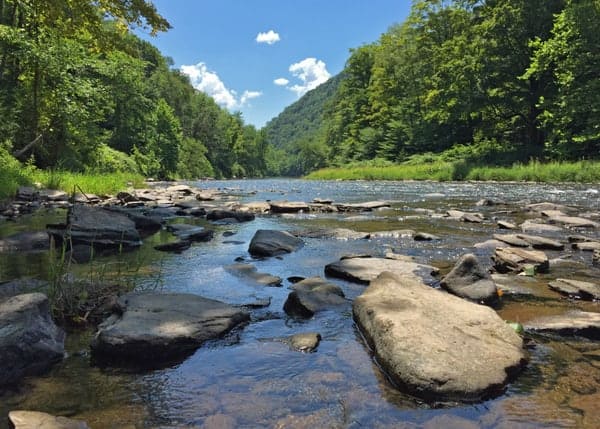
The Source of Pine Creek
While Pine Creek might not be a river, it’s actually considered the largest creek in the United States.
From this spot in Potter County, Pine Creek empties into the Susquehanna River, and eventually the Chesapeake Bay, but not before flowing through the incredibly scenic Pennsylvania Grand Canyon.
Pine Creek was important to the development of the region, being first used to transport logs to market along the waterway before train tracks would come to its shores.
The source of Pine Creek is located along Route 449 south of the Triple Continental Divide marker. Sadly, there is no marker denoting the waterway at this spot.
The furthest upstream you can get to the source of Pine Creek can be found at the following coordinates: 41.855915, -77.814198. There is a small amount of room to pull over a car on the southbound side of the road.
If you opt to stop here, use extreme caution as there is little room to pull over, the shoulder is quite narrow, and it is along a busy road.
[Click here for information on how to use the coordinates in this article to find your destination.]
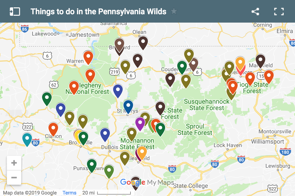
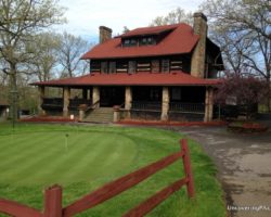
Want to see more of the region? Check out the Coudersport Ice Mine, visit the Pennsylvania Lumber Museum, see the ruins of Austin Dam, or take a drive into downtown Wellsboro.
 "
"


I always heard it as the JEN-es-see River. But that aside, I always wanted to see the triple divide, but it is so far out of the way. Thanks for taking the time to track it down and shoot this footage. Very cool.
Yeah, I pronounced it wrong in the video. Couldn’t go back and shoot by the time I realized it.
I’m so glad you acknowledged it! I couldn’t understand what you were saying at first! Yes GEN*es*see. That was a great video!! Very informative!! I was just there! Great job!
I often think of this location . In Bradford , Tioga , and lycoming there are headwaters for lycoming creek and Towanda creek . Both flowing to the Susquehanna. One the west branch the latter the north branch .
I thought the Monangehela was they only river that flowed upwards !
That is a common myth. Even the neighboring Youghiogheny flows north.
This is a really incredible post about a rather unique place I’d never heard of before! The pictures are excellent, and I loved that you included shots both at the source, and as the rivers grow massive along the way. Very cool post.
I grew up not far from this area. Wanted to let you know the pronouncement of Genesee was incorrect according to us locals. Gen-e-see. There is a town called Genesee about 4-5 miles north of Gold
Yes, I posted a correction twice within the video. I realized my mistake while editing, but couldn’t go back and reshoot.
We had the farm that is on RT 49 where the headwaters of the Alleghany is, we pastured those Fields, someone had to walk them everyday to bring the cows to the barn.
Thanks for such a well-done video that so crisply draws attention to a site of such symbolic value for illustrating the need to protect our rich national resources at their very starting point in the headwaters. The hill of the triple continental divide provides the planning document catchphrase (Triple Divide Trail System) for a two-state greenway (rail trails, nature parks, forested riparian buffers, protected green spaces) that will connect the breathtaking Pine Creek Trail (rail-trail) in PA\’s Pine Creek Gorge to the complementary canyon in NY\’s Letchworth State Park via trails along the Genesee River in NY (WAG Trail, Genesee Valley Greenway), PA state parks near the triple divide (Denton Hill SP, Lyman Run SP, et al.), and Pine Creek. Eventually this will provide a spectacular bicycling and hiking mega-trail connecting Lake Ontario in Rochester, NY, to the Susquehanna River in Williamsport, PA. A long slow process that has been proceeding incrementally over the last few years, but perhaps will be completed in our lifetimes.
I have always known of where the beginning of the Allegheny river was located. My Uncle lived in Coudersport/Roulette Area’s, I grew up North of Pittsburgh & my grandparents had a cottage in Emlenton in the Allegheny. At 6 years old it was amazing to be able to see the growth of the river
I’ve stood on the US continental divide at the (very small!) pond near Yellowstone National Park. Also, in our own county here in NW Atlanta, our street divides the water flowing down to the Gulf of Mexico via the Chattahoochee River (going south) and the Allatoona River (going west, then south). Not as “mountainous” a divide though!
We used to live right there where you are talking about. I believe now The triple Continental Divide Sign has been taken down to be refurbished and may be at the Potter County Historical Society awaiting an artist to volunteer to repainted it. I do know the private property owner that owns the property now.
The one in the article was photographed in the early fall 2018 and looked like it was in great shape. I doubt that it’s been removed for repainting, but may have been put back up shortly before I visited.
where did you get your info on water flow into the Mississippi? does that mean the headwaters of the MS are in PA!
No, the headwaters of the Mississippi are in Minnesota. The water from the Allegheny River flows into the Ohio River, which flows into the Mississippi River and then into the Gulf of Mexico.
The headwaters of the Mississippi by volume is the Allegheny River. The headwaters of the Mississippi River by length is the Missouri River. In terms of history, during the late 1700s, the western boundary of the United States was declared to be a single river, the Mississippi.
Mentioned along the river up in New York, the natives called the river Ohi-yo, and considered the Allegheny and the Ohio rivers to be one and the same. On a map, you can see that the Ohio is much larger than the Mississippi when they merge together. So there’s much debate over which river is the true headwaters. If one were to enter the mouth of the river down at New Orleans and progressively follow the bigger branch, they wouldn’t end up in Minnesota.
Just some input from a resident along the river (where it isn’t as impressive but still floods over the road periodically).
Jim,
I am very interested in seeing the headwaters of the Genesse river. As a resident of Rochester there is some local interest in it. Is it located on private land? I do not want to trespass while in the area.
Thanks!
The spot where I shot the video and took the photos is on a public road. The stream obviously continues further up for a short distance, and that would require permission to see, though I don’t know from whom. So, it depends on how close you wanted to get to the actual source.
As a resident of Rochester, NY is that how you also pronounce the name of the Beer? I noticed you only give the coordinates of places of interest. Someone who does not have a GPS will find it difficult to locate these sites.
If you have a smart phone, you can copy/paste the coordinates directly into your favorite mapping app and it’ll take you right to the spot. Much better than an address, which are sometimes off. Also, spots like these don’t have addresses to give. Coordinates are by far the most helpful option.
Nice work. Very interesting.
I was born, in a manner of saying, on the north bank of the Allegheny in Olean, NY.
I am not Native American, but the Native view of natural things has always intrigued me. I have always felt some personal, somewhat reverent, attachment to the Allegheny River whenever near it.
It was interesting to learn a few years ago while visiting the Iroquois/Seneca Nation Museum in Salamanca, NY that the original name for the Allegheny River is Alligewi Sipo. The whites made Alleghene out of this, while the Six Nations called the river the Ohio. In other words, Natives, including the Lenni Lenape and Iroquois, considered the Allegheny and Ohio rivers as the same.
There is something uniquely gratifying about finding the head waters or the natural divides of significant things of nature .. of life; a glimpse of something profound that logically seems incidental. You captured the place of 6 such places.
I will likely never be able to visit the place you featured here, so I am grateful for the experience via your clip. Thank you.
Hi Jim — Very nice work here. I am looking forward to visiting these places — As someone born in Rochester, I am especially interested in the Genesee — and have been for some time! You’ve pinpointed precisely where I need to go, so thank you. There is a very interesting book that discusses the headwaters: The Genesee by Henry Clune (1963). He interviewed some Gold residents, including the farmer on whose land the divide is located. Of course, this was back in the mid-20th century. But the farmer — a Merle Hosley — had created a small reservoir from the spring that is the source of the Genesee. Obviously things change, but I wonder if the reservoir that is near the sign you mention might be that Hosley reservoir?
“Upon further review” as they say in football games… The place where you claim to step across the Genesee River may not be that river. I have been looking at maps and where you’re standing at Kidney Rd appears to be on the Allegheny River (west) side of the divide. From what I can tell, the Genesee flows east along Route 49, starting near that small reservoir I mentioned in my previous message. Where you’re standing shows a stream flowing west, making it a tributary of the Allegheny.
That’s not correct. Unless Google Maps is wrong, the Allegheny River never crosses Kidney Road. The Genesee River flows east under the road where I’m standing before turning north.
Sure could be. But just to be sure I plan to make a trip there later this summer. I’ll see what the locals have to say and get back to you. I do know that there’s a sign and a little pool of water where the headwaters are supposed to begin.
My Father had been to the farm where all 3 springs are located in the 1950’s or 60’s. He used to tell us a story of Native American origin of 3 sisters who had a spell cast on them that turned them into the 3 rivers. I do not know the source of the story, but my father’s a great collector of local folklore and teller of tales.
The story of the 3 springs arising from 3 Seneca sisters is in Henry Shoemaker, Black Forest Souvenirs, published in 1914 from material collected at the end of the 1800s. The version there is a critique of pollution of the river systems by white settlers. So this particular version cannot be much older than the mid-19th century, whether or not it is based on a much older kernel that genuinely comes from the Senecas. Probably this is just one of many other legends and ritual traditions that arose and disappeared with the changes in individual storytellers and tribal migrations over the millennia. Certainly be interesting to learn more of these older traditions.
Excellent exposition of the triple divide area. Our family has known about this for years and loves N. PA.
SO COOL!