Over the 229 miles that the Appalachian Trail cuts through Pennsylvania, there are many great day hikes along the main path and connecting trails. These short hikes offer visitors a chance to enjoy this amazing trail and the nature surrounding it. One of these hikes is to White Rocks in Boiling Springs, PA.
The White Rocks are a 20-acre site along the White Rocks Ridge in Cumberland County. This section of Antietam quartzite is actually the northernmost reaches of the Blue Ridge of the Appalachian Mountains, which stretches from northern Georgia to southern PA.
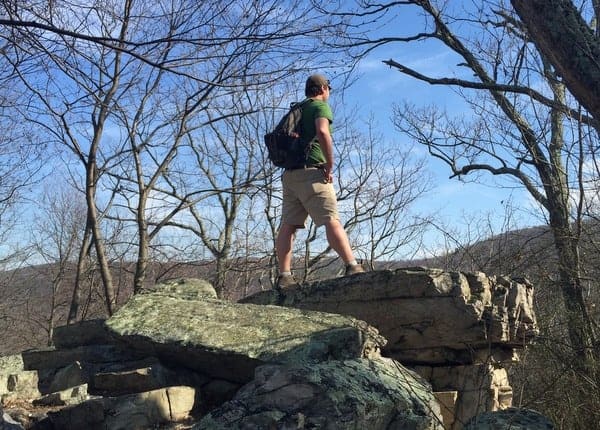
The White Rocks are accessible from the Appalachian Trail, but the easiest and quickest way to reach them is via the White Rocks Trail a few miles outside of Boiling Springs, Pennsylvania. The White Rocks Trail climbs approximately 500 feet up the hillside in the 1.3 mile trek to the Appalachian Trail.
Despite being listed as a 1.3-mile trail, you’ll actually reach the White Rocks sooner than that, with the last 3/10 of a mile or so being along the White Rocks and the ridgeline.
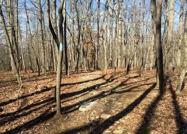
The hike up the White Rocks is marked with blue blazes and is easy to follow. There are several steep sections, but as long as you are wearing proper footwear, the trail shouldn’t pose a significant challenge.
Once at the White Rocks, the trail levels out, but undoubtably gets more difficult. That’s because hiking along the ridgeline requires careful stepping along this rocky outcropping. While many of the more difficult sections can be bypassed by trails along their base, other portions of the rocks must be crossed. While not overly challenging, care is certainly recommended.
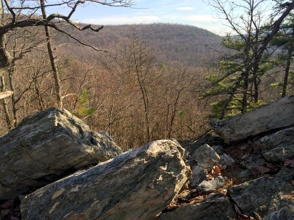
Hiking along the ridgeline is a lot of fun, and offers some spectacular views of the valley below. Fortunately, the land in the valley was purchased by the federal government in 2011 to protect it from developers and ensure a pristine view of the valley for future generations.
After hiking along the White Rocks for a short distance, you’ll come to the point where the trail meets the Appalachian Trail. Before turning around, head up the hill a short distance until you reach Center Point Knob.
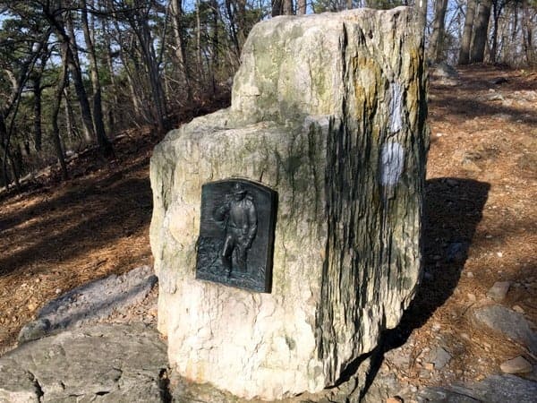
Despite the name, the current center point of the trail lies a few miles south. However, when the trail was originally constructed, this point did mark the center point of the Appalachian Trail. A stone monument still sits at this spot.
While you can continue following the Appalachian Trail for as long as you’d like, this marker makes a nice point to turn around.

"Waterfalls of Pennsylvania" by Jim Cheney
If you love PA waterfalls, you won't want to miss this waterfall book from Jim Cheney, author of Uncovering PA, featuring more than 180 great waterfalls. Order it now on Bookshop.org or Amazon.
If you turn around at Center Point Knob, the entire hike is roughly three miles in length.
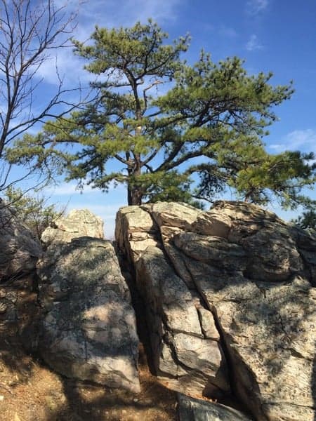
While challenging, the White Rocks Trail near Boiling Springs is far from the hardest trail in the region and offers a great chance to get outdoors and enjoy some of the region’s most beautiful scenery. Along the way, you’ll see some great views, especially when the trees are bare, and one of the best rocky ridges in the south-central PA.
Getting to the White Rocks Trail
The trail to White Rocks is located along Kuhn Road, a little over three miles southeast of Boiling Springs, in Cumberland County, Pennsylvania. There is a large dirt parking area that can be found at the following coordinates: 40.132021, -77.088175.

I’ve seen some places that say that this trail is closed during the winter. I think the reason is that the parking lot isn’t plowed and parking is not allowed along the road. However, make sure to obey any closure signs you might see.
It’s also worth noting that on nice days, this parking lot can fill up early. Getting here early might be a good idea.
The trail to White Rocks leads off from the back of the parking lot. Simply follow the blue blazes as they travel through the forest to the ridge.
Looking for another great hike with a view? Check out Fort Hunter Conservatory, Hammonds Rocks, and Hawk Rock near Harrisburg.
[Click here for information on how to use the coordinates in this article to find your destination.]




 "
"




Nice post. I’m going to share it on the Facebook page of the two clubs that maintain this portion of the A.T., Cumberland Valley A.T. Club and Mountain Club of Maryland. By the way, there’s a fascinating story about the “prodigal” plaque that sits atop Center Point Knob. Follow This link to read the story: https://www.cvatclub.org/lost–found—the-center-point-knob-plaque.html
Sounds great.
I’ve done this hike twice with my kids–once with leaves on trees and once in Winter–much better view after leaves fall–they love climbing along the ridge on those rocks…..even the “I’d rather stay inside with my media teenager” was glad she left the house and came along. The parking lot does fill up quickly on nice days.
Hiked this trail yesterday. A good stop off of the turnpike after being in the car for a long time. It is a fun hike and it was neat to see Center Point Knob. I would recommend hiking boots because of the rocky terrain (your ankles will appreciate the support of good boots). Be sure to climb the rocks as marked to get atop White Rocks Outlook to see the valley.
My brother came across some copperheads here last fall. Keep your eyes open!