

The Appalachian Trail is one of the most famous trails in the world, and 230 of its approximately 2,200 miles run through Pennsylvania. However, did you know that southern PA is where you’ll find the halfway point of the Appalachian Trail?
That’s right, while the exact distance of the trail varies by a few miles from year to year, the halfway point of the Appalachian Trail can be found in Michaux State Forest in Cumberland County, PA.
Ever since I learned this fact, I’ve always thought it would be fun to check out the midway point of the trail. Unfortunately, since the exact length of the trail varies from year to year (It’s going to be 1.2 miles longer in 2022 than it was in 2021, for example), pinning down the exact halfway point can be difficult.
Fortunately, however, in 2011, when the trail was 2,181 miles long, a sign was erected at the then halfway point of the Appalachian Trail in Michaux State Forest. While this puts the sign as many as 6.5 miles away from the current halfway point, this sign is still considered by most hikers to be the official halfway point of their hike.
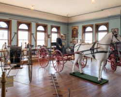
This momentous sign is located a short distance west (South if using trail orientation) of Pine Grove Furnace State Park, home to the Appalachian Trail Museum and the famous half-gallon challenge (where through-hikers attempt to eat a half-gallon of ice cream in one hour).
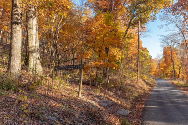
While you could certainly hike to the halfway marker from within the park, I opted to park at the closest trailhead, which you’ll find along Michaux Road. This spot, located just down the road from Camp Michaux, an abandoned World War 2 POW Camp, can be found at the following coordinates: 40.040726, -77.341763.

Here, you’ll find a small parking area big enough for about 3 cars. Should this area be full, you could park about three-tenths of a mile down the road at Camp Michaux (intersection of Michaux Road and Bunkerhill Road) and walk up the road to the trailhead.
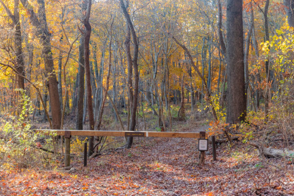
From the main parking area, the Appalachian Trail crosses the road about 100 feet further up the road. Look for a kiosk and a gate that mark the trail. You’ll want to hike past this gate to start your hike (towards Georgia per the sign on the opposite side of the road).
From the trailhead, it’s about nine-tenths of a mile to the halfway marker of the Appalachian Trail. However, for this hike, I recommend continuing another third of a mile to the Tom’s Run Shelter, which is quite a neat spot to see.
If you do this, the total hike is about 2.5 miles in length. If you turn around at the halfway point, the hike will be just under two miles.
This portion of the Appalachian Trail is quite flat and there aren’t really any noticeable hills for the entire hike. Unfortunately, it can be muddy, even when it hasn’t rained in a while. It is also a bit rocky, though nothing compared to further north spots such as Hawk Rock or Bake Oven Knob.

The wetness and rockiness of the trail do make things slower going, but they shouldn’t pose much of an issue for most hikers. However, I definitely recommend shoes with good traction and, if possible, shoes that are waterproof, especially if it’s recently rained.
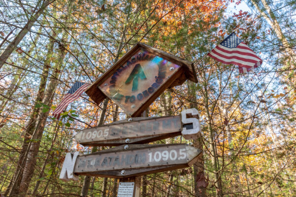
After about a mile of hiking through this beautiful but uneventful woodland, you’ll reach the halfway point of the Appalachian Trail. It can be found at approximately these coordinates: 40.036614, -77.357316.
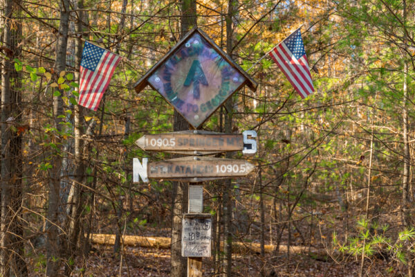
The sign here is about 10 feet in height. It features mileage signs pointing in each direction and is capped with two American flags. A plaque on it indicates that it was built in 2011.
Again, this is no longer the midway point of the trail (I believe it sits a few miles further north now), but this is still considered the official spot by most through-hikers.
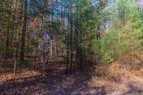
There is also a mailbox adjacent to the marker.
While it was empty when I visited in early November, I’d imagine that it likely has some sort of logbook during the hiking season. Let me know in the comments below if you are aware of what this box normally contains.

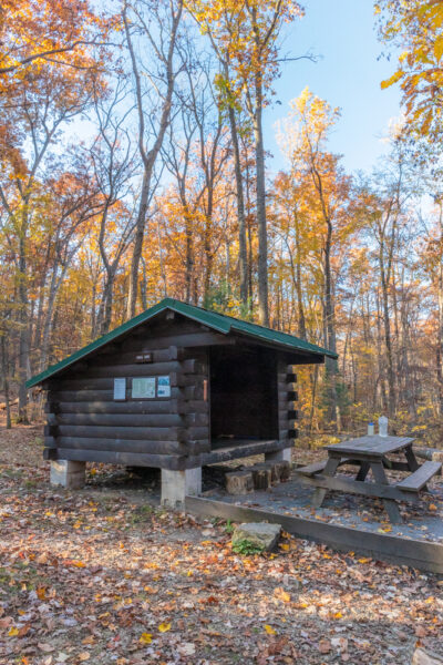
While you could turn around at this point, I definitely recommend continuing the hike for the short distance to Tom’s Run Shelter about a third of a mile further down the trail. The shelter can be found at the following coordinates: 40.033733, -77.356801.
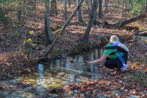
Hiking to the shelter continues to be quite easy, though there is one small spring that must be crossed along the way. My family and I were able to do so without getting our feet wet, but it is probably the most challenging spot to keep your feet dry on this portion of the trail.
Tom’s Run Shelter is one of the hundreds of shelters along the Appalachian Trail that are used by through-hikers of just about any distance. At this spot, you’ll find many spots for setting up tents, a shelter for staying out of the rain, a pavilion, and a nice fire pit with Adirondack chairs.
There’s even a small pit toilet a short distance away that is relatively clean given that it’s a bathroom in the woods.
Even if you are doing a day hike, this is a nice spot to stop for a bit and relax while enjoying part of the Appalachian Trail’s infrastructure. This spot is made even better by the rushing water of Tom’s Run nearby.
Going in for a closer inspection of the stream, I found a neat spring just beyond a brick chimney and several very tiny waterfalls.
While you could continue hiking for as much as 1,090 more miles to the south, Tom’s Run Shelter makes a great spot to turn around and retrace your steps back to your vehicle.
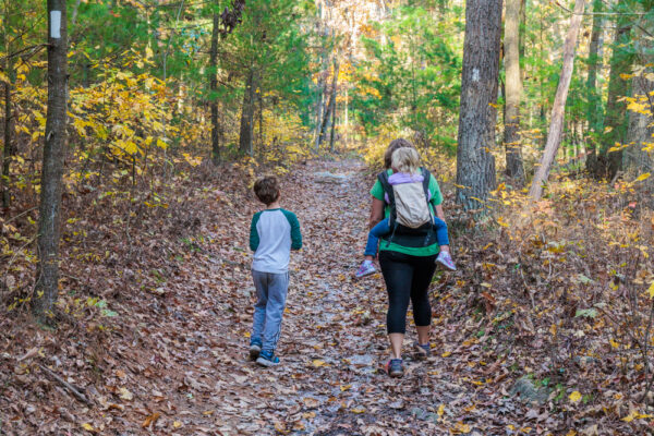
Overall, this is far from the most difficult hike in Michaux State Forest. However, the chance to see the halfway point sign for the Appalachian Trail makes it a neat spot to check out while exploring this portion of Pennsylvania Dutch Country. And, continuing on to Tom’s Run Shelter really gives you a really nice hike that’s perfect for both experienced hikers and younger kids.
Definitely add this trail to your list of great hikes in south-central PA.
Looking for even more spots to visit nearby? Check out Hammonds Rocks, Caledonia Falls, the Cumberland County Historical Society Museum, and Mr. Ed’s Elephant Museum.
[Click here for information on how to use the coordinates in this article to find your destination.]
 "
"


Went to the Appalachian Trail Museum this past Saturday and walked a short distance on the trail. Many people were there on Saturday for the induction of hikers to the Hiker’s Hall of Fame. Very glad I was able to experience a part of Pennsylvania’s trail. We are planning on visiting all 67 counties. We have 37 more counties on the ‘to do’ list. Always enjoy your posts.
Stupid question but why does the distance of the Trail change every year? I have an idea but want to confirm it. Thanks.
Every year there are short trail reroutes, detours, etc. These cause the length of the trail to fluctuate by a few miles each year, which changes the exact mid-point, though it’s always somewhere around Pine Grove Furnace State Park and Michaux State Forest.