There are many incredible outdoor spots to visit in the Poconos. However, few are as much fun to explore as the boulder field in Hickory Run State Park.
This boulder field is hidden deep within the woods of this 16,000-acre state park in Carbon County, PA. In addition to the boulder field, this park features some incredible hiking trails (such as the popular Shades of Death Trail) and the beautiful Hawk Falls.
The Hickory Run State Park boulder field is located in the northeastern corner of the park and can be reached either by car or via a hiking trail (more on those options later in the article). In 1967, the uniqueness of this field led to it being named a National Natural Landmark, one of 27 spots in Pennsylvania with this designation.
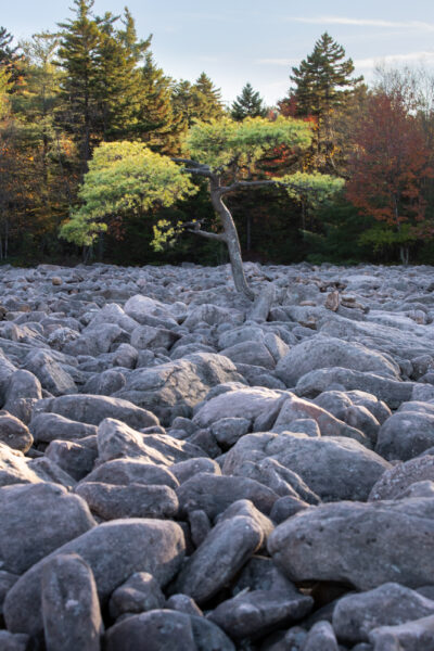
The boulder field is about 16 acres in size and spans nearly 1,800 feet at its widest point. It is said to be the largest boulder field of its kind in all of the Appalachian Mountains. And, while it might not have the interesting ringing quality of the boulder field in Bucks County’s Ringing Rocks County Park, this is an incredible spot and a ton of fun to explore.
This field in the middle of the woods is a very unusual sight, especially because, while most boulder fields in PA are on sloped hillsides, this area is relatively flat.
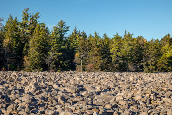
There are several theories on how exactly this boulder field formed. While its origins are up for debate, it likely was created during an ice age as there is evidence of glaciers within about a mile of the field. In fact, the park map even denotes the glacier boundary that runs through the park.
For those that want to learn more about the history and geology of this area, there are signs near the parking area that offer a great overview of the theories about the field’s formation.
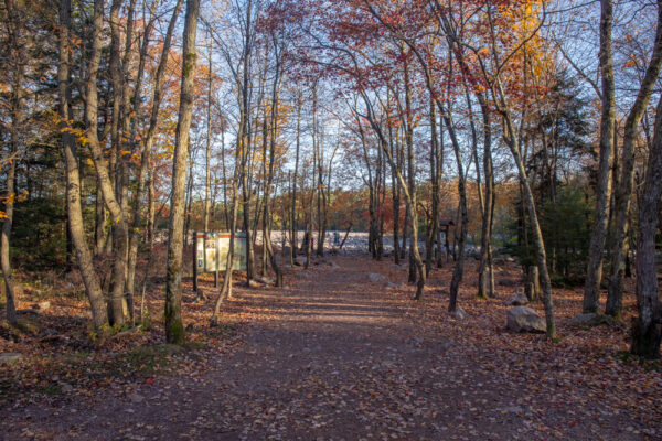
When you get to the boulder field you can certainly just walk to 100 feet to the edge of the field and look out over it. However, if you are able, I’d highly recommend going out on the field and exploring the area.
If you opt to do this, use caution. The rocks here are of varying sizes and shapes, and not all of them are steady. I’d imagine there are a fair number of gashes and sprained ankles that happen here each year.
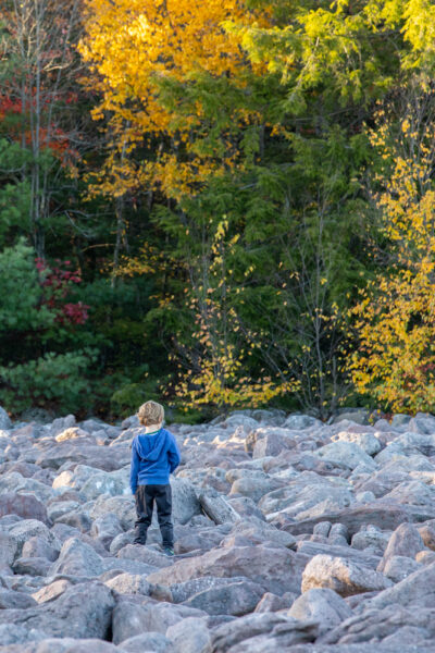
That being said, if you are careful, walking on the rocks isn’t overly difficult. Even my two-year-old and six-year-old children were able to climb around on the rocks without much trouble.

"Waterfalls of Pennsylvania" by Jim Cheney
If you love PA waterfalls, you won't want to miss this waterfall book from Jim Cheney, author of Uncovering PA, featuring more than 180 great waterfalls. Order it now on Bookshop.org or Amazon.
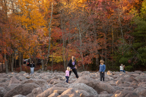
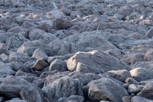
From a distance, the boulder field looks like simply a large pile of humongous rocks. However, once you get out on the field, you can really appreciate the beauty and uniqueness of this spot.
The boulders here range from a foot or so long up to nearly 30 feet in length. There are places where the field is almost all the smaller boulders and spots where it is primarily the larger rocks.
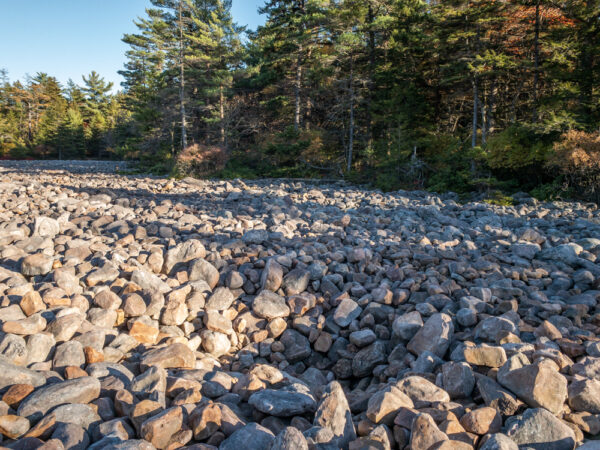
Most of the rocks in the field are sandstone, though there are a few conglomerate rocks scattered throughout the field which are interesting in contrast to the primarily solid gray rocks that dominate the landscape.
Interestingly, there are also spots where the rocks have created circular depressions in the ground, almost as if the pressure of the boulders caved in the ground below. It is estimated that the field of rocks is about 10-12 feet deep, which is a lot of weight for the ground to bear over thousands of years.
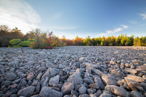
Probably the most interesting area of the boulder field is located on the right side of the boulder field (if facing it from the parking area) about a third of the way into the field.
Here, there are several small areas of trees that have popped up in the middle of the boulder field.
In the middle of this area, there is one single gnarled pine tree that has somehow managed to root its way through the rocks and grow alone in the middle of the boulder field. Without a doubt, this one of my favorite trees in all of Pennsylvania.
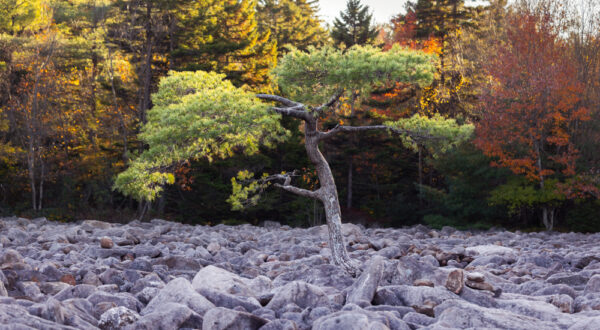
I’d definitely recommend walking out and seeing this tree when exploring the Hickory Run boulder field.
Overall, the boulder field at Hickory Run State Park is not only a must-visit destination when checking out the park, but I’d also venture to say is a spot that is definitely worth taking the time to see if you find yourself exploring the Poconos. Without a doubt, this is one of the most beautiful and unique spots in all of Pennsylvania and is a ton of fun to explore.
How to Get to the Boulder Field in Hickory Run State Park
This boulder field is located within Hickory Run State Park in Carbon County, which is in the western part of the Pocono Mountains region near White Haven and Albrightsville, Pennsylvania.
There are two ways to get to the Hickory Run boulder field: driving and hiking.
The first option, which is one that I recommend it to drive right up to it.

From Route 534, the main road through the park, it’s a four-mile drive to the field. The last three miles of this road are along a well-maintained dirt road that is, primarily, one-way to the field.
This is one of the nicer dirt roads I’ve encountered in PA and is easily drivable in a regular car. It’s also one of the most beautiful spots to see fall colors in the Poconos.
The boulder field is located at the end of this road at the following coordinates: 41.050634, -75.645633.
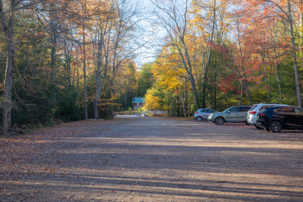
There are actually two parking areas at the end of this road, as well as bathroom facilities. From the closest parking area, you can actually see the boulder field, which sits about 100 feet from the end of the road.
When you are ready to leave, the road out is in a bit worse shape than the road in, but is still very easily doable in a standard car (just keep your eyes out a bit more for potholes in the road).
If you’d rather hike to the boulder field, the aptly named Boulder Field Trail runs 3.5 miles from Route 534 to the edge of the field. The parking area for this trail is located directly across the street from the trailhead for Hawk Falls and can be found at the following coordinates: 41.010736, -75.634551.
To be honest, I’ve never hiked this trail, but, from what I’ve heard, the trail is not anything special enough to warrant the hike, unless it’s just something you really want to do or the road is closed to the boulder field.
Looking for more places to visit nearby? Check out Wild Creek Falls, Jack Frost Ski Resort, Tobyhanna Falls, and the waterfalls of Lehigh Gorge State Park.
[Click here for information on how to use the coordinates in this article to find your destination.]


 "
"


Thanks Jim. Well written. I live in Florida now, but I grew up in Lehigh County. My grandad owned a hunting cabin in Albrightsville. We went camping one time in Hickory Run. I must have been 10 years old. I took my 2 sisters on a hike and out of curiosity we ended up on the Boulder Field. I liked to explore so we crossed the entire field, then it got dark as we were returning to the camp site. We were about a mile away when a ranger who was looking for us, gave us a ride. Of course that memory has been with me for many years. Glad you are encouraging children and adults to explore the field. I was fascinated and it sparked my life lon interest in nature and geology. Thanks for stirring up a memory that I hadn’t thought of in decades. Keep up the good work. Thanks, Mark ( If you ever have a desire to see Florida, be happy to show you and family around.)
Hello, Jim,
Thank you for your excellent website. I was hoping to visit Boulder Field this Wednesday (Oct 6, 2021). However, Apple Maps shows the route to Boulder Field as “Closed” where it passes under the Turnpike. I called Hickory Run State Park and they assured me that the road is NOT closed. However, they also insisted that Boulder Field is “west” of the Turnpike, which I am pretty sure is not true. Can you tell me: Does Boulder Field lie “east” of the Turnpike, and is the road to it open all the way from PA-534?
Thank you, Jacques Kaufman
The Boulder Field is east of the Turnpike, but the road should be open. If the park confirmed that it is, I’m sure that it is, and I wouldn’t think twice about traveling to visit it. Mapping systems like that are often wrong (in both directions) in regards to roads being open/closed.
That being said, the road does close in the winter, so once there is snow/ice on the ground, I wouldn’t plan on driving out there.
the road looks similar to a lot of access roads into/through state park campgrounds – would you say this could be driveable for an RV (sprinter)? or – no way? Thanks! Sherri
The road’s surface itself shouldn’t pose an issue. I can’t speak to width and height, though, so I can’t say for sure.
You should mention that, as you walk out into the field, you can stop and listen to hear water running underneath the boulders.