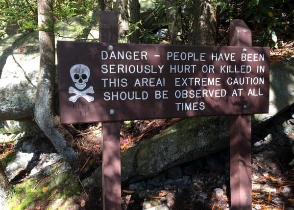
To be honest, the first time I hiked Glen Onoko, I was a bit nervous. I had no idea what to expect from this trail. After all, it’s one of the few trails in Pennsylvania with a sign warning of the trail’s dangers (the trail actually has two signs, along with a third telling you to turn back if you don’t have the proper footwear).
After a few visits to the area, I wanted to tell you both about the amazing beauty of this trail, and to give you a realistic expectation of what the trail is really like. (And check out the video above to see just what the trail is really like)
Note: As of January 2023, Glen Onoko is still closed by the Pennsylvania Game Commission. It is still possible to reach Cave Falls at the top of the glen via alternate trails. I will leave this post up in hopes that this wrong decision is soon changed, but in the meantime, please obey the posted rules and do not visit the lower two falls.
Glen Onoko is located in State Game Lands 141 just outside of Jim Thrope, PA. The parking area for the falls is located along the Lehigh River in Lehigh Gorge State Park. However, all but the first few yards of the trail are outside of the park boundaries.
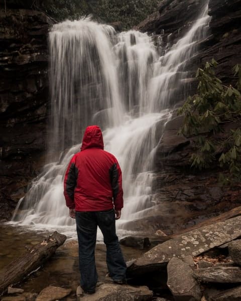
The trail being located on state game lands means that it lacks the blazes and improved trails that you often find in state parks. Since this land abuts the state park, I would love to see the state transfer the land into Lehigh Gorge State Park. This would likely allow for the trail to be improved and for maps to be made of the area. It’s also worth pointing out that since the trail is on state game lands, you should take extra precautions hiking during hunting seasons.
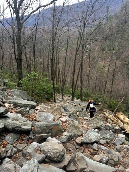
At the beginning of the trail, a large sign welcomes you to the trail, and also notes the dangers present. While the trail starts off easily enough, it is a very challenging trail. Expect slippery, narrow trails, many rocks, and even some places where you will need to use your hands to assist in your climb up the hill towards the falls.
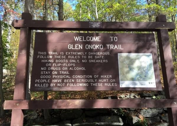
That being said, if you are an experienced hiker, use common sense, and wear proper footwear, the trail shouldn’t pose any significant danger, especially if you stay away from the edges of the waterfalls, which is where most of the serious injuries occur.
The trail up Glen Onoko can be confusing in places because of diverging trails and rogue markings on the trees, but is fairly easy to follow if you know where to go. Start by hiking under the train tracks. Just after the tracks, you’ll head uphill into the woods. If you look through the forest, you should be able to see another large warning sign a bit up the hill.
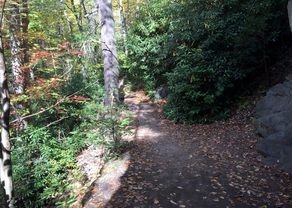
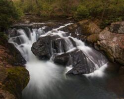
Follow the trail to the left, and you’ll soon come to Glen Onoko Run (if you don’t see the creek within a few minutes of hiking, you’ve gone the wrong way). If water levels are high, this creek falls in an impressive series of drops and cascades down the hillside.

"Waterfalls of Pennsylvania" by Jim Cheney
If you love PA waterfalls, you won't want to miss this waterfall book from Jim Cheney, author of Uncovering PA, featuring more than 180 great waterfalls. Order it now on Bookshop.org or Amazon.
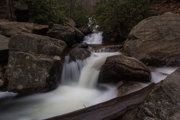
Continue to walk upstream, staying on the right side of the creek. Despite what some of the graffiti may lead you to believe, you do not need to cross the creek for the entire journey to the top.
The trail up Glen Onoko is challenging and steep, but fortunately relatively short. Just as water finds the easiest route down the hillside, so too have people, and you’ll see places where the trail diverges into two or even three different paths. Fortunately, all roads lead to the same place. Stay close to the stream, taking whatever appears to be the easiest path, and you won’t get lost.
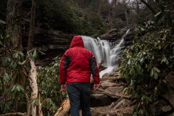
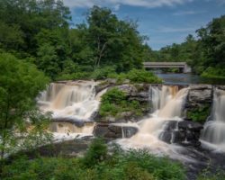
While it seems longer due to the trail’s steepness, you’ll come to the base of Chameleon Falls in about half a mile of hiking. This waterfall consists of two streams that tend to flow into each other, creating one of the more interesting looking waterfalls in Pennsylvania.
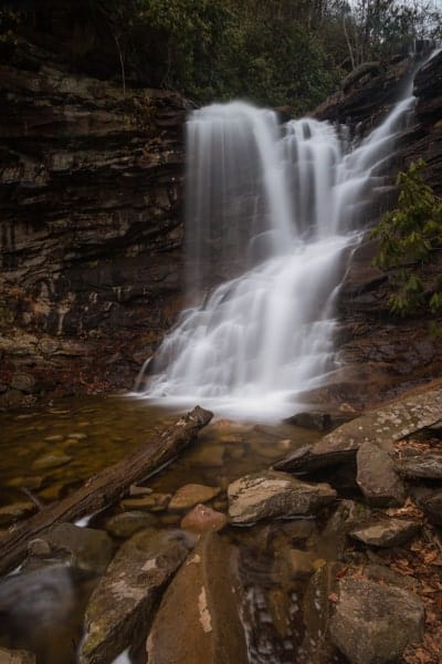
It’s hard to find information on waterfall heights, but I’d guess that Chameleon Falls is somewhere between 30-35 feet in height. To be honest, while it’s not the main attraction of the gorge, it’s my favorite of the three named waterfalls in Glen Onoko.
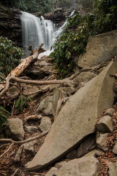
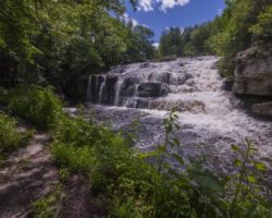
The trail continues up past Chameleon Falls to Glen Onoko Falls, which is just a short distance above the first waterfall. In fact, you may have seen it while hiking up the trail.
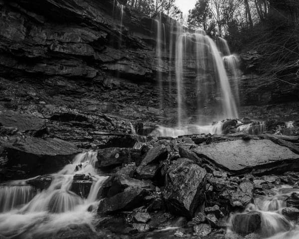
Glen Onoko Falls (some sources simply call it Onoko Falls) is the tallest waterfall in the glen. At 55-60 feet in height, it’s an impressive site. Water falls in a single drop down to the rocks at the bottom before quickly being dropped again over Chameleon Falls.
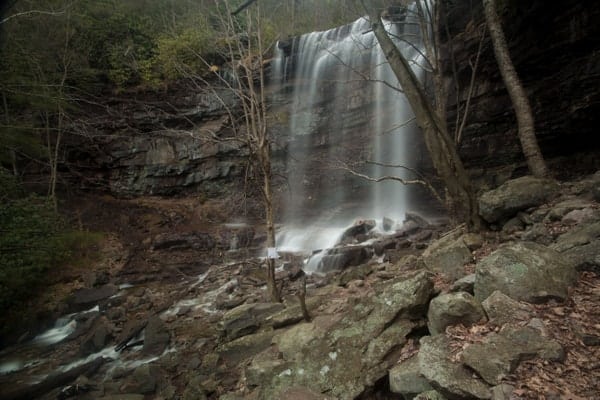
There is a large area filled with rocks around the base of Glen Onoko Falls from which to enjoy its beauty. The gorge is also at its coldest directly below these waterfalls. Depending on the weather on the day you visit, this will either be a welcome relief or encouragement not to dawdle for too long.
After enjoying Glen Onoko Falls, continue up the hill. The trail makes a bit of a diversion away from the creek before returning to it near the top of Glen Onoko Falls.
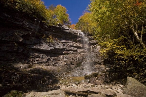
Please, please, please do not cross the ropes that are placed above the falls. The rocks above the falls can be very slippery and serious injury or even death has come from people standing too close to the edge of the falls and tumbling over.
That being said, if you safely stay behind the ropes and on dry land, you can get a great view of the valley from near the top of the falls (but again, from BEHIND the ropes).
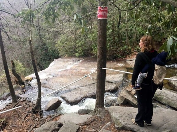
Many hikers think that this is the top of the trail and head back down at this point. However, you’ll notice a small trail heading upstream from near the top of the falls (you do NOT need to cross the creek).
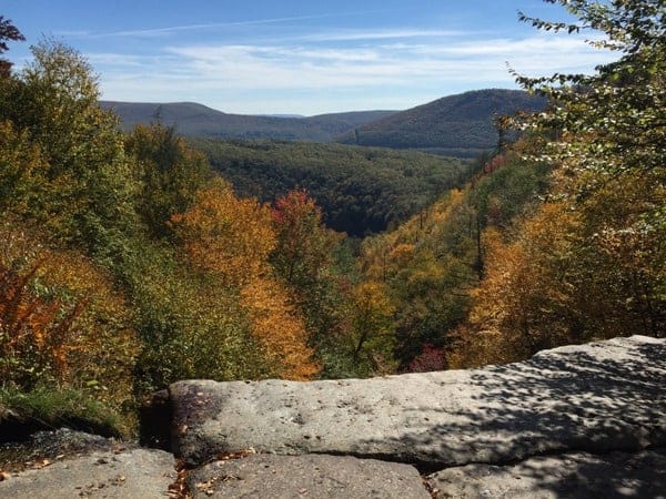
This trail is more narrow than the lower portion and follows through a thin section of forest of rhododendron. Along the way, take a peek through the bushes to see the beautiful cascades that would be focal points elsewhere, but get relegated to unnamed cascades here.
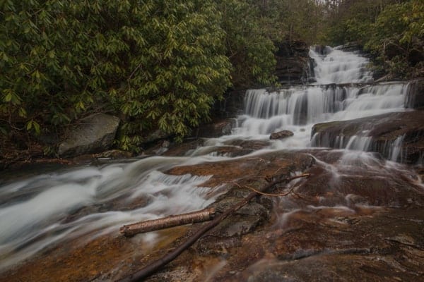
Within a few minutes, you’ll come to the base of Cave Falls.
Also called Hidden Sweet Falls in some sources, this waterfall fits both names very well. However, I tend to prefer Cave Falls because of the large opening behind this beautiful waterfall making this one of the few waterfalls in PA you can go behind.
The shortest of the three named waterfalls in Glen Onoko, this is a very fitting end to an amazing hike.
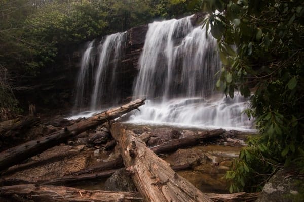
All told, the top of Cave Falls is about three-quarters of a mile from the parking area and about 600 feet above it. As I stated before, the hike isn’t overly long, but it’s very strenuous.
To get down, you have two choices. When I’ve visited, I’ve always found myself a bit pressed for time after taking too many photos along the trail, and have opted to simply head back down the trail. However, it should be noted that while going up is more tiring, going down this steep, rocky trail is probably even more challenging.
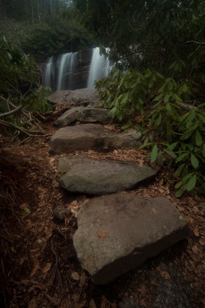
If you’d rather, there is a way to go down a less strenuous trail by continuing upstream. This route also has the benefit of having a view of the valley. While the route is definitely longer, it is likely easier and offers new scenery. Since I haven’t hiked it myself, I won’t try to give you directions, but will instead refer you to this site which has them.
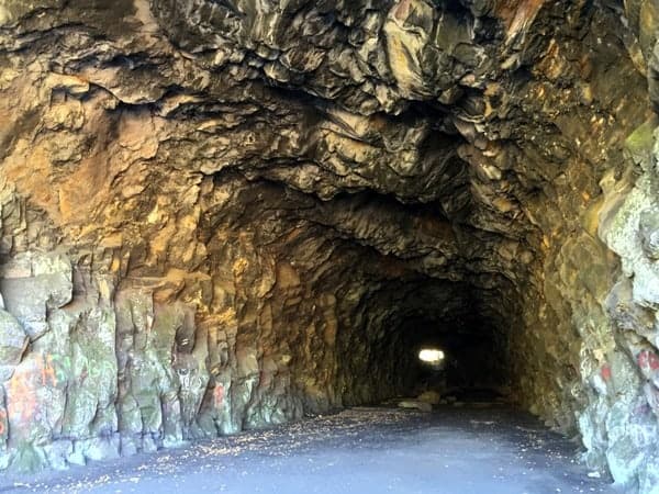
Once at the bottom of the trail, make sure to check out the very cool abandoned train tunnel nearby in Lehigh Gorge State Park. To get there, simply walk across the bridge over the Lehigh River and turn left into the first parking lot. Climb a very small hill, and you’ll be at the entrance to the tunnel.
Known as the Turn Hole Tunnel, it was used by the Lehigh and Susquehanna Railroad from 1866 until 1912. It was then used as a passing lane for trains until it was officially closed in 1956. The tunnel is nearly 500 feet long, and visitors are able to walk through it to see the view of the river from the far side. Note that it gets very dark in here and there are large rocks and railroad ties on the ground, so use extreme caution walking through here.
Overall, the hike at Glen Onoko in Jim Thorpe, Pennsylvania, is one of the most amazing hikes in Pennsylvania. It’s also probably the most challenging hike I’ve done in PA that was along a real trail. While I firmly believe that it can be done with anyone in decent shape that brings the right footwear and mentality to this hike, it is important to understand that people die or get seriously injured in this gorge every year.
To help you better understand what the trail is like, I’ve put together a video, which can be seen near the top of this article. If you are prepared for the hike, don’t let the warnings discourage you. Instead, let them be a reminder that you shouldn’t hang out near the edge of the beautiful waterfalls of Glen Onoko in Carbon County, Pennsylvania.
How to Get to Glen Onoko
Note: As of May 1, 2019, Glen Onoko has been closed by the Pennsylvania Game Commission. According to their press release, it is still possible to reach Cave Falls at the top of the glen via alternate trails. I will leave this post up in hopes that this wrong decision is soon changed, but in the meantime, please obey the posted rules and do not visit the lower two falls.
Glen Onoko is located in State Game Lands 181, though parking and the trailhead are located in Lehigh Gorge State Park in Jim Thorpe, PA.
There are a series of parking lots located at the end of a 1.7-mile roadway that runs from town to the river. It’s worth noting that Apple Maps does not take you down this road to access the parking area, so it’s best to either use a different mapping service, like Google Maps, or keep a look out for a sign that says “Lehigh Gorge State Park: Glen Onoko Access.”
You want to park as far down the road as possible. The trailhead begins just after the bridge over the Lehigh River, and there is one small parking lot on the far side of the river. If that lot is full, park at one of the other lots back up the road. The best parking area and the trailhead can be found at the following coordinates: 40.883493, -75.760377.
To access the trail, cross the river, and take an immediate right down a staircase. At the bottom of the staircase, you will see a large wooden sign for the trail. Turn right to head under the railroad tracks, and then take the trail to the right to head up the hill and start your adventure.
Looking for more great waterfalls? Click the link to check out all of the beautiful Pennsylvania waterfalls that are pictured on the site. Some nearby waterfalls include Hawk Falls, Wild Creek Falls, and Buttermilk Falls and Luke Falls in Lehigh Gorge State Park.
[Click here for information on how to use coordinates to find your destination.]

 "
"

One of my favorite hikes! I especially love that even the graffiti under the bridge warns you to be careful! When you read “Don’t die here” before you even make it to the trail, how could you turn back?
I always inwardly cringe when I hear people say this is their favorite trail. A trail to me is a path that is well planned and maintained with care. This place hasn’t been maintained since the Victorian days and pretty much anything goes here. It’s a shade better than Bake Oven Knob as far as misuse goes (another beautiful disgraced place in Carbon County). If you must go, avoid the weekend when the stampede of the ill-prepared descends and go in with all expectations of “trail” wiped from your mind. It’s a scramble. It’s a washout. It’s not a trail. There are remnants of trails in the area, but you have to know how to find them and good luck without blazes or a map. I 100% agree with you that the state should take ownership. It has little value as game lands; it takes the volunteer emergency services crew roughly 8 hours to evacuate a fallen hiker, I can’t imagine dragging a bear or dear out of there. Keep the top in game lands; transfer the falls to DCNR. Map and maintain the trails. Period. My only guess is that budget limitations and perhaps an obsession with liability have prevented it thus far. Thanks for your efforts. Glad you experienced the beauty of the falls.
I mean no disrespect by this, but descriptions of the trail like you gave are exactly why I wrote this article and put together a video. The trail is challenging, as I noted, but following it is not difficult, even without blazes, and it is doable for anyone with experience hiking and a proper mindset.
I almost didn’t hike Glen Onoko the first time I visited the area because I had read so many things about how bad and dangerous it is. If you treat the trail with respect and don’t go near the edges, it’s not anymore dangerous than many other trails in the state. The campaign to of dire warnings is clearly doing little to keep out the hordes of teenagers and others who come ill-prepared, and I’d hate to see it keep those away who actually want to appreciate the beauty of this place.
Again, I mean no disrespect as I understand where you are coming from, but comments like that are exactly why I wrote this piece.
Really. Hiking a “trail” where people slip and die so often with a child strapped on your back! That part of the video was irresponsible. It was obvious how easily she could have slipped or lost her balance, hiking boots or not! Total insanity. Promote the trail, fine, but don’t play down the dangers.
My wife is a great mother who would never put our child in unnecessary danger. The fact is that the trail is simply not as dangerous as people make it out to be. Yes, it is challenging, and yes, people get hurt or die if they do stupid things (like stand on the edge of the waterfall). However, hiking with a child strapped on the back here is no more dangerous than doing it on any other challenging trail in the state. The whole reason I put this article together is to show people that it simply is not an unsafe trail for those that have experience hiking and stay away from the edges.
I hike this trail three to four times a year throughout the seasons and I’ve been trying to figure out how people die other than sheer stupidity and trying to get that perfect selfie…?
There is nothing dangerous about this trail whatsoever. Typically, I do the trail with girlfriends, but I’ve come with dogs and children as young as six and they all get through the trail effortlessly. As I said, injuries result from stupidity, which comes with any trail you hike anywhere.
Coming here during the week is the way to get the most out of the trail. You avoid the aforementioned stampede of the ill-prepared.
The views are simply amazing, particularly in the fall when the leaves change.
Oh my gosh, I went there once and it was cute. I couldnt beleive how short it was. I was just starting to get loosened up and it was over.
Yeah, I’m always surprised when I reach the falls. I always remember it being longer. Probably because it’s a bit of a workout.
When my husband and I went a few years ago, I hiked it in flip flops because somehow we started above the sign that said not to hike in flip-flops and didn’t realize there wasn’t a true trail. We only saw the sign after we got back. :-/ It was challenging and you had to take care but not nearly as challenging as Mount Monadnock in New Hampshire, which is thought to be the third most climbed mountain in the world (not far from Boston). There were people their climbing with toddlers on foot and children in backpacks and the two shortest trails are STEEP in parts, over large sheer boulders. Anyway, I think this is a fair representation of the hike. It is more challenging than Ricketts Glen’s falls trail which has a path and while similar to Rock Run in Loyalsock State Forest in Lycoming Country in not having a path is steeper, for comparison. My understanding is that many of the deaths are due to falling from the top of Glen Onoko Falls. The ropes weren’t there when we were there, so you could walk right to the edge, sit down, walk in the stream, etc. (We did not get very close to the edge!) It was somewhat challenging to find the alternate path down and the Game Commission Officer we met didn’t know where it was–I think he rarely walked the game lands. But another family knew the way, so we followed them. Many stone steps! It is a lovely area and doable–but don’t do it in flip-flops! The RR tunnel is interesting and the Lehigh Gorge Trail nearby is a fun bike ride!
This a very easy trail, I’ve seen people hike it barefoot. The people who find this challenging are probably weak and out of shape or just sissys. It’s a really short hike, not even a mile total. People aren’t dying while hiking the actual trail, they’re off trail when they fall. Use common sense and don’t believe one persons “terrible” description. The only reason there are warning signs are because it’s a tourist town.
I wouldn’t call it a “very easy” trail in any way, shape, or form. It’s definitely challenging despite it’s short length. What type of shape you’re in doesn’t change tricky footing and sharp drop offs along the trail. While I don’t believe that it’s nearly as bad as some make it out to be, and I agree that people aren’t dying while hiking, it’s not a trail that should be taken lightly.
Thank you so much for the in-depth description and the video for this hike! I was wondering if you knew the approximate length of this hike if you do the out and back like you did with your family?
It’s not long, definitely under a mile each way. It takes a bit of time since it requires some careful hiking, but it’s not super long in length.
Truly an Awesome Trail, and yes it is safe, if you use common sense. This Article is extremely well written, and very accurate. Thanks so much for sharing this amazing hike!
I couldn’t find when this was written but my friend and I used your article as a reference two days ago when we hiked the Falls. It seems as though it might be better marked than when you wrote this? There were plenty of orange blazes and when you got to the top (fire pit), the red blazes took you down the trail to the overlook and through the Victorian ruins (old rock walls). I didn’t know if that would help anyone else…we were a little confused at the top but the red blazes turned out being the correct trail and much more enjoyable than hiking up the way we came!
Thanks for all you do! I have greatly appreciated discovering the different waterfalls of Pennsylvania!
Glad they improved the blazes. This was written in the Spring of 2017 based on a visit at that same time. Nice to see someone has done some work on the trail since then.
This is a good description on the Glen Onoko Falls trail hike but it’s only half of the hike. For the second half continue up the trail (not as steep) about a quarter mile or less to a fire road. Note your location to find your way back, then take the fire road to the right for about a mile. The road will bend to the left but take the well worn path to the right at that point. Go a short distance and suddenly you arrive at an extremely spectacular overlook, looking down on the Lehigh River from “the top of the world”. Do not take the return path along the ridge unless you want to disturb rattlesnakes.
Take the fire road back.
I have been hiking this for years. Once you get to the top of the falls and before you hit the roads, you can follow the trail right that will lead to a different path down. It is easy to go down this path. It is almost like steps. If you go past the path down there are other overlooks with more beautiful views you will see from on top the falls.
Is there any camping in this area, that is not a camp site. We were thinking of seting up a camp and hiking out from there. Thanks for your help.
Not that I know of. Camping on state game lands is not allowed. There are campgrounds at nearby state parks like Hickory Run State Park and Beltzville State Park, but I don’t know of any legal campsites that aren’t in a campground in that area.
Excellent write-up. The comments are interesting, especially those that depart significantly from your view – which I agree with. Saying this trail is “easy” is nonsense. It is what it is. Respect it and enjoy. Sadly, PA is looking at shutting it down as of April 2019.
I’ve heard that. It’s definitely the wrong thing to do, and the worst choice of all the possible options.
Hi,
I’ve wondered why the State doesn’t make some basic safety improvements to the trail.
I have 100 year old post cards of the falls that show that back then there were stairs , walkways, and bridges, making the hike easy, even for women in their full length dresses.
The State doesn’t do much maintenance of that kind anymore.
I always enjoy you messages.
Thank you,
Rick Myers
The main issue is that Glen Onoko is owned by the PA Game Commission. Their mission isn’t to great access for non-hunters, so they don’t typically build trails or infrastructure like that. If it were transferred to the adjacent state park, that could be done by DCNR, but until that happens, no improvements will be made. Doing so would fix nearly every problem there, in my opinion.
I just discovered this site and I am enjoying it immensely. Glen Onoko was a favorite one day trip from the Allentown PA area for me back in the 1960’s. Three good friends and I often rode our motorcycles up on beautiful Sunday afternoons. I no longer remember how difficult the hike was but I don’t remember it being a problem.
Good memories. Beautiful area.