Northumberland County, Pennsylvania, is home to four beautiful covered bridges, including the oldest remaining bridge in the state.
Two of the bridges are located south of the Susquehanna River and two are located north of the river, making it easy to divide this trip into two parts if you don’t have time to visit them all.
All four covered bridges in Northumberland County are well maintained and located in beautiful settings. Even better, all four still allow traffic to drive across them.
The bridges are listed in order from south to north. If you are looking for other options before or after visiting these bridges, I’ve provided a few suggestions at the bottom of this article.
Himmel’s Church Covered Bridge
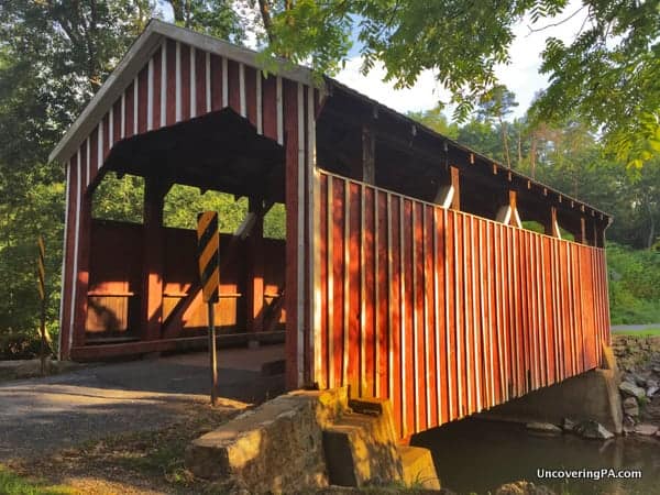
Himmel’s Church Covered Bridge (also known as Rebuck Covered Bridge) is the southernmost covered bridge in Northumberland County. Without a doubt, this is the most unique covered bridge I’ve come across in the state. To my knowledge, there are no other candy-striped covered bridges in Pennsylvania.
The bridge is located in a small park in the middle of a beautiful valley. The bridge is located in the village of Rebuck in Washington Township. The bridge is 43 feet long and crosses Schwaben Creek. It was built in 1874 using multiple Kingpost Truss.

Getting There: Himmel’s Church Covered Bridge is located at the edge of a small community park with baseball fields and a playground. It is also located fairly close to a few Amish farms. While there is no parking lot next to the bridge, the park area makes pulling off to the side of the road very easy. The bridge is located at the following coordinates: 40.723164, -76.719609.
Keefer Station Covered Bridge
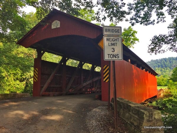
Keefer Station Covered Bridge is located just a few miles outside of the city of Sunbury, south of the Main Branch of the Susquehanna River. The bridge was built in 1888, but was refurbished just a few years ago. It is 109 feet long and spans Shamokin Creek.
The around surrounding the bridge is beautiful farmland, though you may pass a small car junkyard depending on how you reach the bridge. Nevertheless, its distance from the bridge means it doesn’t detract from the bridge itself.
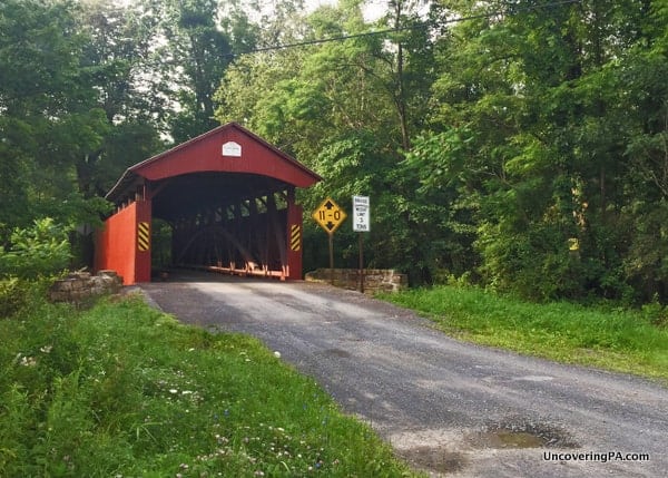
Getting There: Keefer Station Covered bridge is located about 4 miles west of Sunbury, Pennsylvania. There are several places to pull off near the bridge, so you shouldn’t have any trouble finding somewhere to park. The bridge is located at the following coordinates: 40.870786, -76.723278.

"Waterfalls of Pennsylvania" by Jim Cheney
If you love PA waterfalls, you won't want to miss this waterfall book from Jim Cheney, author of Uncovering PA, featuring more than 180 great waterfalls. Order it now on Bookshop.org or Amazon.
Rishel Covered Bridge
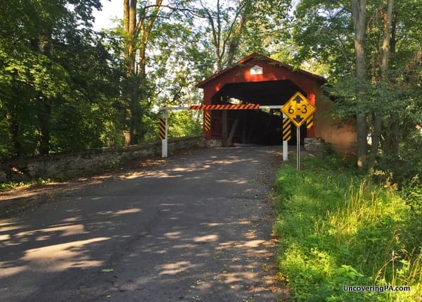
Rishel Covered Bridge is the oldest still standing covered bridge in Pennsylvania. Originally built in 1830, it has been refurbished on several occasions, most recently in 1990. The bridge spans 121 feet over Chillisquaque Creek, making it the longest covered bridge in Northumberland County.
Like several other covered bridges in the area, Rishel Covered Bridge has a height bar located a few feet in front of the covered bridge. This ensures that overheight vehicles don’t damage the structure. While it does detract a bit from the bridge, the beauty and historical nature of this bridge make it a great one to visit.
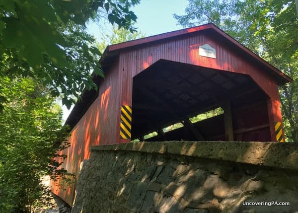
Getting There: Rishel Covered Bridge is located in the northern part of Northumberland County, near Route 147. The bridge is located at the following coordinates: 40.960160, -76.815742.
For parking, there is a nice pull-off on the bridge’s southwestern end. Be aware that much of the area around the bridge is posted as private property.
Sam Wagner Covered Bridge
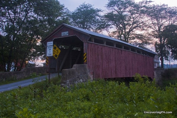
Sam Wagner Covered Bridge (also known as Gottlieb Brown Covered Bridge) spans the border between Northumberland County and Montour County. The bridge is 78 feet long and crosses Chillisquaque Creek. It was built in 1881.
This bridge is set in a very scenic area of farmland near Interstate 80 and is the northernmost covered bridge in Northumberland County, PA.
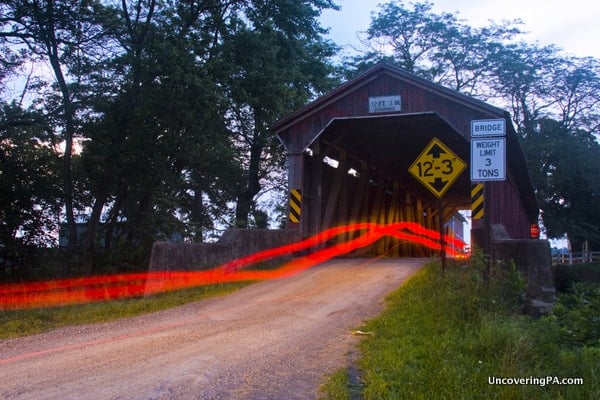
Getting There: Despite its proximity to I-80, getting to Sam Wagner Covered Bridge takes a bit of driving along some windy two-lane roads. The bridge is located near the small town of Potts Grove at the following coordinates: 41.002096, -76.773680. There is a nice pull-off on the Northumberland County side of the bridge.
Where to go from here?
If these bridges leave you wanting more, you have a few options. From Sam Wagner Covered Bridge, it is only a few miles to the last remaining covered bridge that’s entirely within Montour County. You can also cross the Susquehanna River and visit the Covered Bridges of Union County or check out the nearby covered bridges in Columbia County. Shikellamy State Park, the Joseph Priestley House, and the Montour Preserve Fossil Pit are also located nearby.
If you’ve done this trip in reverse, you are only a few minutes from the northernmost covered bridge of Dauphin County, Pennsylvania.
[Click here for information on how to use coordinates to find your destination.]






I really enjoy your articles. I’m heading from latrobe to knoebel’s park on the 15th. What is there to do in between.
Your best bet is always to check out my travel map, which features all of the places I’ve visited and written about throughout the state: https://uncoveringpa.com/pennsylvania-travel-map.