
While I love visiting towering waterfalls, sometimes the smaller ones are much more beautiful and enjoyable to explore. Mill Creek Falls in Westmoreland County is one such places.
Mill Creek Falls is located in southwestern PA within State Game Lands 42 only a short drive from the Lincoln Highway and the community of Ligonier, home of the popular Fort Ligonier.
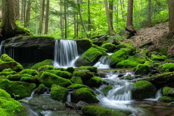
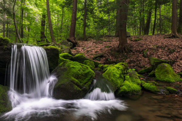
At only about eight feet in total height, Mill Creek Falls is definitely on the shorter side. This is even more true because the tallest drop here is only about four feet.
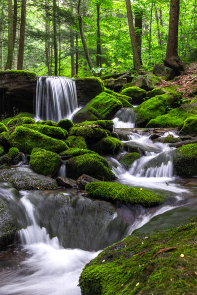
However, what makes this spot special is the incredibly thick and colorful moss that covers this spot. It is truly one of the most photogenic waterfalls in all of PA despite it’s small size.
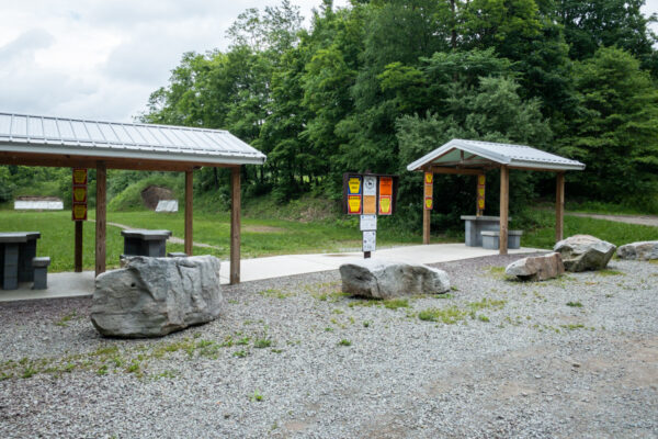
Parking for Mill Creek Falls
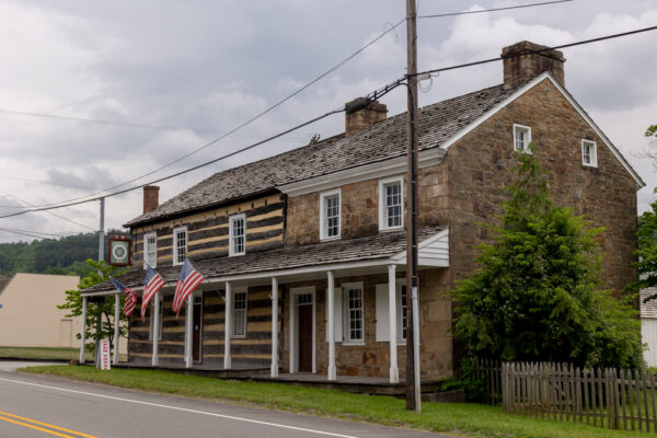
Mill Creek Falls is located roughly 3.5 miles from Laughlintown, PA along Route 30. This spot is known for both the Compass Inn Museum and the popular Pie Shoppe, both of which are worthwhile stops while you are in the area.
It’s worth noting that there are several other Mill Creek Falls in Pennsylvania, including in York County and Sullivan County, so make sure you don’t get confused on which one you’re visiting.
The parking area for Mill Creek Falls is located at the shooting range in State Game Lands 42. This means that sometimes there is a bit of noise here. However, the angle of the shooting range is such that it doesn’t pose any risk for hikers.
Still, since this hike is on state game lands, wearing a bit of blaze orange is recommended any time of the year.
The parking lot can be found at the following coordinates: 40.230417, -79.143028.
Note that the last bit of drive here is along dirt roads that are in good condition but aren’t likely maintained in the winter months.
[Click here for information on how to use coordinates to find your destination.]
Hiking to Mill Creek Falls
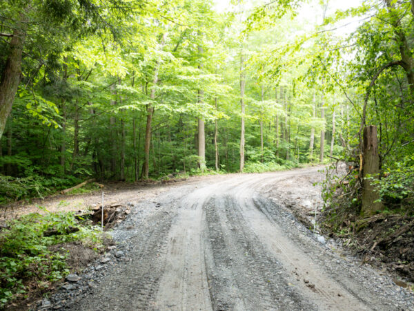
It’s an easy half-mile walk to Mill Creek Falls. The hike is primarily along old dirt roads, but it’s worth noting that the entire hike is unmarked, though easy to follow.
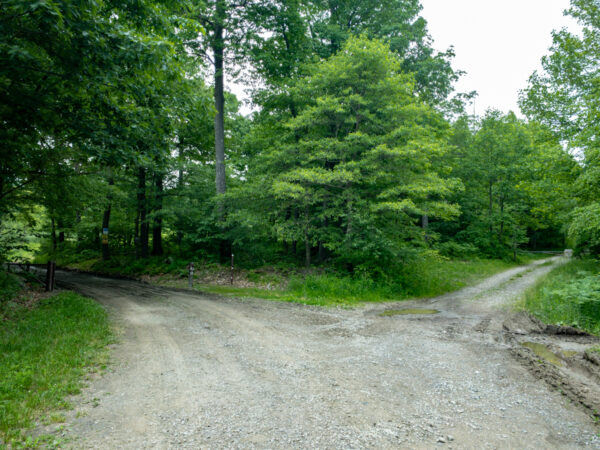
From the parking area, you’ll want to take the gated road next to the shooting range. There is another road here, but you want the one on the left.
Should this gate be open, as it was when I visited, do not drive further down here as it very quickly deteriorates and there isn’t anywhere to park down the road anyway.
You’ll be following this dirt road for about four-tenths of a mile, and you’ll notice it deteriorate in quality as you walk along it. It also can be quite muddy if it’s rained recently, so make sure to wear footwear that can get dirty.
After 0.4-miles, you’ll see an old dirt road heading off very sharply to your left (about 120 degree angle). Take this side road to continue your trek.
From, here, it’s less than two-tenths of a mile to Mill Creek Falls. For those that use coordinates when hiking, the waterfall can be found here: 40.231389, -79.137382.
Along the way, you’ll pass a utility pad of some kind shortly before the trail reaches the banks of the South Fork of Mill Creek. Shortly after this, Mill Creek Falls will come in on your right.
As noted above, Mill Creek Falls isn’t overly tall, but its quite scenic. The total drop here is about eight feet with the largest drop being four feet in size.
This is a beautiful and very peaceful spot, and it’s worth taking a few minutes to enjoy it.
Once you’ve had your fill of this spot, simply retrace your steps for the 10-minute or so walk back to your car.
Overall, Mill Creek Falls near Laughlintown is an incredibly beautiful spot to visit. While it’s far from the tallest waterfall in the Laurel Highlands, it’s certainly among the most scenic and a great spot to visit while traveling through the region.
Looking for more places to visit nearby? Check out the waterfalls in Ohiopyle State Park, Adams Falls in Linn Run State Park, and Idlewild Amusement Park.
 "
"