Every once in a while, I come across a previously unknown-to-me stream that’s home to multiple waterfalls. And, in an effort to share the best undiscovered places with you, I make the trek to see what it’s all about.
One such area was Slateford Creek in Northampton County, just a few miles from Stroudsburg, Sango Kura Sake Brewery, and Columcille Megalith Park, along the edge of the Delaware Water Gap National Recreation Area. Of course, the Delaware Water Gap is known for its many amazing waterfalls. In fact, some of the highest waterfalls in Pennsylvania are located here, as is the much heralded Bushkill Falls.
For some reason, though, Slateford Creek sits in obscurity, little known outside of the local area. However, given the stories I’d heard and pictures I’d seen, I knew I needed to check it out.
From the parking pull-off (See directions below), I ventured along a narrow trail up and over a small hill, and into the woods. Soon, I heard the sound of falling water to my left and knew that I had reached the top of the first waterfall along Slateford Creek.
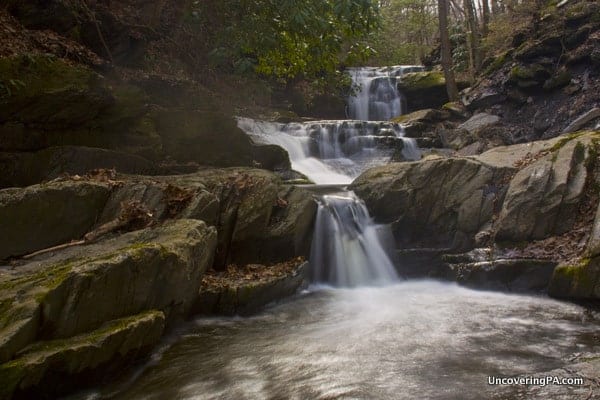
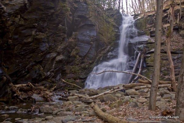
Depending on how you look at this waterfall, you might actually consider it to be two separate falls. The top waterfall is roughly 12-15 feet tall, while the second waterfall, about 100 feet downstream, is probably around six feet tall. There is also another small drop of about 3 feet just downstream, which makes for a great foreground for photos.
Truthfully, getting down to this waterfall was very difficult, and I’d only recommend it for very experienced hikers. And, if you think getting down was hard, getting up is even harder. Typically, this isn’t the case, but here, I found myself climbing up the hill grasping for anything I could to steady my ascent.
While it might be possible to come at the waterfall from downstream, a huge logjam just below this waterfall would make this difficult at best.
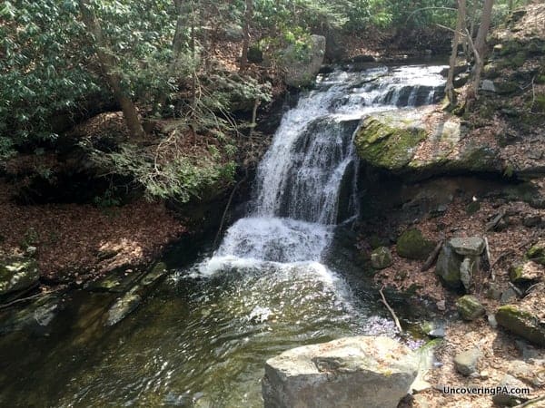
I wasn’t even planning on going all the way down to the waterfall myself, but a gust of wind blew my tripod (fortunately without the camera attached), all the way to the bottom of the gorge, forcing me to head to the bottom. And, while I’m glad I made it down, I can’t stress how difficult the hike back up the gorge was.
Once you are finished with the lower waterfall, continue along the same trail deeper into the woods. The trail, while not marked, isn’t difficult to follow, and meanders along the right bank above Slateford Creek.
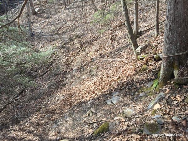
After walking along the relatively flat path for 5-7 minutes, you’ll come over a small rise and see the middle waterfall along Slateford Creek come into view. However, the trickiest part of the hike is just ahead of you as the trail has been washed out. Fortunately, someone has strung up a rope across this section. With care, crossing here isn’t too difficult, but it can be a bit challenging if the slope is wet.

"Waterfalls of Pennsylvania" by Jim Cheney
If you love PA waterfalls, you won't want to miss this waterfall book from Jim Cheney, author of Uncovering PA, featuring more than 180 great waterfalls. Order it now on Bookshop.org or Amazon.
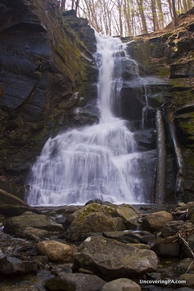
The middle waterfall on Slateford Creek is the largest of the three waterfalls here. I’d estimate the height to be somewhere between 40-50 feet (If anyone knows of its official height, please let me know). Here, the water flows off the hillside in a narrow stream, before spreading out a bit more near the bottom.
The waterfall was very impressive given how little water seemed to be flowing at the bottom of the falls.
Looking around the area near the falls, it’s easy to notice evidence of the former slate quarry that used to be here in the mid-19th century. Today, however, aside from a few obvious cuts in the rocks, most of the evidence of the quarry has disappeared.
After you’ve finished at the second waterfall, you have two choices to get to the third waterfall along Slateford Creek.
Some local men that I talked to at the second falls told me that it’s possible to hike to the last waterfall. To do this, head back down the trail. About halfway between the waterfall and the rope over the washed-out trail, scramble up the hill to the top. From here, there is a trail that takes you above the waterfall, and continues along Slateford Creek until you reach the third waterfall.
It’s worth noting, however, that these guys also told me that there wasn’t much of interest until the third waterfall, and I was better hiking back to my car and driving up. So, this is what I opted to do.
Driving up to the top of Slateford Creek is quite easy, and makes this the easiest of the three waterfalls to get to, though it also was the most crowded with about a dozen local high school students passing by during my brief visit.
The hike from the car to the uppermost waterfall on Slateford Creek is only about 200 yards down a well established, but unmarked, path. This waterfall sits on the far side of a circular pool that I imagine would be a popular swimming spot if the water was high enough.
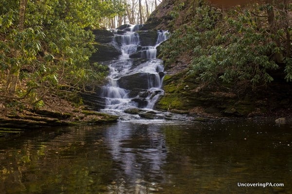
The waterfall itself cascades down the hillside in a series of falls, probably equalling 25-30 feet in total height. From a photography perspective, I found this to be the most beautiful of the three waterfalls along Slateford Creek.
Just below the waterfall are the remains of a concrete dam, which may date from either the later days of the slate quarry or possibly a mill of some sort. Today, however, the water flows freely past the concrete remnants.
Overall, I can’t recommend a visit to Slateford Creek in Northampton County enough. This area is definitely one of the hidden gems of the Delaware Water Gap and is worth visiting for anyone that loves Pennsylvania waterfalls as much as I do!
How to Get to the Waterfalls of Slateford Creek
Note: There is roadwork along the road with Slateford Creek, and it will be closed until approximately May 2022. At this time, I have no alternate parking suggestions.
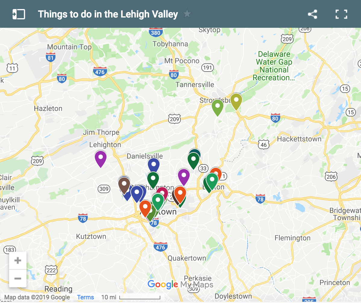
The waterfalls of Slateford Creek are located in Northampton County, just south of Stroudsburg, Pennsylvania, along the southern reaches of the Delaware Water Gap National Recreation Area.
Driving along Route 611 and the Delaware River, turn onto National Park Drive. Shortly after turning on the road, you’ll cross a bridge over Slateford Creek and reach a curve in the road.
Just after this curve, you’ll see a pull-off along the left side of the road big enough for 3-4 cars. If you reach the nearly 180-degree turn in the road, you’ve missed it. The coordinates for this parking area are 40.946450, -75.116036.
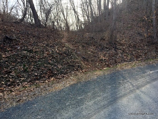
After parking, walk uphill. Just after the guardrail, you’ll see a very small hill, with a faint trail going over it. Follow this trail, which gets much more obvious over the hill, along the creek.
After just 100 yards or so, you’ll see the first waterfall far below you. Remember, this waterfall is difficult to get down to and VERY difficult to get up from. Use extreme caution here.
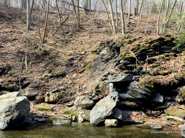
Continuing on this trail for about 7-10 minutes will bring you to the next waterfall.
To get to the third waterfall, you can try to find the trail above the second falls that I talked about above, but I’d recommend retracing your steps to your car and driving.
To drive to the uppermost waterfall on Slateford Creek, continue uphill along National Park Drive. After 0.7 miles, you’ll reach a dead end, with the road, now barely paved, continuing off to your left. Follow this for a short distance until you come to a small bridge. Just before this bridge there is an area to park along the left side of the road.
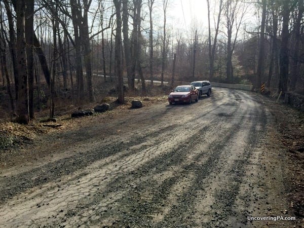
Park here, and follow the obvious path downhill for a few minutes until you reach the upper waterfall of Slateford Creek.
[Click here for information on how to use the coordinates in this article to find your destination.]
Want to see more of Pennsylvania’s best waterfalls? Check out our Pennsylvania Waterfalls page! You can also explore other nearby waterfalls such as Resica Falls and Indian Ladders Falls.




 "
"



Hi Jim! Thank you so much for this article. We completed the hike on 4/27/16 and were not dissappointed. Your descriptions were very easy to follow and we appreciate you posting this!
That’s great to hear, Anna. I’m glad you had a great visit.
Just for the record, that trail head looks nothing like that after a very wet May ?? We started the trail but it started downpouring 5 minutes in. Alas, we will have to come back! Thanks for all the tips.
Hi Jim,
Thank you for posting this special place… My young adult children, wife & myself had a great day with this hike. Even if we had stumbled upon the Slateford area, without your specifically noted pull off spots, we would have missed this gem.
From this National Park’s website: “Swimming, Wading, and Jumping In and Around Waterfalls is PROHIBITED!
Alert 1 , Severity ,danger ,,Swimming, Wading, and Jumping In and Around Waterfalls is PROHIBITED!
Swimming, wading, and jumping into the waterfalls and areas above and below waterfalls is prohibited in the entire Park. Your safety is vital to us. Please don’t risk your LIFE. There are costly fines for violating federal law.”
People ruin local spots that have been so quiet for years. Can’t go here on the weekend anymore without running into 20 people treating it as a water park. Thanks internet
I wrote about this site years ago, well before just about anyone else had. I visited it on a weekday in the late spring (when there was still ice in some places). I saw probably 15 people there during my visit, so it’s been well-known long before I, or anyone else, “ruined” it. I get your frustration, but it’s misplaced on this site.