
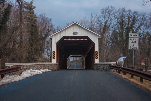
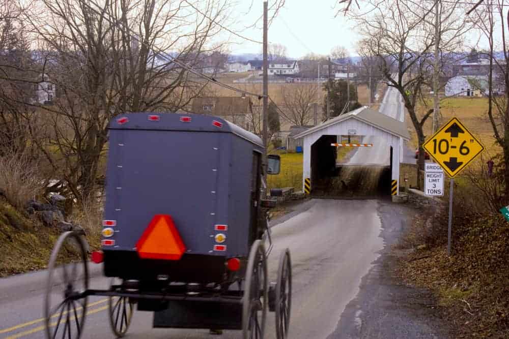
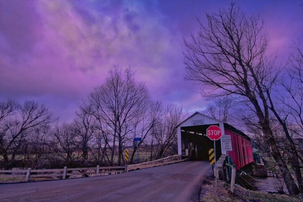
There are more than 200 historic covered bridges in Pennsylvania, but no county has more than the 29 in Lancaster County.
During my travels, I’ve had a chance to visit 27 of these historic spots. Unfortunately, two bridges, Buck Hill Farm Covered Bridge in Lititz and Herr’s Mill Covered Bridge formally of Soudersburg, are located on private property and can’t be seen from the road. However, for those that want to explore the county, its public covered bridges are well worth taking the time to see.
The bridges below are sorted into regions of the county: Northwestern, Central, North-Central, Northeastern, Southeastern, and Southwestern. Many of these regions can be combined together to explore the county’s bridges. Within each region, the bridges are ordered in a way that would make sense to visit.
So scroll down to learn more about the history of and to see photos of each of the historic covered bridges in Lancaster County, PA.
Northwestern Lancaster County Covered Bridges
There are five covered bridges in northwestern Lancaster County. They are listed below from west to east. Visiting these bridges can also be done in the opposite direction just as easily if you wanted to.
It’s also worth noting that the first three bridges listed are south of 283 and north of Route 30, while the last three bridges are located south of the Pennsylvania Turnpike and north of Route 283. This access from three major roads through the area makes these bridge easy destinations for travelers in the area wanting to see some of the historic covered bridges in Pennsylvania.
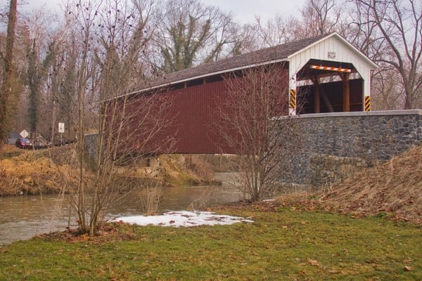
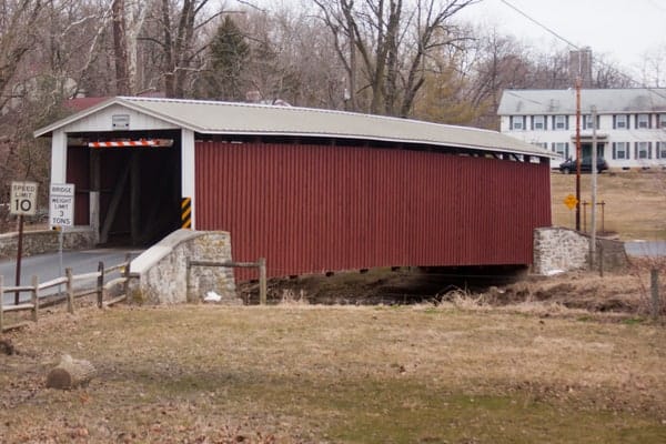
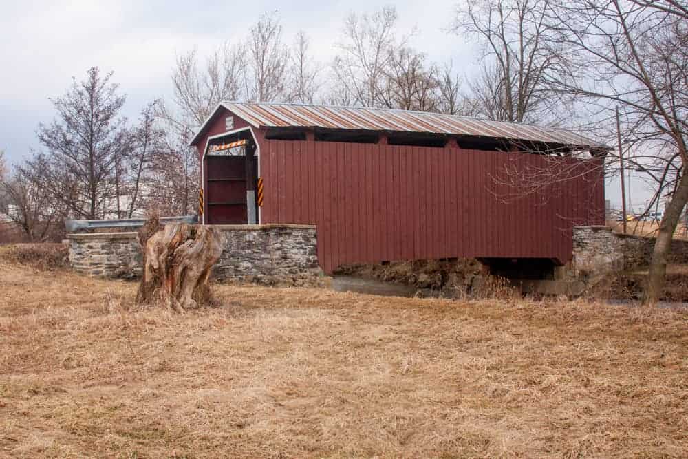
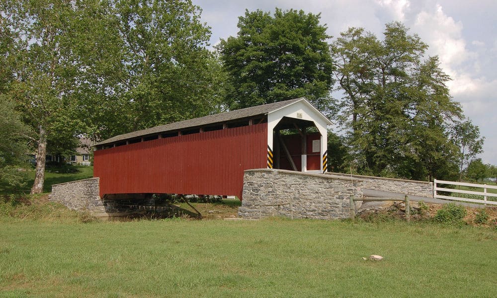
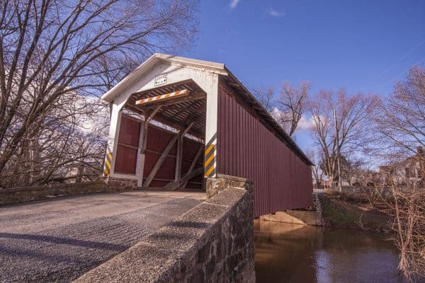
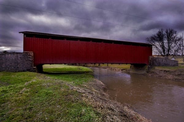
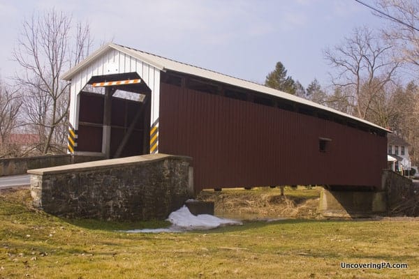
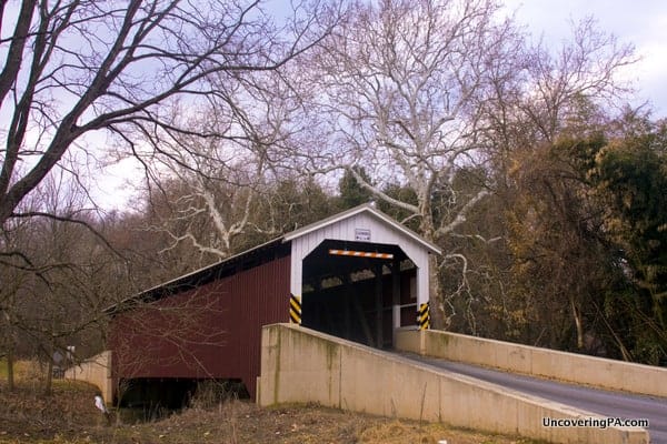
Forry’s Mill Covered Bridge
Forry’s Mill Covered Bridge is the last covered bridge over Big Chiques Creek before it meets the Susquehanna River between Marietta and Columbia. Forry’s Mill Covered Bridge was built in 1869 and is 103 feet in length.
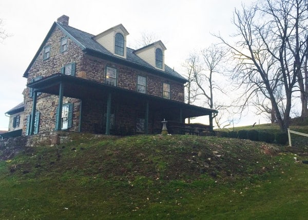
The bridge was named after the Forry family who lived in a stone house that’s still located on the hillside overlooking this beautiful bridge.
Getting There: Forry’s Mill Covered Bridge is located less than a mile and a half from Siegrist’s Mill Covered Bridge. It can be found at the following coordinates: 40.066479, -76.478153.
There are no official pull-offs here, though there is room next to the electrical station on the bridge’s eastern end.
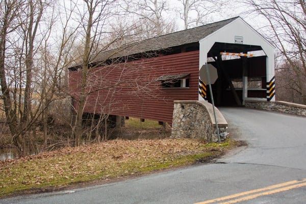
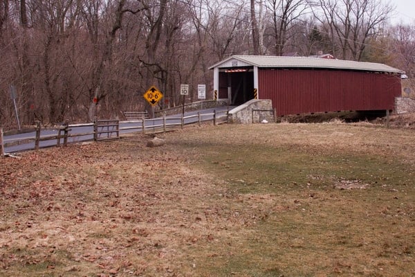
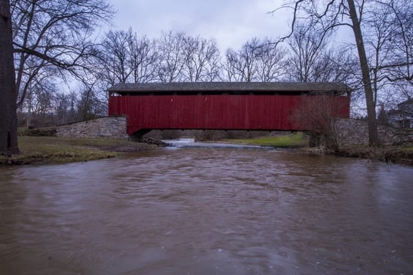
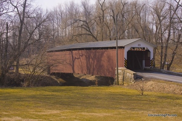
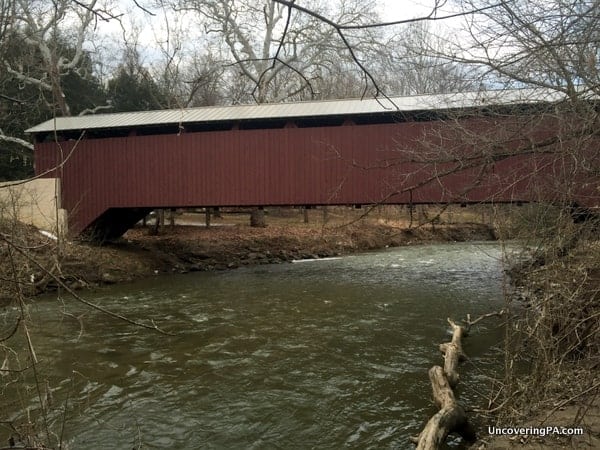
Siegrist’s Mill Covered Bridge
Siegrists’s Mill Covered Bridge is a 102-foot-long covered bridge that crosses Big Chiques Creek. It is located southwest of Mount Joy near the community of Farmdale.
Siegrists’s Mill Covered Bridge was originally built in 1855. While it was one of the few covered bridges that survived the massive floods brought on by Hurricane Agnes in 1972, it was swept downstream by a flood in September 2011 during Tropic Storm Lee (See footage of it being swept away).
After sitting along the side of the road for a period of time, the bridge was rebuilt in 2013. Today, it is one of the most scenic covered bridges in Lancaster County.
Getting There: Siegrist’s Mill Covered Bridge is located approximately 3.5 miles south of Route 283. It can be found at the following coordinates: 40.076091, -76.470992.
Parking at this bridge is a challenge as there is little room to pull over along the side of the road. Ensure that, if you do park, you aren’t blocking traffic or a driveway.
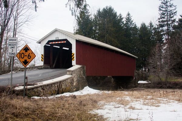
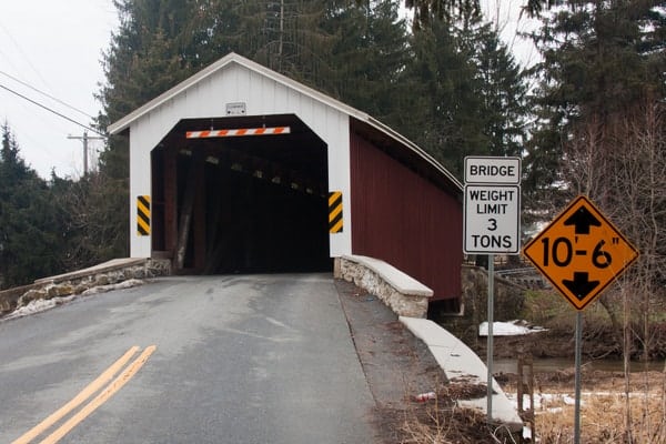
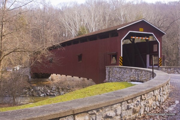
Schenck’s Mill Covered Bridge
Schenck’s Mill Covered Bridge is the third covered bridge to cross Big Chiques Creek. It is 96 feet long and was completed in 1855.
The original Schenck’s farmhouse and mill are still standing along Shenck Road, directly in front of the bridge. The buildings are now the home of Longenecker’s Construction.
Like Shearer’s Covered Bridge, it is one of three covered bridges in the county that have horizontal boards on the outside instead of vertical boards.
Getting There: Schenck’s Mill Covered Bridge is located just over a mile off of Route 283, and just around the corner from the massive Spooky Nook Sports Complex, making this a very easy covered bridge to visit.
It can be found at the following coordinates: 40.115683, -76.425147.
The best option for parking is on the northeastern side of the bridge where there is a small gravel pull-off along Shenck Road.
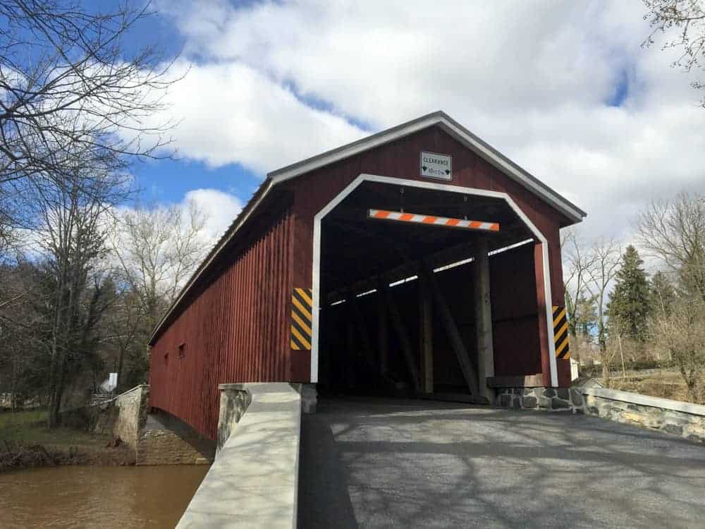
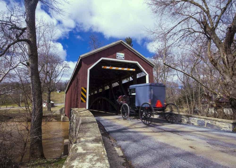
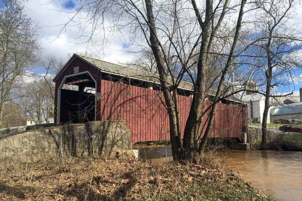
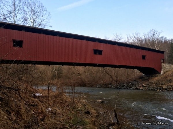
Kauffman’s Distillery Covered Bridge
Kauffman’s Distillery Covered Bridge is located southwest of Manheim and is the second historic covered bridge on Big Chiques Creek.
The bridge was originally built in 1857 and named for the nearby Kauffman’s Distillery Mill. At that time, Kauffman’s was one of 130 distilleries in just Lancaster County.
While sources differ on the length, it appears that the bridge is up to 96 feet in length. It is still open to vehicular traffic.
Getting There: Kauffman’s Distillery Covered Bridge is located southwest of Manheim, about a quarter-mile off of Route 772, also known as Mount Joy Road.
The bridge can be found at the following coordinates: 40.148294, -76.409949.
Parking at this bridge is a bit of a challenge as there is not a set area for parking. However, there are places where a car could carefully pull off to the side of the road. Just ensure if you go this route, you aren’t blocking traffic while enjoying this beautiful bridge.
Shearer’s Covered Bridge
Shearer’s Covered Bridge is located in Manheim, directly next to Manheim Central High School.
This bridge was originally built in 1847, though it had to be rebuilt in 1855. The bridge stayed in its original location until 1971 when it was moved to Manheim Memorial Park to ensure its preservation.
Today, Shearer’s Covered Bridge crosses 86 feet over Big Chiques Creek. It is the furthest upstream of the five covered bridges that cross this waterway. While cars are no longer allowed on the bridge, pedestrians can use the bridge to cross to a portion of Manheim Memorial Park.
Interestingly, while all Lancaster County covered bridges are painted red, this is the only bridge that features a red interior and red approaches, giving it a bit of a unique look.
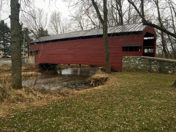
Getting There: Shearer’s Covered Bridge is located on the outskirts of Manheim next to Manheim Central High School. The bridge can be found at the following coordinates: 40.171917, -76.389764.
There is plenty of parking around the bridge, though it might be difficult to find parking if you visited during school hours. Should you have difficulties with parking, the park has several parking lots that should have parking during school hours, though you may have to walk through the park to see the bridge.
Central Lancaster County Covered Bridges
For the purposes of this guide, Central Lancaster County is defined as the area along Route 30 and the City of Lancaster. In this part of the county, you’ll find four historic covered bridges.
These are some of the easiest bridges in the entire county to visit as they are located along the main thoroughfare through the region (other than the PA Turnpike) for those traveling between Philadelphia and Harrisburg.
The bridges here are listed from west to east.
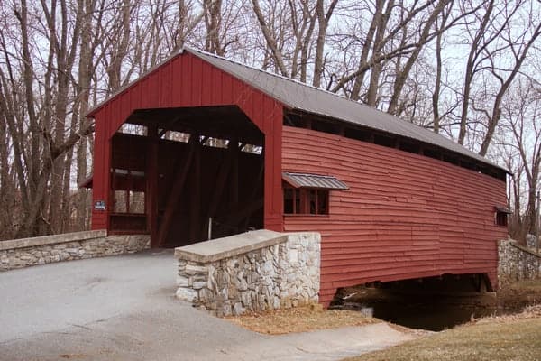
Landis Mill Covered Bridge
Landis Mill Covered Bridge is located a short distance northwest of downtown Lancaster just a minute or two drive from Park City Mall. Despite being in a much more populated setting than most of the bridges on this list, it’s located in a beautiful spot and along a road that doesn’t see a lot of traffic.
Landis Mill Covered Bridge was constructed in 1873 and is the only one in the county that uses a unique combination of Burr arches and King post trusses. At 53 feet, it is the shortest of Lancaster County’s covered bridges.
This bridge, which is officially known as Little Conestoga #1 Bridge crosses the Little Conestoga Creek.
Getting There: Landis Mill Covered Bridge is located adjacent to Park City Mall near Route 30.
It can be found at the following coordinates: 40.068606, -76.345005.
There is room for cars to pull off the road on the far side of the bridge if coming from the mall.
Kurtz’s Mill Covered Bridge

Kurtz’s Mill Covered Bridge is located just south of downtown Lancaster in Williamson Park.
This bridge was built near Hinkletown in northeastern Lancaster County in 1876. It originally crossed the Conestoga River.
After being severely damaged in 1972 during Hurricane Agnes, this bridge was rebuilt in its current location in 1973.
Kurtz’s Mill Covered Bridge is 90 feet long and crosses Mill Creek in the heart of this park. While it’s not in its original location, the bridge is located in a very beautiful spot at the bottom of a steep road in the middle of the forest.

Without a doubt, this is one of the most beautiful covered bridges in the county.
Getting There: Kurtz’s Mill Covered Bridge is located just south of downtown Lancaster in the western part of Williamson Park. It can be found at the following coordinates: 40.015175, -76.282250.
Just after the bridge, Kiwanis Drive dead-ends into a parking lot. This lot provides great access for those visiting the bridge.
Willow Hill Covered Bridge
Willow Hill Covered Bridge might be the most seen covered bridge in Lancaster County. That’s because it’s located directly along Route 30 between Target and the American Music Theatre east of downtown Lancaster.
Willow Hill Covered Bridge spans Miller Run and is actually a combination of two historic covered bridges (Good’s Fording Covered Bridge and Miller’s Farm Covered Bridge) that were combined together in 1962. While that means this isn’t a historic bridge, I’ve decided to include it here since it does use the parts of historic bridges in its construction.
The bridge that you can see today is 93 feet long and uses a Burr arch truss.
Getting There: Willow Hill Covered Bridge is located along the northern side of Route 30 at the following coordinates: 40.024431, -76.201557.
While it’s easy to see from the road, it’s not quite as easy to figure out where to park.
The best place is probably near the Panera Bread in the Target shopping center. You can also easily walk to it if visiting nearby attractions like the American Music Theatre, The Amish Farm and House, and Rockvale Outlets.
Leaman’s Place Covered Bridge
Leaman’s Place Covered Bridge is located a short distance east of downtown Lancaster, half a mile north of Route 30. If you are looking for an easy to visit covered bridge in Lancaster County that’s located in the middle of farmland, this is the bridge for you.
Leaman’s Place Covered Bridge, which is also known as Eshelman’s Mill Covered Bridge, spans the Pequea Creek and is 113 feet long. A covered bridge was originally built on this spot in 1845, but the existing structure dates to 1893.
Since this bridge is located in an area near several Amish farms, it’s not uncommon to see buggies crossing the span.
Getting There: Leaman’s Place Covered Bridge is located half a mile north of Route 30 near Paradise, PA. It can be found at the following coordinates: 40.012285, -76.107967.
There is room for several cars to pull off of the road on the southern side of the bridge.
North-Central Lancaster County Covered Bridges
North-central Lancaster County stretches from Lancaster to Ephrata along Route 222. In this area, there are five historic covered bridges.
The bridges below are listed from south to north, making these a great trip from downtown Lancaster.
Hunsecker’s Mill Covered Bridge
Hunsecker’s Mill Covered Bridge a short distance north of Route 30 and crosses the Conestoga River.
It was originally built in 1843 but was completely destroyed during Hurricane Agnes in 1972. The bridge was rebuilt in 1973 on the location of the original bridge.
Today, the bridge is located in a quaint area of Lancaster County. At 180 feet long, it’s the second-longest of Lancaster’s 29 historic covered bridges.
Getting There: Hunsecker’s Mill Covered Bridge is located north of Route 30 and east of Route 222 near Zook’s Corner, PA. It can be found at the following coordinates: 40.087414, -76.247718.
There is a bit of room to pull off of the road on both sides of the bridge.
Pinetown Covered Bridge
Pinetown Covered Bridge, also known as Pinetown Bushong’s Mill Covered Bridge, is located near Oregon, PA. It was built in 1867.
The bridge crosses the Conestoga River, and like many others in the county, was heavily damaged by Hurricane Agnes in 1972. However, it was rebuilt in 1973. When it was rebuilt, it was raised a bit to make sure it was as high as possible over the water below.
Pinetown Covered Bridge is located at the point where Lititz Run meets the Conestoga River.
Getting There: Pinetown Covered Bridge is located less than two hundred yards east of Route 222. It can be found at the following coordinates: 40.105706, -76.248285.
There is room for cars to pull off the road on the eastern side of the bridge.
Zook’s Mill Covered Bridge
Zook’s Mill Covered Bridge is located near Brownstown, Pennsylvania. Built in 1849, it crosses the Cocalico Creek. Unlike many other nearby bridges, it survived the aftermath of Hurricane Agnes in 1972.
It is 89 feet long and uses a Burr arch truss.
Interestingly, this bridge can be seen in the 1978 science-fiction film “The Boy from Brazil” starring Gregory Peck and Laurence Olivier.
Getting There: Zook’s Mill Covered Bridge is located a short distance west of Route 222 near the community of Brownstown. It can be found at the following coordinates: 40.130323, -76.231394.
There is room for a couple of cars to pull off of the road on the western side of the bridge.
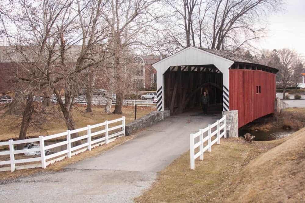
Keller’s Mill Covered Bridge

Keller’s Mill Covered Bridge is located near Akron, a short drive from Ephrata, PA. It is the only bridge in the county that is painted white.
This historic bridge was constructed in 1891 and was located in its original location near Ephrata until 2006. At that point, it was moved a few miles downstream to its present location. This was done because a larger bridge was needed at its original location, so the bridge was rebuilt at the site of another aging one-lane bridge.
Today, the bridge sits in a beautiful part of the county and crosses Cocalico Creek. It is 74 feet long.
Getting There: Keller’s Mill Covered Bridge is located west of Route 222 near Akron, PA. It can be found at the following coordinates: 40.164191, -76.232483.
There is an area for several cars to pull off a short walk from the bridge on its southeastern side.
Erb’s Covered Bridge
Erb’s Covered Bridge is located just a short distance from Keller’s Mill Covered Bridge. It crosses Hammer Creek.
Unlike most covered bridges that cut straight across a waterway, Erb’s Covered Bridge crosses the creek on a diagonal, which provides nice views of the water below when approaching the bridge from the south.
The bridge was originally built in 1849 and was replaced in 1887. It is 80 feet long and utilizes a Burr arch truss.
Getting There: Erb’s Covered Bridge is located north of Rothsville, PA. It can be found at the following coordinates: 40.167751, -76.243914.
There is room for cars to pull off the road on both sides of the bridge.
Northeastern Lancaster County Covered Bridges
The five covered bridges in northeastern Lancaster County are located in close proximity to routes 222 and 322 east of Ephrata, PA. They are also located just south of the Pennsylvania Turnpike near the Reading exit.
Thanks to these major roads that traverse north Lancaster County, visiting these five covered bridges couldn’t be easier.
Each of these five bridges is well-maintained and well worth the short diversion to see them during your travels or even a dedicated trip. They are listed in this guide from west to east, but they are just as easy to visit by reversing the order shown here.
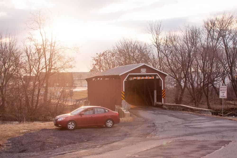
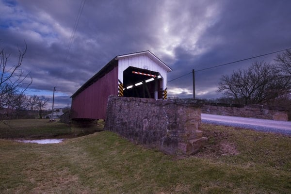
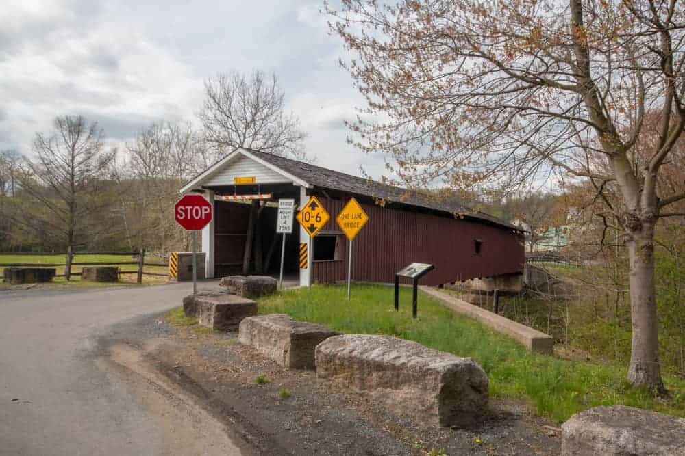
Bitzer’s Mill Covered Bridge
Bitzer’s Mill Covered Bridge has the distinction of being the oldest Lancaster County Covered Bridge that is still open to vehicular traffic. It was originally built in 1846 and was reconstructed in 1997. The bridge crosses the Conestoga River and is 98 feet long.
Like many covered bridges, the name of Bitzer’s Mill Covered Bridge changed over the years depending on the names of the nearby mill and landowners. This bridge is also known as Eberly’s Cider Mill Covered Bridge, Martin’s Mill Bridge, Fiand’s Covered Bridge, and Fiantz’s Covered Bridge.
Getting There: Bitzer’s Mill Covered Bridge is located southeast of Ephrata and just a few miles from the intersection of Routes 322 and 222. It is located at the following coordinates: 40.140415, -76.151942.
Parking here is a little tricky as the road is narrow. However, there is a bit of room to pull off on the northern side of the bridge, though it’s probably best to use your flashers.
Bitzer’s Mill Covered Bridge is surrounded by private property and fencing is located on all four sides of the bridge. This makes it hard to get a good look at the side of the bridge but does make for a picturesque surrounding thanks to the farmland and many trees around the bridge.
Bucher’s Mill Covered Bridge
Bucher’s Mill Covered Bridge (also known at Butcher’s Mill Covered Bridge) is located just outside of Reamstown and is the northernmost covered bridge in the county. It crosses Cocalico Creek and is only 64 feet long, making it one of the shortest covered bridges in Lancaster County, Pennsylvania.
It was built in 1891 and repaired after flood damage a year later.
Getting There: Bucher’s Mill Covered Bridge is located just off of Route 272 in a residential area. It is located at the following coordinates: 40.208044, -76.134662.
Parking at this bridge is quite difficult, as there is little room to pull off to the side of the road when visiting. When I stopped by, I did my best to get off the road as much as possible and turned on my flashers. However, this may not be advisable depending on the amount of traffic along the roadway.
Keep in mind that since the area surrounding the bridge is residential, it is private property. Make sure to be respectful of landowners when visiting the bridge.
Red Run Covered Bridge
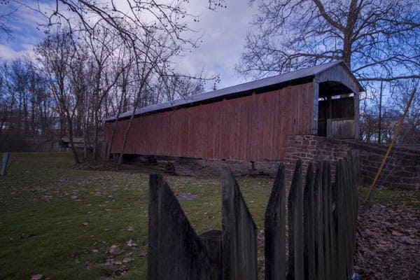
Red Run Covered Bridge (also known as Oberhaltzer’s Covered Bridge) is the only covered bridge on this list that no longer crosses water and is not open to vehicular traffic.
While the bridge used to cross Muddy Creek, it now sits next to the creek on the property of Red Run Campground. Red Run Covered Bridge was built in 1866 and is 107 feet long.
I tried to find information on when this bridge was moved to its current spot and came across a curious note.
According to this site, the bridge wasn’t moved. Instead, a new bridge was built over the creek in 1961 and the creek was rerouted to go under that bridge instead. Should anyone have any more information about this, please comment below and let me know.
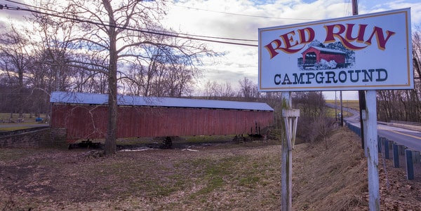
Red Run Covered Bridge sits on private property and can only be viewed from the roadway. However, it sits close to the road and can be easily viewed from outside of the gate.
It currently appears that the bridge is being used for storage, and while I’ve seen covered bridges in worse shape, it certainly appears that it’s seen better days. Hopefully, the owners will refurbish this bridge at some point in the near future.
Getting There: Red Run Covered Bridge is located in Brecknock Township, along the banks of Muddy Run. It can be found at the following coordinates on the grounds of Red Rock Campground: 40.175401, -76.081099.
There is room to pull off along the side of the road. Note that the land surrounding the bridge is marked as private property, and you will only be able to view this bridge from Martin Church Road. Fortunately, the bridge sits close enough to the road that this isn’t an issue.
From here, it’s also a short drive up Route 222 to the covered bridges of Berks County.
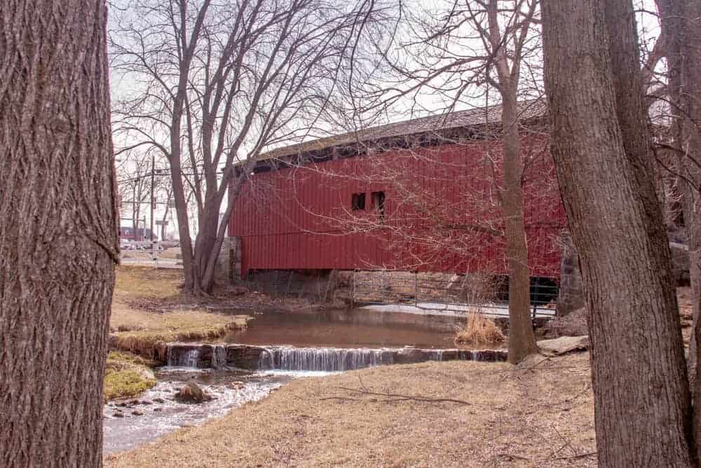
Weaver’s Mill Covered Bridge
Weaver’s Mill Covered Bridge (also known as Isaac Shearer’s Mill Covered Bridge) is located just a few miles west of Pool Forge Covered Bridge. Like Pool Forge, Weaver’s Mill Covered Bridge crosses the Conestoga River. It is 85 feet long and was built in 1878.
Weaver’s Mill Covered Bridge is located in a beautiful area filled with Lancaster County farmland. It’s just upstream from where the Conestoga River meets the Little Conestoga.
Getting There: Weaver’s Mill Covered Bridge is located in East Earl Township. It is located at the following coordinates: 40.141248, -75.997858. There is room for cars to pull off the side of Weaver’s Mill Road on either side of the bridge.
The land around Weaver’s Mill Covered Bridge is private property, but most of it was not posted when I visited. Be sure to always be courteous around these bridges so that access can continue to be allowed, and make sure to respect any no trespassing signs that you may see.
Pool Forge Covered Bridge
Pool Forge Covered Bridge is located just over a mile from Route 322 in northeastern Lancaster County. It is the easternmost covered bridge within the county. The bridge is one of three that crosses the Conestoga River, with Pool Forge Covered Bridge furthest upstream. It was built in 1859 and is 99 feet long.
Pool Forge Covered Bridge is located on private property and is part of Historic Poole Forge. Unlike many bridges on private property, this bridge is fully accessible and the park-like setting around the bridge makes access very easy for photos.
The Historic Poole Forge area includes a 17th-century iron master’s home, as well as a lime kiln and several exterior buildings. These historic buildings make for one of the most picturesque settings for a covered bridge in Pennsylvania.
Getting There: Pool Forge Covered Bridge is located near Route 23 in Caernarvon Township near the northeastern corner of Lancaster County. The bridge is located at the following coordinates: 40.129871, -75.976397.
Since this is a park, there is ample parking around the bridge. Parking spaces are available on the northern side of the bridge, and there is also space to pull off the side of the road along the southern side of the bridge.
More information about visiting Historic Poole Forge can be found on their website.
Southeastern Lancaster County Covered Bridges
Southeastern Lancaster County is home to four historic covered bridges. Of these, several cross the border from Lancaster County into Chester County (which is also home to some incredible covered bridges).
These bridges are listed north to south.
Mercer’s Mill Covered Bridge

Mercer’s Mill Covered Bridge is the most upstream of the four historic covered bridges that cross the Octoraro Creek. The creek spans the border between Lancaster County and Chester County, but since owned by Lancaster County, I’m putting it here.
This bridge was originally constructed in 1880 and is 80 feet long. It’s located in a relatively isolated part of the county near Atglen, PA.
Getting There: Mercer’s Mill Covered Bridge is located a short drive from Parkesburg, home of a Victory Brewing Company brewery. It is also near Atglen and Christiana.
It can be found at the following coordinates: 39.931468, -75.981625.
There is room to pull off the road on the eastern side of the bridge in Chester County.
Jackson’s Sawmill Covered Bridge
Jackson’s Sawmill Covered Bridge is one of the most isolated covered bridges in the county, and you’re unlikely to see this bridge without making a special trip to do so.
This bridge, which is also known as Eichelberger’s Covered Bridge, is the second to cross the Octoraro Creek and was completed in 1878. The bridge was washed away in 1985, but, as it was mostly intact, it was put back in place, though raised a few feet to protect it from future flooding.
While the bridge is 139 feet long, it actually crosses a rather narrow waterway, instead of a major stream.
Getting There: Jackson’s Sawmill Covered Bridge is located east of Quarryville, Pennsylvania. It can be found at the following coordinates: 39.896763, -76.080159.
There is room for cars to park on the southern end of the bridge.
White Rock Forge Covered Bridge
White Rock Forge Covered Bridge is the third covered bridge that crosses the Octoraro Creek. It is located just upstream of Octoraro Lake.
This bridge was constructed in 1884 to replace a destroyed bridge that had originally been built on the site in 1847. It is 103 feet long.
This is a great covered bridge to visit if you want to explore the Lancaster County countryside as its surrounded for many miles by farms. It is also located adjacent to the Slumbering Groundhog Lodge, which does a Groundhog Day celebration similar to the one held in Punxsutawney.

Getting There: White Rock Forge Covered Bridge is located in the southern part of Lancaster County and is one of the most isolated covered bridges in the region.
It can be found at the following coordinates: 39.824715, -76.090011.
There is a bit of room to pull off the road on both sides of the bridge.
Pine Grove Covered Bridge
Pine Grove Covered Bridge is, in my opinion, one of the most scenic covered bridges in Lancaster County. It is also one of two covered bridges that bridge the border from Lancaster County into Chester County.
At 198 feet in length, Pine Grove Covered Bridge is the longest covered bridge in either Lancaster County or Chester County. It crosses the Octoraro Creek just downstream of two dams on the waterway. In fact, the smaller of the two dams is located just upstream of the bridge and adds a lot of beauty to this spot.

This covered bridge was constructed in 1884 and is the southernmost of Lancaster County’s covered bridges.
Getting There: Pine Grove Covered Bridge is located just below Octoraro Lake about five miles west of Oxford, PA. It can be found at the following coordinates: 39.793574, -76.044660.
There is a large parking area on the Lancaster County side of the bridge that is great for those wanting to see the bridge or recreate in the area.
Southwestern Lancaster County Covered Bridges
There are four covered bridges in the southwestern portion of the county stretching from Strasburg in the northeast to Pequea in the southwest. All four bridges cross Pequea Creek as it makes its way to the Susquehanna River.
The four Lancaster County covered bridges below are listed with the closest to downtown Lancaster being first, which coincidently is also east to west and north to south.
Neff’s Mill Covered Bridge
Neff’s Mill Covered Bridge is located just outside of Strasburg, home to several popular railroad destinations.
The bridge spans 102 feet over Pequea Creek and is only 15-feet wide. A bridge was built in this location in 1824 and called Bowman’s Mill Covered Bridge. The current bridge dates from 1874 when the original bridge was rebuilt.
The bridge is set in a very picturesque valley. Next to the bridge is a white picket fence that is home to a few very friendly horses. Opposite the horses is an open field with no property markings, making this the best area for photographs.

Getting There: Neff’s Mill Covered Bridge is located about 15 minutes from downtown Lancaster and close to the borough of Strasburg. The bridge can be found at the following coordinates: 39.978615, -76.225828.
There isn’t really a good area to pull off and park, but if you are careful, there are a few places where you can get your car mostly off the road. During my visit, the best area to park seemed to be opposite the white fence on the bridge’s western bank.
Lime Valley Covered Bridge
Lime Valley Covered Bridge sits in a very scenic low valley near Willow Street, Pennsylvania. Despite not being in Strasburg and being further from the borough than Heff’s Mill Covered Bridge, this bridge is also known as Strasburg Covered Bridge.
The bridge is located about halfway between downtown Lancaster and Quarryville, just off of Route 222, a major north-south road in the area.
It spans 103 feet over Pequea Creek and was built in 1871 by either Elias McMellan or Joseph Cramer.
The wide valley that this bridge is located in offers several great angles for photography. However, in my opinion, the best is from a hundred yards away along Lime Valley Road, which runs perpendicular to the bridge.
Getting There: Lime Valley Covered Bridge is located 15 minutes from downtown Lancaster and 10 minutes from Quarryville. If you’re traveling Route 222 between the two towns, the bridge is less than a mile out of your route. The bridge is located at the following coordinates: 39.960596, -76.234926.
As long as there aren’t a lot of other visitors, parking for this bridge is quite easy to figure out as there is ample space to pull off the road. However, the best area seems to be along the southwestern side of Brenneman Road.
Baumgardener’s Covered Bridge
Baumgardener’s Covered Bridge in Pequea is the next covered bridge that you’ll come to on your journey through Lancaster County’s covered bridges.
Like the other bridges listed here, it crosses the Pequea Creek. Baumgardener’s Covered Bridge was built in 1860 by Davis Kitch and is 120-feet long. The bridge you see today is actually longer and taller than it was when it was originally built.
After being damaged in a flood in 1986, the bridge was rebuilt the following year. However, to help prevent future damage, the bridge was raised four feet, which necessitated lengthening it by nine feet to compensate for the extra height.
The valley where Baumgardener’s Covered Bridge is located is very forested, making photos of the bridge a bit difficult to obtain. However, there is a large field on the northern side of the bridge that isn’t posted as being private property.
While there, make sure to check out the very cool, old barn just a few hundred yards away from the bridge on the northern side.
Getting There: Baumgardener’s Covered Bridge is located in Pequea, south of downtown Lancaster and west of Route 222. It’s a 20-minute drive south of Lancaster and 15 minutes from Lime Valley Covered Bridge.
It is located at the following coordinates: 39.930657, -76.295291.
Parking at the bridge is along pull-offs next to the road. Make sure you pull your car far enough off of the road to avoid traffic but don’t pull into the fields as this is private property.
The best parking area is on the northern side of the bridge (the side you approach from if coming from downtown Lancaster or Lime Valley Covered Bridge).
Colemanville Covered Bridge
Of the four bridges in this part of the county, Colemanville Covered Bridge, also known as Martic Forge Covered Bridge, is my favorite.
It crosses the Pequea Creek over a wide, fairly deep gorge. At 170-feet long, this is one of the longest bridges in Lancaster County. The peaceful setting and surrounding woods make this a perfect setting for a beautiful covered bridge.
Colemanville Covered Bridge was built in 1856 by James C. Carpenter. It was rebuilt in 1938 and in 1973 after heavy flooding. In 1992, the bridge was completely rebuilt and moved a few feet to help prevent future flood damage.
I like this bridge because it reminds me a lot of one of my favorite covered bridges, Forksville Covered Bridge in Sullivan County, PA. I’m not entirely sure why it does, but that was the first thought I had when I saw it, and I couldn’t get that comparison out of my head during my visit.
Colemanville Covered Bridge is located next to State Game Lands 288. Along the southern bank for the river is the 1.3-mile Trolley Trail that runs through the game lands between the covered bridge and the small town of Martic Forge.
This trail follows an old trolley line that used to run from Lancaster to Pequea and looks like it would be a very beautiful walk along the creek.
Getting There: Colemanville Covered Bridge is located just a few miles from where the Pequea River empties into the Susquehanna River in southwestern Lancaster County and close to Shenks Ferry Wildflower Preserve.
It is about 25 minutes south of downtown Lancaster and only five minutes east of Pequea, Pennsylvania. It sits about 10 minutes southwest of Baumgardener’s Covered Bridge at the following coordinates: 39.898932, -76.342164.
Parking at this bridge is a little tricky, and I’m not exactly sure where to park. There is a nice large area next to the bridge and the game lands that seems like a perfect area for parking, but the area is covered with no parking signs.
When I visited, I pulled my car into this area since it was off the road and just made sure to stay close to my car. However, I can’t guarantee a passing police officer or game warden might not give you a ticket. It really is a shame that I couldn’t park here, as I would have enjoyed checking out the Trolley Trail.
Looking for more spots to visit in Lancaster County? Check out Barry’s Car Barn, the National Watch and Clock Museum, the Julius Sturgis Pretzel Bakery, and the Wolf Sanctuary of PA.
[Click here for information on how to use the coordinates in this article to find your destination.]
 "
"


We love covered bridges and we go to Vermont to see all the Bridges they have. Now is the
time we go for the fall trees and bridges. We didn’t know that Pennsylvania had so many. I guess we will have to plan some time to go see your Bridges that we love to photography
Thank you for showing us your Bridges. We have a book with all the Bridges in Vermont
and how to get to them.B
There are over 200 historic covered bridges in PA, so a lot of great spots to check out. Have fun!