

Located just outside of State College is one of the most interesting natural areas of Pennsylvania: the Scotia Barrens. This area is not only geologically unique but is also home to the hidden ruins of Scotia, PA.
The Scotia Barrens is located in a valley in Centre County, PA. It is home to a unique micro-climate that makes the area cooler than the surrounding region. This climate gives the barrens a unique variety of plants not often found elsewhere in the region. That alone makes it an interesting State College hiking trail.
However, in addition to a unique climate, this area is also rich in industrial history. In the mid-1800s, the land here was extensively lumbered to create charcoal for the nearby Centre Furnace. In the 1880s, Andrew Carnegie purchased the land and used it to mine iron ore for his steel mills.
In 1909, the mines closed and within a couple of years, Scotia was a ghost town. While some logging continued to occur on the land, it was finally protected by the Pennsylvania Game Commission in the early 1940s.
However, during World War 2, the mine was briefly reopened again to support the war effort only to be quickly shut down for the final time when the iron ore produced here didn’t meet purity standards.

It’s the remnants of this ire ore mining operation that are most evident today in the Scotia Barrens. Depending on where you look, you can see evidence of iron ore pits, the railroad, the community of Scotia, and even several structures that were part of the complex here.
The Scotia Barrens is part of State Game Lands 176 and is open for visitors to explore. Most popular with runners and mountain bikers, the landscape here is also great for birders and those that want to explore one of the more interesting abandoned places in PA.
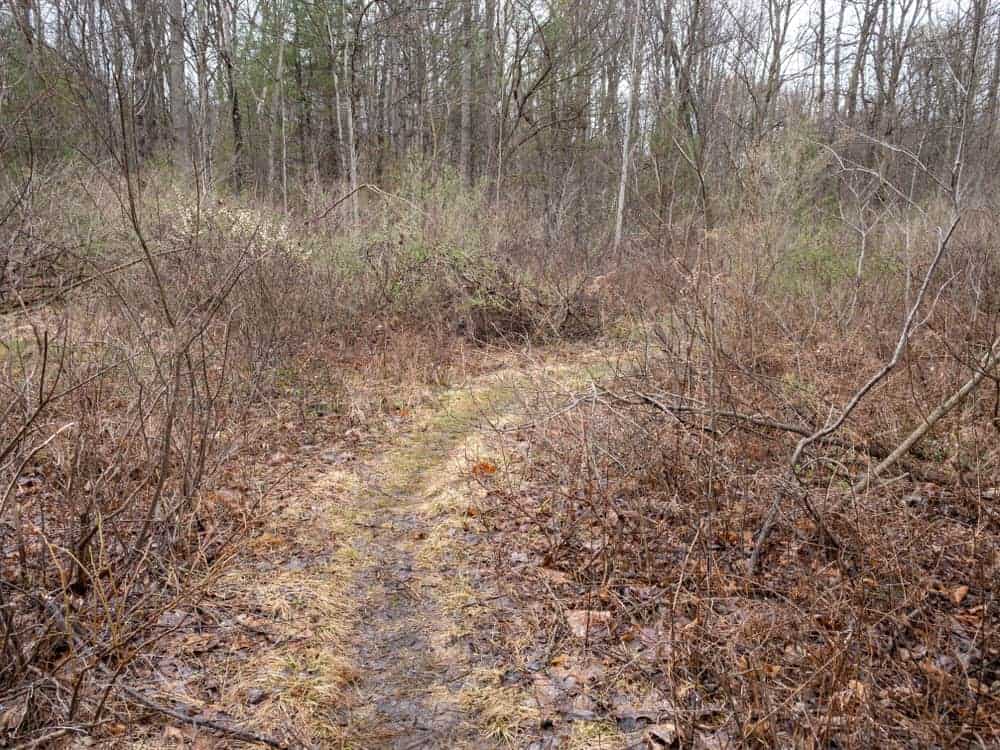
The area is crisscrossed by miles of trails many of which are often ridden by local mountain bikers, though whether this is technically allowed is questionable. While it was out of production for a few years, a new version of the fantastic Scotia Map by Purple Lizard has been released recently. If you want to explore the area more, this is a great resource to have and the only map that I know of to the area.
Fortunately, if you know where to look, finding the ruins of Scotia is quite easy, and there are plenty of other great hidden gems that you can find on your own by exploring the area.
When visiting Scotia, the best place to enter is via Scotia Road in the northern reaches of State Game Lands 176. While the road is a bit rutted in places, it’s easy enough to drive in a car with a bit of care.
The hike to the abandoned ruins in Scotia starts behind a gate along Scotia Range Road. The gate is approximately at these coordinates on the right side of the road roughly 0.6 miles from the turn off of Scotia Road: 40.800420, -77.946291.
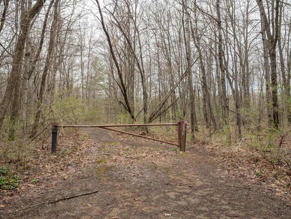
To reach the ruins, walk past the gate and take the trail to the left. Continue taking the left trail at every split until you reach the ruins. The entire hike back to the Scotia ruins should only take you about 5 minutes. For those that use a GPS, the ruins can be found at approximately these coordinates: 40.800368, -77.946305
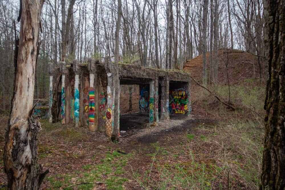
There are two main abandoned structures at the Scotia Barrens.
The first that you’ll come to is approximately 15 feet in height and made of concrete. This is said to have been part of an ore washer from the 1940s. While all that’s left is a tall tower, it’s still pretty interesting to see, especially since it’s set aside in the woods by itself.

After passing a few smaller concrete pieces, the largest of the two main parts comes into view.
This second abandoned structure is probably my favorite spot in the Scotia Barrens. Given its location near the old train track, I’m assuming the building had something to do with the loading and unloading of coal, but honestly, I’m not 100% sure of its purpose (Please let me know in the comments if you know).
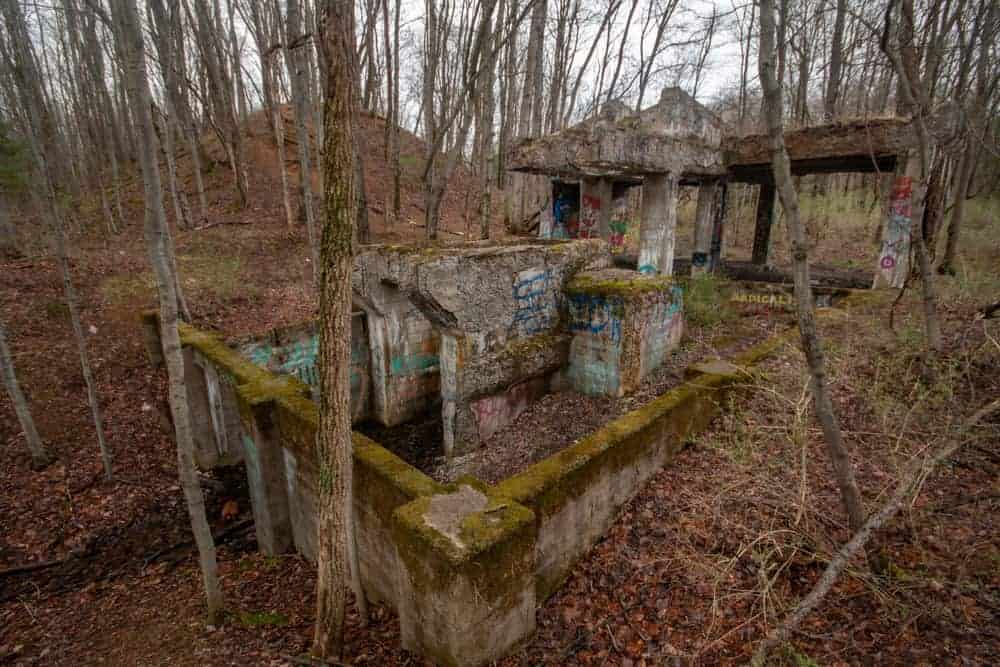
The building is comprised of two parts with only the concrete shell of the structure still intact.
The upper portion sits above ground and almost appears to be a garage without walls. The interior is filled with graffiti, which creates an interesting look to the site. This also served a nice spot to wait out a short spring hail storm during my visit.
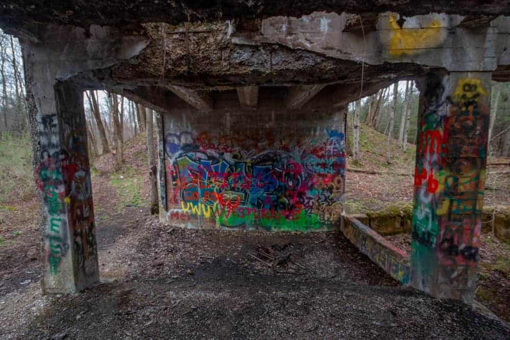
The lower portion of the site may have once sat below ground and includes several supports and dirt that slopes up towards ground level. Portions of the wall here were moss-covered which was really neat to see.
While at this structure, you may notice two hillsides on either end of the building. I believe, but am not totally sure, that these were part of the railroad and that a bridge once spanned the hillsides here. The contours of the hillsides seem perfect for a railroad, and there was one that once ran right through this area.
Once you’ve finished enjoying the abandoned buildings in Scotia, you can either return the way you came or spend a bit more time checking out this interesting area.
There are many trails that crisscross the land, and it would be quite easy to get yourself a bit turned around here, even if you aren’t all that far from the roadway. I definitely recommend having some sort of GPS with you (or making sure your phone has good coverage) before venturing off the main trails.
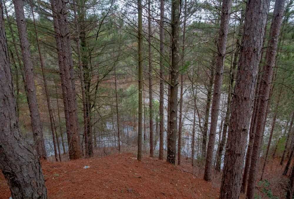
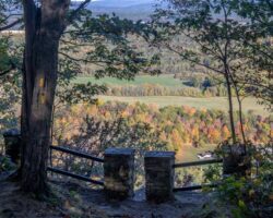
While I didn’t discover any more ruins during my hike, I did see several old pits that were likely part of the mining operation here and a few beautiful ponds.
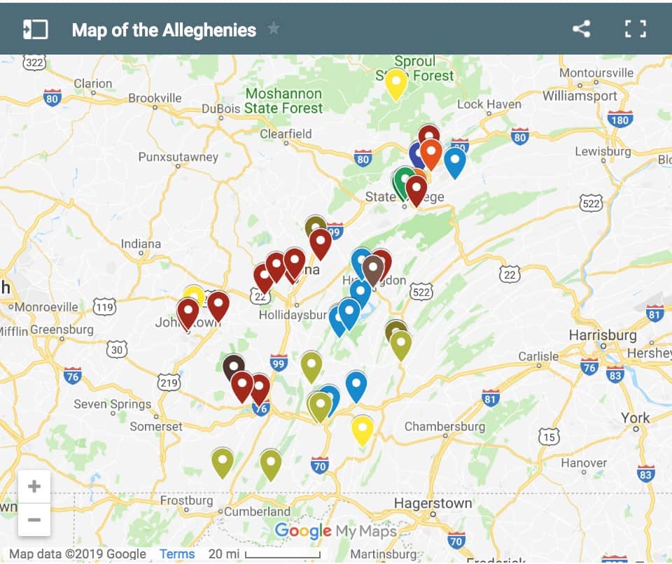
While the ruins of Scotia, PA, might be the highlight of State Game Lands 176, this is also an incredibly beautiful and unique area of the state. Because of this, I highly recommend at least driving further into the area.
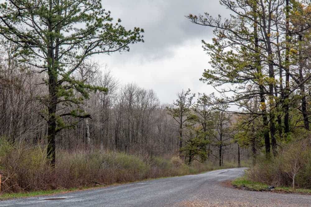
About a mile further down the road, the forest opens up and you can see the full uniqueness of the barrens. If you’ve never visited a spot like this, such as the Nottingham Serpentine Barrens in southeastern PA, it’s a very interesting landscape to see and might remind you a bit of the US southwest in some respects.
Overall, the Scotia Barrens and its ruins are a hidden gem of Centre County, Pennsylvania. If you are looking to get into the outdoors this area is right up there with Mount Nittany and Shingletown Gap as a fantastic spot to explore.
Looking for more places to visit near State College? Check out the Arboretum at Penn State, Raystown Lake, Shaver’s Creek, and Black Moshannon State Park.
[Click here for information on how to use coordinates to find your destination.]
 "
"


This is very interesting. My grandfather, Ray Showers and his wife Florence Lykens lived in Scotia after they were married. Florence, I believe was born in Scotia and lived there untie she and Ray moved into State College. They lost their home to a fire. My father was born in 1915. I do not know if you could find more information from the Lukens family in Port Matilda. I was a young child when my grandparents took me into Scotia and showed me the remains of their home that burned. Thanks for uncovering PA
I too, Connie, have some interest in knowing about Scotia. My great father Mark Lykens worked in the ore mines there. Florence Lykens is a relative of mine. I enjoyed visiting them often while growing up. Also Mrs. Baudis was my Uncle Milford’s grandmother. So Sotica always fascinated me.
In the early 50’s my father was a grad student in electrical engineering. He had an ionosphere research lab in the Scotia Barrens. He had high voltage electrical equipment he used to generate pulse waves that he bounced off the ionesphere. I was a child at the time and went there with him a number of times, but have no idea of the location of his lab. It was a small stand alone building.
Can anybody tell me the adress to this place
There is no address. If you copy/paste the coordinates listed in the article into your GPS or a mapping system like Google Maps or Apple Maps, and follow the directions listed, it will take you there.
when you turn onto scotia road, go about 3/4 of a mile and watch for the “scotia range road” sign on your left. its a stone road that leads back into game lands.
If you head west from State College on Rt. 322, you would take the exit for Grays Woods. Follow that road for maybe two miles, then turn left onto a stone road. I’m not sure how far back the gate is.
Seems like its alot more popular with hunters than bikers and joggers
Is Scotia now game lands property, interesting to run a metal detector back there. Scott
It is on state game lands property. Not sure of the legality of using a metal detector on the lands, though.
Regulations for SGL are different than State Forest or State Park. No, it is not legal to dig for or remove artifacts. (It’s unlawful to ride bikes there, too) Walking, running, hiking, hunting are all legal and welcome.
I live in Marysville, which is one of the leftover villages from those days. I grew up there, and have always been fascinated with the history surrounding the place. i live right next to the edge of the game lands, and occasionally walk those trails, getting a feel for how they mined the ore. my parent’s property contains the cemetery of the old church that used to reside there, as well as the foundations for bert delige’s parents house as well as his unmarked grave.
Hi Scott
My gggrandfather, Henry Mosel died in a mining accident at Scotia
Mines in November1896. I have been trying to locate where he is buried.
The newspaper article about the accident did not mention where he was buried, but said he was totally crushed,
Thinking he may have been buried nearby. Do you have any information
on who is buried near your family’s property, or know where I might access this information? Do you know the name of the church?
Thank you so much for any information you can provide.
And have a Merry Christmas!
Sincerely, Jeanne Baker (jeannelbaker@yahoo.com
Hi there! I found this article and saw your comment. Henry was my husband’s great grandfather , James was his grandfather, John was his father. According to info that I have, Henry was buried in Tyrone, Blair County, in Eastlawn Cemetery. Hope this helps!
I grew up there, played with the kids of the eight houses there at the time and we ran all over the “Barrens”. We played on the concrete remains, climbing and jumping from the dirt ramps of the old stone crusher and other remnants. We lived right next to the Ghaners from the late 50s until the late 60s. I often dream back to those days and have written a book about our youthful adventures which is available on Amazon. It’s called Life in a Barrens World. It is written as we communicate with one another back then and chronicles our lives from 1957 through 1966.
Be aware! The ruins are crawling with deer ticks — removed two of them after scrambling up one of the moss-covered walls
Interestingly someone cleared out some areas around some of the ruins and we discovered “new to us” ruins on the left side of the road while on a recent scout hike in august. Lots of foundations. The purple lizard historical map that is out of print is great- we have one. But I’m still not exactly sure what we found! Every time we go back there we discover something new, and it’s also very easy to get turned around hiking!
I’m sure there’s a lot more out there waiting to be discovered. Such a fun area to explore.
The ruins on the left side of the road are the 1892 (Carnegie) washer. The current road bisects the original village of SCOTIA that contained at least eleven houses, store and much more. We are in the process of recreating ( in HO scale) what we can of the operation and village.
The two-tier structure may be an ash pit. Locomotives would pull over the pit (hence the bridge supports) to empty ash from the fire box. In wooded areas, structure such as this would contain hot ash until it could be cooled/ extinguished. I read about something like this sometime in the past 60 years. Sorry I can’t be more precise. 🥺🥺
The Scotia trails are extensively mapped out at OpenStreetMap.org. Search for “Scotia Ore Mine Ruins”. You can zoom in or out for more or less detail. OpenStreetMap also interfaces with several phone apps including Gaia GPS and Offline Topo Maps.
I wasn’t aware of that. Thanks for the information.
Mac and I have the same thought on your 2 tier structure. Not all trains ran on coal, some were fueled by less than desirable wood. Imagine all the tree limbs that would be twisted or bent into shapes which can’t be used for lumber being cut up and stacked on top of the tall structure. The loading of the tender would be easier just throw it onto the car from on top of the structure.
Thanks for the overview of this interesting area Jim!
There is an exciting chapter of its history that you missed. After Carnegie sells out,
Colonel Boal (Boalsburg) purchases 6,600 acres from an intermediary. Col Boal had
returned from WWI and realized his military “base” on his property in Boalsburg was too small for what he rightfully envisioned was coming (WWII). So he tried to convince the US military to purchase most of the land from him for a major military base. Instead, they constructed it at Indiantown Gap. His son, the ambassador, subsequently sold the land to the Fish & Game Commission. As a side note: at the Boal Mansion Museum there is an original map of a planned French-style village (LaGarde Village) for Scotia that was designed by Col. Boal and named in honor of his wife. The map shows some of the features such as Carnegie’s church, the rail road, etc. The Boals total land holdings locally in the early 1900s were nearly 10,000 acres.
Local historian Robert Hazelton is in the process of writing another book about Scotia. I went on a personal tour with him a few weeks ago and GPS’d numerous significant sites. Robert and his colleague Bryce Boyer know detailed information about the function and purpose of the original structures. There are diagrams and photos, soon to be published. The most common concrete ruins were parts of the WWII era ore washing station (the 1880s ore washer site is now bisected by Range Rd but plenty is still there). The vegetation clearing mentioned in another comment was conducted via a Special Use Permit obtained from the Game Commission by the historical society. Soon the ruins will much more thoroughly documented. A few updates that you may wish to edit into the main article: • Mt biking, removing artifacts, blocking a gate, alcohol/drugs, litter including flagging tape are unlawful on State Game Lands. • Scotia is infested with disease-carrying ticks. Spray clothes before, check yourself after. • Ruins include rusty steel bolts and rebar sticking up from the ground. Use caution! • The entrance to Range Rd has been moved up Scotia Rd about 500 ft.
Has any biologist/botanist/naturalist ever conducted a plant inventory of the area? Seems like the place might have an unusual flora due to climate, topography, geology, soils, etc.
Yes, and it is very unusual. There are times in the dead of summer that areas get to freezing at night.
The barrens are their own micro ecosystem. I’m told plants grow there that don’t grow elsewhere nearby because it’s too warm outside of the barrens. It’s quite an interesting spot.