
There are few spots in Pennsylvania that are more well know than Valley Forge National Historical Park a short distance outside of Philadelphia. And, while there is a lot of great Revolutionary War history to explore here, the park is also home to some fun hiking trails, including one that leads to the ruins of a spring water bottling plant.
The abandoned Colonial Spring Water Bottling Plant is located along the Mount Misery Trails on the western end of the park. This small hill features four miles of interconnected trails and makes for a beautiful and historic hike through the lightly-trafficked woods in the park.
A beautiful 2.5-mile loop along the trails here passes through this incredibly beautiful forest and past the ruins of the Colonial Springs Bottling Plant deep in the woods of Valley Forge.
This hike is great for the whole family and is a great way to spend time exploring the Philadelphia suburbs.
Where to Park for the Mount Misery Trails
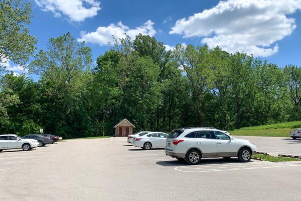
While there are several potential parking areas to reach the Mount Misery Trails at Valley Forge, the closest parking area is the Yellow Springs Trail Parking lot near the Philander Chase Knox Estate.
This parking area can be found just off of Yellow Springs Road at the following coordinates: 40.083187, -75.456879.
This large parking area features bathrooms and easy access to the Mount Misery Trails.
[Click here for information on how to use the coordinates in this article to find your destination.]
Hiking the Mount Misery Trails to the Colonial Springs Bottling Plant
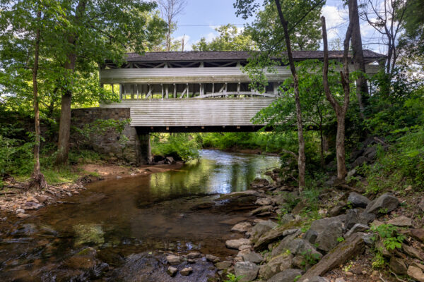
From the parking area mentioned above, start this 2.5-mile loop by following the paved trail back towards Yellow Springs Road, and then turning to head towards Knox Covered Bridge (one of 15 historic covered bridges in Chester County).
Right before you cross Library Lane (which heads back to the Philander Chase Knox Estate), cross Yellow Springs Road at an official crosswalk.
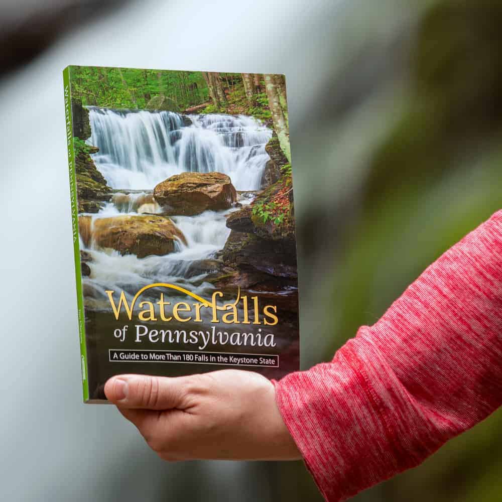
"Waterfalls of Pennsylvania" by Jim Cheney
If you love PA waterfalls, you won't want to miss this waterfall book from Jim Cheney, author of Uncovering PA, featuring more than 180 great waterfalls. Order it now on Bookshop.org or Amazon.
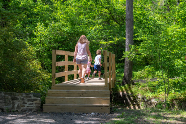
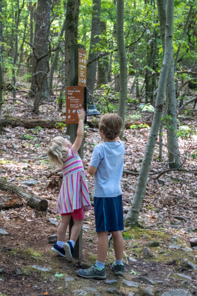
On the opposite side of the road from the parking area, you’ll see an obvious trailhead with an information sign adjacent to it that features a trail map. The trail starts by crossing the wooden bridge and heading into the woods.
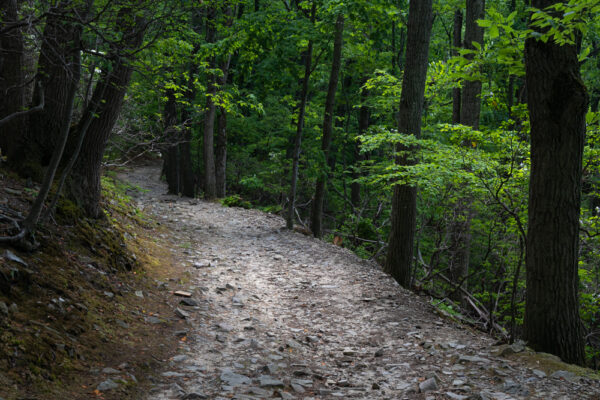
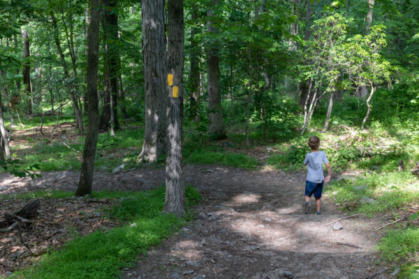
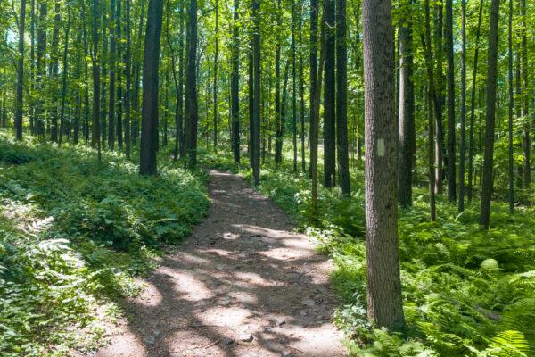
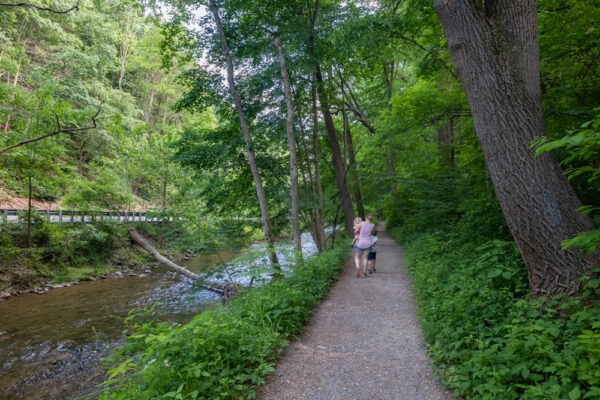
The trail here is easy to follow as it meanders through this beautiful woodland.
It quickly begins to climb uphill, and while there isn’t much elevation gain in this hike, nearly all of it is in the first half of the hike, so you’ll get a bit of a workout right away.
While this trail is easy to follow and quite wide, there is one spot near the ridgeline where an unmarked trail heads off to the left. I made the mistake of taking this turn, and it leads nowhere. I came to find out later that all of the actual trail turns are well marked, so ignore this unmarked turnoff.
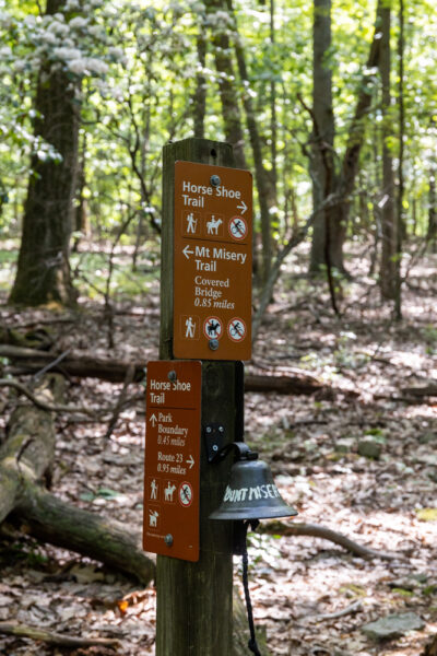
Half a mile into the hike, there is a trail split. Head to the left along the Mount Misery Trail. Heading right offers the chance for a shorter loop, but misses the ruins of the Colonial Springs Bottling Plant, so I recommend continuing the loop as listed here.
After turning left, the trail continues along the rocky ridgeline for 0.2 miles towards the “summit” of Mount Misery.
At the summit, there is a trail marker that includes a bell you can ring for reaching the top of Mount Misery. My kids quite enjoyed this milestone.
After you’ve rung the bell, head to the right on the Horse-Shoe Trail. This trail winds its way along the ridgeline and makes several turns before reaching the ruins of the Colonial Springs Bottling Plant about a third of a mile from the summit.
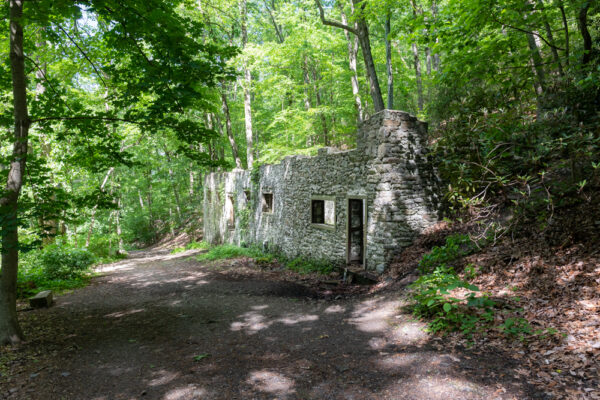
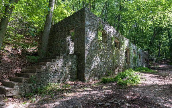
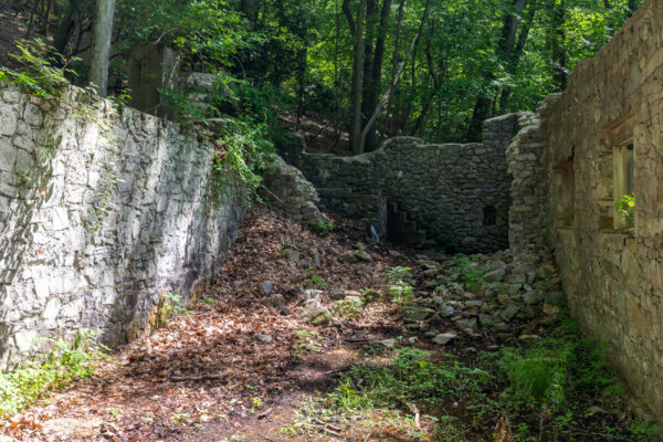
The Colonial Springs Bottling Plant sits deep in the woods along a seemingly unnamed stream. For those that use coordinates, it can be found here: 40.094544, -75.466439.
From roughly 1908 through 1930, the Colonial Springs Bottling Company sold the waters of the spring here in southeastern Pennsylvania. The spring water is said to have been quite popular in Philadelphia homes.
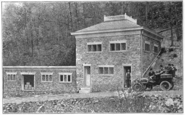
Visitors could get the spring water delivered in bottles to their homes or take a trip to the bottling plant to get the water for free.
In 1930, Valley Forge State Park (It was Pennsylvania’s first state park before it was taken over by the National Park Service) purchased the land and stopped the bottling of the spring.
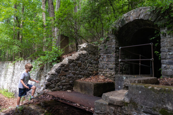
Today, the shell of the bottling plant is quite interesting to see, and the waters of the spring still flow through the building as they once did (though they probably didn’t flow out the front door in days past).
Visitors can walk into the building and check out what’s left of the interior, including heading into a chamber to see the hidden reaches of the spring.
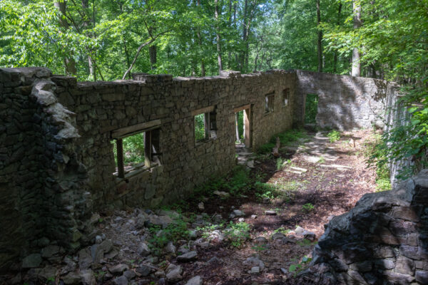
It should be noted that I’m unsure of the stability of the structure. I’ve seen photos from less than a decade ago that show two walls that are no longer standing, so use caution while near the structure. Also, make sure to leave the structure as you found it so others can enjoy it after you.
Once you’ve enjoyed the ruins of the Colonial Springs Bottling Plant, continue to follow the trail downhill along the cascading stream.
Just below the ruins, there is a trail that crosses the creek and branches off to the left. Ignore this trail and continue hiking downhill.
A quarter-mile from the ruins, the Horse-Shoe Trail will meet the Valley Creek Trail. At this trail split, there is a bench if you need to sit and rest for a minute before continuing on your way.
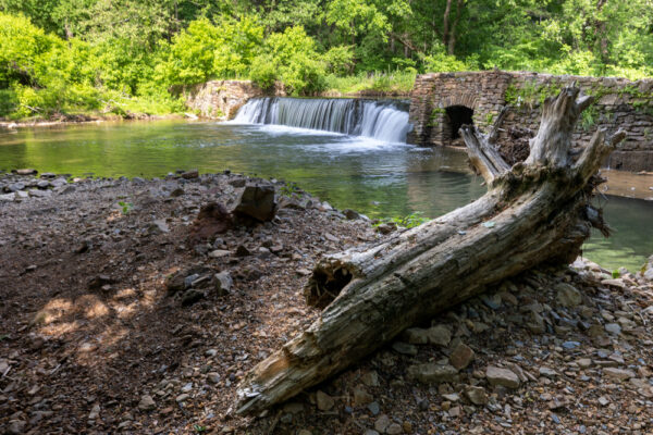
Turn right on the Valley Creek Trail. It unsurprisingly follows the beautiful Valley Creek upstream for a mile and takes you to Knox Covered Bridge and back to Yellow Springs Road.
Along the way, you’ll see a 100-year-old historic dam along the stream that is quite beautiful.
Otherwise, there are no specific highlights along this portion of the trail other than great views of Valley Creek. Unfortunately, there is a bit of car noise here as the road is located just on the other side of the stream, but, overall, it’s a very pleasant hike.
Eventually, the trail returns to Yellow Springs Road adjacent to the historic Knox Covered Bridge.
This bridge was constructed in 1865 and is in great condition. While it doesn’t date back to when the Continental Army was at Valley Forge, it’s still a beautiful and historic spot to check out when you’re in the area. (Note that the bridge is open to vehicles, so use caution while checking it out.)
After enjoying the bridge, cross Yellow Springs Road, and turn right (Do not cross the covered bridge) for your short walk back to your vehicle.
Overall, hiking the Mount Misery Trails to the abandoned Colonial Springs Bottling Plant is a great loop that’s perfect for the whole family. I personally loved that it not only featured some incredibly beautiful scenery but also offered two historic elements in the ruins and the covered bridge while my kids loved the beauty and ease of the trail.
So, whether you are looking for great hiking trails near Philadelphia, love visiting abandoned places in Pennsylvania, or are simply wanting to check out a little-known part of Valley Forge National Historical Park, don’t miss this great hike.
Looking for more places to visit nearby? Check out the American Treasure Tour, the Wharton Esherick Museum, the American Helicopter Museum, and the Peter Wentz Farmstead.
 "
"


Hi Jim,
Thanks again for all that you do. Would it be possible to mention if trails are wheelchair accessible? I have no problem on most trails that are not horribly rocky or with tree roots.
Thanks.
If the trail is listed as wheelchair accessible, I try to make a point to mention that in the article. Otherwise, you’ll have to just read the description to determine the suitability for your situation. You could also try contacting the park to talk to a ranger to discuss your abilities with them to get more specific guidance.
Jim,
Thanks for the detailed report. We followed your directions with no trouble. This was an interesting hike, although we were a bit winded from the initial upgrade. In reply to Mr. Schmitt above, you could start at the covered bridge and go in reverse of Jim’s directions. This would take you along the stream, past the dam, and you could almost get to the ruins. However, you would encounter several log steps which are placed to prevent trail erosion. I am not sure if a wheelchair could pass over them.
Thank you for this article. My friends and I just hiked it and there is no bell to ring. A woman who lives nearby said it hasn’t been there since the pandemic.
Interesting. I hiked it in mid-2020, but I guess they could have removed it since then.
Thanks so much. Excellent article. I will follow your instructions the whole way.
I love the Mount Misery trails and I was a little skeptical when I started reading, but your attention to detail is impressive, and if I hadn’t been there before I’d want to go. Thank you for a job well done.
Thanks so much for the kinds words. It’s a fun area to explore.
Thank you for helping to make our father’s day a success! We followed your instructions completely, had an excellent walk, and would have been completely lost otherwise! Happy to report the bell is there 🙂
I’m glad you had a great visit and that the directions were good. It’s really a fun spot.